
NATL: JERRY - Tropical Storm - Discussion
Moderators: hurricanetrack, S2k Moderators

The posts in this forum are NOT official forecasts and should not be used as such. They are just the opinion of the poster and may or may not be backed by sound meteorological data. They are NOT endorsed by any professional institution or STORM2K. For official information, please refer to products from the National Hurricane Center and National Weather Service.

Re: NATL: INVEST 95L - Discussion (90/90)
Looks like we've had a lot of WPAC-style genesis this year, with broad waves coalescing into TCs while maintaining a large footprint. The wave that became Gabrielle looked similar, though conditions had already deteriorated by the time Gabrielle formed.
1 likes


Re: NATL: INVEST 95L - Discussion (90/90)
12z Best Track:
Close but no cigar (at least, not yet).
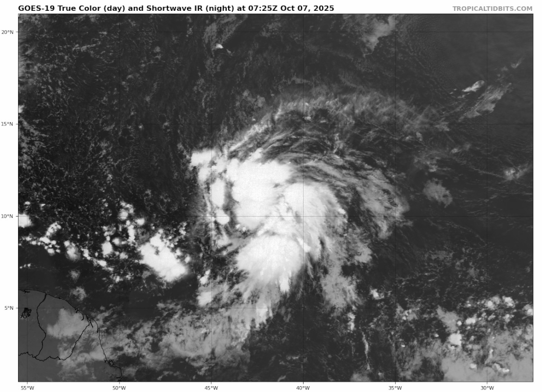
AL, 95, 2025100712, , BEST, 0, 111N, 430W, 30, 1008, LO...
Close but no cigar (at least, not yet).
Last edited by abajan on Tue Oct 07, 2025 7:44 am, edited 1 time in total.
0 likes
-
wxman57

- Moderator-Pro Met

- Posts: 23068
- Age: 68
- Joined: Sat Jun 21, 2003 8:06 pm
- Location: Houston, TX (southwest)
Re: NATL: INVEST 95L - Discussion (90/90)
Scatterometer hit (finally) at 0930Z indicated a closed circulation and some 35kt wind. Likely already a TS. Should recurve east of the islands.
12 likes

Re: NATL: INVEST 95L - Discussion (90/90)
With that pass we might go straight to TS Jerry at 11am.
1 likes
-
tropicwatch

- Category 5

- Posts: 3419
- Age: 61
- Joined: Sat Jun 02, 2007 10:01 am
- Location: Panama City Florida
- Contact:
Re: NATL: INVEST 95L - Discussion (90/90)
It needs to start gaining some latitude if it going to miss the islands. Some of the forecast Models are trending towards the islands.
0 likes
Tropicwatch
Agnes 72', Eloise 75, Elena 85', Kate 85', Charley 86', Florence 88', Beryl 94', Dean 95', Erin 95', Opal 95', Earl 98', Georges 98', Ivan 2004', Arlene 2005', Dennis 2005', Ida 2009' Debby 2012' Irma 2017' Michael 2018'
Agnes 72', Eloise 75, Elena 85', Kate 85', Charley 86', Florence 88', Beryl 94', Dean 95', Erin 95', Opal 95', Earl 98', Georges 98', Ivan 2004', Arlene 2005', Dennis 2005', Ida 2009' Debby 2012' Irma 2017' Michael 2018'

Re: NATL: JERRY - Tropical Storm - Discussion
AL, 10, 2025100712, , BEST, 0, 113N, 438W, 40, 1006, TS, 34, NEQ, 120, 90, 0, 0, 1012, 130, 20, 0, 0, L, 0, , 0, 0, JERRY, S, 0, , 0, 0, 0, 0, genesis-num, 029, TRANSITIONED, alB52025 to al102025,
6 likes
Re: NATL: JERRY - Tropical Storm - Discussion
Subtrop wrote:AL, 10, 2025100712, , BEST, 0, 113N, 438W, 40, 1006, TS, 34, NEQ, 120, 90, 0, 0, 1012, 130, 20, 0, 0, L, 0, , 0, 0, JERRY, S, 0, , 0, 0, 0, 0, genesis-num, 029, TRANSITIONED, alB52025 to al102025,
Welcome TS Jerry:

6 likes


Re: NATL: INVEST 95L - Discussion (90/90)
NHC will initiate advisories on Tropical Storm Jerry (formerly AL95), located over the central tropical Atlantic, at 1100 AM AST (1500 UTC).
2 likes
Re: NATL: INVEST 95L - Discussion (90/90)
zzzh wrote:https://i.imgur.com/FT9itG4.png
ASCAT does not show a closed circulation

A more detailed version.
1 likes
Re: NATL: JERRY - Tropical Storm - Discussion
zzzh wrote:zzzh wrote:https://i.imgur.com/FT9itG4.png
ASCAT does not show a closed circulation
https://i.imgur.com/w3UY82f.png
A more detailed version.
I'm not sure what your definition of "closed" is but it sure looked like it to me on that ASCAT
1 likes
-
tropicwatch
- Category 5
- Posts: 3419
- Age: 61
- Joined: Sat Jun 02, 2007 10:01 am
- Location: Panama City Florida
- Contact:
Re: NATL: JERRY - Tropical Storm - Discussion
hipshot wrote:zzzh wrote:zzzh wrote:https://i.imgur.com/FT9itG4.png
ASCAT does not show a closed circulation
https://i.imgur.com/w3UY82f.png
A more detailed version.
I'm not sure what your definition of "closed" is but it sure looked like it to me on that ASCAT
The southwest part of it is questionable.
1 likes
Tropicwatch
Agnes 72', Eloise 75, Elena 85', Kate 85', Charley 86', Florence 88', Beryl 94', Dean 95', Erin 95', Opal 95', Earl 98', Georges 98', Ivan 2004', Arlene 2005', Dennis 2005', Ida 2009' Debby 2012' Irma 2017' Michael 2018'
Agnes 72', Eloise 75, Elena 85', Kate 85', Charley 86', Florence 88', Beryl 94', Dean 95', Erin 95', Opal 95', Earl 98', Georges 98', Ivan 2004', Arlene 2005', Dennis 2005', Ida 2009' Debby 2012' Irma 2017' Michael 2018'
-
MEANINGLESS_NUMBERS
- Category 1

- Posts: 435
- Joined: Mon Nov 02, 2020 1:43 pm
Re: NATL: JERRY - Tropical Storm - Discussion
hipshot wrote:zzzh wrote:zzzh wrote:https://i.imgur.com/FT9itG4.png
ASCAT does not show a closed circulation
https://i.imgur.com/w3UY82f.png
A more detailed version.
I'm not sure what your definition of "closed" is but it sure looked like it to me on that ASCAT
There are no westerly winds.
0 likes
Emily '87, Felix '95, Gert '99, Fabian '03, Humberto '19, Paulette '20, Teddy '20, Fiona '22, Lee '23, Ernesto '24, Humberto/Imelda '25
-
MEANINGLESS_NUMBERS
- Category 1
- Posts: 435
- Joined: Mon Nov 02, 2020 1:43 pm
Re: NATL: JERRY - Tropical Storm - Discussion
In the cone again - I think that's five times this season?
0 likes
Emily '87, Felix '95, Gert '99, Fabian '03, Humberto '19, Paulette '20, Teddy '20, Fiona '22, Lee '23, Ernesto '24, Humberto/Imelda '25
Re: NATL: JERRY - Tropical Storm - Discussion
And as my third post, a mandatory update of this list: the most aggressive first advisories based on NHC advisories since 1998 (of which the 1998 - 2002 advisories only went to +72 hrs). At the end of the name I have added the verified peak intensity in kt for each storm.
120 kt
2023 - Lee (145)
105 kt
2024 - Kirk (130)
2023 - Nigel (85)
100 kt
2025 - Erin (140)
2021 - Sam (135)
2010 - Tomas (85)
95 kt
2025 - Humberto (140)
2024 - Milton (155)
2024 - Helene (120)
2024 - Ernesto (85)
2022 - Ian (140)
2021 - Ida (130)
2020 - Iota (135)
2019 - Lorenzo (140)
2012 - Isaac (70)
2010 - Danielle (115)
2005 - Philippe (70)
2004 - Karl (110)
90 kt
2024 - Beryl (145)
2021 - Larry (110)
2017 - Jose (135)
2016 - Matthew (145)
2009 - Bill (115)
2007 - Dean (150)
85 kt
2020 - Delta (120)
2015 - Danny (110)
2014 - Gonzalo (125)
2011 - Katia (120)
2010 - Igor (135)
2010 - Earl (125)
2006 - Helene (105)
2005 - Wilma (160)
80 kt
2025 - Jerry (-)
2024 - Leslie (90)
2022 - Danielle (75)
2020 - Teddy (120)
2019 - Jerry (90)
2017 - Maria (150)
2017 - Irma (155)
2016 - Gaston (105)
2012 - Leslie (70)
2005 - Rita (155)
2004 - Earl (45)
1999 - Emily (45)
5 likes
Re: NATL: JERRY - Tropical Storm - Discussion
tropicwatch wrote:hipshot wrote:zzzh wrote:https://i.imgur.com/w3UY82f.png
A more detailed version.
I'm not sure what your definition of "closed" is but it sure looked like it to me on that ASCAT
The southwest part of it is questionable.
Yeah, I'll give you that but not for long I suspect. This think could be huge and I agree with another poster that Jerry needs to start
towards the NW soon or the islands could be in for a heck of a storm.
0 likes
Re: NATL: JERRY - Tropical Storm - Discussion
kevin wrote:And as my third post, a mandatory update of this list: the most aggressive first advisories based on NHC advisories since 1998 (of which the 1998 - 2002 advisories only went to +72 hrs). At the end of the name I have added the verified peak intensity in kt for each storm.
[...]
FYI, I've put this list in a dedicated Talkin' Tropics thread, together with some improvements (color coding, 5-day vs. peak intensity, error fixes).
Interestingly, this is the second time that the name Jerry appeared on the list -- in the same section as the previous Jerry in 2019 (80 kts forecast). Four other names have appeared on this list twice: Danielle, Earl, Helene and Leslie.
4 likes
-
cycloneye

- Admin

- Posts: 147739
- Age: 69
- Joined: Thu Oct 10, 2002 10:54 am
- Location: San Juan, Puerto Rico
Re: NATL: JERRY - Tropical Storm - Discussion
0 likes
Visit the Caribbean-Central America Weather Thread where you can find at first post web cams,radars
and observations from Caribbean basin members Click Here
and observations from Caribbean basin members Click Here
Re: NATL: JERRY - Tropical Storm - Discussion
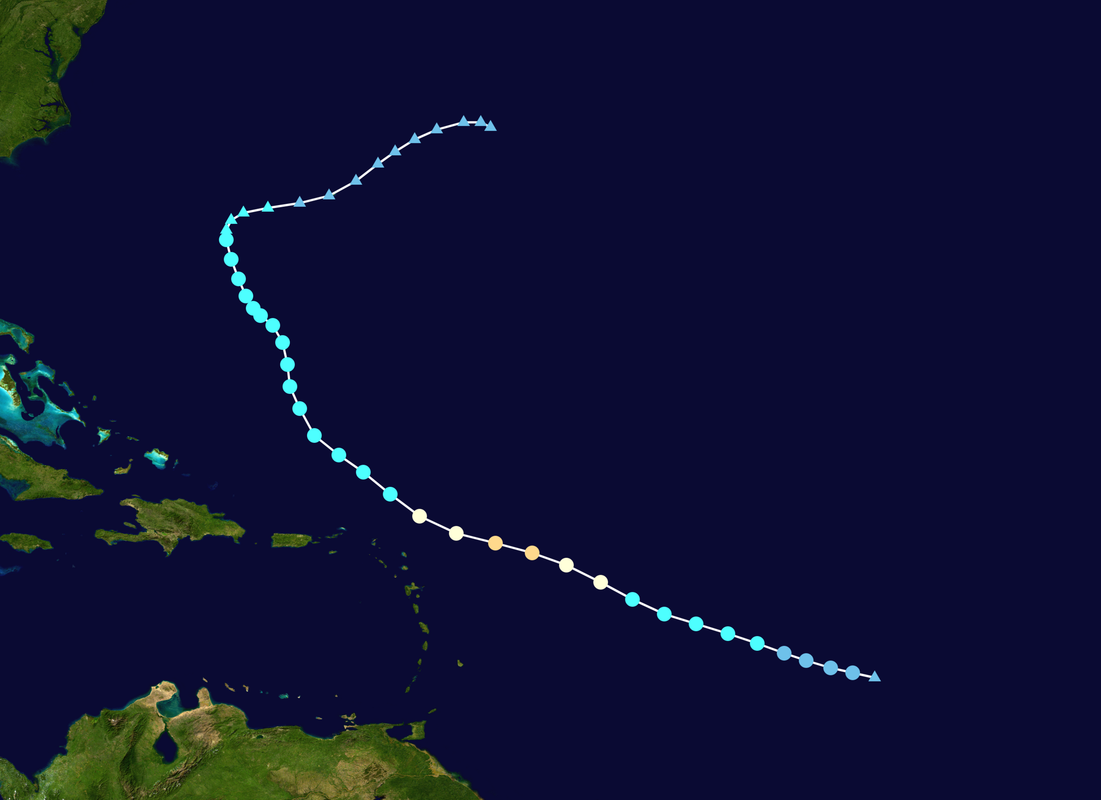
Jerry 2025's projected track and intensity (officially) are both eerily similar to the last Jerry, in 2019.
This is not the first time that it happened this season: Humberto 2025 also had similarities in track with Humberto 2019, but it eventually overperformed by 2 categories. Will Jerry do the same?
This is not the first time that it happened this season: Humberto 2025 also had similarities in track with Humberto 2019, but it eventually overperformed by 2 categories. Will Jerry do the same?
6 likes
-
CyclonicFury

- Category 5
- Posts: 2030
- Age: 26
- Joined: Sun Jul 02, 2017 12:32 pm
- Location: NC
- Contact:
Re: NATL: JERRY - Tropical Storm - Discussion
It's interesting how we have seen more October MDR storms in recent years. Hurricane Tammy in 2023, Hurricanes Kirk and Leslie last year, and now Jerry this year. October wasn't historically considered part of CV season, but in recent years it has been.
4 likes
NCSU B.S. in Meteorology Class of 2021. Tropical weather blogger at http://www.cyclonicfury.com. My forecasts and thoughts are NOT official, for official forecasts please consult the National Hurricane Center.
Return to “Active Storms/Invests - Atlantic/EastPAC/CentralPAC/MED”
Who is online
Users browsing this forum: No registered users and 74 guests