hurricanetrack wrote:Topsail not Top Soil
Yes,I fixed it.
Moderator: S2k Moderators


txwatcher91 wrote:Wthrman13 wrote:Shear does not ventilate the storm, the UL divergence does. Shear is pretty much never beneficial in and of itself for a developing tropical system. It just so happens that UL lows usually have regions of shear surrounding them. Depending on the location of the tropical disturbance relative to the UL, the system can find itself in a region of UL divergence and/or strong vertical wind shear. The best case is if it is in a region of UL divergence, with low shear. The point is that there is no such thing as "favorable shear" for a tropical system. It's all about the UL divergence, and UL lows/troughs can enhance that for tropical systems, but sometimes at the expense of providing too much shear as well. Sometimes a system can intensify even under the presence of shear, and this is usually due to some sort of baroclinic mechanism, sometimes resulting in a subtropical storm, but this only goes far. To really get a cranking TC, you need to relax the shear to very low values.
EDIT: I should point out that when I'm talking about shear above, I mean shear that is positioned directly over a TC's center that is associated with external influences. All TC's have strong vertical shear on their outskirts, due in part to their own outflow (which is anticyclonic, being positioned directly over the low-level inflow, which is cyclonic).
Is the ULL in a position to continue helping this thing intensify, or will it hinder it?
hurricanedude wrote:dont much matter if its goes straight to TS status....35 mph td or 40 mph ts....not much difference
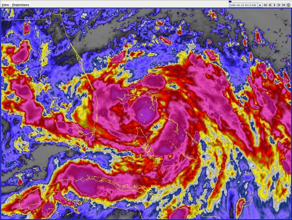
Derek Ortt wrote:This needs one good convective burst to form a well-defined LLC
Predicting the burst, however, is nearly impossible

Derek Ortt wrote:This needs one good convective burst to form a well-defined LLC
Predicting the burst, however, is nearly impossible


HURAKAN wrote:Latest:
I'M A MODERATOR!!!
Users browsing this forum: No registered users and 60 guests


