

Countrygirl911 wrote:wow i leave for church come back and the model runs are comming in showinf SWLA and texas line and that it looks to be a monster i pray that is not the fact and that it just becomes a fish or dissapears. Nearly 5 years after Katrina they have a monster heading that way as of now i know model runs changes very often expecially this far out but lord help us all if that model run shows to be on the right track.
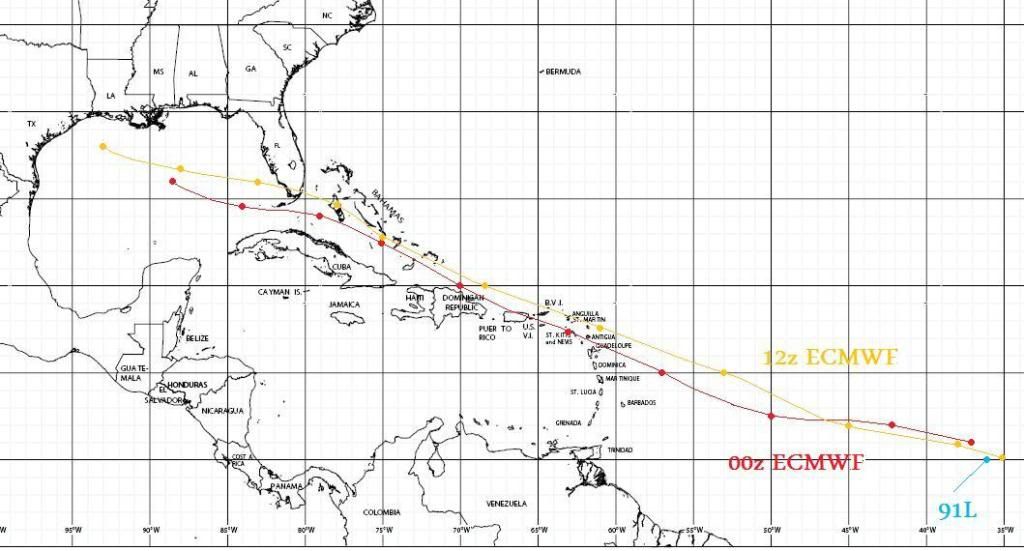
The Euro is not showing a monster, a tropical storm at the most. It is also the western outlier at the moment.
Plenty of time for everyone to watch it. The Islanders don't have as much time ...


 On the one hand, there's no need to get worked up over a very long range track/intensity forecast because of the inherent error involved. However, it smacks of logical fallacy to completely trash all the work that's been put into these models simply because they can't nail a track and intensity of a feature whose inner workings they can only resolve poorly/not at all. It's shortsighted to say that it is all worthless, because there's still important information that can be gleaned from the mass fields even at this long range.