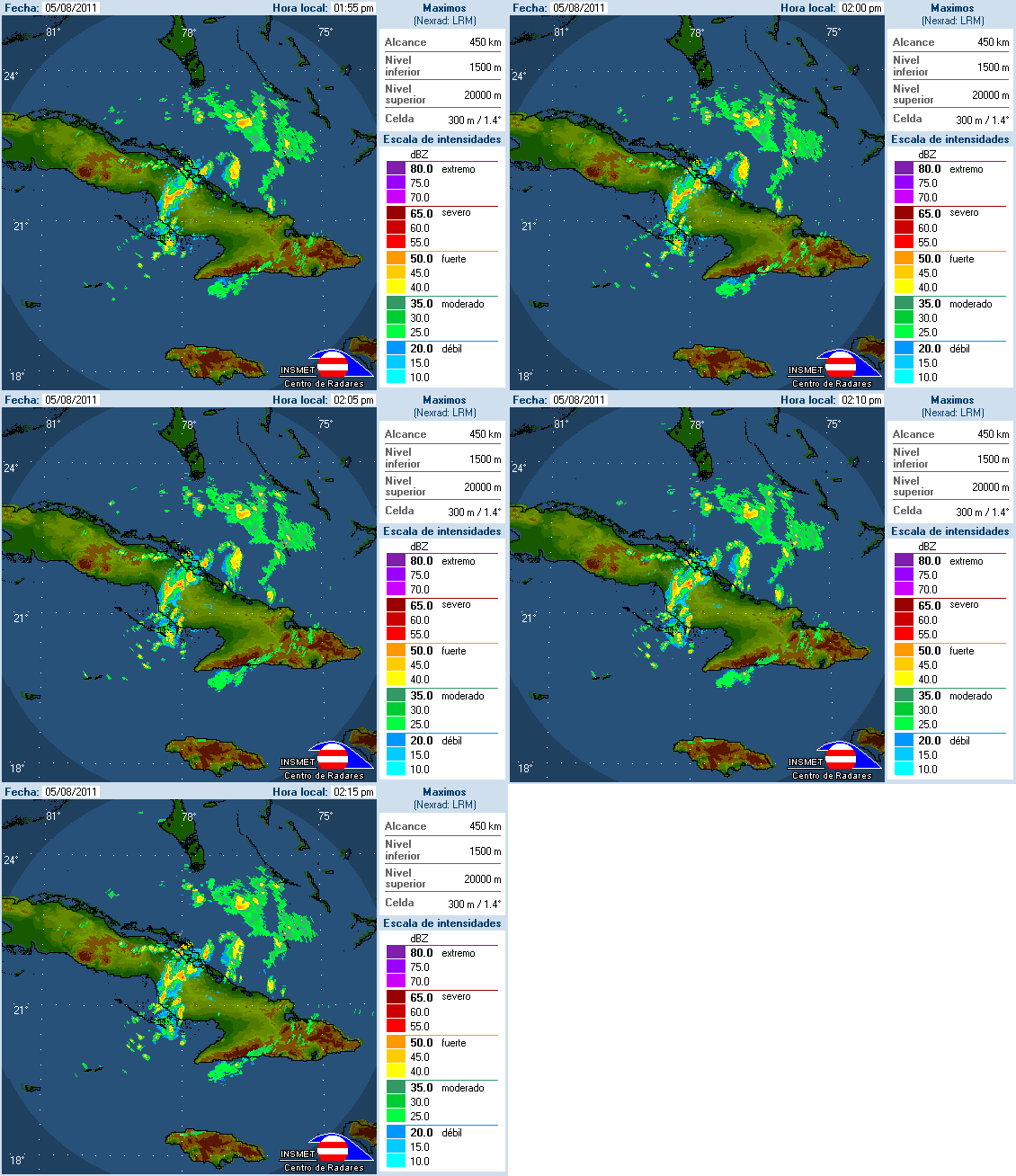
ozonepete wrote:If it's the LLC by 23.3N 79W that will be quite interesting. That one sure looks like it's going WNW into the eastern Gulf. No way that's going to wind up east of Florida.
Steering currents suggest otherwise.
Moderator: S2k Moderators

ozonepete wrote:If it's the LLC by 23.3N 79W that will be quite interesting. That one sure looks like it's going WNW into the eastern Gulf. No way that's going to wind up east of Florida.
wxman57 wrote:gatorcane wrote:Click the link below and then click on the FRONTS tab. You can see where the low is located.
I can also see clouds quicks blowing off of cuba and getting sucked into where that Low is located (inflow).
Lots of convection now starting to surround that area of lower pressure.
There is something going on there. If trends continue I can see this up to 80%+ by next TWO:
http://www.ssd.noaa.gov/goes/flt/t2/loop-vis.html
That's where the weak low pressure area WAS located quite a while ago. It's not there now.


wxman57 wrote:ozonepete wrote:If it's the LLC by 23.3N 79W that will be quite interesting. That one sure looks like it's going WNW into the eastern Gulf. No way that's going to wind up east of Florida.
Steering currents suggest otherwise.


Vortex wrote:A few reports now of SW winds over Cuba....
Cienfuegos
Cuba
Current Cienfuegos Weather Conditions Updated Aug 05, 2011 12:52 PM
Mostly Cloudy
Temperature: 33°C Dew Point: 25°C
Barometer: 101.2 kPa Wind: SW 17 km/h
Humidity: 63 % Visibility: n/a

BigJoeBastardiJoe Bastardi
Emily fought Hispaniola and Hispaniola won. System looks ragged psble cntr 22.5, 75.0 http://t.co/PyN3X3i
5 hours ago

ozonepete wrote:wxman57 wrote:ozonepete wrote:If it's the LLC by 23.3N 79W that will be quite interesting. That one sure looks like it's going WNW into the eastern Gulf. No way that's going to wind up east of Florida.
Steering currents suggest otherwise.
How so wxman? Here's the steering winds for weak systems from CIMSS:
http://i189.photobucket.com/albums/z174 ... -0518Z.gif
Where do you think it would go?

ozonepete wrote:Where do you think it would go?
wxman57 wrote:Steering currents today won't match tomorrow. The disturbance is rounding an area of high pressure to its east. Should track northward through the western Bahamas tomorrow then NE and out to sea Sunday. Oh, and the NHC position as of an hour ago was in the vicinity of 23N/78W.

ozonepete wrote:ozonepete wrote:Where do you think it would go?wxman57 wrote:Steering currents today won't match tomorrow. The disturbance is rounding an area of high pressure to its east. Should track northward through the western Bahamas tomorrow then NE and out to sea Sunday. Oh, and the NHC position as of an hour ago was in the vicinity of 23N/78W.
Thanks, wxman. That NHC position is definitely the one that's on the KMIA radar. And it DOES look like it may close off.

wxman57 wrote:Now being weaker, that low-level vorticity center COULD pass right over south Florida before turning north. In that case, heaviest squalls would still remain offshore tomorrow, but it would enhance daytime storms across the state through Sunday morning.
ozonepete wrote:wxman57 wrote:Now being weaker, that low-level vorticity center COULD pass right over south Florida before turning north. In that case, heaviest squalls would still remain offshore tomorrow, but it would enhance daytime storms across the state through Sunday morning.
I'm inclined to think that that really may happen since it's moving quite fast.


Users browsing this forum: No registered users and 41 guests