ATL: EMILY - Remnants

Moderator: S2k Moderators

Message
Author
User avatar
wxman57
Moderator-Pro Met
Moderator-Pro Met
Posts: 22979
Age: 67
Joined: Sat Jun 21, 2003 8:06 pm
Location: Houston, TX (southwest)

Re: ATL: EMILY - Remnants - Discussion

#7901 Postby wxman57 » Fri Aug 05, 2011 1:58 pm

ozonepete wrote:If it's the LLC by 23.3N 79W that will be quite interesting. That one sure looks like it's going WNW into the eastern Gulf. No way that's going to wind up east of Florida.


Steering currents suggest otherwise.
0 likes   

cpdaman
Category 5
Category 5
Posts: 3131
Joined: Sat Jun 10, 2006 11:44 am
Location: SPB county (gulf stream)

Re: Re:

#7902 Postby cpdaman » Fri Aug 05, 2011 1:58 pm

wxman57 wrote:
gatorcane wrote:Click the link below and then click on the FRONTS tab. You can see where the low is located.

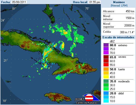
I can also see clouds quicks blowing off of cuba and getting sucked into where that Low is located (inflow).

Lots of convection now starting to surround that area of lower pressure.

There is something going on there. If trends continue I can see this up to 80%+ by next TWO:

http://www.ssd.noaa.gov/goes/flt/t2/loop-vis.html


That's where the weak low pressure area WAS located quite a while ago. It's not there now.


nhc says it is 1 hour ago.

are you basing this on a lack of obs. because obs are sparse and would never really find a LLC based on how sparse the obs are.

but obviously you know your stuff....so what other tools do you use besides lack of obs to determine LLC is not there
0 likes   

jonj2040
Tropical Storm
Tropical Storm
Posts: 227
Age: 30
Joined: Sat Jul 10, 2010 10:00 pm
Location: Palm Bay, FL

#7903 Postby jonj2040 » Fri Aug 05, 2011 1:59 pm

Cuban radar gif
btw is there any way to speed these up? could some one PM me if there is
Image
0 likes   
I am just an amateur and a "noob" at that so any speculations that I have made are just that, uneducated speculations. Please refer to the NHC for accurate information.
Thank you all for your thoughts, I've loved reading through this community since '06 and finally decided to post more actively.
-JJ :D

ozonepete
Professional-Met
Professional-Met
Posts: 4743
Joined: Mon Sep 07, 2009 3:23 pm
Location: From Ozone Park, NYC / Now in Brooklyn, NY

Re: ATL: EMILY - Remnants - Discussion

#7904 Postby ozonepete » Fri Aug 05, 2011 2:04 pm

wxman57 wrote:
ozonepete wrote:If it's the LLC by 23.3N 79W that will be quite interesting. That one sure looks like it's going WNW into the eastern Gulf. No way that's going to wind up east of Florida.


Steering currents suggest otherwise.


How so wxman? Here's the steering winds for weak systems from CIMSS:

Image

Where do you think it would go?
Last edited by ozonepete on Fri Aug 05, 2011 2:05 pm, edited 1 time in total.
0 likes   

Frank2
Category 5
Category 5
Posts: 4061
Joined: Mon Jul 25, 2005 12:47 pm

Re: ATL: EMILY - Remnants - Discussion

#7905 Postby Frank2 » Fri Aug 05, 2011 2:05 pm

Nothing much there, aside from scattered convection associated with perhaps a weak ULL, the remnants (which is a word hard to spell - lol) of Em and the frontal trough to the north...

Have a good weekend, everyone...

Frank
0 likes   

User avatar
Vortex
S2K Supporter
S2K Supporter
Posts: 4644
Age: 53
Joined: Fri Aug 01, 2003 9:34 pm
Location: Hilton Head, SC

Re: ATL: EMILY - Remnants - Discussion

#7906 Postby Vortex » Fri Aug 05, 2011 2:05 pm

A few reports now of SW winds over Cuba....


Cienfuegos
Cuba


Current Cienfuegos Weather Conditions Updated Aug 05, 2011 12:52 PM


Mostly Cloudy
Temperature: 33°C Dew Point: 25°C
Barometer: 101.2 kPa Wind: SW 17 km/h
Humidity: 63 % Visibility: n/a
0 likes   

ozonepete
Professional-Met
Professional-Met
Posts: 4743
Joined: Mon Sep 07, 2009 3:23 pm
Location: From Ozone Park, NYC / Now in Brooklyn, NY

Re: ATL: EMILY - Remnants - Discussion

#7907 Postby ozonepete » Fri Aug 05, 2011 2:08 pm

Vortex wrote:A few reports now of SW winds over Cuba....


Cienfuegos
Cuba


Current Cienfuegos Weather Conditions Updated Aug 05, 2011 12:52 PM


Mostly Cloudy
Temperature: 33°C Dew Point: 25°C
Barometer: 101.2 kPa Wind: SW 17 km/h
Humidity: 63 % Visibility: n/a


That could be the seabreeze though, right?
0 likes   

User avatar
Vortex
S2K Supporter
S2K Supporter
Posts: 4644
Age: 53
Joined: Fri Aug 01, 2003 9:34 pm
Location: Hilton Head, SC

#7908 Postby Vortex » Fri Aug 05, 2011 2:08 pm

Convection continues to increase overall and is beginning to tap into the NW carribean...
0 likes   

Sanibel
Category 5
Category 5
Posts: 10375
Joined: Mon Aug 30, 2004 11:06 pm
Location: Offshore SW Florida

Re: ATL: EMILY - Remnants - Discussion

#7909 Postby Sanibel » Fri Aug 05, 2011 2:08 pm

I'm also seeing a naked weak center headed through the Straits to the Gulf.
0 likes   

Frank2
Category 5
Category 5
Posts: 4061
Joined: Mon Jul 25, 2005 12:47 pm

Re: ATL: EMILY - Remnants - Discussion

#7910 Postby Frank2 » Fri Aug 05, 2011 2:09 pm

Ceinfuegos would be too far away (due south of Miami) and perhaps just related to their afternoon seabreezes from the Caribbean...

Perhaps still a very weak LLC without any upper air support but it can't be more than that at this time...
Last edited by Frank2 on Fri Aug 05, 2011 2:11 pm, edited 1 time in total.
0 likes   

bamajammer4eva
Category 4
Category 4
Posts: 907
Joined: Sun Apr 18, 2010 3:21 am
Location: Ozark, AL

Re: ATL: EMILY - Remnants - Discussion

#7911 Postby bamajammer4eva » Fri Aug 05, 2011 2:11 pm

JB still likes it

BigJoeBastardiJoe Bastardi

Emily fought Hispaniola and Hispaniola won. System looks ragged psble cntr 22.5, 75.0 http://t.co/PyN3X3i

5 hours ago
0 likes   

User avatar
wxman57
Moderator-Pro Met
Moderator-Pro Met
Posts: 22979
Age: 67
Joined: Sat Jun 21, 2003 8:06 pm
Location: Houston, TX (southwest)

Re: ATL: EMILY - Remnants - Discussion

#7912 Postby wxman57 » Fri Aug 05, 2011 2:13 pm

ozonepete wrote:
wxman57 wrote:
ozonepete wrote:If it's the LLC by 23.3N 79W that will be quite interesting. That one sure looks like it's going WNW into the eastern Gulf. No way that's going to wind up east of Florida.


Steering currents suggest otherwise.


How so wxman? Here's the steering winds for weak systems from CIMSS:

http://i189.photobucket.com/albums/z174 ... -0518Z.gif

Where do you think it would go?


Steering currents today won't match tomorrow. The disturbance is rounding an area of high pressure to its east. Should track northward through the western Bahamas tomorrow then NE and out to sea Sunday. Oh, and the NHC position as of an hour ago was in the vicinity of 23N/78W.
0 likes   

ozonepete
Professional-Met
Professional-Met
Posts: 4743
Joined: Mon Sep 07, 2009 3:23 pm
Location: From Ozone Park, NYC / Now in Brooklyn, NY

Re: ATL: EMILY - Remnants - Discussion

#7913 Postby ozonepete » Fri Aug 05, 2011 2:19 pm

ozonepete wrote:Where do you think it would go?


wxman57 wrote:Steering currents today won't match tomorrow. The disturbance is rounding an area of high pressure to its east. Should track northward through the western Bahamas tomorrow then NE and out to sea Sunday. Oh, and the NHC position as of an hour ago was in the vicinity of 23N/78W.


Thanks, wxman. That NHC position is definitely the one that's on the KMIA radar. And it DOES look like it may close off.
0 likes   

User avatar
wxman57
Moderator-Pro Met
Moderator-Pro Met
Posts: 22979
Age: 67
Joined: Sat Jun 21, 2003 8:06 pm
Location: Houston, TX (southwest)

Re: ATL: EMILY - Remnants - Discussion

#7914 Postby wxman57 » Fri Aug 05, 2011 2:22 pm

ozonepete wrote:
ozonepete wrote:Where do you think it would go?


wxman57 wrote:Steering currents today won't match tomorrow. The disturbance is rounding an area of high pressure to its east. Should track northward through the western Bahamas tomorrow then NE and out to sea Sunday. Oh, and the NHC position as of an hour ago was in the vicinity of 23N/78W.


Thanks, wxman. That NHC position is definitely the one that's on the KMIA radar. And it DOES look like it may close off.


Now being weaker, that low-level vorticity center COULD pass right over south Florida before turning north. In that case, heaviest squalls would still remain offshore tomorrow, but it would enhance daytime storms across the state through Sunday morning.
0 likes   

User avatar
Vortex
S2K Supporter
S2K Supporter
Posts: 4644
Age: 53
Joined: Fri Aug 01, 2003 9:34 pm
Location: Hilton Head, SC

#7915 Postby Vortex » Fri Aug 05, 2011 2:24 pm

I think deep convection firing over her suspected center should be enough to spawn a surface reflection overnight in the vicinity of Andros...Should track NW/NNW to just offshore the SE FL coast by late Saturday before turning N then NE....
0 likes   

ozonepete
Professional-Met
Professional-Met
Posts: 4743
Joined: Mon Sep 07, 2009 3:23 pm
Location: From Ozone Park, NYC / Now in Brooklyn, NY

Re: ATL: EMILY - Remnants - Discussion

#7916 Postby ozonepete » Fri Aug 05, 2011 2:26 pm

wxman57 wrote:Now being weaker, that low-level vorticity center COULD pass right over south Florida before turning north. In that case, heaviest squalls would still remain offshore tomorrow, but it would enhance daytime storms across the state through Sunday morning.


I'm inclined to think that that really may happen since it's moving quite fast.
0 likes   

User avatar
artist
Category 5
Category 5
Posts: 9792
Joined: Mon Jun 06, 2005 3:26 pm
Location: West Palm

#7917 Postby artist » Fri Aug 05, 2011 2:27 pm

I'm just waiting for her to possibly get over the Gulf Stream and see what happens then.
0 likes   

canes04
Category 1
Category 1
Posts: 302
Joined: Sat May 22, 2004 5:41 pm
Location: Miami, FL

Re: ATL: EMILY - Remnants - Discussion

#7918 Postby canes04 » Fri Aug 05, 2011 2:28 pm

2PM TWD.

A 1011 MB LOW PRESSURE CENTER IS NEAR 22N76W JUST OFF THE COAST
OF CUBA ON THE BAHAMAS SIDE.
0 likes   

User avatar
Vortex
S2K Supporter
S2K Supporter
Posts: 4644
Age: 53
Joined: Fri Aug 01, 2003 9:34 pm
Location: Hilton Head, SC

Re: ATL: EMILY - Remnants - Discussion

#7919 Postby Vortex » Fri Aug 05, 2011 2:29 pm

ozonepete wrote:
wxman57 wrote:Now being weaker, that low-level vorticity center COULD pass right over south Florida before turning north. In that case, heaviest squalls would still remain offshore tomorrow, but it would enhance daytime storms across the state through Sunday morning.


I'm inclined to think that that really may happen since it's moving quite fast.


more or less my current thinking....
0 likes   

User avatar
wxman57
Moderator-Pro Met
Moderator-Pro Met
Posts: 22979
Age: 67
Joined: Sat Jun 21, 2003 8:06 pm
Location: Houston, TX (southwest)

Re: ATL: Ex EMILY - Models

#7920 Postby wxman57 » Fri Aug 05, 2011 2:34 pm

All models in agreement now. Even the Canadian shifted to the eastern Bahamas - it was the farthest west before. A couple of GFDL versions do take the vorticity over the FL Peninsula:

Image
0 likes   


Return to “2011”

Who is online

Users browsing this forum: No registered users and 32 guests