SFLcane wrote:https://i.imgur.com/aVM52y5.png
Just a tad weaker.
Moderator: S2k Moderators

SFLcane wrote:https://i.imgur.com/aVM52y5.png
AutoPenalti wrote:MJGarrison wrote:AutoPenalti wrote:Am I reading this wrong? HWRF seems to be quite the opposite of big loser. It's not the lowest but it's not the highest either..
Wxman specifically was calling out Day 4
Sent from my iPad using Tapatalk
Oh, the way he wrote it out I thought he was saying all 4 days.


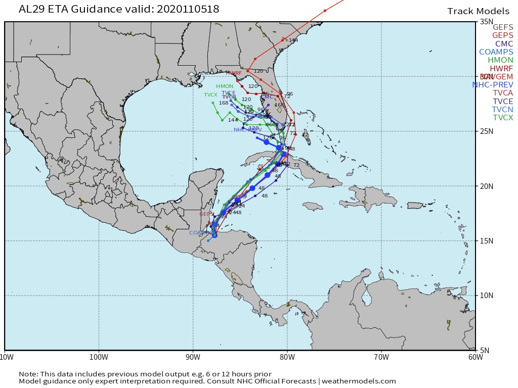
AutoPenalti wrote:wxman57 wrote:Here's a website (Univ. of Albany) that has track and intensity verification for storms.
Eta: http://www.atmos.albany.edu/facstaff/tang/tcguidance/al292020/
Worst models for track are NGX/NOGAPS and the UKMET.
http://wxman57.com/images/Etatrack.png
HWRF is the big loser for intensity. EC is best at day 4, but only has one verification point.
http://wxman57.com/images/Etaintensity.png
Am I reading this wrong? HWRF seems to be quite the opposite of big loser. It's not the lowest but it's not the highest either..


CyclonicFury wrote:wxman57 wrote:Here's a website (Univ. of Albany) that has track and intensity verification for storms.
Eta: http://www.atmos.albany.edu/facstaff/tang/tcguidance/al292020/
Worst models for track are NGX/NOGAPS and the UKMET.
http://wxman57.com/images/Etatrack.png
HWRF is the big loser for intensity. EC is best at day 4, but only has one verification point.
http://wxman57.com/images/Etaintensity.png
How is the HWRF a big loser for intensity, when it consistently showed Eta becoming a Category 4 hurricane before it formed while the Euro showed only a TS/weak C1?


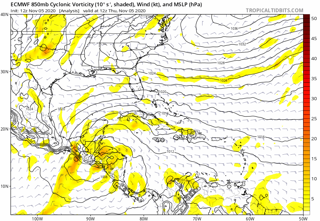
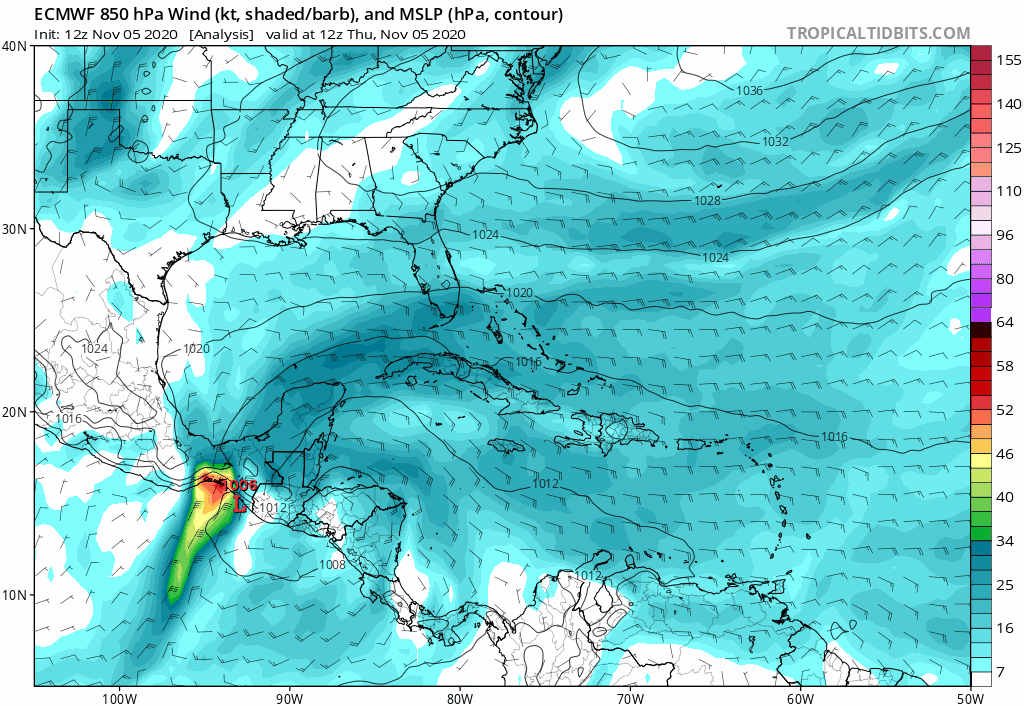
gatorcane wrote:Blocked from moving into the Florida peninsula and off into the Gulf towards northern Gulf coast it goes...again...
https://i.postimg.cc/Qth1gRnh/ecmwf-uv850-vort-watl-fh0-168.gif

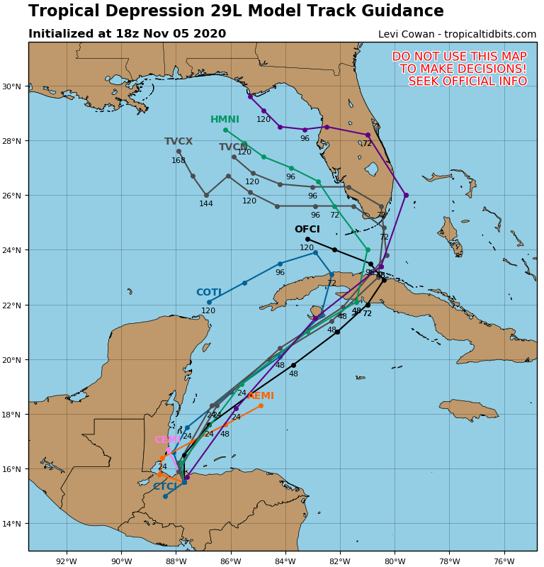
SFLcane wrote:Big shift east with tcvn now across SFL!

SFLcane wrote:Big shift east with tcvn now across SFL!
https://i.postimg.cc/L6PxZ53X/DC597-D22-D2-AF-4060-A126-3-E2-F6-DC605-C7.png
SFLcane wrote:Big shift east with tcvn now across SFL!
https://i.postimg.cc/L6PxZ53X/DC597-D22-D2-AF-4060-A126-3-E2-F6-DC605-C7.png


Emmett_Brown wrote:Eta is shaping up to be the ultimate nowcast storm with a potentially dizzying track. However, while the operational runs are still moving all over the place, I do think model ensembles are probably pretty useful in this situation. The 12Z GEFS shows lighter shear over the E GOM for M-W next week than it did a couple of days ago
LarryWx wrote:12Z EPS: look at the Gulf!


Users browsing this forum: No registered users and 117 guests

