ATL: INVEST 96L - Discussion

Moderator: S2k Moderators

Message
Author
User avatar
Teban54
Category 5
Category 5
Posts: 1974
Joined: Sat May 19, 2018 1:19 pm

Re: ATL: INVEST 96L - Discussion

#21 Postby Teban54 » Sat Jul 29, 2023 12:36 pm

abajan wrote:
cycloneye wrote:Looks like a skeleton.

https://i.imgur.com/0aW64ZC.gif


Definitely looks less vigorous than yesterday. The dry air is affecting it. They should probably reduce the 2-day development chance in the next TWO to 10%, if not 0%. Seven days is a long way out. So, I'd leave that at 70% for now, I guess.

And they upped it to 30% :lol:
3 likes   

User avatar
Teban54
Category 5
Category 5
Posts: 1974
Joined: Sat May 19, 2018 1:19 pm

Re: ATL: INVEST 96L - Discussion

#22 Postby Teban54 » Sat Jul 29, 2023 1:33 pm

96L heard all the complaints about dry air and reacted with this:
Image
4 likes   

MEANINGLESS_NUMBERS
Tropical Depression
Tropical Depression
Posts: 61
Joined: Mon Nov 02, 2020 1:43 pm

Re: ATL: INVEST 96L - Discussion

#23 Postby MEANINGLESS_NUMBERS » Sat Jul 29, 2023 2:37 pm

Nimbus wrote:The Apex of the wave is already closing in on 18N so still no danger for the islands.


Except that one island.
0 likes   

Sciencerocks
Category 5
Category 5
Posts: 7287
Age: 38
Joined: Thu Jul 06, 2017 1:51 am

Re: ATL: INVEST 96L - Discussion

#24 Postby Sciencerocks » Sat Jul 29, 2023 4:43 pm

Image
4 likes   

User avatar
Category5Kaiju
Category 5
Category 5
Posts: 3402
Age: 22
Joined: Thu Dec 24, 2020 12:45 pm
Location: Seattle

Re: ATL: INVEST 96L - Discussion

#25 Postby Category5Kaiju » Sat Jul 29, 2023 5:15 pm

And once again, we see a perfect example of how a dry tropical wave doesn't necessarily always have to stay as a dry tropical wave. :lol:
5 likes   
Unless explicitly stated, all information covered in my posts is based on my opinions and observations. Please refer to a professional meteorologist or an accredited weather research agency otherwise, especially if serious decisions must be made in the event of a potentially life-threatening tropical storm or hurricane.

User avatar
cycloneye
Admin
Admin
Posts: 139329
Age: 67
Joined: Thu Oct 10, 2002 10:54 am
Location: San Juan, Puerto Rico

Re: ATL: INVEST 96L - Discussion

#26 Postby cycloneye » Sat Jul 29, 2023 6:45 pm

Tropical Weather Outlook
NWS National Hurricane Center Miami FL
800 PM EDT Sat Jul 29 2023

For the North Atlantic...Caribbean Sea and the Gulf of Mexico:

1. Central Tropical Atlantic (AL96):
Disorganized cloudiness and showers located about 1000 miles
east-northeast of the Leeward Islands are associated with a
tropical wave and broad area of low pressure. Environmental
conditions are forecast to be favorable for gradual development of
this system during the next few days, and a tropical depression is
likely to form during the early part of next week. The disturbance
is expected to move northwestward at about 15 mph during the next
day or so, and then turn northward over the central subtropical
Atlantic by late Monday or Tuesday.
* Formation chance through 48 hours...low...30 percent.
* Formation chance through 7 days...high...70 percent.

Forecaster Beven
0 likes   
Visit the Caribbean-Central America Weather Thread where you can find at first post web cams,radars
and observations from Caribbean basin members Click Here

User avatar
cycloneye
Admin
Admin
Posts: 139329
Age: 67
Joined: Thu Oct 10, 2002 10:54 am
Location: San Juan, Puerto Rico

Re: ATL: INVEST 96L - Discussion

#27 Postby cycloneye » Sat Jul 29, 2023 8:16 pm

AL, 96, 2023073000, , BEST, 0, 191N, 471W, 25, 1013, DB
1 likes   
Visit the Caribbean-Central America Weather Thread where you can find at first post web cams,radars
and observations from Caribbean basin members Click Here

Sciencerocks
Category 5
Category 5
Posts: 7287
Age: 38
Joined: Thu Jul 06, 2017 1:51 am

Re: ATL: INVEST 96L - Discussion

#28 Postby Sciencerocks » Sat Jul 29, 2023 8:40 pm

Image
0 likes   

User avatar
abajan
S2K Supporter
S2K Supporter
Posts: 4175
Joined: Sun Sep 07, 2003 5:10 am
Location: Barbados

Re: ATL: INVEST 96L - Discussion

#29 Postby abajan » Sun Jul 30, 2023 12:48 am

Tropical Weather Outlook
NWS National Hurricane Center Miami FL
200 AM EDT Sun Jul 30 2023

For the North Atlantic...Caribbean Sea and the Gulf of Mexico:

1. Central Tropical Atlantic (AL96):
Disorganized showers and thunderstorms located about 1000 miles
east-northeast of the Leeward Islands are associated with a
tropical wave and broad area of low pressure. Environmental
conditions are forecast to be favorable for gradual development of
this system during the next few days, and a tropical depression is
likely to form during the early part of the week. The disturbance
is expected to move northwestward at about 15 mph during the next
day or so, and then turn northward over the central subtropical
Atlantic by late Monday or Tuesday.
* Formation chance through 48 hours...medium...40 percent.
* Formation chance through 7 days...high...70 percent.

Forecaster Kelly/Beven
0 likes   

User avatar
cycloneye
Admin
Admin
Posts: 139329
Age: 67
Joined: Thu Oct 10, 2002 10:54 am
Location: San Juan, Puerto Rico

Re: ATL: INVEST 96L - Discussion

#30 Postby cycloneye » Sun Jul 30, 2023 6:43 am

8 AM TWO:

Central Tropical Atlantic (AL96):
Disorganized showers and thunderstorms continue in association with
a broad area of low pressure located a little less than 1000 miles
east-northeast of the Leeward Islands. Environmental conditions are
forecast to be marginally favorable for gradual development of this
system during the next few days, and a tropical depression is likely
to form during the early part of this week. The system is expected
to move northwestward at about 15 mph during the next day or so, and
then turn northward over the central subtropical Atlantic by late
Monday or Tuesday.
* Formation chance through 48 hours...medium...40 percent.
* Formation chance through 7 days...high...70 percent.
0 likes   
Visit the Caribbean-Central America Weather Thread where you can find at first post web cams,radars
and observations from Caribbean basin members Click Here

User avatar
cycloneye
Admin
Admin
Posts: 139329
Age: 67
Joined: Thu Oct 10, 2002 10:54 am
Location: San Juan, Puerto Rico

Re: ATL: INVEST 96L - Discussion

#31 Postby cycloneye » Sun Jul 30, 2023 7:52 am

AL, 96, 2023073012, , BEST, 0, 205N, 499W, 25, 1013, DB
0 likes   
Visit the Caribbean-Central America Weather Thread where you can find at first post web cams,radars
and observations from Caribbean basin members Click Here

User avatar
Teban54
Category 5
Category 5
Posts: 1974
Joined: Sat May 19, 2018 1:19 pm

Re: ATL: INVEST 96L - Discussion

#32 Postby Teban54 » Sun Jul 30, 2023 10:00 am

Looks like a broad rotation is being pulled north towards the western edge of the convection.
Image
0 likes   

Sciencerocks
Category 5
Category 5
Posts: 7287
Age: 38
Joined: Thu Jul 06, 2017 1:51 am

Re: ATL: INVEST 96L - Discussion

#33 Postby Sciencerocks » Sun Jul 30, 2023 12:11 pm

LLC developing near the western edge of the convection so it would only need only slight organization to be considered a depression. I think this has a pretty good chance at being named during the next couple of days.
Image
1 likes   

User avatar
cycloneye
Admin
Admin
Posts: 139329
Age: 67
Joined: Thu Oct 10, 2002 10:54 am
Location: San Juan, Puerto Rico

Re: ATL: INVEST 96L - Discussion

#34 Postby cycloneye » Sun Jul 30, 2023 12:56 pm

Central Tropical Atlantic (AL96):
Shower and thunderstorm activity has become a little more
concentrated in association with an area of low pressure located
about 700 miles east-northeast of the Leeward Islands. Environmental
conditions are forecast to be marginally favorable for gradual
development of this system over the next few days, and a tropical
depression is likely to form during the early part of this week. The
system is expected to move northwestward at about 15 mph during the
next day or so, and then turn northward over the central subtropical
Atlantic by late Monday or Tuesday.
* Formation chance through 48 hours...medium...50 percent.
* Formation chance through 7 days...high...70 percent.
0 likes   
Visit the Caribbean-Central America Weather Thread where you can find at first post web cams,radars
and observations from Caribbean basin members Click Here

User avatar
cycloneye
Admin
Admin
Posts: 139329
Age: 67
Joined: Thu Oct 10, 2002 10:54 am
Location: San Juan, Puerto Rico

Re: ATL: INVEST 96L - Discussion

#35 Postby cycloneye » Sun Jul 30, 2023 1:46 pm

TXNT22 KNES 301822
TCSNTL

A. TROPICAL DISTURBANCE (96L)

B. 30/1800Z

C. 21.4N

D. 51.0W

E. FIVE/GOES-E

F. T1.0/1.0

G. IR/EIR/VIS

H. REMARKS...GREATER THAN 2/10 BANDING RESULTS IN A DT OF 1.0. MET AND
PT ARE ALSO 1.0. THE FT IS BASED ON THE DT.

I. ADDL POSITIONS

NIL


...CLARK
0 likes   
Visit the Caribbean-Central America Weather Thread where you can find at first post web cams,radars
and observations from Caribbean basin members Click Here

User avatar
aspen
Category 5
Category 5
Posts: 8057
Joined: Sat Oct 12, 2019 7:10 pm
Location: Connecticut, USA

Re: ATL: INVEST 96L - Discussion

#36 Postby aspen » Sun Jul 30, 2023 3:40 pm

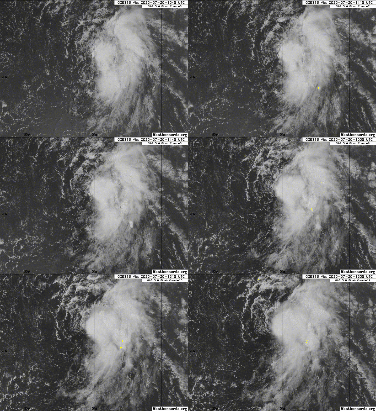
This is getting pretty close. The circulation still looks broad, but there has been a lot of consistent and very deep convection on the eastern edge of where the LLC seems to be forming. 96L’s 48hr odds should be up to code red by 8pm and we could have TS Emily tomorrow if this persists.
0 likes   
Irene '11 Sandy '12 Hermine '16 5/15/2018 Derecho Fay '20 Isaias '20 Elsa '21 Henri '21 Ida '21

I am only a meteorology enthusiast who knows a decent amount about tropical cyclones. Look to the professional mets, the NHC, or your local weather office for the best information.

User avatar
Hurricane2022
Category 4
Category 4
Posts: 945
Joined: Tue Aug 23, 2022 11:38 pm
Location: Araçatuba, Brazil

Re: ATL: INVEST 96L - Discussion

#37 Postby Hurricane2022 » Sun Jul 30, 2023 3:45 pm

Image
1 likes   
Sorry for the bad English sometimes...!
For reliable and detailed information for any meteorological phenomenon, please consult the National Hurricane Center, Joint Typhoon Warning Center , or your local Meteo Center.

--------

Una cvm Christo, pro Christo, et in Christo. Sit nomen Domini benedictvm.

Sciencerocks
Category 5
Category 5
Posts: 7287
Age: 38
Joined: Thu Jul 06, 2017 1:51 am

Re: ATL: INVEST 96L - Discussion

#38 Postby Sciencerocks » Sun Jul 30, 2023 4:45 pm

1 likes   

ChrisH-UK
Category 1
Category 1
Posts: 426
Joined: Sat May 29, 2021 8:22 am

Re: ATL: INVEST 96L - Discussion

#39 Postby ChrisH-UK » Sun Jul 30, 2023 5:20 pm

96L at sunset.

Red Band + Clean IR, Source - https://col.st/mKhtI

Image
0 likes   

User avatar
ElectricStorm
Category 5
Category 5
Posts: 4597
Age: 23
Joined: Tue Aug 13, 2019 11:23 pm
Location: Skiatook, OK / Norman, OK

Re: ATL: INVEST 96L - Discussion

#40 Postby ElectricStorm » Sun Jul 30, 2023 6:44 pm

1. Central Tropical Atlantic (AL96):
Shower and thunderstorm activity has become a little more organized
in association with an area of low pressure located about 700 miles
east-northeast of the Leeward Islands. Environmental conditions are
forecast to be marginally favorable for development over the next
few days, and a tropical depression is likely to form during the
next day or so. The system is expected to move northwestward at
about 15 mph during the next day or so, and then turn northward
over the central subtropical Atlantic by late Monday or Tuesday.
* Formation chance through 48 hours...high...70 percent.
* Formation chance through 7 days...high...80 percent.
1 likes   
I am in no way a professional. Take what I say with a grain of salt as I could be totally wrong. Please refer to the NHC, NWS, or SPC for official information.

Boomer Sooner!


Return to “2023”

Who is online

Users browsing this forum: No registered users and 19 guests