#36 Postby aspen » Sun Jul 30, 2023 3:40 pm
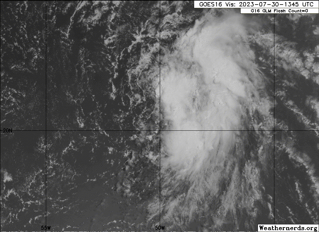
This is getting pretty close. The circulation still looks broad, but there has been a lot of consistent and very deep convection on the eastern edge of where the LLC seems to be forming. 96L’s 48hr odds should be up to code red by 8pm and we could have TS Emily tomorrow if this persists.
0 likes
Irene '11 Sandy '12 Hermine '16 5/15/2018 Derecho Fay '20 Isaias '20 Elsa '21 Henri '21 Ida '21
I am only a meteorology enthusiast who knows a decent amount about tropical cyclones. Look to the professional mets, the NHC, or your local weather office for the best information.


