TD12 forming In the Bahamas?

This is the general tropical discussion area. Anyone can take their shot at predicting a storms path.

Moderator: S2k Moderators

Forum rules

The posts in this forum are NOT official forecasts and should not be used as such. They are just the opinion of the poster and may or may not be backed by sound meteorological data. They are NOT endorsed by any professional institution or STORM2K. For official information, please refer to products from the National Hurricane Center and National Weather Service.

Help Support Storm2K
Message
Author
User avatar
Recurve
Category 5
Category 5
Posts: 1640
Joined: Tue Aug 16, 2005 8:59 pm
Location: St. Petersburg, FL

#81 Postby Recurve » Mon Aug 22, 2005 3:39 pm

This post is NOT an official forecast and should not be used as such. It is just the opinion of the poster and may or may not be backed by sound meteorological data. It is NOT endorsed by any professional institution including storm2k.org For Official Information please refer to the NHC and NWS products.


Looked at the latest vapor loop a lot, here's my attempt to diagram some of the features.

Image

A) Dry air, was diving southward toward the convection, but isn't wrapping or flowing eastward. Seems now to be moving as a mass westward, so the dry slot could reach the eastern islands and Abacos before the convection.

B) A cyclonic circulation, but I can't say at what level; swirl was prounced in vapor loop but without much convection.

C) Where I looked for wrapping convection, didn't see it yet. (D) is the direction of what looks like high outflow from this area.

Like to hear what the more experienced amateurs and pros see in the loop reagrding the development scenarios.

This is the loop I was using (zoomed in):
http://www.ssd.noaa.gov/PS/TROP/DATA/RT/watl-wv-loop.html
0 likes   

WeatherEmperor
S2K Supporter
S2K Supporter
Posts: 4806
Age: 41
Joined: Thu Sep 04, 2003 2:54 pm
Location: South Florida

#82 Postby WeatherEmperor » Mon Aug 22, 2005 3:43 pm

I somehow feel sorry for former TD10. It has been in almost unfavorable conditions almost its entire life! It just hasnt been able to quietly sit and spin all by itself and really organize.

<RICKY>
0 likes   

Matt-hurricanewatcher

#83 Postby Matt-hurricanewatcher » Mon Aug 22, 2005 3:45 pm

This would again be tropcial deprssion 10. Thats if it develops.
0 likes   

rockyman
Category 5
Category 5
Posts: 1967
Joined: Thu Jun 26, 2003 12:24 pm
Location: Dauphin Island, AL

#84 Postby rockyman » Mon Aug 22, 2005 3:55 pm

This afternoon (close to 4pm central)...while I do see some cyclonic turning on the visible loops...the clouds at the very lowest levels are still moving to the west (I do not see any of the lowest level clouds moving east toward a center)...To me it still seems like the low pressure has not made it to the surface.
0 likes   

User avatar
HouTXmetro
Category 5
Category 5
Posts: 3949
Joined: Sun Jun 13, 2004 6:00 pm
Location: District of Columbia, USA

#85 Postby HouTXmetro » Mon Aug 22, 2005 4:16 pm

Image
Just thought I'd post this.
0 likes   
[Disclaimer: My Amateur Opinion, please defer to your local authorities or the NHC for Guidance.]

Stratosphere747
Category 5
Category 5
Posts: 3772
Joined: Thu Sep 11, 2003 8:34 pm
Location: Surfside Beach/Freeport Tx
Contact:

#86 Postby Stratosphere747 » Mon Aug 22, 2005 4:18 pm

I have a feeling that this would be a totally new system, instead of 10.

Maybe the pros can chime in, but it seem 10 would have been much farther west by now.
0 likes   

djones65
Category 1
Category 1
Posts: 264
Age: 59
Joined: Mon Jun 20, 2005 12:05 am
Location: Ocean Springs, MS

#87 Postby djones65 » Mon Aug 22, 2005 4:20 pm

Actually Matt, this would not be TD #10 if
it develops. The remnant swirl of TD 10 is
dissipated, last seen over eastern Cuba late
Saturday. This disturbance is the wave that
was trailing TD #10. BTW look at the recon
plan of the day for August 23. It shows the
initial invest as 01GGA and then subsequent
tasking is shown as Cyclone 0212A. (this would
mean the second flight into the 12th cyclone).
Therefore, if it developed it would be TD #12 not 10.
If they considered it the same system it would be
numbered Invest 02FFA (since they investigated
once previously on August 18). Just my .02
0 likes   

WeatherEmperor
S2K Supporter
S2K Supporter
Posts: 4806
Age: 41
Joined: Thu Sep 04, 2003 2:54 pm
Location: South Florida

#88 Postby WeatherEmperor » Mon Aug 22, 2005 4:21 pm

HouTXmetro wrote:Image
Just thought I'd post this.


I would really not put much faith in those models. Remember those are the BAM models and LBAR models and they do a very poor job of resolving mid-latitude features especially when it is this high in Latitude. Focus more on the global models.

<RICKY>
0 likes   

User avatar
Ixolib
Category 5
Category 5
Posts: 2741
Age: 68
Joined: Sun Aug 08, 2004 8:55 pm
Location: Biloxi, MS

#89 Postby Ixolib » Mon Aug 22, 2005 4:30 pm

WeatherEmperor wrote:
HouTXmetro wrote:Image
Just thought I'd post this.


I would really not put much faith in those models. Remember those are the BAM models and LBAR models and they do a very poor job of resolving mid-latitude features especially when it is this high in Latitude. Focus more on the global models.

<RICKY>


Poor job or not, what do these models see that is causing such a "significant" leftward/southward trend at around 80-82W?
0 likes   

WeatherEmperor
S2K Supporter
S2K Supporter
Posts: 4806
Age: 41
Joined: Thu Sep 04, 2003 2:54 pm
Location: South Florida

#90 Postby WeatherEmperor » Mon Aug 22, 2005 4:33 pm

well you would have to look at the global models for that. You have to ask some of the members here for information on the European and GFS model which shows the features very nicely.

<RICKY>
0 likes   

clfenwi
Category 5
Category 5
Posts: 3331
Joined: Thu Jun 09, 2005 12:54 pm

#91 Postby clfenwi » Mon Aug 22, 2005 4:47 pm

Ixolib wrote:
WeatherEmperor wrote:
HouTXmetro wrote:Image
Just thought I'd post this.


I would really not put much faith in those models. Remember those are the BAM models and LBAR models and they do a very poor job of resolving mid-latitude features especially when it is this high in Latitude. Focus more on the global models.

<RICKY>


Poor job or not, what do these models see that is causing such a "significant" leftward/southward trend at around 80-82W?


It appears that the GFS is shifting the mid-upper level high to the west... such that by day three or four, the system is at the southeast corner of it (with northeasterly flow, thereby causing the storm to move south-west).

You can see the 96 hour steering current forecasts here:
http://www.meteo.psu.edu/~gadomski/COMP ... z/f96.html

Note that all of the models (except the UKMET) on the graphic posted above take their steering currents from the GFS.
0 likes   

WeatherEmperor
S2K Supporter
S2K Supporter
Posts: 4806
Age: 41
Joined: Thu Sep 04, 2003 2:54 pm
Location: South Florida

#92 Postby WeatherEmperor » Mon Aug 22, 2005 4:50 pm

That nice graphic you posted, how strong does it develop the system when it moves it into FL?

<RICKY>
0 likes   

Dean4Storms
S2K Supporter
S2K Supporter
Posts: 6358
Age: 62
Joined: Sun Aug 31, 2003 1:01 pm
Location: Miramar Bch. FL

#93 Postby Dean4Storms » Mon Aug 22, 2005 4:56 pm

Alot of the future track will depend on the strength and deepening of this system. If it remained just a disturbance the further west it goes, if it barely organizes probably the same thing. But if this system was to rapidly deepen as the CMC dictates then this would likely run up against the ridge as it heads poleward meaning more of a NNW movement.

If you notice, the models that barely developing this keep it drifting pretty much westward out toward the central GOM, those that deepen it more rapidly begin moving it more northward.
0 likes   

Dean4Storms
S2K Supporter
S2K Supporter
Posts: 6358
Age: 62
Joined: Sun Aug 31, 2003 1:01 pm
Location: Miramar Bch. FL

#94 Postby Dean4Storms » Mon Aug 22, 2005 5:05 pm

You were right Derek, I do see the tell tales signs of a surface low near 21.4n 72.5 west and it seems to be moving westward maybe near 5-10mph. If the UL winds relax any this could spin up nicely tomorrow.
0 likes   

User avatar
johngaltfla
Category 5
Category 5
Posts: 2069
Joined: Sun Jul 10, 2005 9:17 pm
Location: Sarasota County, FL
Contact:

#95 Postby johngaltfla » Mon Aug 22, 2005 5:16 pm

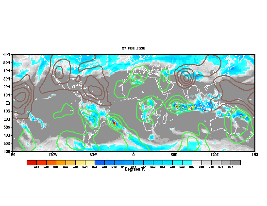
OK, experts...help...What impact does this shift in the MJO have for this storm and the next 7-10 day outlook for development. If I've been doing my homework and reading all of your posts right, we're in for a wild Labor Day and September possibly...

Image
0 likes   

WeatherEmperor
S2K Supporter
S2K Supporter
Posts: 4806
Age: 41
Joined: Thu Sep 04, 2003 2:54 pm
Location: South Florida

#96 Postby WeatherEmperor » Mon Aug 22, 2005 5:19 pm

That graphic shows a positive MJO for the majjority of the Atlantic which means favorable conditions pending some dry air that is still left in the atlantic.

<RICKY>
0 likes   

User avatar
skysummit
S2K Supporter
S2K Supporter
Posts: 5305
Age: 49
Joined: Tue Aug 31, 2004 11:09 pm
Location: Ponchatoula, LA
Contact:

#97 Postby skysummit » Mon Aug 22, 2005 5:32 pm

NOLA's Carl Arrendondo just mentioned it at 5pm. He said if it does develop, it would most likely get into the gulf, BUT woud go to the south of us in La., and toward the Texas/Mex coast. Did anyone catch what anyone esle's thought's were at 5pm?
0 likes   

User avatar
johngaltfla
Category 5
Category 5
Posts: 2069
Joined: Sun Jul 10, 2005 9:17 pm
Location: Sarasota County, FL
Contact:

#98 Postby johngaltfla » Mon Aug 22, 2005 5:48 pm

WeatherEmperor wrote:That graphic shows a positive MJO for the majjority of the Atlantic which means favorable conditions pending some dry air that is still left in the atlantic.

<RICKY>


I wonder why there's that big gap in the middle of the Atlantic. Or day I shudder to say it will fill in right when our peak hits...

Ugh. :eek:
0 likes   

User avatar
Recurve
Category 5
Category 5
Posts: 1640
Joined: Tue Aug 16, 2005 8:59 pm
Location: St. Petersburg, FL

#99 Postby Recurve » Mon Aug 22, 2005 6:03 pm

At 1 pm model runs used 21n 73w as the center, with movement slightly north of west at 7 knots.


...INITIAL CONDITIONS...

LATCUR = 21.0N LONCUR = 73.0W DIRCUR = 280DEG SPDCUR = 7KT


(from post on Tropical Analysis forum)
0 likes   

WeatherEmperor
S2K Supporter
S2K Supporter
Posts: 4806
Age: 41
Joined: Thu Sep 04, 2003 2:54 pm
Location: South Florida

#100 Postby WeatherEmperor » Mon Aug 22, 2005 6:05 pm

very slow mover. especially over those warm gulf stream waters which could fuel development.

<RICKY>
0 likes   


Return to “Talkin' Tropics”

Who is online

Users browsing this forum: AnnularCane, cajungal, cycloneye, dl20415, IsabelaWeather, Ivanhater, jaguars_22, kenayers, kevin and 51 guests