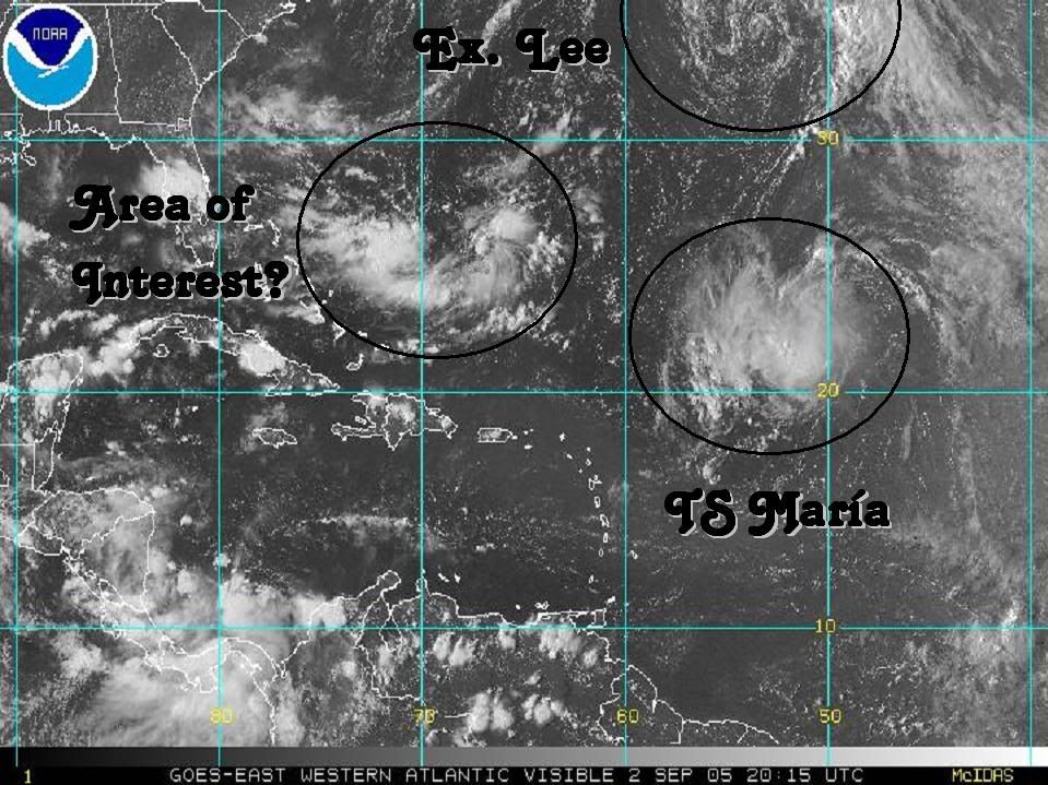
I believe this is the low that the models are depicting that gets caught under the CONUS ridge and gets pushed westward. You can also make out the other low to it's NNE that the models show getting absorbed into the westerlies and out to sea.
Looks like the early signs to me and a definite rotation beginning.
25.5n/66w Looking suspicious this PM
Moderator: S2k Moderators
Forum rules

The posts in this forum are NOT official forecasts and should not be used as such. They are just the opinion of the poster and may or may not be backed by sound meteorological data. They are NOT endorsed by any professional institution or STORM2K. For official information, please refer to products from the National Hurricane Center and National Weather Service.
-
Dean4Storms
- S2K Supporter

- Posts: 6358
- Age: 62
- Joined: Sun Aug 31, 2003 1:01 pm
- Location: Miramar Bch. FL
-
WeatherEmperor
- S2K Supporter
- Posts: 4806
- Age: 41
- Joined: Thu Sep 04, 2003 2:54 pm
- Location: South Florida
-
Hurricaneman

- Category 5

- Posts: 7404
- Age: 45
- Joined: Tue Aug 31, 2004 3:24 pm
- Location: central florida
-
WeatherEmperor
- S2K Supporter
- Posts: 4806
- Age: 41
- Joined: Thu Sep 04, 2003 2:54 pm
- Location: South Florida
-
Hurricaneman
- Category 5
- Posts: 7404
- Age: 45
- Joined: Tue Aug 31, 2004 3:24 pm
- Location: central florida

-
MiamiensisWx
Hurricaneman wrote:Do you think this will become something
No... some development is possible, but almost surely not much. There is at least 20KT to 30KT shear in the general area around the system. Not only that, but it's persistent shear, although it may be slowly decreasing. See below...
http://cimss.ssec.wisc.edu/tropic/real-time/atlantic/winds/wg8shr.GIF
Possible rainmaker for Florida? Maybe. Significant development? Almost surely not.
0 likes

-
Dean4Storms
- S2K Supporter
- Posts: 6358
- Age: 62
- Joined: Sun Aug 31, 2003 1:01 pm
- Location: Miramar Bch. FL
-
Dean4Storms
- S2K Supporter
- Posts: 6358
- Age: 62
- Joined: Sun Aug 31, 2003 1:01 pm
- Location: Miramar Bch. FL
Here you go, maybe this will help. Go to link and then zoom on the area just South and then further SSW of Bermuda, you will see both rotations.
http://www.ssd.noaa.gov/PS/TROP/DATA/RT ... -loop.html
http://www.ssd.noaa.gov/PS/TROP/DATA/RT ... -loop.html
0 likes


-
cycloneye

- Admin

- Posts: 148823
- Age: 69
- Joined: Thu Oct 10, 2002 10:54 am
- Location: San Juan, Puerto Rico
HURAKAN wrote:
HURAKAN you forgot to to put another circule at the low right of the pic to 92L.
0 likes
Visit the Caribbean-Central America Weather Thread where you can find at first post web cams,radars
and observations from Caribbean basin members Click Here
and observations from Caribbean basin members Click Here
Who is online
Users browsing this forum: pepecool20 and 39 guests