Hurricane Nate,Comments,Sat Pics,Models Thread
Moderator: S2k Moderators

my ametuer second guessing is already beginning in response to the 15 track forecast.Seems this high that is going to build in and is suppose to push 94L west eventually but move 15 NE?Guess i do not understand the effects of high pressure or have not paid enough attention to the models recently to know what they say! If its such a strong high wouldn't it feasibly push 15 SW not NE if its building in from the NW of the storm?
0 likes


-
Matt-hurricanewatcher
-
SkeetoBite

- S2K Supporter

- Posts: 515
- Age: 60
- Joined: Fri Sep 03, 2004 8:25 am
- Contact:
-
cycloneye

- Admin

- Posts: 149725
- Age: 69
- Joined: Thu Oct 10, 2002 10:54 am
- Location: San Juan, Puerto Rico
Now I know why the delay.They were at conference among the forecasters at the office deciding to upgrade TD15 or not and now we know what happpened the 14th storm of the season.
0 likes
Visit the Caribbean-Central America Weather Thread where you can find at first post web cams,radars
and observations from Caribbean basin members Click Here
and observations from Caribbean basin members Click Here


-
cycloneye
- Admin
- Posts: 149725
- Age: 69
- Joined: Thu Oct 10, 2002 10:54 am
- Location: San Juan, Puerto Rico
HURAKAN wrote:By the way, what about the TWO at 10:30 PM that is referring to this system as TD 15 and not TS Nate.
It was a last minute decision to upgrade TD15.
0 likes
Visit the Caribbean-Central America Weather Thread where you can find at first post web cams,radars
and observations from Caribbean basin members Click Here
and observations from Caribbean basin members Click Here

i hate when they end a discussion this way!!!!!!
While a weak ridge should induce slow westward motion for the
next 2-3 days... the ridge is forecast by most models to then break
down and force Nate northeastward. The new official forecast
follows this general scenario and is an eastward adjustment of the
previous advisory track. It is safe to say this is a low
confidence track forecast.
leaves me with a slightly uneasy feeling.
0 likes
-
krysof
-
cycloneye
- Admin
- Posts: 149725
- Age: 69
- Joined: Thu Oct 10, 2002 10:54 am
- Location: San Juan, Puerto Rico
TROPICAL STORM NATE (AL152005) ON 20050906 1200 UTC
...00 HRS... ...12 HRS... ...24 HRS... ...36 HRS...
050906 1200 050907 0000 050907 1200 050908 0000
LAT LON LAT LON LAT LON LAT LON
BAMD 28.6N 66.6W 28.9N 66.9W 29.2N 67.2W 29.8N 67.2W
BAMM 28.6N 66.6W 29.0N 66.9W 29.2N 67.3W 29.7N 67.7W
A98E 28.6N 66.6W 28.6N 66.8W 29.0N 66.7W 30.0N 65.9W
LBAR 28.6N 66.6W 28.9N 66.6W 29.1N 66.7W 29.5N 66.9W
SHIP 50KTS 61KTS 68KTS 73KTS
DSHP 50KTS 61KTS 68KTS 73KTS
...48 HRS... ...72 HRS... ...96 HRS... ..120 HRS...
050908 1200 050909 1200 050910 1200 050911 1200
LAT LON LAT LON LAT LON LAT LON
BAMD 30.9N 66.3W 34.0N 60.3W 37.4N 46.7W 36.9N 31.2W
BAMM 30.6N 67.7W 33.1N 64.8W 36.6N 55.1W 41.6N 41.8W
A98E 31.3N 64.6W 33.4N 60.1W 36.4N 51.4W 40.3N 37.3W
LBAR 29.8N 67.2W 32.4N 65.6W 36.4N 59.2W 41.2N 45.1W
SHIP 75KTS 73KTS 65KTS 55KTS
DSHP 75KTS 73KTS 65KTS 55KTS
...INITIAL CONDITIONS...
LATCUR = 28.6N LONCUR = 66.6W DIRCUR = 0DEG SPDCUR = 0KT
LATM12 = 28.4N LONM12 = 66.6W DIRM12 = 77DEG SPDM12 = 2KT
LATM24 = 28.5N LONM24 = 67.5W
WNDCUR = 50KT RMAXWD = 25NM WNDM12 = 35KT
CENPRS = 1000MB OUTPRS = 1012MB OUTRAD = 160NM SDEPTH = D
RD34NE = 40NM RD34SE = 40NM RD34SW = 40NM RD34NW = 40NM
0 likes
Visit the Caribbean-Central America Weather Thread where you can find at first post web cams,radars
and observations from Caribbean basin members Click Here
and observations from Caribbean basin members Click Here


-
krysof
-
Hyperstorm

- Category 5

- Posts: 1500
- Joined: Sun Sep 07, 2003 3:48 am
- Location: Ocala, FL
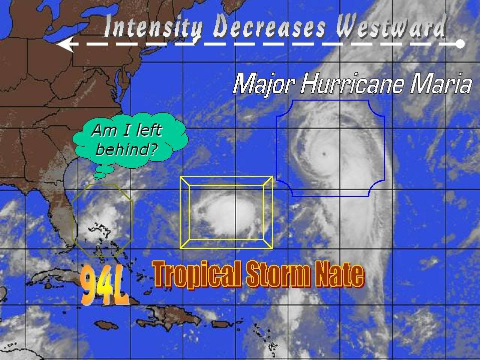
Nate is VERY close to being a hurricane if not one already. Satellite images reveal a very impressive CDO developing and outflow is very good. Winds could definitely be increased to 75mph at the 5pm advisory. If not, very likely at 11pm.
Bermuda should watch out for this system as it could very well pack quite a punch. Category 2 hurricane potential is increasing...
Bermuda should watch out for this system as it could very well pack quite a punch. Category 2 hurricane potential is increasing...
0 likes
-
Hyperstorm
- Category 5
- Posts: 1500
- Joined: Sun Sep 07, 2003 3:48 am
- Location: Ocala, FL
-
cycloneye
- Admin
- Posts: 149725
- Age: 69
- Joined: Thu Oct 10, 2002 10:54 am
- Location: San Juan, Puerto Rico
TROPICAL STORM NATE (AL152005) ON 20050907 0000 UTC
...00 HRS... ...12 HRS... ...24 HRS... ...36 HRS...
050907 0000 050907 1200 050908 0000 050908 1200
LAT LON LAT LON LAT LON LAT LON
BAMD 28.7N 66.3W 29.3N 66.5W 30.3N 66.2W 31.7N 64.5W
BAMM 28.7N 66.3W 29.4N 66.7W 30.3N 66.9W 31.6N 66.3W
A98E 28.7N 66.3W 28.9N 66.2W 29.3N 65.6W 30.8N 64.8W
LBAR 28.7N 66.3W 29.0N 66.4W 29.5N 66.6W 30.1N 66.7W
SHIP 55KTS 61KTS 66KTS 69KTS
DSHP 55KTS 61KTS 66KTS 69KTS
...48 HRS... ...72 HRS... ...96 HRS... ..120 HRS...
050909 0000 050910 0000 050911 0000 050912 0000
LAT LON LAT LON LAT LON LAT LON
BAMD 33.5N 61.1W 36.4N 47.6W 34.7N 29.3W 32.3N 17.9W
BAMM 32.9N 64.4W 35.3N 57.8W 38.6N 48.0W 43.2N 35.9W
A98E 32.5N 62.7W 34.9N 56.8W 37.9N 46.2W 40.7N 31.0W
LBAR 31.0N 66.2W 34.3N 62.0W 38.6N 51.5W 40.9N 35.8W
SHIP 70KTS 65KTS 55KTS 45KTS
DSHP 70KTS 65KTS 55KTS 45KTS
...INITIAL CONDITIONS...
LATCUR = 28.7N LONCUR = 66.3W DIRCUR = 40DEG SPDCUR = 1KT
LATM12 = 28.5N LONM12 = 66.5W DIRM12 = 41DEG SPDM12 = 1KT
LATM24 = 28.4N LONM24 = 66.6W
WNDCUR = 55KT RMAXWD = 25NM WNDM12 = 50KT
CENPRS = 994MB OUTPRS = 1015MB OUTRAD = 200NM SDEPTH = D
RD34NE = 80NM RD34SE = 60NM RD34SW = 40NM RD34NW = 60NM
A little more stronger at 11 PM 65 mph.
0 likes
Visit the Caribbean-Central America Weather Thread where you can find at first post web cams,radars
and observations from Caribbean basin members Click Here
and observations from Caribbean basin members Click Here
Who is online
Users browsing this forum: No registered users and 42 guests