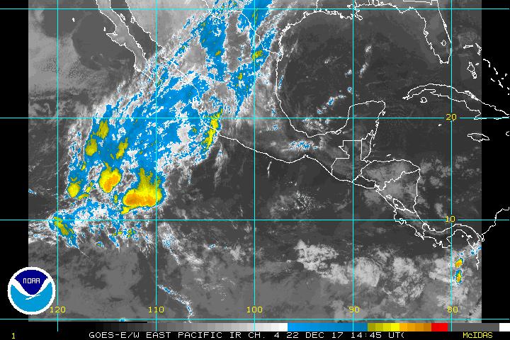
E Pacific activity exploded.

This is the general tropical discussion area. Anyone can take their shot at predicting a storms path.

Moderator: S2k Moderators

Forum rules

The posts in this forum are NOT official forecasts and should not be used as such. They are just the opinion of the poster and may or may not be backed by sound meteorological data. They are NOT endorsed by any professional institution or STORM2K. For official information, please refer to products from the National Hurricane Center and National Weather Service.

Help Support Storm2K
Message
Author
krysof

E Pacific activity exploded.

#1 Postby krysof » Fri Sep 16, 2005 9:57 pm

They were well behind in TS until now, two strong hurricanes Jova and Kennith are out there. There is potential for two more depressions which may be the L and M names getting close to our amount of storms.
0 likes   

Scorpion

#2 Postby Scorpion » Fri Sep 16, 2005 11:19 pm

And we are about to get another possibly 3 storms. EPAC won't get close. It will likely be L vs R in 10 days.
0 likes   

chadtm80

#3 Postby chadtm80 » Fri Sep 16, 2005 11:20 pm

Image
Image
0 likes   

chadtm80

#4 Postby chadtm80 » Fri Sep 16, 2005 11:40 pm

Image
0 likes   

Scorpion

#5 Postby Scorpion » Fri Sep 16, 2005 11:48 pm

Yep, gonna occur in the Atlantic soon.
0 likes   

Matt-hurricanewatcher

#6 Postby Matt-hurricanewatcher » Fri Sep 16, 2005 11:49 pm

That K storm looks like a very powerful storm right now.
0 likes   

User avatar
skysummit
S2K Supporter
S2K Supporter
Posts: 5305
Age: 49
Joined: Tue Aug 31, 2004 11:09 pm
Location: Ponchatoula, LA
Contact:

#7 Postby skysummit » Fri Sep 16, 2005 11:49 pm

Just imagine that image looking at the entire western hemisphere with 4 storms in the Pacific, and 4 storms in the Atlantic. That would be like something from a SciFi movie or something.
0 likes   

User avatar
skysummit
S2K Supporter
S2K Supporter
Posts: 5305
Age: 49
Joined: Tue Aug 31, 2004 11:09 pm
Location: Ponchatoula, LA
Contact:

#8 Postby skysummit » Fri Sep 16, 2005 11:51 pm

Wow.....

Image
0 likes   

Scorpion

#9 Postby Scorpion » Fri Sep 16, 2005 11:54 pm

They won't get very strong since they're so close together. Stupid EPAC, all it can do is raise numbers. Considering the Atlantic has had a Cat 5 and 2 strong 4's so far, even if the EPAC somehow beat it numberwise(won't happen) the activity level still wouldn't be close.
0 likes   

oneness
Category 1
Category 1
Posts: 427
Joined: Sat Aug 27, 2005 5:21 am

#10 Postby oneness » Fri Sep 16, 2005 11:55 pm

wow, I've seen a close line of three powerful cyclones in the SW pacific in the mid-late 1990s, but never have seen 4 like that, wonder if they will all fire up? BTW one of the line of three was a cat 5
0 likes   

User avatar
skysummit
S2K Supporter
S2K Supporter
Posts: 5305
Age: 49
Joined: Tue Aug 31, 2004 11:09 pm
Location: Ponchatoula, LA
Contact:

#11 Postby skysummit » Fri Sep 16, 2005 11:59 pm

Scorpion wrote:Stupid EPAC, all it can do is raise numbers.


LOL....That's hilarious!!!! :roflmao:
0 likes   

User avatar
WindRunner
Category 5
Category 5
Posts: 5806
Age: 34
Joined: Fri Jul 29, 2005 8:07 pm
Location: Warrenton, VA, but Albany, NY for school
Contact:

#12 Postby WindRunner » Sat Sep 17, 2005 8:35 am

skysummit wrote:Just imagine that image looking at the entire western hemisphere with 4 storms in the Pacific, and 4 storms in the Atlantic. That would be like something from a SciFi movie or something.


And an overview would have to use the GOES-east shot. That isn't something I've seen before.
0 likes   

Patrick99
Category 5
Category 5
Posts: 1772
Joined: Mon May 24, 2004 3:43 pm
Location: SW Broward, FL

#13 Postby Patrick99 » Sat Sep 17, 2005 9:07 am

Any of those seriously threatening Hawaii a few days out? The leading storm looks like it's getting close.
0 likes   

Brent
S2K Supporter
S2K Supporter
Posts: 38264
Age: 37
Joined: Sun May 16, 2004 10:30 pm
Location: Tulsa Oklahoma
Contact:

#14 Postby Brent » Sat Sep 17, 2005 9:12 am

Patrick99 wrote:Any of those seriously threatening Hawaii a few days out? The leading storm looks like it's getting close.


Jova's the closest, but the 5-day position is still well east of Hawaii and moving Northwest and weakening. Hawaii is WAY out there. :wink:

Image
0 likes   
#neversummer

MiamiensisWx

#15 Postby MiamiensisWx » Sat Sep 17, 2005 4:20 pm

There are now three named storms out in the east-central Pacific: Hurricane Jova (first), Hurricane Kenneth (second), and Tropical Storm Lidia (last and closest to the Mexican coast).
0 likes   


Return to “Talkin' Tropics”

Who is online

Users browsing this forum: No registered users and 296 guests