This is what I mentioned could be a possible player to turn future Rita northward toward the north Gulf Coast. It would be very unusual for her to be a west tracker all the way across the Gulf this time of year. All it takes is a slight weakness in the ridge and here comes the possible player, a weak front.
After the South Florida brush or strike Rita could threaten anywhere from South TX. to Mobile, AL.
AREA FORECAST DISCUSSION...UPDATED
NATIONAL WEATHER SERVICE MOBILE AL
1125 AM CDT SUN SEP 18 2005
.UPDATE...
AFTER REVIEW OF 1000 AM TEMPERATURES...DECIDED TO RAISE MAXIMUMS FOR
THIS AFTERNOON A DEGREE OR TWO IN MOST LOCATIONS. ALSO...RAISED
TONIGHTS MINIMUMS A FEW DEGREES IN MOST AREAS...AS I FEEL THAT
TEMPERATURES TONIGHT WILL BE VERY SIMILAR TO THOSE EARLY THIS
MORNING. PATCHY FOG EXPECTED TO DEVELOP OVER THE AREA LATE TONIGHT
AND CONTINUE INTO THE MID MORNING HOURS ON MONDAY. ALL UPDATES GONE.
&&
.PREV DISCUSSION...
ISSUED 409 AM CDT SUN SEP 18 2005
.SHORT TERM...TODAY THROUGH TUESDAY.
BROAD MID/UPR LEVEL RIDGE EXTENDS FROM EASTERN TX TO THE FLORIDA
PANHANDLE AND WILL KEEP THE REGION GENERALLY HOT AND DRY THRU
TUESDAY. A DECAYING EAST-WEST FRONTAL BOUNDARY LYING ACROSS THE
REGION WILL GRADUALLY SINK SOUTH TO NEAR THE GULF COAST BY THIS
EVENING. WILL HOLD ON TO ISOLD POPS FOR THIS AFTN/EARLY EVE WITH THE
FRONT IN THE AREA. DRIER AIR IN NORTHERN MS/AL WILL SLOWLY FILTER IN
BEHIND THE FRONT AND SHOULD GIVE JUST A BIT OF RELIEF FROM THE HOT
AND MUGGY CONDITIONS AWAY FROM THE COASTAL AREAS FOR MON AND TUE.
NEXT CHANCE FOR PRECIP MAY COME AS EARLY AS TUE EVE AS A SHTWV TROF
ROUNDS THE TOP OF THE RIDGE AND MOVES SE TOWARD THE TENNESSEE VALLEY
AND APPALACHIANS. 6Z NAM IS A BIT FASTER THAN THE 0Z GFS WITH THIS
TROF AND HAVE ADDED SOME LOW POPS STARTING IN THE NORTH TUES EVE TO
TREND TOWARD THE NAM. WEAK COLD FRONT MAY ALSO APPROACH THE AREA
BEHIND THE TROF AXIS.
.LONG TERM...WEDNESDAY THROUGH SUNDAY.
FORECAST FOR WED AND BEYOND WILL BE HIGHLY AFFECTED BY THE EVENTUAL
PATH OF TD-18...SOON TO BE TROPICAL STORM RITA. BY EARLY WED IT
SHOULD HAVE PASSED WEST OF THE FLORIDA STRAITS AND EMERGED INTO THE
GULF OF MEXICO...WITH NHC FORECASTING IT TO STRENGTHEN INTO A
HURRICANE BY THAT TIME. HAVE BEGUN TO TREND CLOUD COVER AND POPS
UPWARD ALONG THE COAST...SLOWLY SPREADING NORTH...BEGINNING THU
MORN. THE STORM MAY BE DRAWN TO THE NORTH A BIT ON WED AS A WEAKNESS
DEVELOPS IN THE RIDGE FROM THE AFOREMENTIONED TROUGH...HOWEVER THE
MAJORITY OF THE GUIDANCE TAKES IT ON A COURSE SOUTH OF LATITUDE 25N
INTO THE WESTERN GULF BY THE END OF THE WEEK.
&&
.MARINE...
PROGS INDICATE FRONT OVER SOUTH CENTRAL MISSISSIPPI AND SOUTH
CENTRAL ALABAMA WILL BE QSTNRY THE NEXT COUPLE DAYS BEFORE
FRONTOLYSIS. RIDGE TO BUILD OVER THE AREA AND SLIDE A BIT WEST TO
BRING AN OFFSHORE WIND EARLY ON. THEN...WITH MODELS INDICATING A
SURFACE DISTURBANCE MOVING WEST OVER THE SOUTHEAST AND SOUTHERN
GULF....WILL STEEPEN PRESSURE GRADIENT...BRINGING WINDS AND SEAS
INCREASING. MODELS CONTINUE WITH WESTERLY MOVEMENT TOWARD SOUTHERN
TX/NORTHERN MX. ONE OR TWO MODELS ARE DISJUNCTIVE WITH THE MAJORITY
RESPECTIVE TO MOVEMENT...BUT THE MAJORITY MOVE IT WEST. WITH ALL
THIS IN PLACE...EXPECTING INCREASING SWELLS LATE TUESDAY THROUGH
THURSDAY AS IT PASSES WELL SOUTH OF THE AREA BRINGING TRANSITION OF
NORTHEAST WIND TO EAST.
&&
Mobile AFD, Possible Weakness in Ridge.......
Moderator: S2k Moderators
Forum rules
The posts in this forum are NOT official forecasts and should not be used as such. They are just the opinion of the poster and may or may not be backed by sound meteorological data. They are NOT endorsed by any professional institution or STORM2K. For official information, please refer to products from the National Hurricane Center and National Weather Service.
-
Dean4Storms
- S2K Supporter

- Posts: 6358
- Age: 62
- Joined: Sun Aug 31, 2003 1:01 pm
- Location: Miramar Bch. FL
-
Dean4Storms
- S2K Supporter

- Posts: 6358
- Age: 62
- Joined: Sun Aug 31, 2003 1:01 pm
- Location: Miramar Bch. FL
I didn't think to look. Anyway, I'm going to watch this one carefully. Guidance this far out usually has an error by nearly 300+ miles or so. We know with Katrina when she first formed the guidance was ending it up out to sea, then east of Appalachicola even once she entered the Gulf. It wasn't until she was 2 days out of heading just east of New Orleans that the guidance clustered.
I'm just not sold on a pure mostly west track across the Gulf this time of year, hasn't happened in my lifetime and I'm 40 something.
I'm just not sold on a pure mostly west track across the Gulf this time of year, hasn't happened in my lifetime and I'm 40 something.
0 likes
- Ivanhater
- Storm2k Moderator

- Posts: 11206
- Age: 39
- Joined: Fri Jul 01, 2005 8:25 am
- Location: Pensacola
Dean4Storms wrote:I didn't think to look. Anyway, I'm going to watch this one carefully. Guidance this far out usually has an error by nearly 300+ miles or so. We know with Katrina when she first formed the guidance was ending it up out to sea, then east of Appalachicola even once she entered the Gulf. It wasn't until she was 2 days out of heading just east of New Orleans that the guidance clustered.
I'm just not sold on a pure mostly west track across the Gulf this time of year, hasn't happened in my lifetime and I'm 40 something.
i agree, im certainly keeping an eye on this one
0 likes
-
Scorpion
- gatorcane
- S2K Supporter

- Posts: 23703
- Age: 47
- Joined: Sun Mar 13, 2005 3:54 pm
- Location: Boca Raton, FL
.Many had Dennis going to Texas in July. This is mid September. IMO this could very well be a N GOM storm. Very bad. THe good news however, is that if that was the case the SST's wouldnt support a Cat 5, and it would also weaken at landfall like all GOM storms do
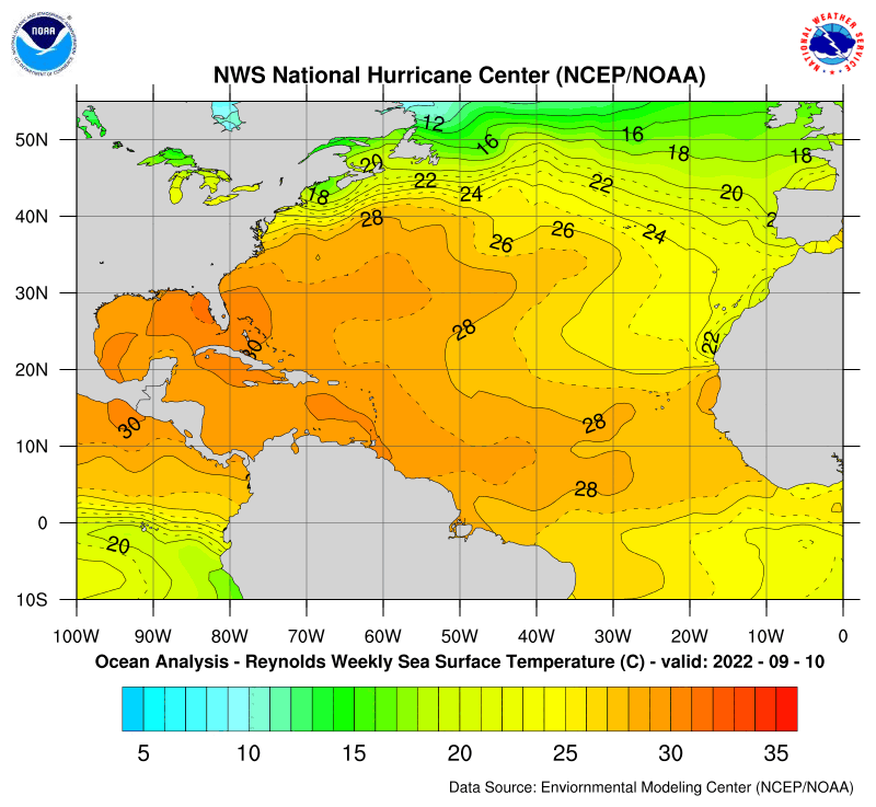
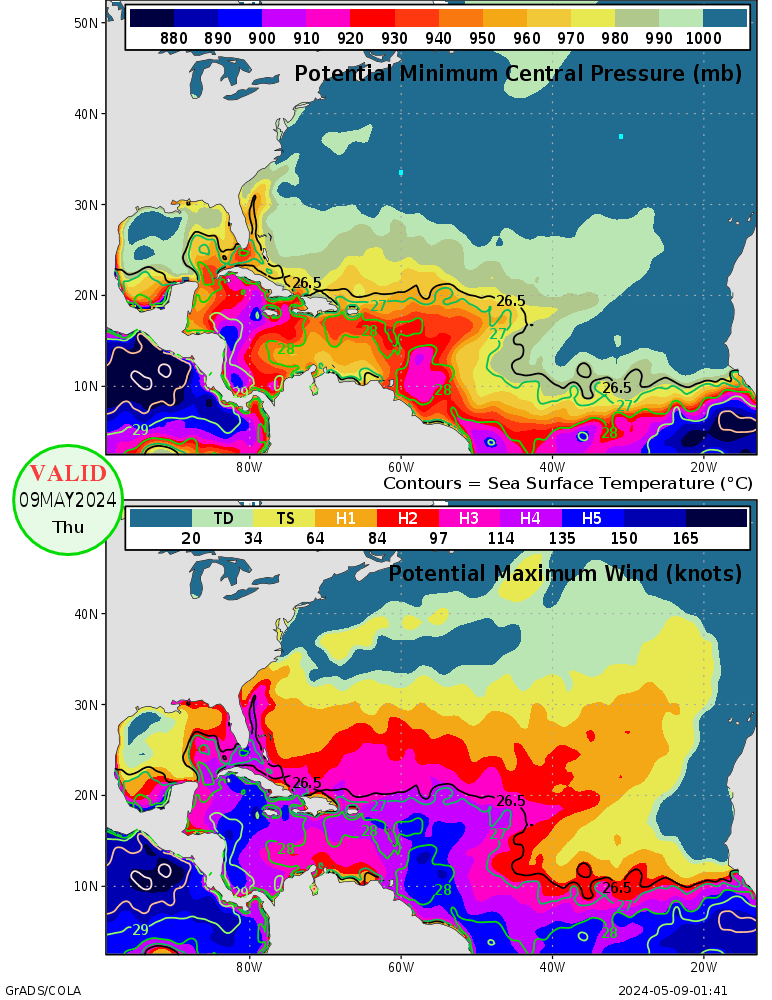
I agree there may be more of a weakness which will pose a N. GOM threat but your SST statement I staunchly disagree with. The GOM can easily support a CAT 5. Look at these SSTs:

0 likes
I agree. Being past mid September, ridges usually do not hold their own for as long as July and August. Our first true cool front is past due here in south Louisiana.
Regardless any major storm headed into Texas will bring higher than normal tides to Louisiana, raising concern for already weakened and un- repaired levees.
Any major storm to the upper Texas or even West Louisiana coast would obviously bring higher tides and more concern.
Lets hope for New Orleans sake the ridge prevails. Recovery has made some great strides in just a few weeks.
0 likes
-
Opal storm
- beachbum_al
- Category 5

- Posts: 2163
- Age: 55
- Joined: Thu Jul 14, 2005 9:23 pm
- Location: South Alabama Coast
- Contact:
-
Dean4Storms
- S2K Supporter

- Posts: 6358
- Age: 62
- Joined: Sun Aug 31, 2003 1:01 pm
- Location: Miramar Bch. FL
beachbum_al wrote:So does this mean that we might be waking up to a TD that forms into something bigger at our back door in a couple of days.
Right now guidance is for the most part taking 18 on a mostly westward track until it reaches the western GOM. That scenario has not happened with a hurricane north of 23n since as far back as 1950 because the westerlies are usually active enough to create either a trough dropping down or a weakness in the ridging forming as the trough's send energy southward to turn the TC northward. If this was July thru early Sept. it would be a good possibility but mid sept. on very unusual. I'm not saying that it is out of the realm of possibility, just not very likely. Throw in the error margin for TC guidance that far out and there are at least two strikes against it IMO. Also, we have seen several storms get caught up in weaknesses this year only to stall and eventually go northward. Those along the north Gulf coast should not turn a deaf ear to this storm just because guidance right now is saying it goes west.
0 likes
Who is online
Users browsing this forum: No registered users and 66 guests


