Shear now eroding Rita

This is the general tropical discussion area. Anyone can take their shot at predicting a storms path.

Moderator: S2k Moderators

Forum rules

The posts in this forum are NOT official forecasts and should not be used as such. They are just the opinion of the poster and may or may not be backed by sound meteorological data. They are NOT endorsed by any professional institution or STORM2K. For official information, please refer to products from the National Hurricane Center and National Weather Service.

Help Support Storm2K
Message
Author
superfly

Re: Comment and Question

#61 Postby superfly » Thu Sep 22, 2005 3:34 am

camilletider wrote:wups, I thought you were refering in some way to what wxman_91 was talking about earlier. As you so astutely pointed out NGa, I haven't been on the board much and I only remember seeing EWC. Man, it is late.

Okay, NGa and whomever, do you really think that cycle spanked Rita and the outflow that bad?

From comments above, have major storms developed secondary wind maximas and yet not shortly gone into some kind of dynamic change in the core?


ERC has NOT occured. A full secondary wind maxima has not even formed, but it is in the process of forming. Rita will likely undergo an ERC throughout the day today and finish sometime tonight or tomorrow morning.
0 likes   

camilletider
Tropical Depression
Tropical Depression
Posts: 50
Joined: Tue Aug 31, 2004 4:53 pm
Location: alabama

The cycle may be a fast one

#62 Postby camilletider » Thu Sep 22, 2005 3:48 am

I'm not argueing or disagreeing. I know and agree that ERC has not taken place. I believe the beginnings of one is apparent. My line of thought is from some comments on other threads, can Rita just blow right on through if outflow is re-established and she encounters what a few think may be even slightly warmer water for the next few hours? That was all I was asking. These are questions, not challenges. End of questions and discussion from my end.
0 likes   

BReb
Tropical Storm
Tropical Storm
Posts: 203
Joined: Sun Sep 05, 2004 12:39 pm

#63 Postby BReb » Thu Sep 22, 2005 3:52 am

"We don't know what the cause of this lessing of "stuff" is."

According to the 5 am report, it's 12 k shear from the anticyclone to the southeast of the hurricane.
0 likes   

User avatar
tailgater
S2K Supporter
S2K Supporter
Posts: 3339
Joined: Sun Jul 11, 2004 9:13 pm
Location: St. Amant La.

#64 Postby tailgater » Thu Sep 22, 2005 5:13 am

COME ON SHEAR. I would love to see this trend continue. but the track trend is NOT my friend
0 likes   

BamaMan
Tropical Storm
Tropical Storm
Posts: 187
Joined: Thu Sep 30, 2004 8:23 pm
Location: Mobile,AL

#65 Postby BamaMan » Thu Sep 22, 2005 5:23 am

Where exactly are you? Not familiar with your city.
0 likes   

User avatar
tailgater
S2K Supporter
S2K Supporter
Posts: 3339
Joined: Sun Jul 11, 2004 9:13 pm
Location: St. Amant La.

#66 Postby tailgater » Thu Sep 22, 2005 5:30 am

In the sticks between Baton Rouge and New Orleans, but my father's place just north of Morgan City and most of my work is southern La.
0 likes   

User avatar
bvigal
S2K Supporter
S2K Supporter
Posts: 2276
Joined: Sun Jul 24, 2005 8:49 am
Location: British Virgin Islands
Contact:

#67 Postby bvigal » Thu Sep 22, 2005 6:21 am

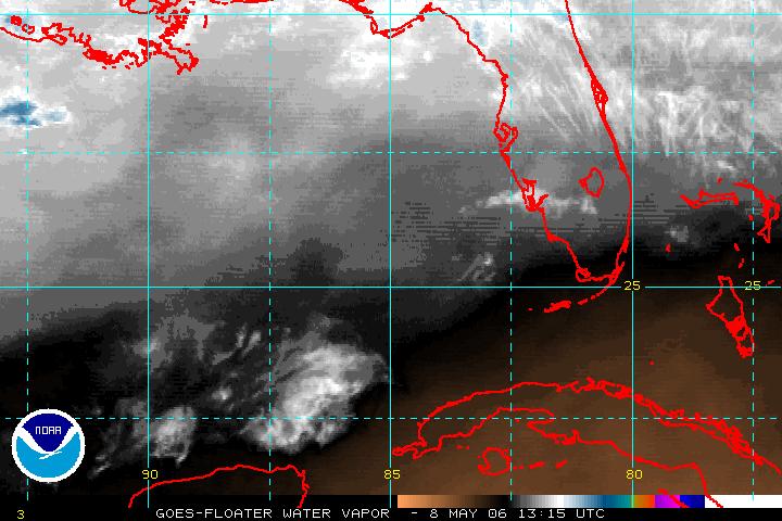
I don't believe it's shear. But Rita pushing against some dry air. Take a look at the water vapor - it's looks significant.

Image

Whether that will begin to effect strength, dunno. But, reduction in strength is already predicted:
FORECAST VALID 22/1800Z 25.3N 89.3W
MAX WIND 150 KT...GUSTS 185 KT.

FORECAST VALID 23/0600Z 26.1N 91.1W
MAX WIND 145 KT...GUSTS 175 KT.

FORECAST VALID 23/1800Z 27.2N 92.8W
MAX WIND 140 KT...GUSTS 170 KT.

FORECAST VALID 24/0600Z 28.8N 94.3W
MAX WIND 130 KT...GUSTS 160 KT.
0 likes   

Scorpion

#68 Postby Scorpion » Thu Sep 22, 2005 6:26 am

There is no dry air intrusion. If there was you would see a dry slot forming in the storm, like what happened to Katrina.
0 likes   

BamaMan
Tropical Storm
Tropical Storm
Posts: 187
Joined: Thu Sep 30, 2004 8:23 pm
Location: Mobile,AL

#69 Postby BamaMan » Thu Sep 22, 2005 6:26 am

[quote="bvigal"]I don't believe it's shear. But Rita pushing against some dry air. Take a look at the water vapor - it's looks significant.

Also seems to be what is pushing her more northward than forecast. She is almost already north of the 4:00 AM plots already. IMO
0 likes   

Patrick99
Category 5
Category 5
Posts: 1772
Joined: Mon May 24, 2004 3:43 pm
Location: SW Broward, FL

#70 Postby Patrick99 » Thu Sep 22, 2005 6:55 am

The hurricane clearly looks better on its eastern half...I think the dry air is having some kind of effect in eroding the western half - I also think Rita has reached her max intensity. Better there than at landfall.
0 likes   

User avatar
mvtrucking
S2K Supporter
S2K Supporter
Posts: 698
Age: 67
Joined: Sat Jul 09, 2005 10:01 am
Location: Monroe,La

#71 Postby mvtrucking » Thu Sep 22, 2005 7:03 am

Question here. How long does an eye replacement cycle take? If she was to start one now, does it take a day, shorter?
0 likes   

User avatar
mf_dolphin
Category 5
Category 5
Posts: 17758
Age: 69
Joined: Tue Oct 08, 2002 2:05 pm
Location: St Petersburg, FL
Contact:

#72 Postby mf_dolphin » Thu Sep 22, 2005 8:00 am

They can take just a matter of hours. If you watch the recon thread you'll see both the inner and outer eyewalls reported. The inner one will shrink and then collapse.
0 likes   

Frank2
Category 5
Category 5
Posts: 4061
Joined: Mon Jul 25, 2005 12:47 pm

#73 Postby Frank2 » Thu Sep 22, 2005 8:29 am

Lots of arguments about this topic, but it does seem that Rita is encountering some subtle amount of shear from the southwest at this time, which did seem to begin about 0200Z last evening, as the original post mentioned, though it seems more evident in just the last two frames:

http://www.ssd.noaa.gov/PS/TROP/DATA/RT ... -loop.html

Frank
0 likes   

Rashid
Tropical Depression
Tropical Depression
Posts: 60
Joined: Sat Jul 23, 2005 12:51 am

#74 Postby Rashid » Thu Sep 22, 2005 9:28 am

I agree Frank - the author of this thread obviously witnessed a trend that is now evidently clear. The western half of Rita is a shadow of its former self. I would bet that steady weakening is in store between now and landfall early Saturday AM. I'm not talking about significant weakening because the dry air isn't overwhelming, just enough to give her a hard time maintaining CAT 5 or top-end CAT 4 status. 115-125 knot landfall speed is probably in order.
0 likes   

DLI2k5

#75 Postby DLI2k5 » Thu Sep 22, 2005 9:39 am

Couldn't the turn towards the north affect the wind speed to an extent? Also, doesn't the outflow look to be increasing or expanding on the NE quad side of the storm to an extent? We also may be dealing with the beginning stages of an ERC and if so, with it being this early and being further north than thought before it could reintensify with the warmer water temps.
0 likes   

DLI2k5

#76 Postby DLI2k5 » Thu Sep 22, 2005 9:40 am

Couldn't the turn towards the north affect the wind speed to an extent? Also, doesn't the outflow look to be increasing or expanding on the NE quad side of the storm to an extent? We also may be dealing with the beginning stages of an ERC and if so, with it being this early and being further north than thought before it could reintensify with the warmer water temps.
0 likes   

Frank2
Category 5
Category 5
Posts: 4061
Joined: Mon Jul 25, 2005 12:47 pm

#77 Postby Frank2 » Thu Sep 22, 2005 9:40 am

Rashid,

Yes, I agree - it'll be interesting to see what the next TCD has to say. In the last few frames, the distance between the eyewall and the western outer edge of the cloud canopy is separated by only 50 miles or so, as opposed to it being centered perfectly yesterday afternoon. Also evident is the blow-off to the northeast, which has not been seen at all since Rita passed south of this area on Tuesday. In the most recent frame, the eye has begun to have a slightly ragged, cloud-filled appearance.

Good to hear from you again,

Frank
0 likes   

DLI2k5

#78 Postby DLI2k5 » Thu Sep 22, 2005 9:41 am

Couldn't the turn towards the north affect the wind speed to an extent? Also, doesn't the outflow look to be increasing or expanding on the NE quad side of the storm to an extent? We also may be dealing with the beginning stages of an ERC and if so, with it being this early and being further north than thought before it could reintensify with the warmer water temps.
0 likes   

Frank2
Category 5
Category 5
Posts: 4061
Joined: Mon Jul 25, 2005 12:47 pm

#79 Postby Frank2 » Thu Sep 22, 2005 9:42 am

Rashid,

Yes, I agree - it'll be interesting to see what the next TCD has to say. In the last few frames, the distance between the eyewall and the western outer edge of the cloud canopy is separated by only 50 miles or so, as opposed to it being centered perfectly yesterday afternoon. Also evident is the blow-off to the northeast, which has not been seen at all since Rita passed south of this area on Tuesday. In the most recent frame, the eye has begun to have a slightly ragged, cloud-filled appearance.

Good to hear from you again,

Frank
0 likes   

Frank2
Category 5
Category 5
Posts: 4061
Joined: Mon Jul 25, 2005 12:47 pm

#80 Postby Frank2 » Thu Sep 22, 2005 9:48 am

Oops - this site is so slow at this time that I managed to post twice - sorry!

Frank
0 likes   


Return to “Talkin' Tropics”

Who is online

Users browsing this forum: SconnieCane, Team Ghost and 65 guests