90L Invest,Comments,Sat Pics,Models Thread

This is the general tropical discussion area. Anyone can take their shot at predicting a storms path.

Moderator: S2k Moderators

Forum rules

The posts in this forum are NOT official forecasts and should not be used as such. They are just the opinion of the poster and may or may not be backed by sound meteorological data. They are NOT endorsed by any professional institution or STORM2K. For official information, please refer to products from the National Hurricane Center and National Weather Service.

Help Support Storm2K
Message
Author
MiamiensisWx

#41 Postby MiamiensisWx » Fri Sep 30, 2005 11:31 am

LarryWx wrote:I agree that it isn't looking organized at all. Also, I realize it may never get organized. However, it is moving westward and could easily make it to the U.S. below the big high in whatever form, organized or not. It may very well come in only as a tropical wave. But, I do think the U.S. E coast should monitor for next week.


Agreed... it needs to be monitored. Still, most models don't develop it much.
0 likes   

CHRISTY

#42 Postby CHRISTY » Fri Sep 30, 2005 11:42 am

can some post a close up picture of this feature that the models are showing a possibility of reaching the us. thanks
0 likes   

MiamiensisWx

#43 Postby MiamiensisWx » Fri Sep 30, 2005 11:46 am

CHRISTY wrote:can some post a close up picture of this feature that the models are showing a possibility of reaching the us. thanks


Click on the infra-red floater on the NHC site for the western Atlantic and Caribbean and let it load. The system is in the upper left-hand corner of the screen. It is a cluster of showers and storms. Click on "zoom" then click on the system to zoom in.

NOTE - Sorry if this is off-topic!
0 likes   

MiamiensisWx

#44 Postby MiamiensisWx » Fri Sep 30, 2005 11:57 am

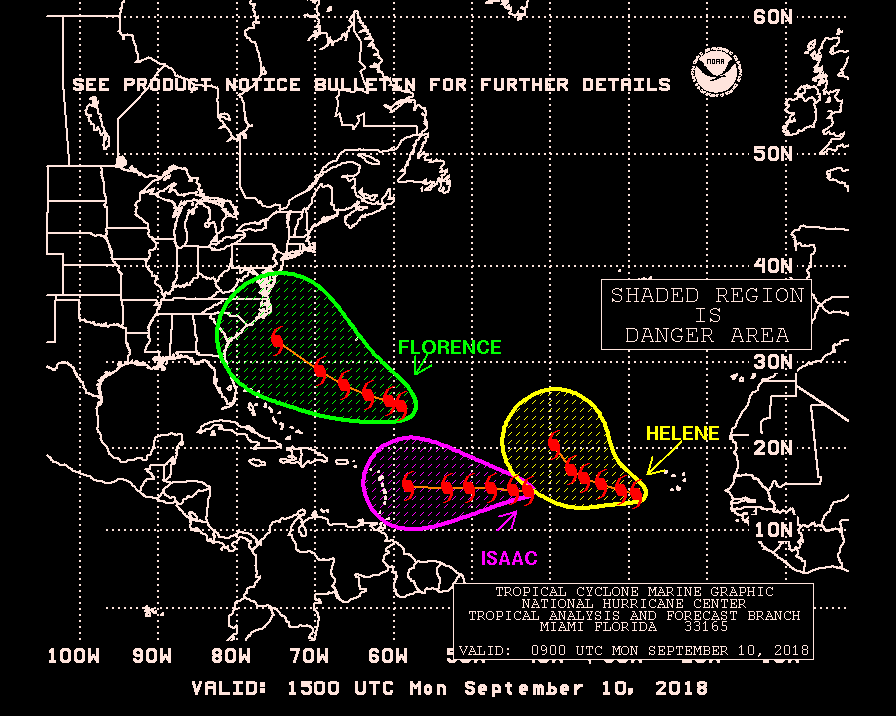
Danger zones... INVEST.90L is one of them.
Image
0 likes   

User avatar
SouthFloridawx
S2K Supporter
S2K Supporter
Posts: 8346
Age: 47
Joined: Tue Jul 26, 2005 1:16 am
Location: Sarasota, FL
Contact:

#45 Postby SouthFloridawx » Fri Sep 30, 2005 12:04 pm

We continue to track a low pressure area near 11 north and 34 west. This feature is not moving very quickly and the upper-level winds over this feature will slowly become somewhat favorable for development in a day or two.[/b][b] A tropical wave along 63 west has a surface low associated with it, but an upper-level feature nearby is preventing this from developing. Some computer information shows this wave eventually moving northwest and away from this upper-level feature by the end of the weekend. This could place the wave in the northern Bahamas by Monday.

The system highlighted in red is 90L and the system in blue is not an invest yet they are merely just monitoring it for some possible development in a few days from now. just to clear that up
0 likes   

User avatar
SouthFloridawx
S2K Supporter
S2K Supporter
Posts: 8346
Age: 47
Joined: Tue Jul 26, 2005 1:16 am
Location: Sarasota, FL
Contact:

#46 Postby SouthFloridawx » Fri Sep 30, 2005 12:25 pm

to clear it up

Image
0 likes   

User avatar
EDR1222
S2K Supporter
S2K Supporter
Posts: 1253
Joined: Mon Nov 10, 2003 12:58 pm
Location: Melbourne, FL

#47 Postby EDR1222 » Fri Sep 30, 2005 12:25 pm

Interestingly this looks better than anything we have seen that far east this year.
0 likes   

User avatar
Swimdude
Category 5
Category 5
Posts: 2270
Joined: Mon Jul 26, 2004 11:57 am
Location: Houston, TX

#48 Postby Swimdude » Fri Sep 30, 2005 12:38 pm

What the heck is that just east of due North of 90L?
0 likes   

User avatar
cjrciadt
S2K Supporter
S2K Supporter
Posts: 1616
Joined: Mon Aug 22, 2005 1:11 pm
Location: Kissimmee, FL

#49 Postby cjrciadt » Fri Sep 30, 2005 12:39 pm

Swimdude wrote:What the heck is that just east of due North of 90L?

An ULC with lots of convection with an outside chance of becoming tropical/subtropical.
0 likes   

User avatar
cycloneye
Admin
Admin
Posts: 148497
Age: 69
Joined: Thu Oct 10, 2002 10:54 am
Location: San Juan, Puerto Rico

#50 Postby cycloneye » Fri Sep 30, 2005 1:05 pm

646
WHXX04 KWBC 301732
CHGQLM
ATTENTION...NATIONAL HURRICANE CENTER

NCEP UNCOUPLED GFDL HURRICANE MODEL FORECAST MADE FOR

TROPICAL DEPRESSION INVEST 90L

INITIAL TIME 12Z SEP 30

DISCLAIMER ... THIS INFORMATION IS PROVIDED AS GUIDANCE. IT
REQUIRES INTERPRETATION BY HURRICANE SPECIALISTS AND SHOULD
NOT BE CONSIDERED AS A FINAL PRODUCT. PLEASE SEE THE TPC/NHC
OFFICIAL FORECAST.


FORECAST STORM POSITION

HOUR LATITUDE LONGITUDE HEADING/SPEED(KT)

0 11.7 32.4 270./ 4.1
6 11.9 33.1 292./ 7.1
12 11.8 32.8 118./ 2.7
18 12.1 33.1 323./ 3.7
24 12.1 33.3 260./ 2.7
30 12.2 33.9 290./ 5.6
36 12.6 34.0 339./ 3.9
42 13.3 34.4 327./ 7.5
48 14.3 34.4 3./10.8
54 15.8 35.3 327./16.9
60 16.4 35.7 325./ 7.7
66 17.4 36.3 333./11.3
72 18.6 36.5 350./11.6
78 19.6 36.7 346./10.6
84 20.5 36.7 3./ 9.2
90 21.6 36.5 10./11.2
96 22.7 36.0 26./11.3
102 23.6 35.4 31./11.3
108 24.7 34.4 42./13.8
114 25.8 33.3 44./15.0
120 27.1 32.0 46./17.5
126 28.4 30.7 45./17.4


12z GFDL goes fishing.
0 likes   
Visit the Caribbean-Central America Weather Thread where you can find at first post web cams,radars
and observations from Caribbean basin members Click Here

User avatar
cycloneye
Admin
Admin
Posts: 148497
Age: 69
Joined: Thu Oct 10, 2002 10:54 am
Location: San Juan, Puerto Rico

#51 Postby cycloneye » Fri Sep 30, 2005 1:58 pm

TROPICAL DEPRESSION INVEST (AL902005) ON 20050930 1800 UTC

...00 HRS... ...12 HRS... ...24 HRS... ...36 HRS...
050930 1800 051001 0600 051001 1800 051002 0600

LAT LON LAT LON LAT LON LAT LON
BAMD 11.8N 32.9W 11.8N 33.5W 11.9N 34.2W 12.3N 35.3W
BAMM 11.8N 32.9W 11.9N 33.7W 12.1N 34.7W 12.4N 35.7W
A98E 11.8N 32.9W 11.9N 33.6W 12.0N 34.7W 12.5N 35.9W
LBAR 11.8N 32.9W 11.6N 33.4W 12.3N 34.6W 13.6N 36.2W
SHIP 25KTS 30KTS 36KTS 44KTS
DSHP 25KTS 30KTS 36KTS 44KTS

...48 HRS... ...72 HRS... ...96 HRS... ..120 HRS...
051002 1800 051003 1800 051004 1800 051005 1800

LAT LON LAT LON LAT LON LAT LON
BAMD 13.2N 36.5W 15.8N 38.6W 18.0N 40.2W 19.9N 41.5W
BAMM 13.0N 36.9W 14.7N 38.6W 15.4N 39.7W 15.4N 40.7W
A98E 13.2N 37.2W 14.3N 39.5W 15.6N 41.8W 17.0N 44.2W
LBAR 15.6N 38.1W 21.2N 40.2W 26.2N 37.3W 27.0N 29.1W
SHIP 51KTS 57KTS 59KTS 61KTS
DSHP 51KTS 57KTS 59KTS 61KTS

...INITIAL CONDITIONS...
LATCUR = 11.8N LONCUR = 32.9W DIRCUR = 270DEG SPDCUR = 3KT
LATM12 = 11.8N LONM12 = 32.5W DIRM12 = 270DEG SPDM12 = 3KT
LATM24 = 11.8N LONM24 = 31.5W
WNDCUR = 25KT RMAXWD = 30NM WNDM12 = 25KT
CENPRS = 1007MB OUTPRS = 1010MB OUTRAD = 210NM SDEPTH = D
RD34NE = 0NM RD34SE = 0NM RD34SW = 0NM RD34NW = 0NM


18:00z Model Guidance.The BAMM is the only one that has a track more west.
0 likes   
Visit the Caribbean-Central America Weather Thread where you can find at first post web cams,radars
and observations from Caribbean basin members Click Here
User avatar
cycloneye
Admin
Admin
Posts: 148497
Age: 69
Joined: Thu Oct 10, 2002 10:54 am
Location: San Juan, Puerto Rico

#52 Postby cycloneye » Fri Sep 30, 2005 2:20 pm

Image

As I said in post above the BAMM is the only one that at the end of this run goes west.
0 likes   
Visit the Caribbean-Central America Weather Thread where you can find at first post web cams,radars
and observations from Caribbean basin members Click Here

User avatar
terstorm1012
S2K Supporter
S2K Supporter
Posts: 1314
Age: 44
Joined: Fri Sep 10, 2004 5:36 pm
Location: Millersburg, PA

#53 Postby terstorm1012 » Fri Sep 30, 2005 2:21 pm

LarryWx wrote:
HURAKAN wrote:Larry, no one is saying this will make to the US and America for that matter. Everyone agrees with the computer models that this will be nothing more than a marine and fish problem.


terstorm1012 had said "not -removed- but couldn't that guide something up the East Coast?" in this 90L thread. I was sort of responding to that and basically saying that if anything does reach the U.S., it wouldn't be 90L but 25N, 60W would clearly have a shot.


Thanks

JB has 25N 60W in his sights too also for next week.
0 likes   

MiamiensisWx

#54 Postby MiamiensisWx » Fri Sep 30, 2005 2:44 pm

Wow... it continues to intensify. Here it is on infra-red imagery...
Image
0 likes   

User avatar
HURAKAN
Professional-Met
Professional-Met
Posts: 46086
Age: 38
Joined: Thu May 20, 2004 4:34 pm
Location: Key West, FL
Contact:

#55 Postby HURAKAN » Fri Sep 30, 2005 2:58 pm

FLOATER 2 IS NEEDED OVER 90L!
0 likes   

MiamiensisWx

#56 Postby MiamiensisWx » Fri Sep 30, 2005 3:00 pm

HURAKAN wrote:FLOATER 2 IS NEEDED OVER 90L!


I highly agree!
0 likes   

User avatar
HURAKAN
Professional-Met
Professional-Met
Posts: 46086
Age: 38
Joined: Thu May 20, 2004 4:34 pm
Location: Key West, FL
Contact:

#57 Postby HURAKAN » Fri Sep 30, 2005 3:02 pm

Image
0 likes   

MiamiensisWx

#58 Postby MiamiensisWx » Fri Sep 30, 2005 3:03 pm

It must be a depression right now, or at least VERY, VERY CLOSE to being one...
0 likes   

superfly

#59 Postby superfly » Fri Sep 30, 2005 3:07 pm

I think we'll be seeing TD19 at 5 or at the latest 11.
0 likes   

MiamiensisWx

#60 Postby MiamiensisWx » Fri Sep 30, 2005 3:08 pm

It is now Tropical Depression 19... I checked the Navy site!
0 likes   


Return to “Talkin' Tropics”

Who is online

Users browsing this forum: StormWeather, Team Ghost, Yellow Evan and 350 guests