Graphic of three-pronged tropical attack for weekend

This is the general tropical discussion area. Anyone can take their shot at predicting a storms path.

Moderator: S2k Moderators

Forum rules

The posts in this forum are NOT official forecasts and should not be used as such. They are just the opinion of the poster and may or may not be backed by sound meteorological data. They are NOT endorsed by any professional institution or STORM2K. For official information, please refer to products from the National Hurricane Center and National Weather Service.

Help Support Storm2K
Message
Author
PhillyWX
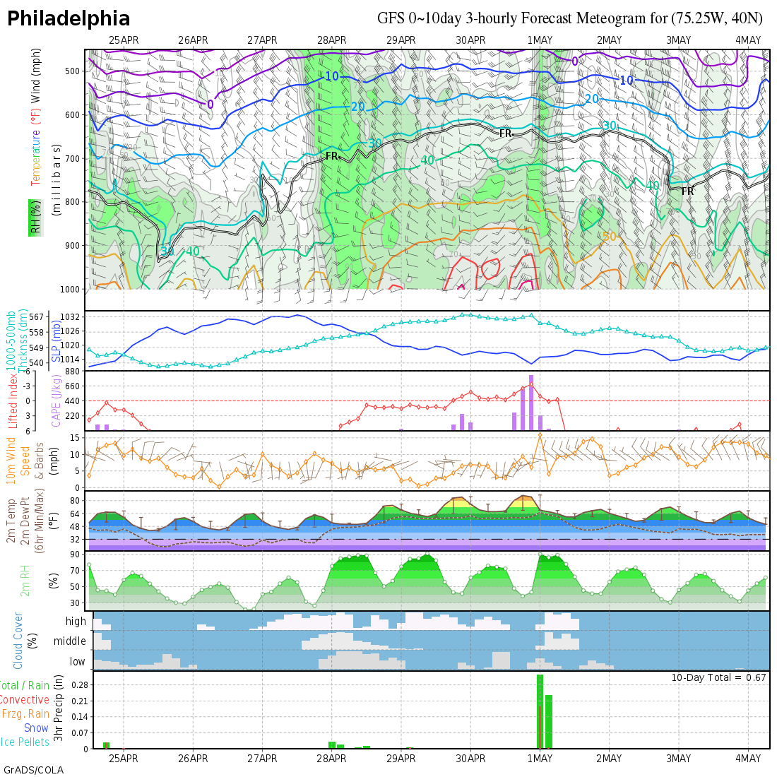
Category 1
Category 1
Posts: 494
Joined: Tue Aug 30, 2005 8:54 am
Location: Philly
Contact:

Graphic of three-pronged tropical attack for weekend

#1 Postby PhillyWX » Wed Oct 05, 2005 1:23 pm

Image

http://philadelphiaweather.blogspot.com/2005/10/triple-trouble.html

Click link for discussion

Disclaimer:

This post is NOT an official forecast and should not be used as such. It is just the opinion of the poster and may or may not be backed by sound meteorological data. It is NOT endorsed by any professional institution including storm2k.org For Official Information please refer to the NHC and NWS products.
Last edited by PhillyWX on Wed Oct 05, 2005 2:08 pm, edited 1 time in total.
0 likes   

User avatar
ishop
Tropical Low
Tropical Low
Posts: 30
Joined: Thu Jun 09, 2005 12:45 pm
Location: Seminole County, Fl

#2 Postby ishop » Wed Oct 05, 2005 1:31 pm

I like this graphic -easy for us lurkers to see and learn.

How good is this met at forcasting?
0 likes   

PhillyWX
Category 1
Category 1
Posts: 494
Joined: Tue Aug 30, 2005 8:54 am
Location: Philly
Contact:

#3 Postby PhillyWX » Wed Oct 05, 2005 1:33 pm

ishop wrote:I like this graphic -easy for us lurkers to see and learn.

How good is this met at forcasting?


Considering I'm the one who made the graphic and does the forecasting at that site I'm not going to judge my own forecasts. :wink:

Thanks for the kind words about the graphic, however!!!
0 likes   

User avatar
ishop
Tropical Low
Tropical Low
Posts: 30
Joined: Thu Jun 09, 2005 12:45 pm
Location: Seminole County, Fl

#4 Postby ishop » Wed Oct 05, 2005 1:36 pm

oops --had no idea you were the brains behind it all. Thanks for sharing!
0 likes   

PhillyWX
Category 1
Category 1
Posts: 494
Joined: Tue Aug 30, 2005 8:54 am
Location: Philly
Contact:

#5 Postby PhillyWX » Wed Oct 05, 2005 1:39 pm

ishop wrote:oops --had no idea you were the brains behind it all. Thanks for sharing!


No problem...and no offense was taken at all by you asking.

FWIW, I did nail Rita as a Cat 3 landfall four days out. Unfortunately, I missed on location (thought it would go further down the TX coast than it did).
0 likes   

mtm4319
Category 5
Category 5
Posts: 1537
Joined: Sun Sep 12, 2004 2:47 am
Location: Mobile, AL

#6 Postby mtm4319 » Wed Oct 05, 2005 1:59 pm

I don't think Otis made its way into the Rockies/Upper Midwest.

From the NHC at 10am PDT this morning:

THE REMNANT CIRCULATION OF FORMER TROPICAL DEPRESSION OTIS WAS
GRADUALLY DISSIPATING ALONG THE EXTREME SOUTHERN PORTION OF THE
PACIFIC SIDE OF THE BAJA CALIFORNIA PENINSULA. REDEVELOPMENT INTO
A TROPICAL CYCLONE IS NOT EXPECTED.
0 likes   

PhillyWX
Category 1
Category 1
Posts: 494
Joined: Tue Aug 30, 2005 8:54 am
Location: Philly
Contact:

#7 Postby PhillyWX » Wed Oct 05, 2005 2:09 pm

mtm4319 wrote:I don't think Otis made its way into the Rockies/Upper Midwest.

From the NHC at 10am PDT this morning:

THE REMNANT CIRCULATION OF FORMER TROPICAL DEPRESSION OTIS WAS
GRADUALLY DISSIPATING ALONG THE EXTREME SOUTHERN PORTION OF THE
PACIFIC SIDE OF THE BAJA CALIFORNIA PENINSULA. REDEVELOPMENT INTO
A TROPICAL CYCLONE IS NOT EXPECTED.


The moisture and the mid and upper level circulation from Otis merged with the front though.

I don't have time to find a satellite loop to point it out but the LLC was decoupled from the rest of the system as it fell apart off the Baja.
0 likes   

User avatar
AZRainman
Tropical Storm
Tropical Storm
Posts: 146
Joined: Fri Sep 23, 2005 12:48 pm
Location: Sonoran Desert
Contact:

#8 Postby AZRainman » Wed Oct 05, 2005 2:13 pm

Image
0 likes   

PhillyWX
Category 1
Category 1
Posts: 494
Joined: Tue Aug 30, 2005 8:54 am
Location: Philly
Contact:

#9 Postby PhillyWX » Wed Oct 05, 2005 7:00 pm

Geesh, that's kicking out a ton of rain for the Delaware Valley!
0 likes   

User avatar
angelwing
S2K Supporter
S2K Supporter
Posts: 4462
Age: 64
Joined: Tue Jan 18, 2005 3:06 pm
Location: Kulpsville, PA

#10 Postby angelwing » Wed Oct 05, 2005 7:33 pm

Woohoo!! That means we can't paint the apartment Friday like we planned :lol:
0 likes   

User avatar
Tampa Bay Hurricane
Category 5
Category 5
Posts: 5598
Age: 37
Joined: Fri Jul 22, 2005 7:54 pm
Location: St. Petersburg, FL

#11 Postby Tampa Bay Hurricane » Wed Oct 05, 2005 7:54 pm

Looks like a wild ride for Philly :eek:
0 likes   

User avatar
wxwatcher91
Category 5
Category 5
Posts: 1606
Joined: Wed Jul 06, 2005 2:43 pm
Location: Keene, NH
Contact:

#12 Postby wxwatcher91 » Wed Oct 05, 2005 8:27 pm

yeah some of the models are showing a washout here in New England.

here's the full disco: http://www.crh.noaa.gov/data/BOX/AFDBOX

Code: Select all

THE GFS IS THE FASTEST AND THE FURTHER EAST WITH THE SYSTEM TRACKING
THE LOW ACROSS MASSACHUSETTS VERY EARLY SATURDAY. THIS TRACK WOULD
PRODUCE HEAVY RAINFALL ACROSS THE REGION WITH THE MAIN ACTION
EXITING THE COAST EARLY SATURDAY AFTERNOON. THE GFS SHOWS QPF VALUES
OF 2 TO 4.50 INCHES WITH THE HIGHEST AMOUNTS IN THE WESTERN ZONES.
MEANWHILE THE UKMET/CANADIAN ARE FURTHER WEST RESULTING IN A SLOWER
PASSAGE OF THE FRONT SOMETIME SATURDAY AFTERNOON. WE WOULD STILL SEE
DECENT RAIN WITH THESE SOLUTIONS...BUT CERTAINLY NOT THE AMOUNTS
THAT THE LATEST GFS RUN SHOWS WITH THE SURFACE LOW PASSING FURTHER
TO OUR WEST.
0 likes   

aerojad
Tropical Storm
Tropical Storm
Posts: 199
Joined: Mon Aug 22, 2005 9:26 pm
Location: Detroit, MI
Contact:

Re: Graphic of three-pronged tropical attack for weekend

#13 Postby aerojad » Wed Oct 05, 2005 9:13 pm

isawitonline wrote:Image

http://philadelphiaweather.blogspot.com/2005/10/triple-trouble.html

Click link for discussion

Disclaimer:

This post is NOT an official forecast and should not be used as such. It is just the opinion of the poster and may or may not be backed by sound meteorological data. It is NOT endorsed by any professional institution including storm2k.org For Official Information please refer to the NHC and NWS products.

Don't know if it's just me but as of 10:15p eastern your site isn't loading :(
0 likes   

User avatar
angelwing
S2K Supporter
S2K Supporter
Posts: 4462
Age: 64
Joined: Tue Jan 18, 2005 3:06 pm
Location: Kulpsville, PA

#14 Postby angelwing » Wed Oct 05, 2005 9:29 pm

10:29Pm Eastern-loading now :D
0 likes   

PhillyWX
Category 1
Category 1
Posts: 494
Joined: Tue Aug 30, 2005 8:54 am
Location: Philly
Contact:

#15 Postby PhillyWX » Wed Oct 05, 2005 10:09 pm

Image

Image

Updated Info...

This post is NOT an official forecast and should not be used as such. It is just the opinion of the poster and may or may not be backed by sound meteorological data. It is NOT endorsed by any professional institution including storm2k.org For Official Information please refer to the NHC and NWS products.


http://philadelphiaweather.blogspot.com/2005/10/heavy-rain-likely-into-saturday.html
0 likes   

aerojad
Tropical Storm
Tropical Storm
Posts: 199
Joined: Mon Aug 22, 2005 9:26 pm
Location: Detroit, MI
Contact:

#16 Postby aerojad » Wed Oct 05, 2005 11:24 pm

angelwing wrote:10:29Pm Eastern-loading now :D
hurrah!
0 likes   

User avatar
myred
S2K Supporter
S2K Supporter
Posts: 89
Joined: Wed Sep 17, 2003 3:32 am
Location: Pocono Mountains in PA

#17 Postby myred » Thu Oct 06, 2005 3:47 am

We need the rain up here, send it on up. :D
0 likes   

PhillyWX
Category 1
Category 1
Posts: 494
Joined: Tue Aug 30, 2005 8:54 am
Location: Philly
Contact:

#18 Postby PhillyWX » Thu Oct 06, 2005 6:29 am

myred wrote:We need the rain up here, send it on up. :D


I agree -- my lawn is dry as a bone.
0 likes   


Return to “Talkin' Tropics”

Who is online

Users browsing this forum: Hurricane2022, Teban54 and 147 guests