Big Rain Event is over for Puerto Rico,USVI,BVI

This is the general tropical discussion area. Anyone can take their shot at predicting a storms path.

Moderator: S2k Moderators

Forum rules

The posts in this forum are NOT official forecasts and should not be used as such. They are just the opinion of the poster and may or may not be backed by sound meteorological data. They are NOT endorsed by any professional institution or STORM2K. For official information, please refer to products from the National Hurricane Center and National Weather Service.

Help Support Storm2K
Message
Author
User avatar
caribepr
Category 5
Category 5
Posts: 1794
Joined: Fri Sep 05, 2003 10:43 pm
Location: Culebra, PR 18.33 65.33

#41 Postby caribepr » Wed Oct 05, 2005 5:35 pm

bvigal wrote:
caribepr wrote:It rained all night (well, as long as I was awake anyway!) here, but nothing this morning and the sun is out, lots of white clouds, but lots of blue as well. The cart will be OPEN! 8-) - as long as it lasts...


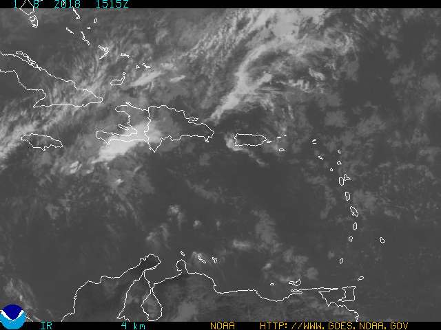
Good morning caribepr! Well, as for our local forecast, the last 3 shots of satellite look to me the trough is disconnecting from Tammy as she gets organized, and the moisture in our area is dissipating. I believe NWS-PR will soon cancel flood watch and change forecast of "widespread showers". What do you think? Have a good "cart" day, make lots of $$! :D


The rain came in around noon, big time, for about an hour. Judy the bartendar was surprised that Happy Hour started at noon along with lunch hour. All the outdoor type workers were there - I think we have four tourists on island...so it wasn't a big cart day.
But one great thing happened! A guy I knew from JUNIOR HIGH in Florida came in by boat and we had a wonderful reunion. They will be at the cart tomorrow morning before heading out again.
It did go all black a couple of hours later with water spouts in the distance but no rain on us, just wonderful cool relief under fabulous clouds, sun and rainbows. AND I talked to the road guy about the pot holes, which of course with the rain get much worse - he's on it.
So a very successful day, even though the cart was only direction central - as in, yes, the only place open today for a meal is right up this street, I'll be there in a minute.
0 likes   

User avatar
cycloneye
Admin
Admin
Posts: 148497
Age: 69
Joined: Thu Oct 10, 2002 10:54 am
Location: San Juan, Puerto Rico

#42 Postby cycloneye » Thu Oct 06, 2005 6:22 am

FXCA62 TJSJ 061017
AFDSJU

AREA FORECAST DISCUSSION
NATIONAL WEATHER SERVICE SAN JUAN PR
615 AM AST THU OCT 6 2005

.DISCUSSION...
AFTER A BRIEF 12-18 HOUR BREAK IN ACTIVE WEATHER...(BOY DID I GET
BURNED YESTERDAY!)...DEEP CONVECTION AGAIN HAS DEVELOPED ACROSS THE
LOCAL AREA OVERNIGHT...WITH THE INCREASED ELY LLVL FLOW DAMMING UP
ALONG E SIDE OF A MID LEVEL VORT THAT CONTINUES TO LINGER ACROSS PR.
THIS VORT IS A WESTWARD EXTENSION OF BROADER MID TO UPPER LOW TO OUR
NE THIS MORNING...WITH THIS VORT FORECAST BY GFS TO BE FORCED SLOWLY
SW TODAY. AS THIS OCCURS I EXPECT TO SEE CONVECTIVE ACTIVITY FORM
ALONG THE E AND NE QUADS OF THIS VORT AND AFFECT E...NE...AND THE
NORTHERN SLOPES OF PR...WITH IMPROVING WEATHER BY AFTERNOON ACROSS
MOST OF THE VIRGIN ISLANDS. AND WITH MORNING CLOUD COVER CONVECTION
WILL LIKELY NOT FOLLOW A TYPICAL DIURNAL PATTERN AS LACK OF DEEP
LLVL CONVERGENCE ACROSS W CENTRAL SECTIONS SHOULD LIMIT AREAL
CONVECTIVE COVERAGE. AREAS OF HEAVY RAIN ACROSS THE NE THIS MORNING
HAVE ALREADY PRODUCED FLASH FLOODING. THESE HEAVY RAINS ARE EXPECTED
TO SHIFT DUE WESTWARD DURING THE LATE MORNING AND AFTERNOON. MID
LEVEL SUBSIDENCE AND DEVELOPING LOW TO MID LEVEL TROUGHING ACROSS
THE LESSER ANTILLES INTERACTING WITH LOW TO OUR NE WILL BEGIN TO
BOTH WEAKEN THE LOCAL PRESSURE GRADIENT AND LOW LEVEL FORCING. THUS
A DRYING TREND ACROSS THE AREA IS EXPECTED TO BEGIN ACROSS THE
VIRGIN ISLANDS THIS AFTERNOON AND THEN ACROSS PR OVERNIGHT...BUT
WITH CHANCE FOR ISOLATED TSTORMS AND HEAVY RAIN E AND NE COASTAL
SECTIONS.

BEYOND TONIGHT...LOCAL WEATHER WILL BE CONTROLLED BY THE EVOLUTION
OF TROFFING ACROSS LESSER ANTILLES AND INTERACTION WITH SAID UPPER
LOW...AND THE EXACT MOVEMENT OF THE UPPER LOW. I AGREE WHOLE
HEARTEDLY WITH PREVIOUS DISCUSSION THAT THERE REMAINS SOME QUESTION
AS TO HOW FAR W THIS LOW WILL MOVE...BUT GLOBAL MODELS ARE IN
REASONABLE AGREEMENT THRU 72 HOURS ANYWAY...WITH SUFFICIENT MID
OCEANIC RIDGING FORCING THE LOW W AND SW UP AGAINST VERY NARROW
RIDGING ACROSS THE BAHAMAS. IT WILL BE INTERESTING TO SEE WHAT
FEATURES EVOLVE AT THE SURFACE...WITH GFS BEING VERY AGGRESSIVE IN
DEVELOPING A LOW JUST E OF THE BAHAMAS...AS SOME PORTION OF DEEP
ELONGATED TROFFING FROM NW CARIB NNE INTO SE U.S. SHIFTS SE INTO THE
ATLC...WITH THIS SURFACE LOW FORECAST TO SINK SE TO ALONG 70W. THE
FORECAST BEYOND SATURDAY IS THEREFORE UNCERTAIN...BUT IF WEATHER
PATTERN EVOLVES AS GFS IS FORECASTING...WE WILL RETURN TO A WET
PATTERN MONDAY THRU WEDNESDAY...WITH FLOODING POTENTIAL AGAIN. STAY
TUNED.


Well aparently some more unsettled weather for the next few days especially for early next week.Last night it was a rainy one in San Juan with scattered showers moving thru but nothing heavy nor floods occured.
0 likes   
Visit the Caribbean-Central America Weather Thread where you can find at first post web cams,radars
and observations from Caribbean basin members Click Here

User avatar
cycloneye
Admin
Admin
Posts: 148497
Age: 69
Joined: Thu Oct 10, 2002 10:54 am
Location: San Juan, Puerto Rico

#43 Postby cycloneye » Thu Oct 06, 2005 9:28 am

Image

Pretty dark skies now in San Juan with a moderate to heavy shower starting now.
0 likes   
Visit the Caribbean-Central America Weather Thread where you can find at first post web cams,radars
and observations from Caribbean basin members Click Here

User avatar
cycloneye
Admin
Admin
Posts: 148497
Age: 69
Joined: Thu Oct 10, 2002 10:54 am
Location: San Juan, Puerto Rico

#44 Postby cycloneye » Thu Oct 06, 2005 3:31 pm

AREA FORECAST DISCUSSION
NATIONAL WEATHER SERVICE SAN JUAN PR
416 PM AST THU OCT 6 2005

.DISCUSSION...
A MORE STABLE AIRMASS IS MOVING IN AS AN UPPER LEVEL LOW IN THE
CENTRAL ATLANTIC WATERS SLOWLY DRIFTS WESTWARD PUTTING THE LOCAL FA
ON THE SUBSIDENT REGION OF THIS FEATURE. THE INCREASED STABILITY WAS
EVIDENT AS THE CONVECTIVE PRECIPITATION OBSERVED EARLIER THIS
MORNING GAVE WAY TO MORE STRATIFORM PRECIPITATION DURING THE LATE
MORNING AND AFTERNOON. SUBSIDENT AIR IS EVIDENT FROM MANY SOURCES...
THE AFOREMENTIONED STRATIFORM DOMINANT PRECIPITATION...DRIER AIR ON
WATER VAPOR IMAGERY SPREADING SOUTHWESTWARD OVER THE LOCAL
AREA...ISENTROPIC ANALYSIS WHICH INDICATES A DOWNWARD SLOPE OF THE
POTENTIAL TEMPERATURE SURFACES AND IMPLYING LARGE SCALE SINKING
MOTION...AND FINALLY VISIBLE SATELLITE AND RADAR IMAGERY WHICH SHOWS
A DECREASE IN CLOUD COVER AND PRECIPITATION IN THE EASTERN PORTION
OF THE FA.

THE STABLE AIRMASS IS EXPECTED TO REMAIN ACROSS THE LOCAL FA UNTIL
MID WEEKEND. FOR THAT REASON...ALTERED WEATHER GRIDS AND DECREASED
POPS ACROSS THE FA TO REFLECT THIS. THAT BEING SAID...STILL
ANTICIPATING SOME DIURNAL ACTIVITY DURING THE AFTERNOON HOURS ON
FRIDAY.

SATELLITE IMAGERY INDICATED THE UPPER LEVEL LOW OVER THE CENTRAL
ATLANTIC CONTINUES TO SLOWLY RETROGRADE BACK TO THE WEST. THIS
MORNINGS SCATTEROMETER PASS INDICATES A SURFACE REFLECTION FROM THIS
FEATURE. MODELS INDICATED A GENERAL WESTWARD MOVEMENT OF THE UPPER
LOW...AND SURFACE REFLECTION ACROSS THE FA SATURDAY
AFTERNOON/EVENING AND AN INCREASE IN PRECIPITATION ACROSS THE AREA.
MODELS HAVE BEEN FAIRLY CONSISTENT WITH THE MOVEMENT OF THE LOW...
AND INCREASE IN SHOWER ACTIVITY...AND GRIDS HAVE BEEN UPDATED TO
REFLECT ANTICIPATED INCREASE IN PRECIPITATION.


Weather has improved this afternoon as less rain has fallen in the island.But as the latest discussion says more rain will arrive by the weekend and linger thru early next week so let's prepare for that.
0 likes   
Visit the Caribbean-Central America Weather Thread where you can find at first post web cams,radars
and observations from Caribbean basin members Click Here

User avatar
caribepr
Category 5
Category 5
Posts: 1794
Joined: Fri Sep 05, 2003 10:43 pm
Location: Culebra, PR 18.33 65.33

#45 Postby caribepr » Thu Oct 06, 2005 5:25 pm

I hope we get at least to mid-weekend! No rain here after 9 a.m.; in fact the sky was postcard blue, with a few beautiful clouds. A three day weekend ahead which of course means visitors wanting sun that doesn't include a free shower.
0 likes   

User avatar
cycloneye
Admin
Admin
Posts: 148497
Age: 69
Joined: Thu Oct 10, 2002 10:54 am
Location: San Juan, Puerto Rico

#46 Postby cycloneye » Fri Oct 07, 2005 5:41 am


AREA FORECAST DISCUSSION
NATIONAL WEATHER SERVICE SAN JUAN PR
615 AM AST FRI OCT 7 2005

.DISCUSSION...
AS INDICATED IN PREVIOUS DISCUSSION...MID LEVEL SUBSIDENCE
ASSOCIATED WITH THE BROAD CIRCULATION OF TUTT LOW TO OUR NE...HAS
SHIFTED SW INTO THE LOCAL AREA OVER THE PAST 12-18 HOURS TO
STABILIZE THE LOCAL ATMOSPHERE. STRONG HIGH PRESSURE AT LOW LEVELS
ACROSS THE NW ATLC HAS BUILT INTO THE SW ATLC PAST SEVERAL DAYS AND
FINALLY NUDGED INTO THE LOCAL ATLC FOR PAST 24-36 HOURS TO PRODUCE
AN INCREASED LLVL FLOW OF 15 TO 20 KNOTS. DESPITE THE MID LEVEL
DRYING AND DOWNWARD MOTION...THIS LLVL FLOW HAS ACCOUNTED FOR
SUFFICIENT CONVERGENCE FOR SCATTERED SHOWERS TO MOVE ACROSS THE
LOCAL WATERS...WITH SEVERAL CLUSTERS AFFECTING EAST COASTAL SECTIONS
OF PR WITH MODERATE TO HEAVY RAIN OVERNIGHT. NWS DOPPLER RADAR
ESTIMATES OVERNIGHT HAVE BEEN GREATLY EXAGGERATED...SO DO NOT
BELIEVE THE PRECIP ESTIMATES THAT WERE GENERATED. WILL LOOK
INTO THIS THIS MORNING AND MAY BE A SIMPLE FIX. TROUGHING MOVING
ACROSS THE EAST AND INTO THE NE CARIB THIS MORNING SHOWING MARKED
CYCLONIC TURNING AND RECENT CARIB SOUNDINGS SUGGEST TO ME THAT THIS
IS THE TROPICAL WAVE EXPECTED IN THE AREA. NORTHERN FRINGES BEING
ACTED UPON BY STRONG SUBSIDENCE AND NOT PRODUCING MUCH WEATHER AT
OUR LAT. THIS WAVE IS PRESENTLY CONNECTED TO A LLVL TROUGH EXTENDING
FROM THE SURFACE REFLECTION OF THE TUTT LOW TO OUR NE...ROUGHLY NEAR
23N 55W. THIS LLVL TROUGH COMBO WILL MOVE W INTO THE AREA THIS
EVENING AND TONIGHT AND BREAK DOWN PRESSURE GRADIENT OF RECENT FOR
QUICKLY WEAKENING WIND FLOW...AND BEGIN TO SET UP THE REGION FOR A
POTENTIALLY VERY ACTIVE PERIOD OF WEATHER OF THE NEXT SEVERAL DAYS.

GLOBAL MODELS CONTINUE TO BRING THE STRONG TUTT LOW TO OUR NE
WESTWARD OVER THE WEEKEND...WHICH WILL BEGIN TO DESTABILIZE THE
LOCAL ATMOSPHERE SIGNIFICANTLY HERE BY SATURDAY AFTERNOON. TUTT LOW
THEN ELONGATES AND DIGS FARTHER SW INTO THE BAHAMAS AND CENTRAL CUBA
MONDAY AND TUESDAY. LOW PRESSURE AND ABUNDANT TROPICAL MOISTURE
ALREADY IN PLACE ACROSS THE REGION ARE THEN EXPECTED TO INTERACT
WITH THIS VIGOROUS MID TO UPPER LOW TO IGNITE WIDESPREAD AREAS OF
DEEP CONVECTION ACROSS THE GREATER ANTILLES AND ADJACENT MARINE
AREAS SUNDAY THROUGH TUESDAY...WITH THE POTENTIAL FOR SOME TYPE OF
CYCLOGENISIS ACROSS THE REGION. MODELS VARY ON VARIOUS SURFACE LOWS
AND THIS MAY BE KEY IN FORECASTING AREAS OF HEAVY PRECIP. OUR
FORECASTS HAVE NOT REFLECTED THIS SCENARIO FROM THE WEEKEND THROUGH
TUESDAY...SO I HAVE MADE SOME DRASTIC CHANGES TO THE FORECAST TO
INTRODUCE THIS WEATHER. MY RAIN CHANCES ARE LIKELY TOO HIGH FOR A
FEW PERIODS DURING THIS TIME AND CAN BE EASILY BROUGHT DOWN AND
REARRANGED AS THIS SCENARIO UNFOLDS. BUT THE BOTTOM LINE IS THAT IS
DOES LOOK AS THOUGH THIS TUTT LOW WILL STRONGLY INFLUENCE THE LOCAL
AREA LATE SATURDAY AFTERNOON THROUGH MONDAY OR TUESDAY...WITH VERY
HIGH RAINFALL POTENTIAL. LOCAL SOILS AREA ALREADY WET AND
SATURATED...AND PR AND HISPANIOLA COULD SEE SOME VERY SIGNIFICANT
FLOODING DURING THIS TIME FRAME.


A great discussion of all the factors that will make the next few days very unsetteled in the NE Caribbean and other areas in the West and Central Caribbean so caribepr prepare for not outdoor activitys in the next few days especially from Saturday night and beyond.
0 likes   
Visit the Caribbean-Central America Weather Thread where you can find at first post web cams,radars
and observations from Caribbean basin members Click Here

User avatar
caribepr
Category 5
Category 5
Posts: 1794
Joined: Fri Sep 05, 2003 10:43 pm
Location: Culebra, PR 18.33 65.33

#47 Postby caribepr » Fri Oct 07, 2005 6:01 am

cycloneye wrote:[b]


A great discussion of all the factors that will make the next few days very unsetteled in the NE Caribbean area so caribepr prepare for not outdoor activitys.


Not what I wanted to read but, thanks Luis! A great discussion indeed, some over my comprehension level but points well made. (right now, it's a beautiful morning here, breeze, 82, sun in the pale blue sky).
0 likes   

User avatar
bvigal
S2K Supporter
S2K Supporter
Posts: 2276
Joined: Sun Jul 24, 2005 8:49 am
Location: British Virgin Islands
Contact:

#48 Postby bvigal » Fri Oct 07, 2005 6:08 am

Morning, Luis! Yes, that was an eye-opener to read this morning! But can't say I'm surprised. Was going to post something on this yesterday but my power kept going out (not weather). If you run a big satellite view loop and speed it up, looks like a giant pinwheel centered about 20N 48W and everything is wrapping into it. If it moves SW we will have some weather, that's for sure!! :eek:
loop
0 likes   

User avatar
caribepr
Category 5
Category 5
Posts: 1794
Joined: Fri Sep 05, 2003 10:43 pm
Location: Culebra, PR 18.33 65.33

#49 Postby caribepr » Fri Oct 07, 2005 6:13 am

bvigal wrote:Morning, Luis! Yes, that was an eye-opener to read this morning! But can't say I'm surprised. Was going to post something on this yesterday but my power kept going out (not weather). If you run a big satellite view loop and speed it up, looks like a giant pinwheel centered about 20N 48W and everything is wrapping into it. If it moves SW we will have some weather, that's for sure!! :eek:
loop


After about my third reading, radar checking, and all of my other amatuer weather voodoo, I'm going to go with cart open 'til it rains! Scientifically, it is 100 percent foolproof 8-)
0 likes   

User avatar
bvigal
S2K Supporter
S2K Supporter
Posts: 2276
Joined: Sun Jul 24, 2005 8:49 am
Location: British Virgin Islands
Contact:

#50 Postby bvigal » Fri Oct 07, 2005 6:22 am

Good morning, CaribePR!!
There you go, that's an excellent plan! The worst that can happen is sometime Saturday you might have to close up and head for cover, :lol:
0 likes   

User avatar
caribepr
Category 5
Category 5
Posts: 1794
Joined: Fri Sep 05, 2003 10:43 pm
Location: Culebra, PR 18.33 65.33

#51 Postby caribepr » Fri Oct 07, 2005 6:33 am

bvigal wrote:Good morning, CaribePR!!
There you go, that's an excellent plan! The worst that can happen is sometime Saturday you might have to close up and head for cover, :lol:


That is why the cart is set up 25 feet away from Dinghy Dock! :D
0 likes   

User avatar
cycloneye
Admin
Admin
Posts: 148497
Age: 69
Joined: Thu Oct 10, 2002 10:54 am
Location: San Juan, Puerto Rico

#52 Postby cycloneye » Fri Oct 07, 2005 6:39 am

Image

GFS 48 hours

Image

GFS 60 hours

Image

GFS 72 Hours


As it is shown in the graphics of the GFS a low pressure develops near Puerto Rico causing very wet weather in the NE Caribbean.


Image

GFS 84 Hours
0 likes   

User avatar
BonesXL
Tropical Storm
Tropical Storm
Posts: 148
Joined: Sat May 15, 2004 10:17 am
Location: Homestead, Florida
Contact:

#53 Postby BonesXL » Fri Oct 07, 2005 9:02 am

Looks like a lot of rain ahead.
0 likes   

User avatar
cycloneye
Admin
Admin
Posts: 148497
Age: 69
Joined: Thu Oct 10, 2002 10:54 am
Location: San Juan, Puerto Rico

#54 Postby cycloneye » Fri Oct 07, 2005 11:35 am

Image

12z GFS continues to show the wet pattern for the northern caribbean.

Image
0 likes   

User avatar
caribepr
Category 5
Category 5
Posts: 1794
Joined: Fri Sep 05, 2003 10:43 pm
Location: Culebra, PR 18.33 65.33

#55 Postby caribepr » Fri Oct 07, 2005 1:18 pm

Well, goodie. A perfect time to plant my aji pepper seeds
(in pots so they don't wash out of the yard down to the bay).
Luis, I am your mouthpiece here on Culebra.
I am thinking of making a little sign for the cart with the title
Luis Speaks! The weather will be ___________ today!
We are all ready for the rain now. Perfect timing actually, as
there is going to be a great birthday party tonight
and no one will feel like working tomorrow anyway!
0 likes   

User avatar
cycloneye
Admin
Admin
Posts: 148497
Age: 69
Joined: Thu Oct 10, 2002 10:54 am
Location: San Juan, Puerto Rico

#56 Postby cycloneye » Fri Oct 07, 2005 7:30 pm

LOL caribepr.

WHILE PLEASANT WEATHER WILL PREVAIL ACROSS THE LOCAL AREA THROUGH
THE FIRST HALF OF SATURDAY...WEATHER CONDITIONS ARE EXPECTED TO
DETERIORATE FOR THE SECOND HALF OF THE WEEKEND. AN UPPER LEVEL
LOW...AND ITS SURFACE REFLECTION...ARE EXPECTED TO MOVE INTO THE
LOCAL AREA BY LATE SATURDAY. THIS FEATURE WILL BRING AN INCREASE IN
MOISTURE AND INSTABILITY TO PRODUCE VERY ACTIVE WEATHER LATE
SATURDAY THROUGH AT LEAST MONDAY. SOILS ARE STILL SATURATED FROM THE
COPIOUS RAINFALL OF THE PAST WEEK...AND CONDITIONS ARE FAVORABLE FOR
FLASH FLOODING AND MUDSLIDES.


The rain event is comming so let's be prepared those friends who live in the NE Caribbean area.
0 likes   
Visit the Caribbean-Central America Weather Thread where you can find at first post web cams,radars
and observations from Caribbean basin members Click Here

User avatar
Tampa Bay Hurricane
Category 5
Category 5
Posts: 5598
Age: 37
Joined: Fri Jul 22, 2005 7:54 pm
Location: St. Petersburg, FL

#57 Postby Tampa Bay Hurricane » Fri Oct 07, 2005 7:35 pm

Very intense storms dot the Carribean

Image
0 likes   

User avatar
Weathermaster
Tropical Depression
Tropical Depression
Posts: 79
Joined: Thu Sep 04, 2003 10:33 am
Location: Carolina, PR

GFS..last 3 runs insist in a tropical Cyclone formation...

#58 Postby Weathermaster » Fri Oct 07, 2005 7:40 pm

The last 3 runs of the GFS, constantly shows a Tropical Cyclone forming in the Mona Channel and crossing north of PR in the next 48 hrs. Local TV meteorolgist Ada Monzon, said , Sunday PR will have very heavy rain and that she does not want to talk at this moment of the worst possible scenario... but mention that MODELS were being very aggressive with this situation.[/size]
People in PR, RD and NE Caribbean Please stay ALERT
0 likes   

User avatar
cycloneye
Admin
Admin
Posts: 148497
Age: 69
Joined: Thu Oct 10, 2002 10:54 am
Location: San Juan, Puerto Rico

#59 Postby cycloneye » Fri Oct 07, 2005 7:50 pm

Image

Image

Image

Image

Image

Latest GFS run shows that the big rain event is about to happen and also this run shows a cyclone developing from the low pressure so let's see what will occur from tommorow until early next week.

Image
0 likes   

User avatar
HurricaneQueen
S2K Supporter
S2K Supporter
Posts: 1011
Age: 80
Joined: Sat Oct 12, 2002 7:36 pm
Location: No. Naples, Fl (Vanderbilt Beach area)

#60 Postby HurricaneQueen » Fri Oct 07, 2005 8:51 pm

Hey you guys out there...

Please be careful and keep us updated. It sounds as if you may be in for a rough ride!

Stay safe

Lynn
0 likes   
GO FLORIDA GATORS


Return to “Talkin' Tropics”

Who is online

Users browsing this forum: riapal and 259 guests