98L Invest Caribbean,Comments,Sat Pics,Models Thread

This is the general tropical discussion area. Anyone can take their shot at predicting a storms path.

Moderator: S2k Moderators

Forum rules

The posts in this forum are NOT official forecasts and should not be used as such. They are just the opinion of the poster and may or may not be backed by sound meteorological data. They are NOT endorsed by any professional institution or STORM2K. For official information, please refer to products from the National Hurricane Center and National Weather Service.

Help Support Storm2K
Message
Author
krysof

#241 Postby krysof » Fri Oct 14, 2005 10:02 pm

CapeVerdeWave wrote:
krysof wrote:not happening right now, and I highly doubt it will become less organized


True... still, I remember that was what lots of people were saying with at first-organized systems (e.g., TD 19) before they became very disorganized. Not saying that will happen, it's just that it reminded me...

I think a special upgrade to tropical depression status may be needed now or at least very soon.


well we all know where TD 19 developed :roll: and the ones close to home had good conditions unlike the cape verde season
0 likes   

jkt21787
Category 5
Category 5
Posts: 2061
Joined: Tue Aug 31, 2004 5:27 pm
Location: Memphis, TN

#242 Postby jkt21787 » Fri Oct 14, 2005 10:04 pm

~Floydbuster wrote:
~Floydbuster wrote:I still think a major hurricane will occur before November 30

Though I never posted one way or the other, I never doubted you on that call given the nature of this season and the favorable conditions that have continued particularly in the Caribbean.

But of course there were MANY who did doubt you and the whole idea of another storm in this season, as seen plenty before this season. Looks like we're headed down the same road again with regards to those calls...
0 likes   

Brent
S2K Supporter
S2K Supporter
Posts: 38118
Age: 37
Joined: Sun May 16, 2004 10:30 pm
Location: Tulsa Oklahoma
Contact:

#243 Postby Brent » Fri Oct 14, 2005 10:05 pm

tracyswfla wrote:
Brent wrote:Interesting to note the main convection is now EAST of Jamaica... that could have major implications on the track.


What sort of implications?


Well probably a more north and east track... but it's REALLY REALLY early.

I also want to note that the Caribbean has been largely undisturbed this season... Stan didn't become anything til it got right to the Yucatan. The last storm of any kind was Emily a full THREE months ago. Those waters are hot.
0 likes   
#neversummer

tracyswfla
S2K Supporter
S2K Supporter
Posts: 792
Joined: Tue May 18, 2004 1:19 pm
Location: Rochester, NY

#244 Postby tracyswfla » Fri Oct 14, 2005 10:06 pm

Brent wrote:
tracyswfla wrote:
Brent wrote:Interesting to note the main convection is now EAST of Jamaica... that could have major implications on the track.


What sort of implications?


Well probably a more north and east track... but it's REALLY REALLY early.

I also want to note that the Caribbean has been largely undisturbed this season... Stan didn't become anything til it got right to the Yucatan. The last storm of any kind was Emily a full THREE months ago. Those waters are hot.


Thanks Brent... I bet you know what I am thinkin'. Starts with a C :eek:
0 likes   

User avatar
fuzzyblow
Tropical Depression
Tropical Depression
Posts: 87
Joined: Fri Sep 10, 2004 2:38 pm
Location: Montreal
Contact:

#245 Postby fuzzyblow » Fri Oct 14, 2005 10:07 pm

txwatcher91 wrote:Do the loop and look at the extremely cold cloud tops. :eek:

http://www.ghcc.msfc.nasa.gov/GOES/goeseastconusir.html


It's a bit scarry to see that, seem juste an open door to w, wnw with nothing apparent to block up that exploding thing now...
0 likes   

MiamiensisWx

#246 Postby MiamiensisWx » Fri Oct 14, 2005 10:08 pm

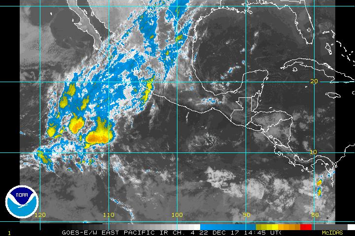
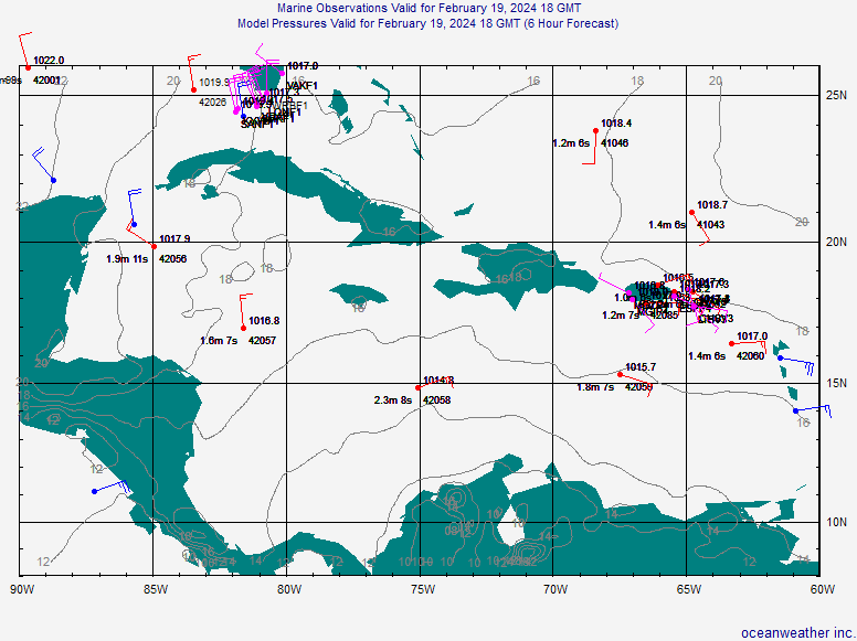
Interesting that while the eastern Pacific system (TD 16-E) has less deep convection but has been upgraded, the Caribbean system (INVEST.98L) with somewhat better banding features and deeper convection has not been upgraded. Compare the two systems currently below...

TD 16-E at eastern Pacific...
Image

INVEST.98L in Caribbean...
Image
0 likes   

User avatar
skysummit
S2K Supporter
S2K Supporter
Posts: 5305
Age: 49
Joined: Tue Aug 31, 2004 11:09 pm
Location: Ponchatoula, LA
Contact:

#247 Postby skysummit » Fri Oct 14, 2005 10:09 pm

Well, there's definately a LLC there...

Image
0 likes   

CHRISTY

#248 Postby CHRISTY » Fri Oct 14, 2005 10:11 pm

FROM JOE B.[img]"Florida hurricane threat next week. The system should develop out of overall pattern in the western Caribbean early to mid part of next week, then it will get pulled into the southeast Gulf".[/img]
0 likes   

quandary
Category 1
Category 1
Posts: 362
Joined: Thu Sep 16, 2004 4:04 pm

#249 Postby quandary » Fri Oct 14, 2005 10:13 pm

cat_6 wrote:Disclaimer: The views expressed below are of me and only me and not Storm2k or anyone else.

OK guys, here is a possible track that this storm could take!

It could make a strategic 4-landfalls hit, brushing over Honduras as a Cat 5 killing over 10,000 people, then working its way back up over Cozumel and the Yucatan peninsula, killing hundreds as a Cat 3, then entering the Gulf of Mexico, where it can grow back into a massive, devastating Category 5 storm, performing an unprecedented slam into Tampa Bay, leaving a wave of destruction in its wake. After this, it could continue across Florida, arriving into the Atlantic ocean and making an incredible fourth landfall along the east caost, and then cause endless flooding in the Northeast states.

Here's an image of this scenario, which could make Wilma the Weapon of mass destruction storm of the millennium:

Image


Why post a wishcast like this? It only serves to inaccurately scare people and hype the situation.
0 likes   

User avatar
Tampa Bay Hurricane
Category 5
Category 5
Posts: 5597
Age: 37
Joined: Fri Jul 22, 2005 7:54 pm
Location: St. Petersburg, FL

#250 Postby Tampa Bay Hurricane » Fri Oct 14, 2005 10:14 pm

quandary wrote:
cat_6 wrote:Disclaimer: The views expressed below are of me and only me and not Storm2k or anyone else.

OK guys, here is a possible track that this storm could take!

It could make a strategic 4-landfalls hit, brushing over Honduras as a Cat 5 killing over 10,000 people, then working its way back up over Cozumel and the Yucatan peninsula, killing hundreds as a Cat 3, then entering the Gulf of Mexico, where it can grow back into a massive, devastating Category 5 storm, performing an unprecedented slam into Tampa Bay, leaving a wave of destruction in its wake. After this, it could continue across Florida, arriving into the Atlantic ocean and making an incredible fourth landfall along the east caost, and then cause endless flooding in the Northeast states.

Here's an image of this scenario, which could make Wilma the Weapon of mass destruction storm of the millennium:

Image


Why post a wishcast like this? It only serves to inaccurately scare people and hype the situation.


I nearly soiled my pants when I saw that forecast track....
0 likes   

cat_6

#251 Postby cat_6 » Fri Oct 14, 2005 10:19 pm

sorry, didn't mean to scare anyone with the description, but i honestly think a path like that (well, maybe not that extreme) is possible...i mean, the gfdl already shows something going near honduras as a large storm, and if it got caught up with a front it could take a northeasterly turn. we have seen many storms late october that are swept up to west florida, so if it's gonna happen, it could happen around this time.
0 likes   

MiamiensisWx

#252 Postby MiamiensisWx » Fri Oct 14, 2005 10:21 pm

cat_6 wrote:Disclaimer: The views expressed below are of me and only me and not Storm2k or anyone else.

OK guys, here is a possible track that this storm could take!

It could make a strategic 4-landfalls hit, brushing over Honduras as a Cat 5 killing over 10,000 people, then working its way back up over Cozumel and the Yucatan peninsula, killing hundreds as a Cat 3, then entering the Gulf of Mexico, where it can grow back into a massive, devastating Category 5 storm, performing an unprecedented slam into Tampa Bay, leaving a wave of destruction in its wake. After this, it could continue across Florida, arriving into the Atlantic ocean and making an incredible fourth landfall along the east caost, and then cause endless flooding in the Northeast states.

Here's an image of this scenario, which could make Wilma the Weapon of mass destruction storm of the millennium:

Image


Just ignore that post by cat_6. It seems he/she really wants to see death (people killed) and destruction for excitement. Cruel, but sadly typical, notably of some teenagers.
Last edited by MiamiensisWx on Fri Oct 14, 2005 10:22 pm, edited 1 time in total.
0 likes   

User avatar
wxmann_91
Category 5
Category 5
Posts: 8013
Age: 34
Joined: Fri Jul 15, 2005 2:49 pm
Location: Southern California
Contact:

#253 Postby wxmann_91 » Fri Oct 14, 2005 10:21 pm

This definately could become a very powerful hurricane if it stays clear of the major land masses. The setup is eerily similar to Mitch.

Notice the location of the anticyclone over Mitch, and the one over 98L right now:

(Mitch 1998)
Image

(today)
Image

Also notice the extratropical cyclone east of Bermuda. Same situation with Mitch. This could help enhance outflow as 98L gets going.

(Mitch 1998)
Image

(today)
Image

Shear is expected to remain low in the western Caribbean for the next 5 days:

Image

All in all, it spells a potentially dangerous storm in the western Caribbean in the next 5 days.
0 likes   

THead
S2K Supporter
S2K Supporter
Posts: 790
Joined: Mon Aug 30, 2004 5:09 pm
Location: Lauderhill, Fla./Jefferson, Ga.

#254 Postby THead » Fri Oct 14, 2005 10:22 pm

Wow, 13 pages in 13 hours on this thread. Just an interesting statistic......I thought........
:wink:
0 likes   

User avatar
Tampa Bay Hurricane
Category 5
Category 5
Posts: 5597
Age: 37
Joined: Fri Jul 22, 2005 7:54 pm
Location: St. Petersburg, FL

#255 Postby Tampa Bay Hurricane » Fri Oct 14, 2005 10:24 pm

THead wrote:Wow, 13 pages in 13 hours on this thread. Just an interesting statistic......I thought........
:wink:

13 is an unlucky number...and we are looking at the unlucky
possibility of a powerful system. Freaky. :eek:
0 likes   

User avatar
mike815
Category 5
Category 5
Posts: 1460
Joined: Fri Jul 22, 2005 8:21 am
Location: palm bay fl

#256 Postby mike815 » Fri Oct 14, 2005 10:24 pm

yeah i posted on this thread first this morn. when someone mentioned something was forming and wow it is impressive
0 likes   

MiamiensisWx

#257 Postby MiamiensisWx » Fri Oct 14, 2005 10:32 pm

It is also October... still, I'm not superstitous. However, good thing you pointed it out.
0 likes   

MiamiensisWx

#258 Postby MiamiensisWx » Fri Oct 14, 2005 10:35 pm

Any conversation on INVEST.98L?
0 likes   

MiamiensisWx

#259 Postby MiamiensisWx » Fri Oct 14, 2005 10:38 pm

Did I kill the conversation?

:cry: :cry: :cry:
0 likes   

User avatar
vaffie
Category 3
Category 3
Posts: 898
Joined: Sat Sep 11, 2004 5:11 pm
Location: Houston, Texas

#260 Postby vaffie » Fri Oct 14, 2005 10:39 pm

Aside from the Florida landfall discussions (which seems most likely considering the time of year however), is anyone on the western Gulf region troubled by the Euro model taking it westnorthwest right through the Yucatan Channel at a fairly fast clip on Day 5? It did a pretty good job with it's southernmost track with Stan in the same general area. I usually like the GFDL but it only just initiated it. Another thing that concerns me about all these southern track models that take it into the southern part of the Yucatan/Honduras is that they are all based on an initialization that has it going southwest right now--which is probably wrong. As a result, when the initialization is corrected to a westerly track, the models will all dutifully move from WSW to WNW in my opinion. Anyway, what do you guys think?

http://www.ecmwf.int/products/forecasts ... 12!!!step/
0 likes   


Return to “Talkin' Tropics”

Who is online

Users browsing this forum: FLCrackerGirl, johngaltfla, MetroMike and 85 guests