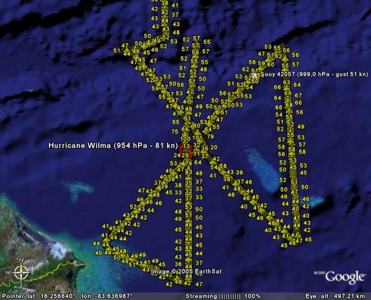
Hurricane Wilma Recon Discussion Thread

This is the general tropical discussion area. Anyone can take their shot at predicting a storms path.

Moderator: S2k Moderators

Forum rules

The posts in this forum are NOT official forecasts and should not be used as such. They are just the opinion of the poster and may or may not be backed by sound meteorological data. They are NOT endorsed by any professional institution or STORM2K. For official information, please refer to products from the National Hurricane Center and National Weather Service.

Help Support Storm2K
Message
Author
User avatar
dhweather
S2K Supporter
S2K Supporter
Posts: 6199
Joined: Sat Aug 14, 2004 9:29 pm
Location: Heath, TX
Contact:

#261 Postby dhweather » Tue Oct 18, 2005 6:43 pm

8 PM EDT TUE OCT 18 2005

...WILMA UNDERGOING RAPID INTENSIFICATION...

A HURRICANE WATCH REMAINS IN EFFECT FOR THE PROVINCES OF MATANZAS
WESTWARD THROUGH PINAR DEL RIO...AND FOR THE ISLE OF YOUTH. A
HURRICANE WATCH ALSO REMAINS IN EFFECT FOR THE YUCATAN PENINSULA OF
MEXICO FROM PUNTA ALLEN TO CABO CATOCHE. A HURRICANE WATCH MEANS
THAT HURRICANE CONDITIONS ARE POSSIBLE WITHIN THE WATCH AREA...
GENERALLY WITHIN 36 HOURS.


how low will she go?
0 likes   

User avatar
fci
S2K Supporter
S2K Supporter
Posts: 3324
Joined: Tue Sep 14, 2004 10:29 am
Location: Lake Worth, FL

#262 Postby fci » Tue Oct 18, 2005 6:43 pm

How does 116 flight convert to surface?
0 likes   

curtadams
S2K Supporter
S2K Supporter
Posts: 1122
Joined: Sun Aug 28, 2005 7:57 pm
Location: Orange, California
Contact:

#263 Postby curtadams » Tue Oct 18, 2005 6:47 pm

senorpepr wrote:Well... maybe I was a bit conservative with my remarks about tomorrow morning...


Well, hurricanes don't normally drop 9 mb in ONE HOUR.
0 likes   

inotherwords
Category 2
Category 2
Posts: 773
Joined: Mon Aug 30, 2004 9:04 pm
Location: Nokomis, FL

#264 Postby inotherwords » Tue Oct 18, 2005 6:54 pm

Tropicswatcher wrote:Looks like we may have a Major Hurricane in our hands sooner than we thought.
Well, the sooner the better, so it can burn itself out earlier.
0 likes   

User avatar
dhweather
S2K Supporter
S2K Supporter
Posts: 6199
Joined: Sat Aug 14, 2004 9:29 pm
Location: Heath, TX
Contact:

#265 Postby dhweather » Tue Oct 18, 2005 6:56 pm

Mike - I presume that the increase in intensity correlates with the
increase in the D values?

David
0 likes   

HenkL
S2K Supporter
S2K Supporter
Posts: 2401
Joined: Fri Sep 10, 2004 5:33 pm
Location: Groningen, The Netherlands
Contact:

#266 Postby HenkL » Tue Oct 18, 2005 6:59 pm

Last picture for tonight (it's 2 AM in the morning here). I set the windspeed on 81 knots, assuming 80% of 101 knots flight level winds.
Image
0 likes   

User avatar
Tropicswatcher
Tropical Depression
Tropical Depression
Posts: 77
Joined: Wed Jun 01, 2005 12:53 pm
Location: San Juan, Puerto Rico

#267 Postby Tropicswatcher » Tue Oct 18, 2005 7:00 pm

inotherwords wrote:
Tropicswatcher wrote:Looks like we may have a Major Hurricane in our hands sooner than we thought.
Well, the sooner the better, so it can burn itself out earlier.


Yeah, and hopefully shear is going to be strong enough to rip this baby apart, when it gets closer to Florida. I got a lot of relatives in Miami, including my father.
0 likes   

User avatar
senorpepr
Military Met/Moderator
Posts: 12542
Age: 43
Joined: Fri Aug 22, 2003 9:22 pm
Location: Mackenbach, Germany
Contact:

#268 Postby senorpepr » Tue Oct 18, 2005 7:07 pm

Recon is back at cruising altitude... goin' home.
0 likes   

MiamiensisWx

#269 Postby MiamiensisWx » Tue Oct 18, 2005 7:09 pm

When will the next RECON mission head out to Wilma? It is needed!
0 likes   

User avatar
senorpepr
Military Met/Moderator
Posts: 12542
Age: 43
Joined: Fri Aug 22, 2003 9:22 pm
Location: Mackenbach, Germany
Contact:

#270 Postby senorpepr » Tue Oct 18, 2005 7:13 pm

CapeVerdeWave wrote:When will the next RECON mission head out to Wilma? It is needed!


The schedule's messed up because of acft problems earlier today.
0 likes   

Brent
S2K Supporter
S2K Supporter
Posts: 38264
Age: 37
Joined: Sun May 16, 2004 10:30 pm
Location: Tulsa Oklahoma
Contact:

#271 Postby Brent » Tue Oct 18, 2005 7:14 pm

CapeVerdeWave wrote:When will the next RECON mission head out to Wilma? It is needed!


AF plane fix scheduled at 1:00am EDT... should have just left Dobbins.

But the problems earlier may delay that.
0 likes   
#neversummer

User avatar
cycloneye
Admin
Admin
Posts: 148497
Age: 69
Joined: Thu Oct 10, 2002 10:54 am
Location: San Juan, Puerto Rico

#272 Postby cycloneye » Tue Oct 18, 2005 7:30 pm

They are returning to the base at Georgia.
0 likes   
Visit the Caribbean-Central America Weather Thread where you can find at first post web cams,radars
and observations from Caribbean basin members Click Here

User avatar
senorpepr
Military Met/Moderator
Posts: 12542
Age: 43
Joined: Fri Aug 22, 2003 9:22 pm
Location: Mackenbach, Germany
Contact:

#273 Postby senorpepr » Tue Oct 18, 2005 7:39 pm

Next mission is taking off...
0 likes   

Brent
S2K Supporter
S2K Supporter
Posts: 38264
Age: 37
Joined: Sun May 16, 2004 10:30 pm
Location: Tulsa Oklahoma
Contact:

#274 Postby Brent » Tue Oct 18, 2005 7:39 pm

senorpepr wrote:Next mission is taking off...


:hoola:

We ought to get a fix by 2am(no problems withstanding)
0 likes   
#neversummer

User avatar
WindRunner
Category 5
Category 5
Posts: 5806
Age: 34
Joined: Fri Jul 29, 2005 8:07 pm
Location: Warrenton, VA, but Albany, NY for school
Contact:

#275 Postby WindRunner » Tue Oct 18, 2005 7:52 pm

Brent wrote:(no problems withstanding)


. . . the phrase of the week!
0 likes   

Jim Cantore

#276 Postby Jim Cantore » Tue Oct 18, 2005 8:15 pm

Wilmas inensifying rapidly now

not what I want to hear
0 likes   

Matt-hurricanewatcher

#277 Postby Matt-hurricanewatcher » Tue Oct 18, 2005 8:19 pm

I'm so sorry I was wrong about this hurricane reminding steady...Its going to bomb...In you can already start to see the larger eye which will appear. I think she is doing a Katrina. I'm so sorry I will eat crow now.
:cry:
0 likes   

User avatar
cycloneye
Admin
Admin
Posts: 148497
Age: 69
Joined: Thu Oct 10, 2002 10:54 am
Location: San Juan, Puerto Rico

#278 Postby cycloneye » Tue Oct 18, 2005 8:30 pm

Those members who live in the west Floridas coast from Cedar key to Tampa,Sarasota,Ft Myers,Port Charlotte and the rest of the coast you can see the plane that is heading to Wilma as it will fly all down the coast.
0 likes   
Visit the Caribbean-Central America Weather Thread where you can find at first post web cams,radars
and observations from Caribbean basin members Click Here

User avatar
HURAKAN
Professional-Met
Professional-Met
Posts: 46086
Age: 38
Joined: Thu May 20, 2004 4:34 pm
Location: Key West, FL
Contact:

#279 Postby HURAKAN » Tue Oct 18, 2005 8:33 pm

By the way, last night at 8 PM the pressure was 989 mb, tonight at 8 PM, it was 954 mb. That's 35 mb in 24 hours, or ~1.46 mb per hour! Talk about explosive cyclogenesis!
0 likes   

User avatar
TreasureIslandFLGal
S2K Supporter
S2K Supporter
Posts: 1584
Age: 57
Joined: Sun Aug 15, 2004 6:16 pm
Location: Cancun, Mexico (northeast Yucatan coast)

#280 Postby TreasureIslandFLGal » Tue Oct 18, 2005 8:35 pm

When would be your guess to see it going by Clearwater beaches?
0 likes   


Return to “Talkin' Tropics”

Who is online

Users browsing this forum: aspen, MGC, Team Ghost, Teban54 and 338 guests