Hurricane Wilma - Cat. 5

Moderator: S2k Moderators

Message
Author
User avatar
Amanzi
Category 5
Category 5
Posts: 4883
Age: 47
Joined: Wed Oct 09, 2002 10:12 pm
Location: Epsom,UK

#1841 Postby Amanzi » Thu Oct 20, 2005 1:59 pm

My heart is so torn right now. I want her to weaken for Florida, but I feel so for the people in the Yuc who have to deal with her wrath now.
0 likes   

User avatar
artist
Category 5
Category 5
Posts: 9792
Joined: Mon Jun 06, 2005 3:26 pm
Location: West Palm

#1842 Postby artist » Thu Oct 20, 2005 2:00 pm

in his tele conference he stated it could be a strong cat 2 or 3, if it hits the yucatan - otherwise it would have been strong cat 3 or 4. BUT he said we don't know for sure basically. Any of those strengths will cause alot of damage.
0 likes   

User avatar
skysummit
S2K Supporter
S2K Supporter
Posts: 5305
Age: 49
Joined: Tue Aug 31, 2004 11:09 pm
Location: Ponchatoula, LA
Contact:

#1843 Postby skysummit » Thu Oct 20, 2005 2:01 pm

Amanzi wrote:My heart is so torn right now. I want her to weaken for Florida, but I feel so for the people in the Yuc who have to deal with her wrath now.


So what we could hope for is for Wilma to miss the Yucatan, and a hell of a lot of shear builds up in the SE gulf to really weakenn her prior to landfall in Florida.
0 likes   

User avatar
storms in NC
S2K Supporter
S2K Supporter
Posts: 2338
Joined: Thu Jul 28, 2005 2:58 pm
Location: Wallace,NC 40 miles NE of Wilm
Contact:

#1844 Postby storms in NC » Thu Oct 20, 2005 2:02 pm

ColinDelia wrote:
storms in NC wrote:I still say the eye will not go over land. For the last few hours it has been going NW and that would put it just off shore. I would like to ask if any one has seen the warm edds in the gulf. That is what I am going by and that it will be a strong 3 low 4 at land fall.


Look at the shear though ::
http://cimss.ssec.wisc.edu/tropic/real- ... shr-1.html

Increasing from 10-40+ knots (currently) between the Yucutan and Florida coast.

True But if she gets back up to a strong 5 and then hits the shear it is not going to bring her down that much that fast.. So a strong cat 3 to a weak 4
0 likes   

Derek Ortt

#1845 Postby Derek Ortt » Thu Oct 20, 2005 2:07 pm

the model consensus is now for an Isidore scenario. CONU has the storm stuck over the NE Yucatan
0 likes   

User avatar
skysummit
S2K Supporter
S2K Supporter
Posts: 5305
Age: 49
Joined: Tue Aug 31, 2004 11:09 pm
Location: Ponchatoula, LA
Contact:

#1846 Postby skysummit » Thu Oct 20, 2005 2:08 pm

She is really starting to look symmetrical again.

Image
0 likes   

User avatar
deltadog03
Professional-Met
Professional-Met
Posts: 3580
Joined: Tue Jul 05, 2005 6:16 pm
Location: Macon, GA

#1847 Postby deltadog03 » Thu Oct 20, 2005 2:10 pm

i think she is about to ramp up again to cat 5....eye looks much better....its looking like hear ERC is finished
0 likes   

Valkhorn
Category 1
Category 1
Posts: 492
Joined: Wed Sep 10, 2003 4:09 am
Contact:

#1848 Postby Valkhorn » Thu Oct 20, 2005 2:10 pm

the model consensus is now for an Isidore scenario. CONU has the storm stuck over the NE Yucatan


Sources?
0 likes   

User avatar
storms in NC
S2K Supporter
S2K Supporter
Posts: 2338
Joined: Thu Jul 28, 2005 2:58 pm
Location: Wallace,NC 40 miles NE of Wilm
Contact:

#1849 Postby storms in NC » Thu Oct 20, 2005 2:10 pm

Derek Ortt wrote:the model consensus is now for an Isidore scenario. CONU has the storm stuck over the NE Yucatan


Do What? Now Derek do you really think this will happen?
0 likes   

User avatar
baygirl_1
S2K Supporter
S2K Supporter
Posts: 825
Joined: Wed Aug 11, 2004 4:06 pm
Location: Mobile, AL

#1850 Postby baygirl_1 » Thu Oct 20, 2005 2:11 pm

Derek Ortt wrote:the model consensus is now for an Isidore scenario. CONU has the storm stuck over the NE Yucatan

Derek, I'm assuming you mean the part of Isidore's path that meandered around the Yucantan for a bit? You aren't referring to its later path toward Louisiana, right?
0 likes   

User avatar
skysummit
S2K Supporter
S2K Supporter
Posts: 5305
Age: 49
Joined: Tue Aug 31, 2004 11:09 pm
Location: Ponchatoula, LA
Contact:

#1851 Postby skysummit » Thu Oct 20, 2005 2:11 pm

Derek Ortt wrote:the model consensus is now for an Isidore scenario. CONU has the storm stuck over the NE Yucatan


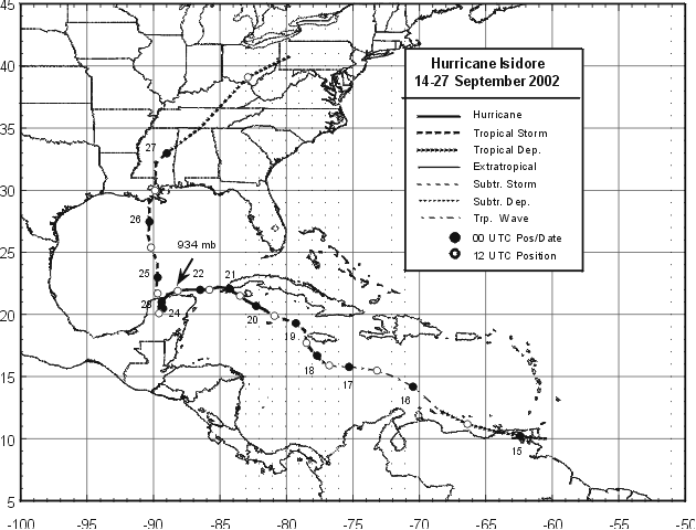
Which Isidore scenario are you talking about?

I know you're not talking about this....

Image
Last edited by skysummit on Thu Oct 20, 2005 2:12 pm, edited 1 time in total.
0 likes   

User avatar
melhow
S2K Supporter
S2K Supporter
Posts: 362
Joined: Sat Sep 04, 2004 4:00 pm
Location: Safety Harbor, FL

#1852 Postby melhow » Thu Oct 20, 2005 2:12 pm

Derek Ortt wrote:the model consensus is now for an Isidore scenario. CONU has the storm stuck over the NE Yucatan


Are you talking just the the stall, or the entire track, ie: Lousianna?
0 likes   

Myersgirl
Tropical Storm
Tropical Storm
Posts: 216
Joined: Fri Jul 23, 2004 7:32 pm
Location: Fort Myers
Contact:

#1853 Postby Myersgirl » Thu Oct 20, 2005 2:14 pm

She looks stretched out to the Northeast to me
0 likes   

User avatar
Aimless
Category 1
Category 1
Posts: 381
Joined: Fri Sep 12, 2003 10:59 am
Location: Orange City
Contact:

#1854 Postby Aimless » Thu Oct 20, 2005 2:16 pm

Myersgirl wrote:She looks stretched out to the Northeast to me


looks that way to me too
0 likes   

User avatar
wxwatcher91
Category 5
Category 5
Posts: 1606
Joined: Wed Jul 06, 2005 2:43 pm
Location: Keene, NH
Contact:

#1855 Postby wxwatcher91 » Thu Oct 20, 2005 2:19 pm

Aimless wrote:
Myersgirl wrote:She looks stretched out to the Northeast to me


looks that way to me too


ditto... not sure what it means though lol

all I know is that between 11am and 2pm it moved .2 N and 0W so I think it has turned
0 likes   

LilNoles2005
Tropical Storm
Tropical Storm
Posts: 143
Joined: Tue Apr 19, 2005 11:32 am

c'mon

#1856 Postby LilNoles2005 » Thu Oct 20, 2005 2:23 pm

C'mon you guys, you know he meant that the Izzy reference was to her long stall over the Yucatan Peninsula.

None of the models show a hint of anything coming close to LA.
0 likes   

User avatar
Ivanhater
Storm2k Moderator
Storm2k Moderator
Posts: 11162
Age: 38
Joined: Fri Jul 01, 2005 8:25 am
Location: Pensacola

#1857 Postby Ivanhater » Thu Oct 20, 2005 2:29 pm

well im back after our meteorology teacher cussed us out cause our class didnt do well on the midterm, she was not happy :eek: back to wilma, :lol:
0 likes   

User avatar
dixiebreeze
S2K Supporter
S2K Supporter
Posts: 5140
Joined: Wed Sep 03, 2003 5:07 pm
Location: crystal river, fla.

#1858 Postby dixiebreeze » Thu Oct 20, 2005 2:30 pm

Convection bands now all the way to Tampa Bay and she looks as though she's moving more NNW than NW. -- Very organized and serious:

http://www.ssd.noaa.gov/PS/TROP/DATA/RT/GMEX/IR4/20.jpg
0 likes   

n o o d l z
Tropical Depression
Tropical Depression
Posts: 96
Joined: Tue Oct 18, 2005 6:47 pm
Location: Gainesville, FL

#1859 Postby n o o d l z » Thu Oct 20, 2005 2:31 pm

ivanhater wrote:well im back after our meteorology teacher cussed us out cause our class didnt do well on the midterm, she was not happy :eek: back to wilma, :lol:


I'd say you had a good reason not to study...
0 likes   

Scorpion

#1860 Postby Scorpion » Thu Oct 20, 2005 2:33 pm

Looks NNW now. Definitely making the turn. Cozumel might escape the worst. Doesnt look at all like its burying itself in the Yucatan.
0 likes   


Return to “2005”

Who is online

Users browsing this forum: No registered users and 18 guests