Invest 94L,Comments,Sat Pics,Models thread

This is the general tropical discussion area. Anyone can take their shot at predicting a storms path.

Moderator: S2k Moderators

Forum rules

The posts in this forum are NOT official forecasts and should not be used as such. They are just the opinion of the poster and may or may not be backed by sound meteorological data. They are NOT endorsed by any professional institution or STORM2K. For official information, please refer to products from the National Hurricane Center and National Weather Service.

Help Support Storm2K
Message
Author
User avatar
cycloneye
Admin
Admin
Posts: 146239
Age: 69
Joined: Thu Oct 10, 2002 10:54 am
Location: San Juan, Puerto Rico

#81 Postby cycloneye » Sun Nov 13, 2005 3:24 pm

abajan wrote:Judging by the flooded condition of streets etc. it must have been raining steadily for the last 4 hrs. or so here. (I don't know for sure because I was indoors attending a church luncheon.)

Since early morning, our Met office has been warning of heavy rains, thunderstorms with gusts in excess of 50 mph and flooding in flood prone and low lying areas. I haven't seen any high winds or heard any thunder as yet, though.

This is typical November weather for Barbados. It's usually our wettest month.


I was waiting eagerly for your report from Barbados.Stay safe down there my friend.
0 likes   
Visit the Caribbean-Central America Weather Thread where you can find at first post web cams,radars
and observations from Caribbean basin members Click Here

User avatar
cycloneye
Admin
Admin
Posts: 146239
Age: 69
Joined: Thu Oct 10, 2002 10:54 am
Location: San Juan, Puerto Rico

#82 Postby cycloneye » Sun Nov 13, 2005 3:39 pm


GLOBAL MODEL DATA TIME 12UTC 13.11.2005


NEW TROPICAL STORM FORECAST TO DEVELOP AFTER 48 HOURS

FORECAST POSITION AT T+48 : 13.7N 68.2W


VERIFYING TIME POSITION STRENGTH TENDENCY

-------------- -------- -------- --------

12UTC 15.11.2005 13.7N 68.2W WEAK

00UTC 16.11.2005 13.6N 68.6W WEAK LITTLE CHANGE

12UTC 16.11.2005 13.8N 69.7W WEAK INTENSIFYING SLIGHTLY

00UTC 17.11.2005 13.6N 70.5W WEAK LITTLE CHANGE

12UTC 17.11.2005 13.7N 71.7W MODERATE INTENSIFYING SLIGHTLY

00UTC 18.11.2005 13.7N 73.0W MODERATE LITTLE CHANGE

12UTC 18.11.2005 13.2N 75.8W MODERATE INTENSIFYING SLIGHTLY

00UTC 19.11.2005 13.2N 77.3W STRONG INTENSIFYING RAPIDLY

12UTC 19.11.2005 13.8N 77.3W STRONG INTENSIFYING SLIGHTLY


12z UKMET
0 likes   
Visit the Caribbean-Central America Weather Thread where you can find at first post web cams,radars
and observations from Caribbean basin members Click Here

User avatar
WindRunner
Category 5
Category 5
Posts: 5806
Age: 34
Joined: Fri Jul 29, 2005 8:07 pm
Location: Warrenton, VA, but Albany, NY for school
Contact:

#83 Postby WindRunner » Sun Nov 13, 2005 3:43 pm

Oh shoot . . . now the UKMET is putting that "Strong" word in there . . . I believe that usually approximates to major hurricanes? (weak - TS, mod - hurr, strong - major) :?: :?:


If a pro knows better, please say so.
0 likes   

User avatar
cjrciadt
S2K Supporter
S2K Supporter
Posts: 1616
Joined: Mon Aug 22, 2005 1:11 pm
Location: Kissimmee, FL

#84 Postby cjrciadt » Sun Nov 13, 2005 3:45 pm

Image
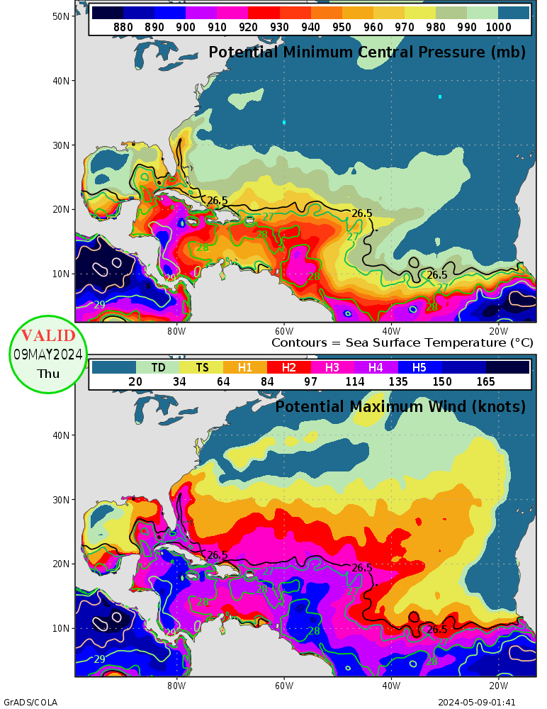
MPI
0 likes   

User avatar
mike815
Category 5
Category 5
Posts: 1460
Joined: Fri Jul 22, 2005 8:21 am
Location: palm bay fl

#85 Postby mike815 » Sun Nov 13, 2005 3:46 pm

Yeah thats not good might have a stronger storm than what i was thinking yesterday. I think it has a ligitamite shot now. :eek:
0 likes   

User avatar
SouthFloridawx
S2K Supporter
S2K Supporter
Posts: 8346
Age: 46
Joined: Tue Jul 26, 2005 1:16 am
Location: Sarasota, FL
Contact:

#86 Postby SouthFloridawx » Sun Nov 13, 2005 3:47 pm

Image
0 likes   

User avatar
SouthFloridawx
S2K Supporter
S2K Supporter
Posts: 8346
Age: 46
Joined: Tue Jul 26, 2005 1:16 am
Location: Sarasota, FL
Contact:

#87 Postby SouthFloridawx » Sun Nov 13, 2005 3:47 pm

0 likes   

User avatar
Hurricanehink
S2K Supporter
S2K Supporter
Posts: 2041
Joined: Sun Nov 16, 2003 2:05 pm
Location: New Jersey

#88 Postby Hurricanehink » Sun Nov 13, 2005 3:55 pm

There might be a slight circulation, though it could be mid-level. This thing is getting interesting.
0 likes   

User avatar
SouthFloridawx
S2K Supporter
S2K Supporter
Posts: 8346
Age: 46
Joined: Tue Jul 26, 2005 1:16 am
Location: Sarasota, FL
Contact:

#89 Postby SouthFloridawx » Sun Nov 13, 2005 3:55 pm

Hurricanehink wrote:There might be a slight circulation, though it could be mid-level. This thing is getting interesting.


I agree after hearing you say that I concur and that's what I though originally but, i wanted to see if someone else thought so too
0 likes   

User avatar
danman
Tropical Low
Tropical Low
Posts: 29
Joined: Mon Oct 24, 2005 2:18 pm
Location: maryland

#90 Postby danman » Sun Nov 13, 2005 4:04 pm

i ALSO see circulation for what thats worth :eek:
0 likes   

User avatar
SouthFloridawx
S2K Supporter
S2K Supporter
Posts: 8346
Age: 46
Joined: Tue Jul 26, 2005 1:16 am
Location: Sarasota, FL
Contact:

#91 Postby SouthFloridawx » Sun Nov 13, 2005 4:40 pm

for what it's worth here is the NAM 18Z T=84

Image
0 likes   

User avatar
P.K.
Professional-Met
Professional-Met
Posts: 5149
Joined: Thu Sep 23, 2004 5:57 pm
Location: Watford, England
Contact:

#92 Postby P.K. » Sun Nov 13, 2005 4:47 pm

WindRunner wrote:Oh shoot . . . now the UKMET is putting that "Strong" word in there . . . I believe that usually approximates to major hurricanes? (weak - TS, mod - hurr, strong - major) :?: :?:


The only thing above strong is intense on that scale. I'm not sure what ranges the different classifications cover though.
0 likes   

User avatar
cycloneye
Admin
Admin
Posts: 146239
Age: 69
Joined: Thu Oct 10, 2002 10:54 am
Location: San Juan, Puerto Rico

#93 Postby cycloneye » Sun Nov 13, 2005 5:30 pm


ABNT20 KNHC 132229
TWOAT
TROPICAL WEATHER OUTLOOK
NWS TPC/NATIONAL HURRICANE CENTER MIAMI FL
530 PM EST SUN NOV 13 2005

FOR THE NORTH ATLANTIC...CARIBBEAN SEA AND THE GULF OF MEXICO...

A LARGE LOW PRESSURE SYSTEM LOCATED OVER THE EXTREME SOUTHEASTERN
CARIBBEAN SEA ABOUT 50 MILES WEST OF THE GRENADINE ISLANDS IS
MOVING WESTWARD TO WEST-NORTHWESTWARD AT 10 TO 15 MPH. THIS SYSTEM
HAS CHANGED LITTLE IN ORGANIZATION TODAY...AND MODERATE UPPER-LEVEL
WESTERLY WINDS HAVE KEPT MOST OF THE SIGNIFICANT SHOWER ACTIVITY
WELL TO THE EAST OF CIRCULATION CENTER. HOWEVER... UPPER-LEVEL
CONDITIONS ARE EXPECTED TO GRADUALLY BECOME A LITTLE MORE FAVORABLE
FOR DEVELOPMENT... AND IT IS POSSIBLE THAT THIS SYSTEM COULD BECOME
A TROPICAL DEPRESSION DURING THE NEXT DAY OR TWO AS IT MOVES INTO
THE CENTRAL CARIBBEAN SEA. REGARDLESS OF WHETHER OR NOT A TROPICAL
DEPRESSION FORMS... THIS SYSTEM WILL PRODUCE BRIEF PERIODS OF GUSTY
WINDS AND LOCALLY HEAVY RAINS TO PORTIONS OF THE LESSER ANTILLES...
THE VIRGIN ISLANDS... AND PUERTO RICO OVER THE NEXT DAY OR TWO.

ELSEWHERE... TROPICAL STORM FORMATION IS NOT EXPECTED THROUGH
MONDAY.

FORECASTER STEWART

0 likes   
Visit the Caribbean-Central America Weather Thread where you can find at first post web cams,radars
and observations from Caribbean basin members Click Here

User avatar
WindRunner
Category 5
Category 5
Posts: 5806
Age: 34
Joined: Fri Jul 29, 2005 8:07 pm
Location: Warrenton, VA, but Albany, NY for school
Contact:

#94 Postby WindRunner » Sun Nov 13, 2005 5:54 pm

P.K. wrote:
WindRunner wrote:Oh shoot . . . now the UKMET is putting that "Strong" word in there . . . I believe that usually approximates to major hurricanes? (weak - TS, mod - hurr, strong - major) :?: :?:


The only thing above strong is intense on that scale. I'm not sure what ranges the different classifications cover though.


Oh yeah, I forgot about intense. I thought I had this figured out a while ago, but I can't remember it now. I do know that what I said earlier isn't right.
0 likes   

User avatar
P.K.
Professional-Met
Professional-Met
Posts: 5149
Joined: Thu Sep 23, 2004 5:57 pm
Location: Watford, England
Contact:

#95 Postby P.K. » Sun Nov 13, 2005 6:26 pm

WHXX04 KWBC 132320
CHGQLM
ATTENTION...NATIONAL HURRICANE CENTER

NCEP COUPLED GFDL HURRICANE MODEL FORECAST MADE FOR

TROPICAL DEPRESSION INVEST 94L

INITIAL TIME 18Z NOV 13

DISCLAIMER ... THIS INFORMATION IS PROVIDED AS GUIDANCE. IT
REQUIRES INTERPRETATION BY HURRICANE SPECIALISTS AND SHOULD
NOT BE CONSIDERED AS A FINAL PRODUCT. PLEASE SEE THE TPC/NHC
OFFICIAL FORECAST.


FORECAST STORM POSITION

HOUR LATITUDE LONGITUDE HEADING/SPEED(KT)

0 12.3 61.5 285./11.1
6 12.8 62.6 295./12.2
12 13.2 63.3 301./ 8.1
18 13.7 64.1 303./ 8.6
24 14.8 64.8 325./12.5
30 14.9 65.8 275./10.4
36 15.7 66.3 332./ 9.9
42 16.5 67.0 320./10.3
48 16.5 67.8 271./ 7.8
54 16.5 68.8 269./ 9.1
60 16.3 69.5 253./ 7.9
66 16.5 70.5 282./ 9.7
72 16.5 71.8 269./12.6
78 16.2 72.7 251./ 8.7
84 16.2 73.6 273./ 8.9
90 16.4 74.7 279./10.1
96 16.6 76.1 279./13.4
102 16.7 77.3 275./12.0
108 16.6 78.6 265./12.8
114 16.4 79.7 258./10.0
120 16.2 80.3 253./ 7.1
126 16.1 80.7 256./ 3.2
0 likes   

User avatar
cycloneye
Admin
Admin
Posts: 146239
Age: 69
Joined: Thu Oct 10, 2002 10:54 am
Location: San Juan, Puerto Rico

#96 Postby cycloneye » Sun Nov 13, 2005 6:30 pm

:uarrow: :uarrow: :uarrow: :uarrow: :uarrow: :uarrow:

P.K. do you have the intensity forecast of that 18z run?
0 likes   
Visit the Caribbean-Central America Weather Thread where you can find at first post web cams,radars
and observations from Caribbean basin members Click Here

User avatar
P.K.
Professional-Met
Professional-Met
Posts: 5149
Joined: Thu Sep 23, 2004 5:57 pm
Location: Watford, England
Contact:

#97 Postby P.K. » Sun Nov 13, 2005 6:33 pm

Not yet, waiting for it though so I can go to bed.:lol:
0 likes   

User avatar
P.K.
Professional-Met
Professional-Met
Posts: 5149
Joined: Thu Sep 23, 2004 5:57 pm
Location: Watford, England
Contact:

#98 Postby P.K. » Sun Nov 13, 2005 6:37 pm

Looking at the phase diagrams it is sub 950hPa in a similar path to the 6am GMT run. :eek:
0 likes   

User avatar
P.K.
Professional-Met
Professional-Met
Posts: 5149
Joined: Thu Sep 23, 2004 5:57 pm
Location: Watford, England
Contact:

#99 Postby P.K. » Sun Nov 13, 2005 6:59 pm

941hPa, 127kt winds at 950hPa :eek:

http://moe.met.fsu.edu/tcgengifs/gfdl/2005111318-invest94l/slp19.png

I'll post the midnight run in the morning, but I guess it will be back to not develping it again. :lol:
0 likes   

User avatar
cycloneye
Admin
Admin
Posts: 146239
Age: 69
Joined: Thu Oct 10, 2002 10:54 am
Location: San Juan, Puerto Rico

#100 Postby cycloneye » Sun Nov 13, 2005 6:59 pm

SPECIAL FEATURE...

A STRONG TROPICAL WAVE ALONG 61W/62W S OF 20N IS MOVING W 10 KT
ACROSS THE LEEWARD/WINDWARD ISLANDS. A 1006 MB LOW IS LOCATED
ALONG THE WAVE NEAR THE GRENADINES AROUND 12.5N. THE LOW
PRESSURE AREA HAS GOTTEN BETTER DEFINED SINCE YESTERDAY WITH
SEVERAL WINDS REPORTED FROM A WLY DIRECTION S OF THE LOW IN THE
WINDWARD ISLANDS W TO NEAR MARGARITA ISLAND. HOWEVER WLY SHEAR
IS DISPLACING MOST OF THE SIGNIFICANT TSTMS TO THE E WITH
SCATTERED MODERATE CONVECTION FROM TRINIDAD TO MARTINIQUE
BETWEEN BARBADOS AND THE GRENADINES. MODERATE WLY SHEAR SHOULD
CONTINUE FOR THE NEXT COUPLE OF DAYS NEAR THE LOW... WHICH
SHOULD PREVENT ANY RAPID TROPICAL CYCLONE DEVELOPMENT. HOWEVER
ANY SIGNIFICANT CONVECTIVE ORGANIZATION COULD LEAD TO TROPICAL
CYCLONE FORMATION WITHIN THE NEXT 36 HOURS... WITH COMPUTER
MODELS SUGGESTING LIGHTER SHEAR POSSIBLY IN THE SYSTEM'S PATH.


7 Pm EST Discussion.

Looks like this system will be eventually Gamma down the road as conditions will be better in the central caribbean so another record for the 2005 season is waiting in the wings..
0 likes   
Visit the Caribbean-Central America Weather Thread where you can find at first post web cams,radars
and observations from Caribbean basin members Click Here

Return to “Talkin' Tropics”

Who is online

Users browsing this forum: StormWeather and 90 guests