Powerful Extratropical Low near the Azores

This is the general tropical discussion area. Anyone can take their shot at predicting a storms path.

Moderator: S2k Moderators

Forum rules

The posts in this forum are NOT official forecasts and should not be used as such. They are just the opinion of the poster and may or may not be backed by sound meteorological data. They are NOT endorsed by any professional institution or STORM2K. For official information, please refer to products from the National Hurricane Center and National Weather Service.

Help Support Storm2K
Message
Author
User avatar
HURAKAN
Professional-Met
Professional-Met
Posts: 46086
Age: 38
Joined: Thu May 20, 2004 4:34 pm
Location: Key West, FL
Contact:

Powerful Extratropical Low near the Azores

#1 Postby HURAKAN » Sun Dec 11, 2005 12:12 pm

A 997 MB STORM LOW IS OVER THE E ATLANTIC NEAR 33N30W. A
COLD FRONT EXTENDS S FROM THE LOW TO 30N24W 26N23W 17N32W. WIDELY
SCATTERED MODERATE CONVECTION EXTENDS 180 NM E OF THE FRONT N OF
20N.


Image

Image

Image

Image

Image

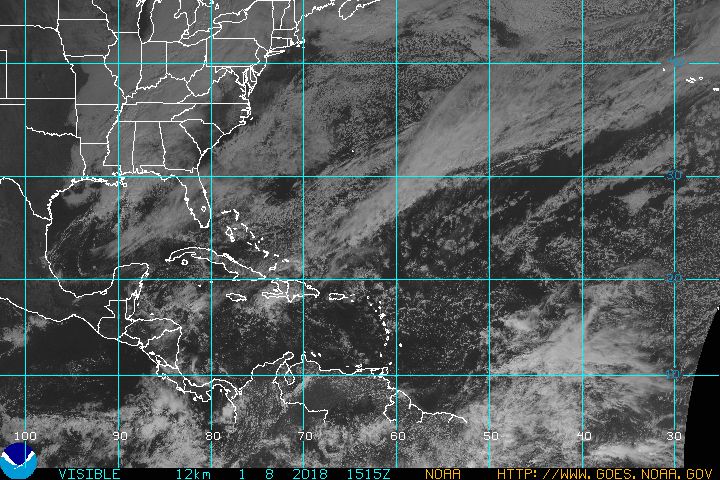
Right now the system is clearly extratropical but it has begun to develop convection near center. It will be interesting to see if it can detach from its cold front and move a little bit closer to warmer water temperatures. Still, it will be incredible if the system can become subtropical, and bizarre if it can become tropical. Chance of becoming Zeta is around 20% or lower, but this is the 2005 hurricane season!
Last edited by HURAKAN on Mon Dec 12, 2005 7:22 am, edited 3 times in total.
0 likes   

whereverwx
Category 5
Category 5
Posts: 1109
Joined: Mon May 31, 2004 10:15 pm

#2 Postby whereverwx » Sun Dec 11, 2005 12:13 pm

I think we might have Zeta! :eek:
0 likes   

User avatar
HURAKAN
Professional-Met
Professional-Met
Posts: 46086
Age: 38
Joined: Thu May 20, 2004 4:34 pm
Location: Key West, FL
Contact:

#3 Postby HURAKAN » Sun Dec 11, 2005 12:20 pm

Calamity wrote:I think we might have Zeta! :eek:


IT WILL BE MORE THAN INTERESTING!
0 likes   

User avatar
Tampa Bay Hurricane
Category 5
Category 5
Posts: 5597
Age: 37
Joined: Fri Jul 22, 2005 7:54 pm
Location: St. Petersburg, FL

#4 Postby Tampa Bay Hurricane » Sun Dec 11, 2005 12:27 pm

ZETA ON THE WAY PERHAPS!!!! THIS SYSTEM IS SMOKING
WILD FISH OUT OF THE WATER!!!
JUST DOGGONE WILD SO CRAZY WILD
I CAN'T STAND IT ANYMORE :eek: :eek: :eek:
DOGGONE-IT 2005 WILL NEVER END!!!!!
UGGHHHH!!!!!
CAT 5 IN 3 DAYS IMO!

Just Kidding.
Yes that is one powerful extratropical low
0 likes   

User avatar
cycloneye
Admin
Admin
Posts: 145604
Age: 68
Joined: Thu Oct 10, 2002 10:54 am
Location: San Juan, Puerto Rico

#5 Postby cycloneye » Sun Dec 11, 2005 12:27 pm

Image

12z GFS at 24 hours.

Image

12z GFS at 48 hours.

Image

12z GFS at 72 hours.

Interesting that the GFS is showing the low but will it turn to a warm core one?

Image

12z GFS at 96 hours.

Image

12z GFS at 120 hours.

Image

12z GFS at 144 hours.
Last edited by cycloneye on Sun Dec 11, 2005 12:33 pm, edited 2 times in total.
0 likes   

User avatar
Tampa Bay Hurricane
Category 5
Category 5
Posts: 5597
Age: 37
Joined: Fri Jul 22, 2005 7:54 pm
Location: St. Petersburg, FL

#6 Postby Tampa Bay Hurricane » Sun Dec 11, 2005 12:31 pm

ZETA ZETA ZETA...imo is written all over this BIG PIGGY.
0 likes   

whereverwx
Category 5
Category 5
Posts: 1109
Joined: Mon May 31, 2004 10:15 pm

#7 Postby whereverwx » Sun Dec 11, 2005 12:41 pm

Impressive system.

Image
0 likes   

Matt-hurricanewatcher

#8 Postby Matt-hurricanewatcher » Sun Dec 11, 2005 12:59 pm

Come on zeta form for us!!! :P
0 likes   

User avatar
HURAKAN
Professional-Met
Professional-Met
Posts: 46086
Age: 38
Joined: Thu May 20, 2004 4:34 pm
Location: Key West, FL
Contact:

#9 Postby HURAKAN » Sun Dec 11, 2005 1:07 pm

1:05 PM EDT TWD:

THE 995 MB GALE CENTER NEAR 31N29W. A COLD FRONT CURVES EASTWARD
FROM THIS LOW CENTER TO 30N22W...TO 23N22W AND TO 16N31W. WIDELY
SCATTERED MODERATE SHOWERS TO ISOLATED STRONG THUNDERSTORMS ARE
FOUND FROM 26N TO 31N BETWEEN 17W AND 20W. OTHER CLOUDS HAVE
DEVELOPED DURING THE LAST SIX HOURS FROM 22N TO 28N BETWEEN 20W
AND 33W IN THE CYCLONIC FLOW.
0 likes   

Matt-hurricanewatcher

#10 Postby Matt-hurricanewatcher » Sun Dec 11, 2005 1:22 pm

Scome on low move southwestward :lol:
0 likes   

User avatar
WindRunner
Category 5
Category 5
Posts: 5806
Age: 34
Joined: Fri Jul 29, 2005 8:07 pm
Location: Warrenton, VA, but Albany, NY for school
Contact:

#11 Postby WindRunner » Sun Dec 11, 2005 1:26 pm

GFS says this is as warm-core as it will get.
http://moe.met.fsu.edu/cyclonephase/gfs/fcst/archive/05121112/17.html

CMC still develops it into more of a deep, warm-core system before making it more shallow.
http://moe.met.fsu.edu/cyclonephase/cmcglb/fcst/archive/05121112/14.html

UKMET shows similar soultion as CMC in terms of core temp/depth of system
http://moe.met.fsu.edu/cyclonephase/ukm/fcst/archive/05121112/20.html

And a 00Z run of the NOGAPS shows the same.
http://moe.met.fsu.edu/cyclonephase/ngp/fcst/archive/05121100/23.html

Certainly looks like all the models are pointing towards this thing turning warm-core (but that doesn't necessarily mean the NHC will upgrade!)
0 likes   

User avatar
HURAKAN
Professional-Met
Professional-Met
Posts: 46086
Age: 38
Joined: Thu May 20, 2004 4:34 pm
Location: Key West, FL
Contact:

#12 Postby HURAKAN » Sun Dec 11, 2005 1:31 pm

Image

The system is located over water temperatures around 20-22 degrees Celsius, this isn't going to help for Zeta to form.
0 likes   

whereverwx
Category 5
Category 5
Posts: 1109
Joined: Mon May 31, 2004 10:15 pm

#13 Postby whereverwx » Sun Dec 11, 2005 1:47 pm

Whatever happens, it will be something to monitor.

Image
0 likes   

Matt-hurricanewatcher

#14 Postby Matt-hurricanewatcher » Sun Dec 11, 2005 1:55 pm

If the system move southward or southwestward theres a better chance. Remember Vince did not need warm water.
0 likes   

User avatar
Tampa Bay Hurricane
Category 5
Category 5
Posts: 5597
Age: 37
Joined: Fri Jul 22, 2005 7:54 pm
Location: St. Petersburg, FL

#15 Postby Tampa Bay Hurricane » Sun Dec 11, 2005 2:09 pm

Zeta Zeta Zeta Phi Fi oh Theta!!!!!
j/k lol
0 likes   

Coredesat

#16 Postby Coredesat » Sun Dec 11, 2005 2:49 pm

Also, keep in mind that Epsilon maintained its strength over waters as cold or colder than Vince.
0 likes   

User avatar
danman
Tropical Low
Tropical Low
Posts: 29
Joined: Mon Oct 24, 2005 2:18 pm
Location: maryland

#17 Postby danman » Sun Dec 11, 2005 3:16 pm

:eek: :eek: :eek: :eek: :eek: :eek: :eek: :eek:
0 likes   

User avatar
gatorcane
S2K Supporter
S2K Supporter
Posts: 23692
Age: 47
Joined: Sun Mar 13, 2005 3:54 pm
Location: Boca Raton, FL

#18 Postby gatorcane » Sun Dec 11, 2005 3:31 pm

Zeta in December...that will blow my mind! :eek:
0 likes   

User avatar
HURAKAN
Professional-Met
Professional-Met
Posts: 46086
Age: 38
Joined: Thu May 20, 2004 4:34 pm
Location: Key West, FL
Contact:

#19 Postby HURAKAN » Sun Dec 11, 2005 4:35 pm

Image

POWERFUL EXTRATROPICAL LOW!
0 likes   

User avatar
HURAKAN
Professional-Met
Professional-Met
Posts: 46086
Age: 38
Joined: Thu May 20, 2004 4:34 pm
Location: Key West, FL
Contact:

#20 Postby HURAKAN » Sun Dec 11, 2005 4:36 pm

boca_chris wrote:Zeta in December...that will blow my mind! :eek:


Maybe not!!
Zeta in any other month, then it will blow my mind!!!!!!! :lol: :eek: :lol:
0 likes   


Return to “Talkin' Tropics”

Who is online

Users browsing this forum: duilaslol, jhpigott, Killjoy12, LarryWx, RomP, Sunnydays, weatherwindow and 81 guests