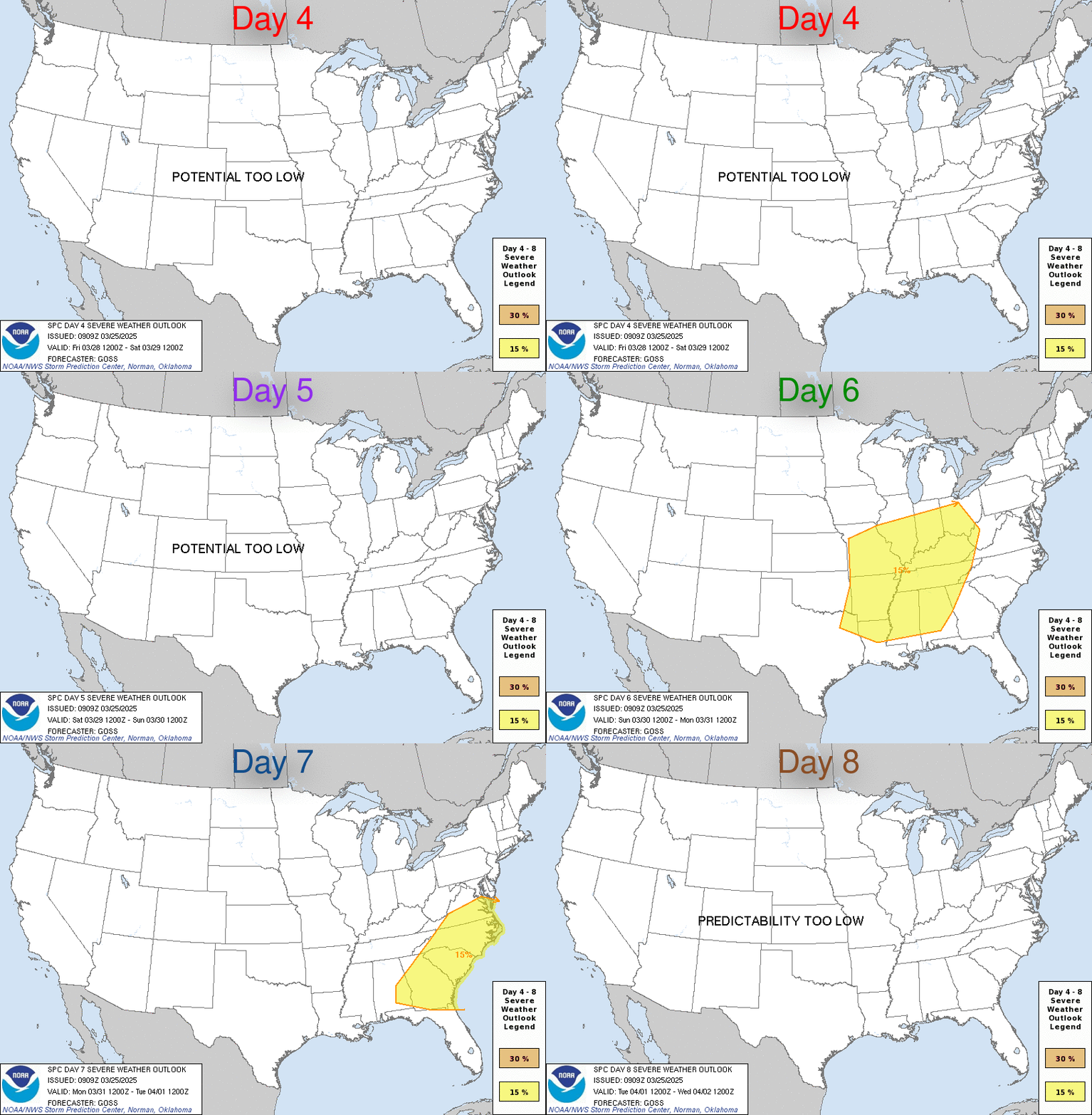
Severe Storms and a Potential Bomb?
Moderator: S2k Moderators
Forum rules
The posts in this forum are NOT official forecast and should not be used as such. They are just the opinion of the poster and may or may not be backed by sound meteorological data. They are NOT endorsed by any professional institution or STORM2K.
- Weatherfreak14
- Category 5

- Posts: 1381
- Joined: Sat Sep 24, 2005 3:40 pm
- Location: Beaufort, SC
- Contact:
- WaitingForSiren
- Category 1

- Posts: 383
- Joined: Sun Jan 08, 2006 12:58 pm
- Location: Minneapolis,Minnesota
- Contact:
- Weatherfreak14
- Category 5

- Posts: 1381
- Joined: Sat Sep 24, 2005 3:40 pm
- Location: Beaufort, SC
- Contact:

DAY 4-8 CONVECTIVE OUTLOOK
NWS STORM PREDICTION CENTER NORMAN OK
0333 AM CST TUE JAN 31 2006
VALID 031200Z - 081200Z
...DISCUSSION...
LATE EVENING MODEL GUIDANCE SUGGEST THERE IS A POTENTIAL FOR SEVERE
THUNDERSTORMS ACROSS MUCH OF THE GULF COAST STATES INTO PORTIONS OF
TN AND THE CAROLINAS FRIDAY AND SATURDAY.
SRN PLAINS SHORTWAVE SHOULD INDUCE A DEEPENING SFC CYCLONE THAT WILL
MATURE AS IT LIFTS NEWD FROM ERN TX INTO THE UPPER OH VALLEY BY 12Z
SUNDAY...WITH FURTHER DEEPENING EXPECTED BEYOND THIS TIME PERIOD
INTO SRN CANADA. SEVERE THUNDERSTORMS ARE POSSIBLE AHEAD OF
SHARPENING COLD FRONT THAT WILL SWEEP ACROSS AN INCREASINGLY
MOIST/DESTABILIZING WARM SECTOR.
..DARROW.. 01/31/2006
Looks like severe weather will be rolling across the southeast on fri and saturday and this seems to have ga, and SC in the futre on Sturday.
0 likes
- WaitingForSiren
- Category 1

- Posts: 383
- Joined: Sun Jan 08, 2006 12:58 pm
- Location: Minneapolis,Minnesota
- Contact:
yeah but you gotta realize that the 4-8 day outlook isnt very reliable, and SPC tends to issue generous foreasts. I mean, a look at the weather map forecasts will show you that the timing just is NOT right for severe weather east of Alabama. Models have the storm reaching Georgia on 12z/7 AM saturday, and severe weather that early in the day with a storm system that isnt particularly intense is VERY rare.


0 likes
- wxmann_91
- Category 5

- Posts: 8007
- Age: 34
- Joined: Fri Jul 15, 2005 2:49 pm
- Location: Southern California
- Contact:
I am waiting for the 0Z runs. The storm has now come ashore in the Pacific Northwest and into our RAOB network, so the 0Z runs should be inputed with this new data. So far the 12Z and 18Z GFS runs have washed out this system, but I am not convinced the storm will go down without a fight, given that the trend for this winter has been 1) a storm shows up and the models are pretty consistant, but then 2) it washes out/dissapears, until 3) the storm comes ashore and the models bring it back.
EDIT: My mistake, the low is not onshore yet, probably won't be until 12Z tomorrow. Sorry.
EDIT: My mistake, the low is not onshore yet, probably won't be until 12Z tomorrow. Sorry.
0 likes
- WaitingForSiren
- Category 1

- Posts: 383
- Joined: Sun Jan 08, 2006 12:58 pm
- Location: Minneapolis,Minnesota
- Contact:
- tornadochaser1986
- Tropical Storm

- Posts: 122
- Joined: Fri Jan 27, 2006 3:56 am
- Location: Mobile AL
- Contact:
- Weatherfreak14
- Category 5

- Posts: 1381
- Joined: Sat Sep 24, 2005 3:40 pm
- Location: Beaufort, SC
- Contact:
- WaitingForSiren
- Category 1

- Posts: 383
- Joined: Sun Jan 08, 2006 12:58 pm
- Location: Minneapolis,Minnesota
- Contact:
Return to “USA & Caribbean Weather”
Who is online
Users browsing this forum: cstrunk and 62 guests

