Upcoming cold for the South (Models, Maps, Discussions)
Moderator: S2k Moderators
Forum rules
 The posts in this forum are NOT official forecast and should not be used as such. They are just the opinion of the poster and may or may not be backed by sound meteorological data. They are NOT endorsed by any professional institution or STORM2K.

The posts in this forum are NOT official forecast and should not be used as such. They are just the opinion of the poster and may or may not be backed by sound meteorological data. They are NOT endorsed by any professional institution or STORM2K.
-
southerngale

- Retired Staff

- Posts: 27418
- Joined: Thu Oct 10, 2002 1:27 am
- Location: Southeast Texas (Beaumont area)
-
Tyler
-
Extremeweatherguy

- Category 5

- Posts: 11095
- Joined: Mon Oct 10, 2005 8:13 pm
- Location: Florida
This is MY idea of what is coming this weekend:
Friday night = Temps. steady near 45-49 overnight, but falling rapidly after overnight frontal passage into the upper 30s. 30% chance of showers. Overcast and breezy.
Saturday = Temperatures nearly steady all day with highs in the 39-46 degree range. Overcast and windy with gusts to 30+mph and a 30% chance of light showers.
Saturday night = Mostly cloudy and cold. Winds becoming light and variable. Lows 24-30 degrees. 20% chance of freezing rain or a few sleet pellets/snow flakes. Little or no accumulation. All wet surfaces (from earlier rain) will freeze.
Sunday = Partly cloudy and very chilly. Highs in the upper 40s and breezy. Winds 5-15mph with gusts to 25mph.
Sunday night = Clear and cold. Low of 24-28 degrees.
***Now this will change day by day, but as of now, this is MY idea of what will happen. This is not -removed- either....if it was, then I would have mentioned a good 3" of snow in the forecast instead of a mere 20% chance of winter weather. Hopefully I will be able to change that for the better. ***
Friday night = Temps. steady near 45-49 overnight, but falling rapidly after overnight frontal passage into the upper 30s. 30% chance of showers. Overcast and breezy.
Saturday = Temperatures nearly steady all day with highs in the 39-46 degree range. Overcast and windy with gusts to 30+mph and a 30% chance of light showers.
Saturday night = Mostly cloudy and cold. Winds becoming light and variable. Lows 24-30 degrees. 20% chance of freezing rain or a few sleet pellets/snow flakes. Little or no accumulation. All wet surfaces (from earlier rain) will freeze.
Sunday = Partly cloudy and very chilly. Highs in the upper 40s and breezy. Winds 5-15mph with gusts to 25mph.
Sunday night = Clear and cold. Low of 24-28 degrees.
***Now this will change day by day, but as of now, this is MY idea of what will happen. This is not -removed- either....if it was, then I would have mentioned a good 3" of snow in the forecast instead of a mere 20% chance of winter weather.
0 likes
-
aggiecutter
- Category 5
- Posts: 1755
- Joined: Thu Oct 14, 2004 9:22 pm
- Location: Texarkana
This weekends cold will be brief. One cold day and maybe two cold nights and its done. The real deal will come at the end of next week. You can see the high that has just crossed the pole on the 7 day EURO. That is the one that is going to mean business.
http://vortex.plymouth.edu/ecmna.108.gif
http://vortex.plymouth.edu/ecmna.108.gif
0 likes
-
Tyler
-
aggiecutter
- Category 5
- Posts: 1755
- Joined: Thu Oct 14, 2004 9:22 pm
- Location: Texarkana
That high will be 1050mb+ by the time it reaches the northern plains. It'll hug the rockies and come straight down the plains. As you can see from the 12z Ensemble run, the flow is coming across the pole straight down into the lower 48 by the end of next week.
http://wwwt.emc.ncep.noaa.gov/gmb/ens/t ... 20612.html
http://wwwt.emc.ncep.noaa.gov/gmb/ens/t ... 20612.html
0 likes
-
Extremeweatherguy
- Category 5
- Posts: 11095
- Joined: Mon Oct 10, 2005 8:13 pm
- Location: Florida
-
Extremeweatherguy
- Category 5
- Posts: 11095
- Joined: Mon Oct 10, 2005 8:13 pm
- Location: Florida
-
aggiecutter
- Category 5
- Posts: 1755
- Joined: Thu Oct 14, 2004 9:22 pm
- Location: Texarkana
This weekends cold looks transient. All the models lift the trough out quickly, even the EURO.
http://vortex.plymouth.edu/ecmna.107.gif
http://vortex.plymouth.edu/ecmna.107.gif
0 likes
-
Tyler
-
weatherrabbit_tx

- Category 1

- Posts: 270
- Joined: Wed Dec 21, 2005 3:13 pm
- Location: Kingwood,Tx
- Contact:
-
Extremeweatherguy
- Category 5
- Posts: 11095
- Joined: Mon Oct 10, 2005 8:13 pm
- Location: Florida
Here is the GFS 0Z view on this weekend's event. This run is colder than the 18Z, but warmer than last night's 0Z. It has most of the cold air to our east. The only way the cold will be further west is if the high is stronger.....if that happens, then the bulk of the cold with probably be a little further west.

0 likes
-
Tyler

-
vbhoutex

- Storm2k Executive

- Posts: 29143
- Age: 74
- Joined: Wed Oct 09, 2002 11:31 pm
- Location: Cypress, TX
- Contact:
What I am seeing with the models doesn't make me think we are going to have a really strong arctic outbreak, at least in TX. Most looks to be off to the East of us and until there is a lot more snow cover between us and the cold air coming down, it will modify quite a bit. Unless the temps in the northern US(Montana, etc.) are well below zero for a while I don't see a real strong hit here. I want it, I just don't see it.
0 likes
-
Tyler
jschlitz wrote:How that trough sets up will make all the difference, if it angles to the SE it may be another case of most of it east of here once again. We'll see though, tomorrow-Wednesday will be critical.
However, whats more important is the strength of the high. That will determine how the trough sets up. I don't buy the GFS for a second, not when the Euro has consistently shown the same solution for the past three days...
0 likes
-
Sean in New Orleans

- Category 5
- Posts: 1794
- Joined: Thu Aug 28, 2003 7:26 pm
- Location: New Orleans, LA 30.0N 90.0W
- Contact:

-
wxman22

- Category 5
- Posts: 1850
- Joined: Mon Jan 30, 2006 12:39 am
- Location: Wichita Falls, TX
- Contact:
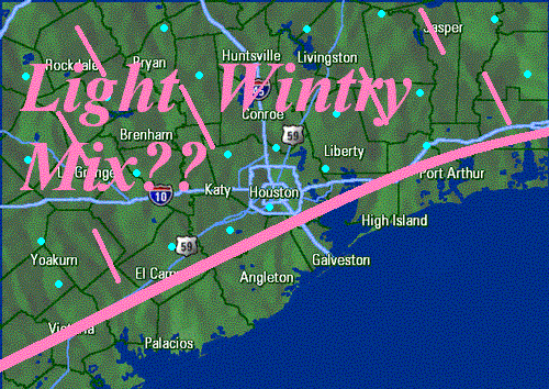
Here's the latest discussion from the NWS in Houston NOTE: It does'nt look to promosing for wintry precip.....
AREA FORECAST DISCUSSION
NATIONAL WEATHER SERVICE HOUSTON/GALVESTON TX
325 AM CST TUE FEB 7 2006
.DISCUSSION...
SURFACE HIGH SETTLING OVER SE TX THIS MORNING WITH CLEAR SKIES AND
DIMINISHING WINDS. HIGH PRESSURE WILL PERSIST OVER THE AREA THROUGH
WEDNESDAY WITH VERY TRANQUIL WEATHER. SOME SCATTERED HIGH CLOUDS MAY
IMPACT ESPECIALLY THE SOUTHERN HALF OF THE CWA LATE TONIGHT AND
EARLY WEDNESDAY. TEMPS WILL BE A LITTLE WARMER ON WEDNESDAY AFTERNOON
WITH SURFACE WINDS OUT OF THE SOUTHWEST. THE NEXT COLD FRONT IS
STILL SLATED TO CROSS THE CWA OVERNIGHT WEDNESDAY NIGHT. THIS DRY
FRONTAL PASSAGE WILL RESULT IN COOLER TEMPS THURSDAY.
THE GFS CONTINUES TO FLIP-FLOP WITH THE HANDLING OF THE COLD AIRMASS
COMING UP FOR THE WEEKEND. PER COORDINATION WITH SURROUNDING OFFICES
DECIDED TO STICK WITH THE COLDER/DRIER ECMWF SOLUTION. AS 500 MB
FLOW BECOMES HIGHLY AMPLIFIED BY THE END OF THE WEEK...STRONG SHOT OF
COLD CANADIAN AIR (1045 MB HIGH) DROPS DOWN THE PLAINS FRIDAY.
ASSOCIATED COLD FRONT SHOULD PUSH ACROSS SE TX FRIDAY EVENING. AT THE
SAME TIME...A 500 MB LOW IN THE SOUTHERN STREAM WILL SHEAR OUT ACROSS
THE AREA ENHANCING LIFT IN ASSOCIATION WITH THE FRONT. AIRMASS BECOMES
SATURATED BY LATE FRIDAY OVER THE AREA WITH PWS INCREASING TO 1.2-1.3
INCHES. WILL HAVE POPS STARTING FRIDAY MORNING...WITH CHANCE POPS
ACROSS THE ENTIRE CWA FRIDAY AFTN/EVENING...DECREASING FROM NORTH TO
SOUTH THEREAFTER. BEST CHANCE OF RAIN OVERALL LOOKS TO BE OVER THE
SOUTHERN HALF OF SE TX AND IN TIME MAY NEED HIGHER POPS FOR THIS
AREA. STRONG COLD ADVECTION WILL ALLOW PRECIP CHANCES TO END OVER
MOST INLAND AREAS BY 12Z SATURDAY. SKIES SHOULD BEGIN CLEARING BY
AFTERNOON NORTHERN ZONES WITH MOST AREAS MOSTLY CLEAR BY SATURDAY
NIGHT. NEW MEXMOS IS CONSIDERABLY WARMER WITH TEMPS IN THE SATURDAY
THROUGH MONDAY PERIOD...BUT ONLY WARMED THEM A LITTLE THIS FORECAST
TO KEEP THE GRIDS IN LINE WITH THE ECMWF FORECAST. SO FORECAST STILL
CALLS FOR FREEZING TEMPS MOST INLAND AREAS SATURDAY NIGHT. A WARMUP
BACK TO NEAR NORMAL TEMPS IS FORECAST BY MONDAY.
35
0 likes
Who is online
Users browsing this forum: No registered users and 37 guests