(New!!) Cold for the Deep South (Models, Maps, Discussion)

Winter Weather Discussion

Moderator: S2k Moderators

Forum rules

The posts in this forum are NOT official forecast and should not be used as such. They are just the opinion of the poster and may or may not be backed by sound meteorological data. They are NOT endorsed by any professional institution or STORM2K.

Help Support Storm2K
Message
Author
User avatar
cheezyWXguy
Category 5
Category 5
Posts: 6108
Joined: Mon Feb 13, 2006 12:29 am
Location: Dallas, TX

#161 Postby cheezyWXguy » Mon Feb 13, 2006 11:16 pm

Tyler wrote:
cheezywxman wrote:how big was the 89 high?


As high as 1080 MB.


Holy crap thats incredable
0 likes   

Tyler

#162 Postby Tyler » Mon Feb 13, 2006 11:17 pm

http://www.nco.ncep.noaa.gov/pmb/nwprod ... _120.shtml

Nasty! The precip you see here is all freezing rain for north Texas and Oklahoma. GFS most likely underdoing QPF as it usually does this far out, I think we could be looking at a major ice concern for this weekend ala Feb 94.
0 likes   

jkt21787
Category 5
Category 5
Posts: 2061
Joined: Tue Aug 31, 2004 5:27 pm
Location: Memphis, TN

#163 Postby jkt21787 » Mon Feb 13, 2006 11:19 pm

QPF is extremely light on the GFS, only in very isolated areas from the Southern Plains and SE would it exceed official NWS ice storm criteria (greater than .25" of ice), but remember what I said on the other thread about QPF at this range. Still need to watch this carefully.

The pattern does support an ice storm, and while I'm not calling for an all out ice storm yet, especially a major and widespread one such as Feb 94, a light icing event (under .25") seems likely at the least for a broad area of the Southern Plains into the SE.
Last edited by jkt21787 on Mon Feb 13, 2006 11:20 pm, edited 2 times in total.
0 likes   

Tyler

#164 Postby Tyler » Mon Feb 13, 2006 11:19 pm

cheezywxman wrote:
Tyler wrote:
cheezywxman wrote:how big was the 89 high?


As high as 1080 MB.


Holy crap thats incredable


Indeed.
0 likes   

User avatar
cheezyWXguy
Category 5
Category 5
Posts: 6108
Joined: Mon Feb 13, 2006 12:29 am
Location: Dallas, TX

#165 Postby cheezyWXguy » Mon Feb 13, 2006 11:19 pm

what does qpf stand for again...sry im kinda new at this
0 likes   

Tyler

#166 Postby Tyler » Mon Feb 13, 2006 11:21 pm

QPF: Quantitative Precipitation Forecast

Basically, the amount of precipitation to fall during the 6 hour period shown on the panel.
0 likes   

User avatar
cheezyWXguy
Category 5
Category 5
Posts: 6108
Joined: Mon Feb 13, 2006 12:29 am
Location: Dallas, TX

#167 Postby cheezyWXguy » Mon Feb 13, 2006 11:22 pm

Tyler wrote:QPF: Quantitative Precipitation Forecast

Basically, the amount of precipitation to fall during the 6 hour period shown on the panel.


thanx tyler
0 likes   

Tyler

#168 Postby Tyler » Mon Feb 13, 2006 11:22 pm

http://www.nco.ncep.noaa.gov/pmb/nwprod ... _126.shtml

Freezing rain Dallas.
Cold rain Houston.
0 likes   

User avatar
cheezyWXguy
Category 5
Category 5
Posts: 6108
Joined: Mon Feb 13, 2006 12:29 am
Location: Dallas, TX

#169 Postby cheezyWXguy » Mon Feb 13, 2006 11:23 pm

Tyler wrote:http://www.nco.ncep.noaa.gov/pmb/nwprod/analysis/namer/gfs/00/fp1_126.shtml

Freezing rain Dallas.
Cold rain Houston.


geez! thats the coldest run for me yet!( so far in the model run)
0 likes   

Tyler

#170 Postby Tyler » Mon Feb 13, 2006 11:30 pm

0 likes   

Tyler

#171 Postby Tyler » Mon Feb 13, 2006 11:31 pm

http://www.nco.ncep.noaa.gov/pmb/nwprod ... _162.shtml

Good news, the gulf ridge weakens somewhat, and should allow the trough in the west to dig more our way, then we can get cold again...

And look at that monster ridge in Alaska. The pacific jet is dead.
0 likes   

User avatar
wxman22
Category 5
Category 5
Posts: 1492
Joined: Mon Jan 30, 2006 12:39 am
Location: Wichita Falls, TX
Contact:

#172 Postby wxman22 » Mon Feb 13, 2006 11:44 pm

Yep we may have one more shot of cold air before winters over.
0 likes   

Tyler

#173 Postby Tyler » Tue Feb 14, 2006 12:29 am

http://www.nco.ncep.noaa.gov/pmb/nwprod ... _180.shtml

This is SE TX next shot of some very cold weather after this weekend's cool, rainy weather. The air behind this front on hour 180 is not bitterly cold, but its a decent cold front for the end of Feb, thats for sure.

We have quite the next 7 days coming up for SE TX. We will go from cool, to very humid, to cold and winter-like, to summer humid again, then back to winter cold, all in the next 7 days!

GFS MOS sure does look funny for the end of Feb, so much contrast!

http://www.srh.noaa.gov/data/Guidance/G ... KIAH.1.txt

0z GFS MOS looks like this for Houston:
Tommorow: 69
Wednesday: 58/75
Thursday: 64/79 WARM AND VERY HUMID - summer like!
Friday: 54/58 All of the sudden, very cool and wet!
Saturday: 44/52 Continued very cool, and wet
Sunday: 44/53 Dreary weekend continues
Monday: 50/70 Drying out with a drastic warmup!
Tuesday: 53/63 Finally a shot of canadian air moves through Tuesday afternoon!

We'll go through summer, spring, and winter during the next 7 days. Only in SE TX...
0 likes   

User avatar
wxman22
Category 5
Category 5
Posts: 1492
Joined: Mon Jan 30, 2006 12:39 am
Location: Wichita Falls, TX
Contact:

#174 Postby wxman22 » Tue Feb 14, 2006 12:40 am

Thats Southeast Texas weather for you!! If you dont like the weather wate the next day and the weather will change :D .
0 likes   

Tyler

#175 Postby Tyler » Tue Feb 14, 2006 12:41 am

Ain't that the truth!
0 likes   

User avatar
wxman22
Category 5
Category 5
Posts: 1492
Joined: Mon Jan 30, 2006 12:39 am
Location: Wichita Falls, TX
Contact:

#176 Postby wxman22 » Tue Feb 14, 2006 3:18 am

Heres my forcast map for RIGHT now....:

Image
0 likes   

User avatar
Extremeweatherguy
Category 5
Category 5
Posts: 11095
Joined: Mon Oct 10, 2005 8:13 pm
Location: Florida

#177 Postby Extremeweatherguy » Tue Feb 14, 2006 7:56 am

I think the GFS is on drugs with that Gulf ridge, the European does not show it at all. Yes, the European does have a small ridge over Mexico and southern Texas, but not the sprawling Gulf ridge of the GFS. The only problem with the European is that it only has the high at about 1048mb, which is much weaker than the GFS 1056mb high. If we have a high the strength of the GFS high and a pattern more similar to the Euro's pattern...then we may be able to get some mighty cold low level air in here. Just something to watch and think about. Also..even if the European is correct with the 1048mb high, I still see a pattern more set-up for cold...on day 5 it has the pattern positioned in a way that any ridge over eastern TX is pushed south and that cold air would spill along the rockies into NW Texas and then down through the state.
0 likes   

User avatar
Extremeweatherguy
Category 5
Category 5
Posts: 11095
Joined: Mon Oct 10, 2005 8:13 pm
Location: Florida

#178 Postby Extremeweatherguy » Tue Feb 14, 2006 8:02 am

Here is the latest discussion from the Houston NWS, they think it will get very chilly:

AREA FORECAST DISCUSSION
NATIONAL WEATHER SERVICE HOUSTON/GALVESTON TX
434 AM CST TUE FEB 14 2006

.DISCUSSION...
A SLIGHT PATTERN CHANGE IS IN STORE ALOFT WITH THE BROAD AREA OF
LOW PRESSURE ESTABLISHING ITSELF OVER SOUTHERN CANADA AND HIGH
PRESSURE BUILDING OVER THE FAR SOUTHERN GULF OF MEXICO. SE TX WILL
SEE A WARMUP OVER THE NEXT FEW DAYS AS ONSHORE WINDS DEVELOP
AHEAD OF THE SURFACE LOW OVER THE SOUTHERN PLAINS. THAT WILL COME
TO AN END FRIDAY AS SHALLOW COLD AIR MOVES ACROSS THE STATE
ACCOMPANIED BY ISENTROPIC LIFT...IN OTHER WORDS IT WILL BE A
CHILLY AND RAINY DAY FRIDAY. THOSE CONDITIONS ARE EXPECTED TO LAST
THROUGH THE WEEKEND.


ALTHOUGH IT MAY BE A BIT HARD TO BELIEVE WITH SUCH A LARGE HIGH
PRESSURE AREA OVER THE SOUTHERN GULF AND A WEST-SOUTHWEST FLOW
ALOFT...THE COLD FRONT IS FORECAST BY THREE MODELS TO WORK ITS WAY
TO THE COAST FRIDAY.
PW/S AHEAD OF THIS SYSTEM GET TO AROUND 1.3
INCHES. THIS IS CLOSE TO 2 STANDARD DEVIATIONS HIGHER THAN NORMAL
FOR THE LCH RAOB DATA. FOR NOW WILL KEEP THE CHANCE POPS IN PLACE
BUT FEEL THAT RAIN CHANCES MAY GET HIGHER FOR THE WEEKEND IN THE
NEXT FEW MODEL RUNS.
0 likes   

Air Force Met
Military Met
Military Met
Posts: 4372
Age: 56
Joined: Tue Jul 08, 2003 9:30 am
Location: Roan Mountain, TN

#179 Postby Air Force Met » Tue Feb 14, 2006 10:27 am

Hi guys...I'm back. Sorry I've been hit and miss so much but there has been a lot of other things going on and I have not had the chance to even look at the boards at all, but I have been looking at the weather.

First...I said a long time ago that I was doubtful that the pattern was a setup for the cold shots to come south and that most of the cold air was going to go east...and I still feel that way....and I think we have seen that. I think those of you who are thinking this arctic high is going to overwhelm the pattern are just in wishful thinking mode. :D 
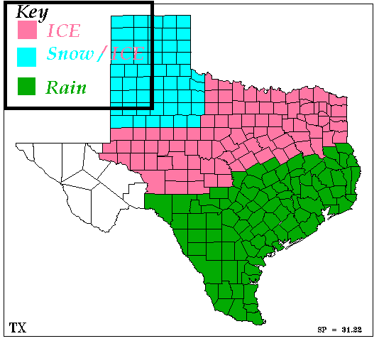
That's not going to happen. The cold air will filter down here and the front will go through SETX...but the arctic air is NOT going to keep on going until it hits Mexico. We will cool down and I think it will be cool on Saturday and Sunday with some overrunning. Highs in the low 50's....depends on how much overrunning we get.

You CANNOT compare this event to Feb. 1989. NO way no how. There are big differences.

1) The high - The high in 1989 was 1080mb. It was ALREADY in existance when it was dislodged FROM Alaska by the ridge and sent screaming down the east side of the rockies. This high, which is really yet to form, is FORECASTED to be (at max) 1056MB...that's a BIG difference. It's formed due more to by the upper ridging and breaking off of the big Pacific high, rather than air that has sat in the Yukon territory and is terribly cold.

2) The upper flow - This is the BIGGIE. If you look back at the upper level flow in 1989...the westerlies started in Nebraska and Colorado. Now, the westerlies are along the Canadian Border, a lot stronger and there is a cut-off low over the NW US...which was there in 1989...but did not hang around...but swung out. This one will not.

So...here's what you have when you think about this air overwhelming the pattern: 1) There air is not as cold; 2) The pressure is not as high; 3) The westerlies are a lot further north; 4) The flow is stronger

So...basically take the temps you saw in 1989 and move them 300-500 miles to the north. Highs in the mid 20's...instead of being in central Texas will be in central OK.

Now...as far as Houston WX...and the AFD...that boggles my mind. They call for a "chilly, rainy day on Friday" but are going for a high in the low 60's and a 30% chance of rain?

What's wrong with this picture? :D
0 likes   

Air Force Met
Military Met
Military Met
Posts: 4372
Age: 56
Joined: Tue Jul 08, 2003 9:30 am
Location: Roan Mountain, TN

#180 Postby Air Force Met » Tue Feb 14, 2006 10:41 am

Wanted to add one more thing about the diff b/w 1989 (since it is the classic overwhelming the pattern example) and now:

In 1989, the flow aloft was straight out of the NNW all the way from the north pole until it hit the westerlies in NE. So, the high had momentum...and all overwhelming the pattern highs have momentum because of this. This pattern is set up in such a way that the high is fighting the upper air pattern most of the way. It gets a push out...but before it hits the states the upper air pattern is trying to push it back in towards the rockies. It sinks south under its own momentum but because of the NE flow aloft...this SLOWS it down. If the flow was parallel to the rockies...like the flow in 1989...then the high would move down the lee-side and would have some momentum to move a little more south than it is presently going to.

So...it's first fighting the NE winds...then it's fighting the westerlies. If you add some straight flow during the first part of it's journey then it would have a better shot at overwhelming the pattern...but it is getting pushed west before it gets pushed east. That causes drag and slows it down...which means the westerlies can pick it up and take the brunt of it east.
0 likes   


Return to “Winter Weather”

Who is online

Users browsing this forum: No registered users and 12 guests