Tropical Depression Basyang at WPAC

This is the general tropical discussion area. Anyone can take their shot at predicting a storms path.

Moderator: S2k Moderators

Forum rules

The posts in this forum are NOT official forecasts and should not be used as such. They are just the opinion of the poster and may or may not be backed by sound meteorological data. They are NOT endorsed by any professional institution or STORM2K. For official information, please refer to products from the National Hurricane Center and National Weather Service.

Help Support Storm2K
Message
Author
User avatar
cycloneye
Admin
Admin
Posts: 146221
Age: 69
Joined: Thu Oct 10, 2002 10:54 am
Location: San Juan, Puerto Rico

#41 Postby cycloneye » Fri Mar 03, 2006 12:15 pm

HURAKAN wrote:That's the problem when you have a bunch of agencies and no one is in agreement on what to do with tropical cyclones. I think they should all meet and agree on what terms they will define tropical depressions, storms, and typhoons. Therefore, it will be much less confusing for the general public!


Agree.Like NHC which is only one agencie that has the responsability for the Atlantic and EPAC.
0 likes   
Visit the Caribbean-Central America Weather Thread where you can find at first post web cams,radars
and observations from Caribbean basin members Click Here

User avatar
P.K.
Professional-Met
Professional-Met
Posts: 5149
Joined: Thu Sep 23, 2004 5:57 pm
Location: Watford, England
Contact:

#42 Postby P.K. » Fri Mar 03, 2006 12:18 pm

I like the confusion personally. :wink: :lol: Most of the general public don't follow worldwide TC activity though, they'll just follow their own basin so I don't see a problem.
0 likes   

User avatar
P.K.
Professional-Met
Professional-Met
Posts: 5149
Joined: Thu Sep 23, 2004 5:57 pm
Location: Watford, England
Contact:

#43 Postby P.K. » Fri Mar 03, 2006 12:20 pm

senorpepr wrote:What they should do is let JMA act as the role of a RSMC and produce the only official advisories on WPAC storms. Other agencies, such as the CMA or KMA will translate the JMA advisories with no additional forecasting involved for the system.


I was just looking at the KMA and there is nothing on there.
0 likes   

User avatar
HURAKAN
Professional-Met
Professional-Met
Posts: 46086
Age: 38
Joined: Thu May 20, 2004 4:34 pm
Location: Key West, FL
Contact:

#44 Postby HURAKAN » Fri Mar 03, 2006 12:21 pm

P.K. wrote:I like the confusion personally. :wink: :lol: Most of the general public don't follow worldwide TC activity though, they'll just follow their own basin so I don't see a problem.


Maybe the general public was an exaggeration in my part, but at least it will be less confusing for the meteorological enthusiastic community like us! :D
0 likes   

User avatar
HURAKAN
Professional-Met
Professional-Met
Posts: 46086
Age: 38
Joined: Thu May 20, 2004 4:34 pm
Location: Key West, FL
Contact:

#45 Postby HURAKAN » Fri Mar 03, 2006 12:24 pm

Image

If that thing named Grace in 2003 was a tropical storm, then Invest 93W has a good chance of already being a tropical storm!!! :lol: :lol: :lol:
0 likes   

User avatar
P.K.
Professional-Met
Professional-Met
Posts: 5149
Joined: Thu Sep 23, 2004 5:57 pm
Location: Watford, England
Contact:

#46 Postby P.K. » Fri Mar 03, 2006 12:27 pm

HURAKAN wrote:Maybe the general public was an exaggeration in my part, but at least it will be less confusing for the meteorological enthusiastic community like us! :D


I like the way I have to find things on different pages, that they are in different formats, and have different classifications etc. If it was all in one place it would be too easy. :wink:
0 likes   

User avatar
cycloneye
Admin
Admin
Posts: 146221
Age: 69
Joined: Thu Oct 10, 2002 10:54 am
Location: San Juan, Puerto Rico

#47 Postby cycloneye » Fri Mar 03, 2006 12:34 pm

Image

Certainly it looks better organized than earlier this morning our time.I would not be surprised if JTWC jumps on the bandwagon of Tropical Depression before this day is out here in the western hemisphere.
0 likes   

User avatar
HURAKAN
Professional-Met
Professional-Met
Posts: 46086
Age: 38
Joined: Thu May 20, 2004 4:34 pm
Location: Key West, FL
Contact:

#48 Postby HURAKAN » Fri Mar 03, 2006 12:38 pm

P.K. wrote:
HURAKAN wrote:Maybe the general public was an exaggeration in my part, but at least it will be less confusing for the meteorological enthusiastic community like us! :D


I like the way I have to find things on different pages, that they are in different formats, and have different classifications etc. If it was all in one place it would be too easy. :wink:


OK, IT CLEARLY SEEMS OUR OPINIONS ARE VERY DISSIMILAR! :lol: :lol: :lol:
0 likes   

User avatar
James
Category 5
Category 5
Posts: 1531
Joined: Tue Aug 24, 2004 10:29 am
Location: Gloucestershire, England
Contact:

#49 Postby James » Fri Mar 03, 2006 12:42 pm

HURAKAN wrote:
If that thing named Grace in 2003 was a tropical storm, then Invest 93W has a good chance of already being a tropical storm!!! :lol: :lol: :lol:


LOL, agreed! Based upon appearance alone, it seems that Chanchu isn't all that far away.
0 likes   

User avatar
cycloneye
Admin
Admin
Posts: 146221
Age: 69
Joined: Thu Oct 10, 2002 10:54 am
Location: San Juan, Puerto Rico

#50 Postby cycloneye » Fri Mar 03, 2006 1:01 pm

GLOBAL MODEL DATA TIME 12UTC 03.03.2006


TROPICAL STORM DEVELOPED IN THE MODEL ANALYSIS AT POSITION :

4.0N 137.5E


VERIFYING TIME POSITION STRENGTH TENDENCY

-------------- -------- -------- --------

12UTC 03.03.2006 4.0N 137.5E WEAK

00UTC 04.03.2006 4.0N 138.5E WEAK INTENSIFYING SLIGHTLY

12UTC 04.03.2006 3.9N 139.2E WEAK WEAKENING SLIGHTLY

00UTC 05.03.2006 3.5N 139.4E WEAK LITTLE CHANGE

12UTC 05.03.2006 3.5N 140.3E WEAK LITTLE CHANGE

00UTC 06.03.2006 3.5N 140.8E WEAK LITTLE CHANGE

12UTC 06.03.2006 3.5N 140.7E WEAK LITTLE CHANGE

00UTC 07.03.2006 3.9N 139.7E WEAK INTENSIFYING SLIGHTLY

12UTC 07.03.2006 4.9N 138.1E WEAK LITTLE CHANGE

00UTC 08.03.2006 6.3N 136.5E WEAK LITTLE CHANGE

12UTC 08.03.2006 8.0N 135.1E WEAK LITTLE CHANGE

00UTC 09.03.2006 9.1N 134.1E WEAK INTENSIFYING SLIGHTLY

12UTC 09.03.2006 9.4N 133.7E WEAK INTENSIFYING SLIGHTLY


12 UTC UKMET.
0 likes   
Visit the Caribbean-Central America Weather Thread where you can find at first post web cams,radars
and observations from Caribbean basin members Click Here

Matt-hurricanewatcher

#51 Postby Matt-hurricanewatcher » Fri Mar 03, 2006 1:28 pm

No quastion that is a tropical depression or a tropical storm. Nice cdo and banding...Really nice may I say! :cheesy:
0 likes   

User avatar
James
Category 5
Category 5
Posts: 1531
Joined: Tue Aug 24, 2004 10:29 am
Location: Gloucestershire, England
Contact:

#52 Postby James » Fri Mar 03, 2006 3:09 pm

JTWC has issued a TCFA:

WTPN21 PGTW 032030
MSGID/GENADMIN/NAVPACMETOCCEN PEARL HARBOR HI/JTWC//
SUBJ/TROPICAL CYCLONE FORMATION ALERT/032021ZMAR2006//
RMKS/
1. FORMATION OF A SIGNIFICANT TROPICAL CYCLONE IS POSSIBLE WITHIN
120 NM EITHER SIDE OF A LINE FROM 5.0N 138.5E TO 6.1N 136.1E
WITHIN THE NEXT 12 TO 24 HOURS. AVAILABLE DATA DOES NOT JUSTIFY
ISSUANCE OF NUMBERED TROPICAL CYCLONE WARNINGS AT THIS TIME.
WINDS IN THE AREA ARE ESTIMATED TO BE 20 TO 25 KNOTS. METSAT IM­
AGERY AT 031730Z INDICATES THAT A CIRCULATION CENTER IS LOCATED
NEAR 5.1N 138.2E. THE SYSTEM IS MOVING WEST-NORTHWESTWARD AT 02
KNOTS.
2. REMARKS: AN AREA OF CONVECTION NEAR 5.1N 138.2E, APPROXIMATELY
120 NM EAST-SOUTHEAST OF PALAU, HAS PERSISTED OVER THE PAST 12
HOURS. ANIMATED ENHANCED INFRARED IMAGERY REVEALS DEEP CONVECTION
OVER A TIGHTENING LOW LEVEL CIRCULATION CENTER (LLCC) HAS IN-
CREASED. UPPER LEVEL ANALYSIS SHOWS THAT THE AREA IS UNDER LOW TO
MODERATE VERTICAL WIND SHEAR, HAS AN INCREASINGLY SYMMETRIC
850 MB VORTICITY SIGNATURE, AND HAS EXCELLENT POLEWARD OUTFLOW.
MAXIMUM SUSTAINED SURFACE WINDS ARE ESTIMATED AT 20 TO 25 KNOTS.
MINIMUM SEA LEVEL PRESSURE IS ESTIMATED TO BE 1002 MB. DUE TO A
FAVORABLE ENVIRONMENT AND CONSOLIDATION OF BOTH THE LLCC AND
CONVECTION, THE POTENTIAL FOR THE DEVELOPMENT OF A SIGNIFICANT
TROPICAL CYCLONE WITHIN THE NEXT 24 HOURS IS GOOD.
3. THIS ALERT WILL BE REISSUED, UPGRADED TO WARNING OR CANCELLED BY
042030Z.//

Image
0 likes   

User avatar
cycloneye
Admin
Admin
Posts: 146221
Age: 69
Joined: Thu Oct 10, 2002 10:54 am
Location: San Juan, Puerto Rico

#53 Postby cycloneye » Fri Mar 03, 2006 4:21 pm

Image
0 likes   
Visit the Caribbean-Central America Weather Thread where you can find at first post web cams,radars
and observations from Caribbean basin members Click Here

User avatar
P.K.
Professional-Met
Professional-Met
Posts: 5149
Joined: Thu Sep 23, 2004 5:57 pm
Location: Watford, England
Contact:

#54 Postby P.K. » Fri Mar 03, 2006 4:47 pm

From the JMA at 1800 GMT:

TROPICAL DEPRESSION 1004 HPA AT 05N 138E WNW SLOWLY.

From the CMA at 1800 GMT:

TROPICAL DEPRESSION 1006HPA AT 06N 137E MOVING WEST SLOWLY=
0 likes   

User avatar
cycloneye
Admin
Admin
Posts: 146221
Age: 69
Joined: Thu Oct 10, 2002 10:54 am
Location: San Juan, Puerto Rico

#55 Postby cycloneye » Fri Mar 03, 2006 4:49 pm

P.K. wrote:From the JMA at 1800 GMT:

TROPICAL DEPRESSION 1004 HPA AT 05N 138E WNW SLOWLY.

From the CMA at 1800 GMT:

TROPICAL DEPRESSION 1006HPA AT 06N 137E MOVING WEST SLOWLY=


P.K What is the TD #?
0 likes   
Visit the Caribbean-Central America Weather Thread where you can find at first post web cams,radars
and observations from Caribbean basin members Click Here

User avatar
P.K.
Professional-Met
Professional-Met
Posts: 5149
Joined: Thu Sep 23, 2004 5:57 pm
Location: Watford, England
Contact:

#56 Postby P.K. » Fri Mar 03, 2006 4:52 pm

Only tropical storms get numbers in this region so no number.
0 likes   

User avatar
cycloneye
Admin
Admin
Posts: 146221
Age: 69
Joined: Thu Oct 10, 2002 10:54 am
Location: San Juan, Puerto Rico

#57 Postby cycloneye » Fri Mar 03, 2006 4:53 pm

P.K. wrote:Only tropical storms get numbers in this region so no number.


Oh ok thank you.
0 likes   
Visit the Caribbean-Central America Weather Thread where you can find at first post web cams,radars
and observations from Caribbean basin members Click Here

User avatar
cycloneye
Admin
Admin
Posts: 146221
Age: 69
Joined: Thu Oct 10, 2002 10:54 am
Location: San Juan, Puerto Rico

#58 Postby cycloneye » Fri Mar 03, 2006 5:22 pm

03/2033 UTC 5.8N 138.2E T2.0/2.0 93W -- West Pacific Ocean
0 likes   
Visit the Caribbean-Central America Weather Thread where you can find at first post web cams,radars
and observations from Caribbean basin members Click Here

User avatar
cycloneye
Admin
Admin
Posts: 146221
Age: 69
Joined: Thu Oct 10, 2002 10:54 am
Location: San Juan, Puerto Rico

#59 Postby cycloneye » Fri Mar 03, 2006 6:14 pm

Image

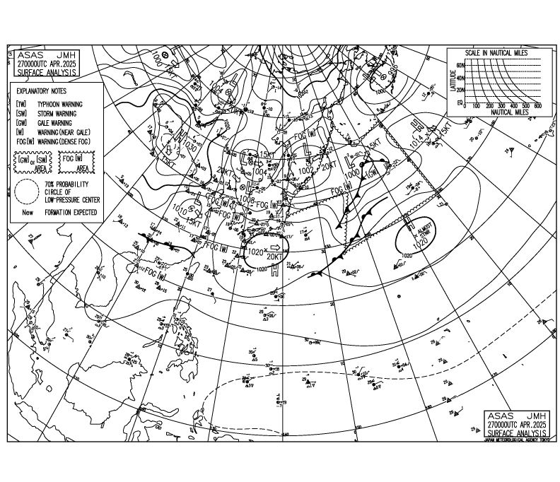
The latest JMA surface data shows TD status for 93W.
0 likes   

User avatar
cycloneye
Admin
Admin
Posts: 146221
Age: 69
Joined: Thu Oct 10, 2002 10:54 am
Location: San Juan, Puerto Rico

#60 Postby cycloneye » Fri Mar 03, 2006 8:13 pm

NRL just changed to 1W NONAME.

http://tcweb.fnmoc.navy.mil/tc-bin/tc_home.cgi
0 likes   
Visit the Caribbean-Central America Weather Thread where you can find at first post web cams,radars
and observations from Caribbean basin members Click Here


Return to “Talkin' Tropics”

Who is online

Users browsing this forum: StPeteMike and 61 guests