Historic outbreak Sunday: The aftermath

U.S. & Caribbean Weather Discussions and Severe Weather Events

Moderator: S2k Moderators

Forum rules

The posts in this forum are NOT official forecast and should not be used as such. They are just the opinion of the poster and may or may not be backed by sound meteorological data. They are NOT endorsed by any professional institution or STORM2K.

Help Support Storm2K
Message
Author
User avatar
therock1811
Category 5
Category 5
Posts: 5163
Age: 39
Joined: Thu May 15, 2003 2:15 pm
Location: Kentucky
Contact:

#241 Postby therock1811 » Thu Mar 09, 2006 8:47 pm

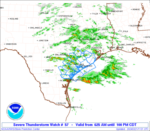
New Thunderstorm WATCH is in effect.

SEL7

URGENT - IMMEDIATE BROADCAST REQUESTED
SEVERE THUNDERSTORM WATCH NUMBER 57
NWS STORM PREDICTION CENTER NORMAN OK
740 PM CST THU MAR 9 2006

THE NWS STORM PREDICTION CENTER HAS ISSUED A
SEVERE THUNDERSTORM WATCH FOR PORTIONS OF

SOUTHEAST ILLINOIS
SOUTHERN INDIANA
CENTRAL KENTUCKY
NORTHERN MIDDLE TENNESSEE

EFFECTIVE THIS THURSDAY NIGHT FROM 740 PM UNTIL MIDNIGHT CST.

HAIL TO 1 INCH IN DIAMETER...THUNDERSTORM WIND GUSTS TO 70
MPH...AND DANGEROUS LIGHTNING ARE POSSIBLE IN THESE AREAS.

THE SEVERE THUNDERSTORM WATCH AREA IS APPROXIMATELY ALONG AND 60
STATUTE MILES EAST AND WEST OF A LINE FROM 30 MILES EAST NORTHEAST
OF BLOOMINGTON INDIANA TO 70 MILES SOUTH SOUTHWEST OF CLARKSVILLE
TENNESSEE. FOR A COMPLETE DEPICTION OF THE WATCH SEE THE
ASSOCIATED WATCH OUTLINE UPDATE (WOUS64 KWNS WOU7).

REMEMBER...A SEVERE THUNDERSTORM WATCH MEANS CONDITIONS ARE
FAVORABLE FOR SEVERE THUNDERSTORMS IN AND CLOSE TO THE WATCH AREA.
PERSONS IN THESE AREAS SHOULD BE ON THE LOOKOUT FOR THREATENING
WEATHER CONDITIONS AND LISTEN FOR LATER STATEMENTS AND POSSIBLE
WARNINGS. SEVERE THUNDERSTORMS CAN AND OCCASIONALLY DO PRODUCE
TORNADOES.

OTHER WATCH INFORMATION...CONTINUE...WW 53...WW 54...WW 55...WW
56...

DISCUSSION...VORT-INDUCED STORM CLUSTERS/BANDS EXPECTED TO CONTINUE
MOVING/DEVELOPING NEWD UP THE LWR OH VLY AS STRONG MID LVL
COOLING/FORCING FOR ASCENT OVERSPREAD LOW LVL MOIST CORRIDOR. 100
KT SPEED MAX AT 500 MB AND STEEP LOW TO MID LVL LAPSE RATES IN WAKE
OF STORMS SUGGEST CONTINUED THREAT FOR HIGH WIND...SOME HAIL AND
POSSIBLY AN ISOLATED TORNADO.

AVIATION...A FEW SEVERE THUNDERSTORMS WITH HAIL SURFACE AND ALOFT
TO 1 INCH. EXTREME TURBULENCE AND SURFACE WIND GUSTS TO 60 KNOTS.
A FEW CUMULONIMBI WITH MAXIMUM TOPS TO 400. MEAN STORM MOTION
VECTOR 24050.


...CORFIDI
Image
0 likes   

Colby

#242 Postby Colby » Thu Mar 09, 2006 8:57 pm

Methinks they're having some image generator troubles...
0 likes   

User avatar
JenyEliza
Category 5
Category 5
Posts: 1529
Joined: Fri Sep 24, 2004 5:07 pm
Location: Metro ATL

#243 Postby JenyEliza » Thu Mar 09, 2006 9:00 pm

Severe Thunderstorm Watch
SEVERE THUNDERSTORM WATCH OUTLINE UPDATE FOR WS 56
NWS STORM PREDICTION CENTER NORMAN OK
803 PM EST THU MAR 09 2006

SEVERE THUNDERSTORM WATCH 56 REMAINS IN EFFECT UNTIL 100 AM EST
FOR THE FOLLOWING LOCATIONS

GAC015-045-047-055-057-067-077-083-097-111-115-123-129-143-149-
213-223-227-233-285-295-313-100600-
/O.CON.KWNS.SV.A.0056.000000T0000Z-060310T0600Z/

GA
. GEORGIA COUNTIES INCLUDED ARE

BARTOW CARROLL CATOOSA
CHATTOOGA CHEROKEE COBB
COWETA DADE DOUGLAS
FANNIN FLOYD GILMER
GORDON HARALSON HEARD
MURRAY PAULDING PICKENS
POLK TROUP WALKER
WHITFIELD
$$


[size=large]Special Weather Statement[/size]
SPECIAL WEATHER STATEMENT
NATIONAL WEATHER SERVICE PEACHTREE CITY GA
835 PM EST THU MAR 9 2006

GAZ030>033-041>044-052-053-100200-

835 PM EST THU MAR 9 2006

...SIGNIFICANT WEATHER ALERT FOR 40 TO 50 MPH WINDS CONTINUES UNTIL
9 PM FOR HEARD...COWETA...DOUGLAS...CARROLL...HARALSON...
PAULDING...POLK...COBB AND FULTON COUNTIES...

AT 835 PM EST...NATIONAL WEATHER SERVICE DOPPLER RADAR INDICATED A
SECOND STRONGER LINE OF SHOWERS AND THUNDERSTORMS EXTENDING FROM
NEAR ROME TO 50 MILES WEST OF FRANKLIN...AND MOVING EAST AT 45
MPH.

THIS LINE OF STORMS WILL INTERACT WITH THE STRONG SOUTHERLY WINDS TO
PRODUCE WIND GUSTS OF 40 TO 50 MPH...WHICH COULD CAUSE SOME DAMAGE
TO TREES...POWER LINES AND EVEN SOME MINOR DAMAGE TO ROOF TOPS IN
THE ADVISED AREA.

RESIDENTS SHOULD CONTINUE TO MONITOR NOAA WEATHER RADIO...
WEATHER.GOV OR OTHER MEDIA OUTLETS FOR FURTHER STATEMENTS OR
POSSIBLE WARNINGS ON THESE STORMS.
0 likes   

User avatar
therock1811
Category 5
Category 5
Posts: 5163
Age: 39
Joined: Thu May 15, 2003 2:15 pm
Location: Kentucky
Contact:

#244 Postby therock1811 » Thu Mar 09, 2006 9:30 pm

Colby wrote:Methinks they're having some image generator troubles...


There's been problems for like 2-3 days.
0 likes   

CrazyC83
Professional-Met
Professional-Met
Posts: 34002
Joined: Tue Mar 07, 2006 11:57 pm
Location: Deep South, for the first time!

#245 Postby CrazyC83 » Thu Mar 09, 2006 10:03 pm

How does this stack up in the history books against other similar events? I can't remember any widespread serial derechos in March...
0 likes   

User avatar
wxmann_91
Category 5
Category 5
Posts: 8013
Age: 34
Joined: Fri Jul 15, 2005 2:49 pm
Location: Southern California
Contact:

#246 Postby wxmann_91 » Thu Mar 09, 2006 10:10 pm

CrazyC83 wrote:How does this stack up in the history books against other similar events? I can't remember any widespread serial derechos in March...


3/4/04
0 likes   

CrazyC83
Professional-Met
Professional-Met
Posts: 34002
Joined: Tue Mar 07, 2006 11:57 pm
Location: Deep South, for the first time!

#247 Postby CrazyC83 » Thu Mar 09, 2006 10:10 pm

PUBLIC INFORMATION STATEMENT
NATIONAL WEATHER SERVICE LITTLE ROCK AR
848 PM CST THU MAR 9 2006

...TORNADO CONFIRMED IN WOODRUFF COUNTY...

THIS AFTERNOON...METEOROLOGISTS FROM THE NATIONAL WEATHER SERVICE IN
LITTLE ROCK SURVEYED DAMAGE WHICH OCCURRED THIS MORNING IN WOODRUFF
COUNTY. THE DAMAGE WAS CONFIRMED TO HAVE BEEN CAUSED BY A TORNADO.

THE TORNADO WAS RATED AS F2 ON THE FUJITA SCALE OF TORNADO
CLASSIFICATION. WINDS WERE ESTIMATED AT 150 MPH. FOUR PEOPLE WERE
INJURED.

THE TORNADO TRACKED FROM 4.2 MILES SOUTHWEST OF MORTON TO 3.5 MILES
NORTHEAST OF MORTON...A DISTANCE OF 7.7 MILES...BEFORE CONTINUING ON
INTO CROSS COUNTY.

CROSS COUNTY IS IN THE MEMPHIS COUNTY WARNING AREA...AND THEY PLAN
TO LOOK AT THAT DAMAGE ON FRIDAY.

IN WOODRUFF COUNTY...18 HOMES WERE DAMAGED. THIS DAMAGE RANGED FROM
MINOR TO SEVERE. A LARGE METAL BUILDING HOUSING A WELDING SHOP WAS
DESTROYED. A CHURCH HAD A LARGE PART OF ITS ROOF TAKEN OFF AND GLASS
BLOWN OUT OF THE WINDOWS AND FRONT DOOR. A HUNTING LODGE SUFFERED
CONSIDERABLE DAMAGE TO ITS ROOF. SEVERAL LARGE GRAIN BINS WERE
DAMAGED...WITH ONE OF THE BINS SPILLING ITS GRAIN ONTO THE GROUND. A
NUMBER OF OUTBUILDINGS WERE DESTROYED. NUMEROUS POWER POLES AND
POWER LINES WERE BLOWN DOWN. DOZENS OF TREES WERE SNAPPED OFF OR
UPROOTED. RAILROAD CROSSING SIGNALS WERE DAMAGED.

FOR AWHILE AFTER THE TORNADO PASSED...U.S. HIGHWAY 64 AND THE UNION
PACIFIC RAILROAD WERE BLOCKED BY DEBRIS. A TRAIN HAD TO BE HALTED
BECAUSE OF THE DEBRIS ON THE TRACKS.

THE STORM SURVEY WAS CONDUCTED BY JOHN ROBINSON...WARNING
COORDINATION METEOROLOGIST...AND RENEE FAIR...METEOROLOGIST IN
CHARGE...FROM THE LITTLE ROCK OFFICE OF THE NATIONAL WEATHER SERVICE.

THE NATIONAL WEATHER SERVICE THANKS WOODRUFF COUNTY SHERIFF FREDDIE
HUDSON AND WOODRUFF COUNTY EMERGENCY MANAGER BRENDA BYERLY FOR THEIR
ASSISTANCE.

DAMAGE IN EXTREME NORTHERN PULASKI COUNTY WAS ALSO SURVEYED. THIS
DAMAGE WAS DETERMINED TO HAVE BEEN CAUSED BY THUNDERSTORM WINDS...
WHICH LIKELY REACHED AT LEAST 80 MPH.

SURVEY PLANS FOR FRIDAY INCLUDE THE KIRBY AREA IN PIKE COUNTY.
0 likes   

SamSagnella
Category 2
Category 2
Posts: 630
Age: 38
Joined: Fri Aug 26, 2005 12:02 pm
Location: Westport, CT
Contact:

#248 Postby SamSagnella » Thu Mar 09, 2006 10:23 pm

The majority of the suspected tornado reports occurred within the CWAs of LZK and PAH, who are always very diligent about completing damage surveys. I expect several PNSs and LSRs in the next couple of days. Dang that's a lot of actronyms. :lol:
0 likes   

User avatar
WaitingForSiren
Category 1
Category 1
Posts: 383
Joined: Sun Jan 08, 2006 12:58 pm
Location: Minneapolis,Minnesota
Contact:

#249 Postby WaitingForSiren » Fri Mar 10, 2006 10:09 am

Yeah, wx_mann is right this event was similar as far as storm reports go to the march 4 04 event. I think spc overdid the high risk on march 4 2004, with their high risk practically busting. I think a mdt risk would have been better suited.

And about yesterday, I wasnt TOO surprised to see the serial derecho event. The potential was there and i adressed it in my graphic, even though i admit i did forecast a tornado outbreak. Oh well, Im sure there will be more events to fulfill my obsession with severe weather.

BUT OH WAIT! What do we have here? Oh, more severe storms on Sunday? interesting. Anyway, heres my graphics for sunday and tomorrow.

Image

Image

THE PREVIOUS GRAPHICS WERE THR OPINION OF THIS STORM2K MEMBER AND NOT OFFICIAL FORECASTS...

I am really excited about Sunday though. Looks much more promising than Thursdays event. NICE dry air intrusion, deep low, abundant moisture brought north from saturdays storm and then even more southerly flow. Looks like a classic set up very similar to a april or may event.
0 likes   

User avatar
jasons2k
Storm2k Executive
Storm2k Executive
Posts: 8245
Age: 51
Joined: Wed Jul 06, 2005 12:32 pm
Location: The Woodlands, TX

#250 Postby jasons2k » Fri Mar 10, 2006 10:25 am

Looks like an interesting day for us today. Looking at the water vapor loops, I see a disturbance about to impact Houston with some showers, is located just west of here. But the big one is now just south of the Big Bend and will impact us later this PM/evening. Maybe we'll get some thunder after all :D
0 likes   

User avatar
wxmann_91
Category 5
Category 5
Posts: 8013
Age: 34
Joined: Fri Jul 15, 2005 2:49 pm
Location: Southern California
Contact:

#251 Postby wxmann_91 » Fri Mar 10, 2006 10:27 am

I agree with Siren on Sunday. There will be better directional shear and more instability, though the dynamics won't be as impressive, so it bears watching. Saturday could be a big day also, the the low isn't particularly strong, good SRH values and instability could support a few supercells across the mid-Mississippi Valley.
0 likes   

User avatar
Skywatch_NC
Category 5
Category 5
Posts: 10949
Joined: Wed Feb 05, 2003 9:31 pm
Location: Raleigh, NC
Contact:

#252 Postby Skywatch_NC » Fri Mar 10, 2006 4:06 pm

Did any of you guys catch TWC's Jeff Morrow doing an onsite report in the middle of a severe t-storm yesterday in Muscle Shoals, AL? :eek:

Eric
0 likes   

User avatar
Weatherfreak14
Category 5
Category 5
Posts: 1383
Joined: Sat Sep 24, 2005 3:40 pm
Location: Beaufort, SC
Contact:

#253 Postby Weatherfreak14 » Fri Mar 10, 2006 6:12 pm

Looking at the computer models IL and IN will be in great risk for severe weather and tornados.
0 likes   

User avatar
breeze
Category 5
Category 5
Posts: 9110
Age: 62
Joined: Sat Feb 08, 2003 4:55 pm
Location: Lawrenceburg, TN

#254 Postby breeze » Fri Mar 10, 2006 8:45 pm

Skywatch_NC wrote:Did any of you guys catch TWC's Jeff Morrow doing an onsite report in the middle of a severe t-storm yesterday in Muscle Shoals, AL? :eek:

Eric


Yep - like a hurricane report, except strong frontline winds and
cold rain!

Ah, Sunday, as well? Can we please collect the shingles from
yesterday's roof demise before we have another, Sunday? :eek:
0 likes   

CrazyC83
Professional-Met
Professional-Met
Posts: 34002
Joined: Tue Mar 07, 2006 11:57 pm
Location: Deep South, for the first time!

#255 Postby CrazyC83 » Fri Mar 10, 2006 9:03 pm

Tough call to make at this point - the SPC is still saying "slight risk" through Sunday, but tomorrow we'll know better.
0 likes   

JonathanBelles
Professional-Met
Professional-Met
Posts: 11430
Age: 35
Joined: Sat Dec 24, 2005 9:00 pm
Location: School: Florida State University (Tallahassee, FL) Home: St. Petersburg, Florida
Contact:

#256 Postby JonathanBelles » Fri Mar 10, 2006 9:21 pm

ill give you guys a break as long as u give us the action
0 likes   

jhamps10

#257 Postby jhamps10 » Fri Mar 10, 2006 11:47 pm

Warning, these graphics can be down right scary!!! and they explain themselves. High risk on Sunday!!!!

Image

Image
0 likes   

CrazyC83
Professional-Met
Professional-Met
Posts: 34002
Joined: Tue Mar 07, 2006 11:57 pm
Location: Deep South, for the first time!

#258 Postby CrazyC83 » Fri Mar 10, 2006 11:58 pm

Where did those models come from? That IS scary!
0 likes   

jhamps10

#259 Postby jhamps10 » Sat Mar 11, 2006 12:29 am

I honestly don't know, I saw them on another forum.
0 likes   

User avatar
Weatherfreak14
Category 5
Category 5
Posts: 1383
Joined: Sat Sep 24, 2005 3:40 pm
Location: Beaufort, SC
Contact:

#260 Postby Weatherfreak14 » Sat Mar 11, 2006 5:12 am

Dang, I'm leaving right now for Evansville and be there Sun afternoon. I might get some good storm footage.
0 likes   


Return to “USA & Caribbean Weather”

Who is online

Users browsing this forum: No registered users and 8 guests