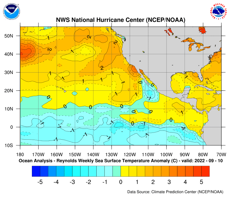
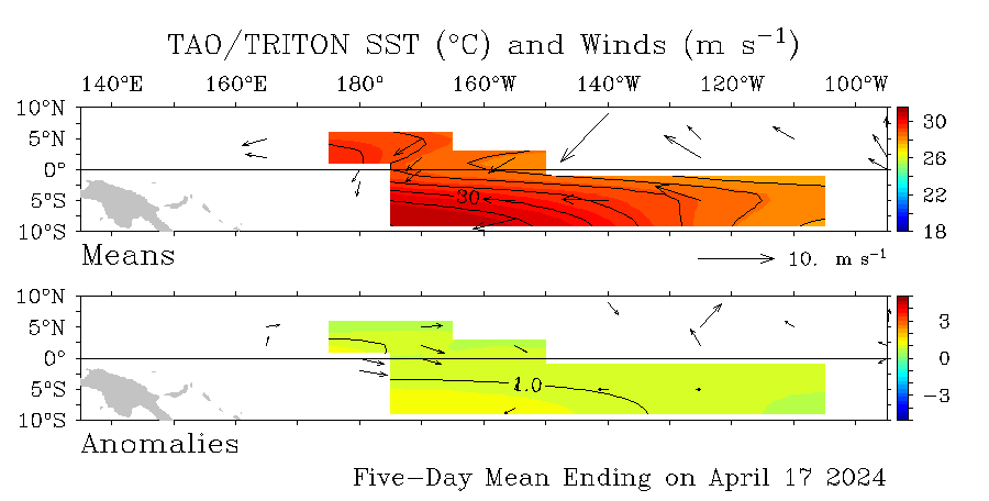
SST'S and Anomalies in Atlantic and Pacific

This is the general tropical discussion area. Anyone can take their shot at predicting a storms path.

Moderator: S2k Moderators

Forum rules

The posts in this forum are NOT official forecasts and should not be used as such. They are just the opinion of the poster and may or may not be backed by sound meteorological data. They are NOT endorsed by any professional institution or STORM2K. For official information, please refer to products from the National Hurricane Center and National Weather Service.

Help Support Storm2K
Message
Author
User avatar
cycloneye
Admin
Admin
Posts: 146204
Age: 69
Joined: Thu Oct 10, 2002 10:54 am
Location: San Juan, Puerto Rico

#501 Postby cycloneye » Mon Mar 20, 2006 4:26 pm

southfloridawx2005 wrote:We cool Luis :D


:cold: :cold:
0 likes   

User avatar
SouthFloridawx
S2K Supporter
S2K Supporter
Posts: 8346
Age: 46
Joined: Tue Jul 26, 2005 1:16 am
Location: Sarasota, FL
Contact:

#502 Postby SouthFloridawx » Mon Mar 20, 2006 4:27 pm

:craz:
0 likes   

User avatar
cycloneye
Admin
Admin
Posts: 146204
Age: 69
Joined: Thu Oct 10, 2002 10:54 am
Location: San Juan, Puerto Rico

#503 Postby cycloneye » Mon Mar 20, 2006 4:30 pm

Ok let's return to discuss about this important topic of the sst's and ssta's.

Image

The weak La Nina still prevails in the Pacific.
0 likes   
Visit the Caribbean-Central America Weather Thread where you can find at first post web cams,radars
and observations from Caribbean basin members Click Here

User avatar
webke
S2K Supporter
S2K Supporter
Posts: 290
Age: 70
Joined: Sun Sep 05, 2004 12:39 pm
Location: North Myrtle Beach SC

#504 Postby webke » Mon Mar 20, 2006 5:39 pm

Looking at these charts the Atlantic looks to be starting to heat up

http://www.cpc.ncep.noaa.gov/products/h ... lsst.shtml
0 likes   

User avatar
cycloneye
Admin
Admin
Posts: 146204
Age: 69
Joined: Thu Oct 10, 2002 10:54 am
Location: San Juan, Puerto Rico

#505 Postby cycloneye » Mon Mar 20, 2006 6:01 pm

Calamity wrote:Image

Image


Good loops there but Calamity does that graphic updates itself because it has the 19th of March and the 20th of March update is out and posted at this thread.
0 likes   
Visit the Caribbean-Central America Weather Thread where you can find at first post web cams,radars
and observations from Caribbean basin members Click Here

whereverwx
Category 5
Category 5
Posts: 1109
Joined: Mon May 31, 2004 10:15 pm

#506 Postby whereverwx » Mon Mar 20, 2006 8:48 pm

cycloneye wrote:Good loops there but Calamity does that graphic updates itself because it has the 19th of March and the 20th of March update is out and posted at this thread.


No, those do not update themselves.


Matt-hurricanewatcher wrote:Yeah the east coast like 2003 is cooling off...

It's only a 4 day period....
0 likes   

User avatar
James
Category 5
Category 5
Posts: 1531
Joined: Tue Aug 24, 2004 10:29 am
Location: Gloucestershire, England
Contact:

#507 Postby James » Tue Mar 21, 2006 11:21 am

Looks like the basin as a whole is starting to warm up. Since the last image (dated March 17th) there seems to have been a little warming in the Caribbean and the cool anomaly off of Africa seems to have shrunk. Of course, it's only four days but it's still interesting.

Image
0 likes   

User avatar
cycloneye
Admin
Admin
Posts: 146204
Age: 69
Joined: Thu Oct 10, 2002 10:54 am
Location: San Juan, Puerto Rico

#508 Postby cycloneye » Tue Mar 21, 2006 3:13 pm

Image

No leddown of La Nina in the equatorial Pacific. as it's still hanging on.Let's see what will occur in the next 3 months as Hurricane Season 2006 in the Atlantic starts.But my estimate is that the Weak La Nina will prevail for the first part of the season with Neutral conditions returning by the peak of the season in August and September.
0 likes   
Visit the Caribbean-Central America Weather Thread where you can find at first post web cams,radars
and observations from Caribbean basin members Click Here

CHRISTY

#509 Postby CHRISTY » Tue Mar 21, 2006 3:19 pm

atlantic seems to be warming a bit?
Last edited by CHRISTY on Tue Mar 21, 2006 3:20 pm, edited 1 time in total.
0 likes   

CHRISTY

#510 Postby CHRISTY » Tue Mar 21, 2006 3:19 pm

Image
0 likes   

User avatar
dhweather
S2K Supporter
S2K Supporter
Posts: 6199
Joined: Sat Aug 14, 2004 9:29 pm
Location: Heath, TX
Contact:

#511 Postby dhweather » Tue Mar 21, 2006 4:51 pm

It's rather disturbing to see the GOMEX acting like it is.
0 likes   

Matt-hurricanewatcher

#512 Postby Matt-hurricanewatcher » Tue Mar 21, 2006 5:06 pm

Interesting to say the least. Overall the Atlantic looks cooler but the Gulf on the other hand is warmer.
0 likes   

User avatar
ROCK
Category 5
Category 5
Posts: 9490
Age: 54
Joined: Tue Aug 17, 2004 7:30 am
Location: Kemah, Texas

#513 Postby ROCK » Tue Mar 21, 2006 5:18 pm

dhweather wrote:It's rather disturbing to see the GOMEX acting like it is.


no doubt...not looking forward to this year at all.....
0 likes   

User avatar
cycloneye
Admin
Admin
Posts: 146204
Age: 69
Joined: Thu Oct 10, 2002 10:54 am
Location: San Juan, Puerto Rico

#514 Postby cycloneye » Tue Mar 21, 2006 5:21 pm

Image

David disturbing the word that you used is the right one to describe how the GOM is right now in terms of the sst's and ssta's.
0 likes   

Matt-hurricanewatcher

#515 Postby Matt-hurricanewatcher » Tue Mar 21, 2006 5:23 pm

It would not suprize me, if a large area of above 95 degrees developed where the loop is.
0 likes   

User avatar
cycloneye
Admin
Admin
Posts: 146204
Age: 69
Joined: Thu Oct 10, 2002 10:54 am
Location: San Juan, Puerto Rico

#516 Postby cycloneye » Wed Mar 22, 2006 3:50 pm

Image

The Northern part of the Gulf is still relativly cool.But the loop current,the Southern Bay of Campeche and in the Southern gulf the waters are warm enough to sustain any tropical system if something forms right now there.
0 likes   

User avatar
SouthFloridawx
S2K Supporter
S2K Supporter
Posts: 8346
Age: 46
Joined: Tue Jul 26, 2005 1:16 am
Location: Sarasota, FL
Contact:

#517 Postby SouthFloridawx » Wed Mar 22, 2006 4:05 pm

.
0 likes   

User avatar
cycloneye
Admin
Admin
Posts: 146204
Age: 69
Joined: Thu Oct 10, 2002 10:54 am
Location: San Juan, Puerto Rico

#518 Postby cycloneye » Wed Mar 22, 2006 4:52 pm

SouthFloridawx wrote:.


:?: :?: :?:
0 likes   
Visit the Caribbean-Central America Weather Thread where you can find at first post web cams,radars
and observations from Caribbean basin members Click Here

User avatar
Tampa Bay Hurricane
Category 5
Category 5
Posts: 5597
Age: 37
Joined: Fri Jul 22, 2005 7:54 pm
Location: St. Petersburg, FL

#519 Postby Tampa Bay Hurricane » Wed Mar 22, 2006 5:28 pm

cycloneye wrote:
SouthFloridawx wrote:.


:?: :?: :?:


Must be a typing error where you accidentally delete highlighted
text right before posting
0 likes   

User avatar
cycloneye
Admin
Admin
Posts: 146204
Age: 69
Joined: Thu Oct 10, 2002 10:54 am
Location: San Juan, Puerto Rico

#520 Postby cycloneye » Wed Mar 22, 2006 5:32 pm

Image

The cool pool of anomalies continues to fade in the Eastern Atlantic as the days go by.Last week the cool anomalies were more pronnounced than what they look this week.
0 likes   
Visit the Caribbean-Central America Weather Thread where you can find at first post web cams,radars
and observations from Caribbean basin members Click Here


Return to “Talkin' Tropics”

Who is online

Users browsing this forum: No registered users and 19 guests