there is currently a severe warning for a cell in SE Texas and according to the NWS, numerous funnel clouds have been spotted across SE Texas today.
Edit: My own county (Harris Co.) went under a warning shortly after this post and I recieved 10 minutes of pea to penny sized hail. For a day that was suppose to have no severe weather for SE Texas; I feel I have done pretty good. It was a surprise for sure. BTW, 3 counties in SE Texas have issued warnings within the last hour and still there is no mesoscale discussion from the NWS and no "slight risk" outline for our area.
Major tornado outbreak Sunday...the aftermath..
Moderator: S2k Moderators
Forum rules

The posts in this forum are NOT official forecast and should not be used as such. They are just the opinion of the poster and may or may not be backed by sound meteorological data. They are NOT endorsed by any professional institution or STORM2K.
-
Extremeweatherguy

- Category 5

- Posts: 11095
- Joined: Mon Oct 10, 2005 8:13 pm
- Location: Florida
-
WaitingForSiren

- Category 1

- Posts: 383
- Joined: Sun Jan 08, 2006 12:58 pm
- Location: Minneapolis,Minnesota
- Contact:
-
CrazyC83
- Professional-Met

- Posts: 34315
- Joined: Tue Mar 07, 2006 11:57 pm
- Location: Deep South, for the first time!
Here is how I see it now:
Tornadoes - less likely. Could be some, but they won't dominate. The only concern is that one or two could become really intense, a la Evansville 2005.
Winds - main threat. Straight line winds of 70-80 mph will be quite common, and possibly some gusts exceeding 90 mph.
Hail - another major threat. I wouldn't be shocked to see numerous reports of golf ball size hail, perhaps even baseball to softball size in a few spots.
It is still a difficult call to make regarding what exactly will happen. There doesn't seem to be the CAPE values and instability of March 12, or even last November 15 or 27.
0 likes
-
6SpeedTA95
- Category 5
- Posts: 1206
- Joined: Wed Oct 19, 2005 3:25 pm
- Location: Oklahoma
- Contact:
Things are pretty up in the air as to what to expect around here tomorrow. Storms are expected to fire between 3pm and 5pm along the dryline. Once they start they're expected to quickly go severe. However, the tornado threat remains very much an unknown at this point. The threat is there, but depending on the timing and position of the system over the next 24 hrs will determine greatly the chance at tornadic supercells developing tomorrow afternoon. It'll be interesting to see what they're saying tomorrowmorning.
0 likes
-
CrazyC83
- Professional-Met
- Posts: 34315
- Joined: Tue Mar 07, 2006 11:57 pm
- Location: Deep South, for the first time!
NOT AN OFFICIAL FORECAST - just my prediction:
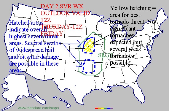
Today (Thursday) still has some uncertainty regarding what exactly will happen. However, I have enough confidence that the worst will be over an area from southern Oklahoma to central Missouri. However, widespread impact - particularly from straight-line winds - will be felt. While there shouldn't be widespread tornadoes, isolated strong or violent tornadoes are definitely not out of the question. This could definitely change - daytime heating could be critical.

Tomorrow (Friday) depends on what happens on Thursday. For now, I see the line weakening as it moves to the northeast, but winds and hail could still be a factor. The tornado threat is low at this time, but could change. The Level 2 over Texas is a new system.

Today (Thursday) still has some uncertainty regarding what exactly will happen. However, I have enough confidence that the worst will be over an area from southern Oklahoma to central Missouri. However, widespread impact - particularly from straight-line winds - will be felt. While there shouldn't be widespread tornadoes, isolated strong or violent tornadoes are definitely not out of the question. This could definitely change - daytime heating could be critical.
Tomorrow (Friday) depends on what happens on Thursday. For now, I see the line weakening as it moves to the northeast, but winds and hail could still be a factor. The tornado threat is low at this time, but could change. The Level 2 over Texas is a new system.
0 likes
-
Weatherfreak14

- Category 5
- Posts: 1381
- Joined: Sat Sep 24, 2005 3:40 pm
- Location: Beaufort, SC
- Contact:
-
conestogo_flood
- Category 5
- Posts: 1268
- Joined: Wed Sep 28, 2005 5:49 pm
-
6SpeedTA95
- Category 5
- Posts: 1206
- Joined: Wed Oct 19, 2005 3:25 pm
- Location: Oklahoma
- Contact:

-
6SpeedTA95
- Category 5
- Posts: 1206
- Joined: Wed Oct 19, 2005 3:25 pm
- Location: Oklahoma
- Contact:
-
6SpeedTA95
- Category 5
- Posts: 1206
- Joined: Wed Oct 19, 2005 3:25 pm
- Location: Oklahoma
- Contact:
-
6SpeedTA95
- Category 5
- Posts: 1206
- Joined: Wed Oct 19, 2005 3:25 pm
- Location: Oklahoma
- Contact:
NOT AN OFFICIAL PREDICTION

Obviously green represents less risk, followed by yellow and red. The most pronounced risk for tornadic development will be afternoon/early evening, but the threat will be there well into the night if the system holds together as its supposed. The negative tilt associated with this system this afternoon and evening coupled with the jet and cape values should be sufficient to fuel supercell activity in the the night.
Obviously green represents less risk, followed by yellow and red. The most pronounced risk for tornadic development will be afternoon/early evening, but the threat will be there well into the night if the system holds together as its supposed. The negative tilt associated with this system this afternoon and evening coupled with the jet and cape values should be sufficient to fuel supercell activity in the the night.
0 likes
-
6SpeedTA95
- Category 5
- Posts: 1206
- Joined: Wed Oct 19, 2005 3:25 pm
- Location: Oklahoma
- Contact:
-
Weatherfreak14
- Category 5
- Posts: 1381
- Joined: Sat Sep 24, 2005 3:40 pm
- Location: Beaufort, SC
- Contact:
6SpeedTA95 wrote:snoopj wrote:PDS watches a high probability then?
--snoopj
If everything goes according to plan I wouldn't be surprised to see one east of I35, north of 40 all the way to Kansas City.
So... this could be bigger outbreak than we first thought.
0 likes
Weatherfreak14 wrote:6SpeedTA95 wrote:snoopj wrote:PDS watches a high probability then?
--snoopj
If everything goes according to plan I wouldn't be surprised to see one east of I35, north of 40 all the way to Kansas City.
So... this could be bigger outbreak than we first thought.It looks now that storms are already starting to fire.
Storms firing this early will help keep the severe weather down later this afternoon, preventing an all out high risk tornado outbreak.
PDS watch already issued. Some discrete development likely early on with a chance of a few strong tornadoes before linear formation beginning late afternoon.
0 likes
-
6SpeedTA95
- Category 5
- Posts: 1206
- Joined: Wed Oct 19, 2005 3:25 pm
- Location: Oklahoma
- Contact:
URGENT - IMMEDIATE BROADCAST REQUESTED
TORNADO WATCH NUMBER 109
NWS STORM PREDICTION CENTER NORMAN OK
845 AM CST THU MAR 30 2006
THE NWS STORM PREDICTION CENTER HAS ISSUED A
TORNADO WATCH FOR PORTIONS OF
CENTRAL AND EASTERN KANSAS
SOUTHEAST NEBRASKA
NORTHERN OKLAHOMA
EFFECTIVE THIS THURSDAY MORNING AND EVENING FROM 845 AM UNTIL 600
PM CST.
...THIS IS A PARTICULARLY DANGEROUS SITUATION...
DESTRUCTIVE TORNADOES...LARGE HAIL TO 3 INCHES IN DIAMETER...
THUNDERSTORM WIND GUSTS TO 80 MPH...AND DANGEROUS LIGHTNING ARE
POSSIBLE IN THESE AREAS.
THE TORNADO WATCH AREA IS APPROXIMATELY ALONG AND 100 STATUTE
MILES EAST AND WEST OF A LINE FROM 35 MILES NORTH NORTHEAST OF
GRAND ISLAND NEBRASKA TO 30 MILES SOUTHWEST OF TULSA OKLAHOMA.
FOR A COMPLETE DEPICTION OF THE WATCH SEE THE ASSOCIATED WATCH
OUTLINE UPDATE (WOUS64 KWNS WOU9).
REMEMBER...A TORNADO WATCH MEANS CONDITIONS ARE FAVORABLE FOR
TORNADOES AND SEVERE THUNDERSTORMS IN AND CLOSE TO THE WATCH AREA.
PERSONS IN THESE AREAS SHOULD BE ON THE LOOKOUT FOR THREATENING
WEATHER CONDITIONS AND LISTEN FOR LATER STATEMENTS AND POSSIBLE
WARNINGS.
OTHER WATCH INFORMATION...THIS TORNADO WATCH REPLACES SEVERE
THUNDERSTORM WATCH NUMBER 108. WATCH NUMBER 108 WILL NOT BE IN
EFFECT AFTER 845 AM CST.
DISCUSSION...VIGOROUS TROUGH AND ASSOCIATED WIND MAX WILL BE DRIVING
EWD ACROSS THE CENTRAL/SRN PLAINS TODAY. VERY STRONG SHEAR PROFILES
COUPLED WITH MLCAPES TO 1500 PROVIDE INGREDIENTS FOR RAPID
DEVELOPMENT OF SUPERCELLS ALONG AND EAST OF DRY LINE WHICH CURRENTLY
IS LOCATED FROM CENTRAL KS INTO NWRN OK. INITIALLY LARGE HAIL WILL
BE PRIMARY THREAT WITH TORNADOES BECOMING INCREASINGLY LIKELY BY
EARLY/MID AFTERNOON. AS SURFACE LOW NOW WRN KS MOVES NEWD TOWARD
SERN NEB CONVERGENCE WILL ENHANCE POTENTIAL FOR POSSIBLE STRONG
TORNADOES BOTH AHEAD OF LOW AND DOWN THE DRY LINE INTO NRN OK.
AVIATION...TORNADOES AND A FEW SEVERE THUNDERSTORMS WITH HAIL
SURFACE AND ALOFT TO 3 INCHES. EXTREME TURBULENCE AND SURFACE WIND
GUSTS TO 70 KNOTS. A FEW CUMULONIMBI WITH MAXIMUM TOPS TO 500.
MEAN STORM MOTION VECTOR 24035.
...HALES
First watch fo the day....
This first batch of storms are supposed to be fairly weak...its the ones later today we have to worry about.
0 likes
-
WaitingForSiren
- Category 1
- Posts: 383
- Joined: Sun Jan 08, 2006 12:58 pm
- Location: Minneapolis,Minnesota
- Contact:
Return to “USA & Caribbean Weather”
Who is online
Users browsing this forum: Brent and 57 guests