Severe Thunderstorms Possible across Texas
Moderator: S2k Moderators
Forum rules
The posts in this forum are NOT official forecast and should not be used as such. They are just the opinion of the poster and may or may not be backed by sound meteorological data. They are NOT endorsed by any professional institution or STORM2K.
Severe Thunderstorms Possible across Texas
Looks to be a storm Mother's Day across portions of Texas. Indeed severe weather is already in progress NE Of Houston Area.


0 likes
The following post is NOT an official forecast and should not be used as such. It is just the opinion of the poster and may or may not be backed by sound meteorological data. It is NOT endorsed by any professional institution including storm2k.org For Official Information please refer to the NHC and NWS products.
Hazardous Weather Outlook
HAZARDOUS WEATHER OUTLOOK
NATIONAL WEATHER SERVICE HOUSTON/GALVESTON TX
630 AM CDT SUN MAY 14 2006
GMZ330-335-350-355-TXZ163-164-176>179-195>200-210>214-226-227-
235>238-151200-
AUSTIN-BRAZORIA-BRAZOS-BURLESON-CHAMBERS-COLORADO-FORT BEND-
GALVESTON-GALVESTON BAY-GRIMES-HARRIS-HOUSTON-JACKSON-LIBERTY-
MADISON-MATAGORDA-MATAGORDA BAY-MONTGOMERY-POLK-SAN JACINTO-
TRINITY-WALKER-WALLER-WASHINGTON-
WATERS FROM FREEPORT TO THE MATAGORDA SHIP CHANNEL OUT 20 NM-
WATERS FROM HIGH ISLAND TO FREEPORT OUT 20 NM-WHARTON-
630 AM CDT SUN MAY 14 2006
...SLIGHT RISK OF SEVERE THUNDERSTORMS ACROSS SOUTHEAST TEXAS TODAY
AND INTO THIS EVENING...
THIS HAZARDOUS WEATHER OUTLOOK IS FOR PORTIONS OF SOUTHEAST TEXAS.
.DAY ONE...TODAY AND TONIGHT...
A SLOW MOVING COLD FRONT LOCATED ACROSS NORTH TEXAS EARLY THIS
MORNING WILL MOVE SOUTH TODAY AND INTO SOUTHEAST TEXAS AROUND
MID-DAY THEN ACROSS THE AREA THIS AFTERNOON AND EVENING. THE
ATMOSPHERE SOUTH OF THIS FRONT IS VERY UNSTABLE DUE TO COLD AIR
PRESENT IN THE MID AND UPPER LEVELS. THE FLOW AT THESE MID AND UPPER
LEVELS IS FROM THE NORTHWEST WHICH WILL RESULT IN THUNDERSTORMS
MOVING SOUTHEAST AND QUICKLY ACROSS THE AREA. AS THE FRONT MOVES
SOUTH TODAY...THUNDERSTORMS ARE EXPECTED TO REPEATEDLY DEVELOP
ALONG THIS BOUNDARY AND THEN MOVE SOUTHEAST ACROSS THE AREA.
A CLUSTER OF THUNDERSTORMS IS ONGOING THIS MORNING JUST NORTH OF
SOUTHEAST TEXAS AND HAS PROMPTED THE ISSUANCE OF A SEVERE
THUNDERSTORM WATCH FOR THE NORTHERN HALF OF SOUTHEAST TEXAS UNTIL
MID-DAY. EXPECT ADDITIONAL WATCHES EXTENDING FURTHER SOUTH LATER TODAY
AND INTO THE EVENING HOURS AS THE FRONT APPROACHES AND MOVES ACROSS
SOUTHEAST TEXAS.
THE PRIMARY SEVERE WEATHER THREATS WILL BE LARGE HAIL AND DAMAGING
DOWNBURST WINDS.
0 likes
The following post is NOT an official forecast and should not be used as such. It is just the opinion of the poster and may or may not be backed by sound meteorological data. It is NOT endorsed by any professional institution including storm2k.org For Official Information please refer to the NHC and NWS products.
- Extremeweatherguy
- Category 5

- Posts: 11095
- Joined: Mon Oct 10, 2005 8:13 pm
- Location: Florida
- Extremeweatherguy
- Category 5

- Posts: 11095
- Joined: Mon Oct 10, 2005 8:13 pm
- Location: Florida
URGENT - IMMEDIATE BROADCAST REQUESTED
SEVERE THUNDERSTORM WATCH NUMBER 349
NWS STORM PREDICTION CENTER NORMAN OK
925 AM CDT SUN MAY 14 2006
THE NWS STORM PREDICTION CENTER HAS ISSUED A
SEVERE THUNDERSTORM WATCH FOR PORTIONS OF
SOUTHERN AND CENTRAL LOUISIANA
SOUTH CENTRAL AND SOUTHEAST TEXAS
COASTAL WATERS
EFFECTIVE THIS SUNDAY MORNING AND AFTERNOON FROM 925 AM UNTIL 500
PM CDT.
HAIL TO 3 INCHES IN DIAMETER...THUNDERSTORM WIND GUSTS TO 70
MPH...AND DANGEROUS LIGHTNING ARE POSSIBLE IN THESE AREAS.
THE SEVERE THUNDERSTORM WATCH AREA IS APPROXIMATELY ALONG AND 75
STATUTE MILES NORTH AND SOUTH OF A LINE FROM 60 MILES WEST OF
AUSTIN TEXAS TO 30 MILES NORTHEAST OF LAFAYETTE LOUISIANA. FOR A
COMPLETE DEPICTION OF THE WATCH SEE THE ASSOCIATED WATCH OUTLINE
UPDATE (WOUS64 KWNS WOU9).
REMEMBER...A SEVERE THUNDERSTORM WATCH MEANS CONDITIONS ARE
FAVORABLE FOR SEVERE THUNDERSTORMS IN AND CLOSE TO THE WATCH
AREA. PERSONS IN THESE AREAS SHOULD BE ON THE LOOKOUT FOR
THREATENING WEATHER CONDITIONS AND LISTEN FOR LATER STATEMENTS
AND POSSIBLE WARNINGS. SEVERE THUNDERSTORMS CAN AND OCCASIONALLY
DO PRODUCE TORNADOES.
OTHER WATCH INFORMATION...THIS SEVERE THUNDERSTORM WATCH REPLACES
SEVERE THUNDERSTORM WATCH NUMBER 348. WATCH NUMBER 348 WILL NOT
BE IN EFFECT AFTER 925 AM CDT.
DISCUSSION...SEVERE THUNDERSTORMS CURRENTLY CENTRAL TX INTO LA WILL
CONTINUE DEVELOPING SEWD INTO A VERY UNSTABLE AIR MASS. WITH
HEATING...ADDITIONAL SEVERE THUNDERSTORMS EXPECTED TO DEVELOP WWD
INTO SCENTRAL TX AND THEN PROPAGATE S/SEWD. PRIMARY THREAT WILL BE
VERY LARGE HAIL WITH LOCAL DAMAGING WINDS IN DOWNBURSTS AND SHORT
LINE SEGMENTS AND BOWS.
AVIATION...A FEW SEVERE THUNDERSTORMS WITH HAIL SURFACE AND ALOFT
TO 3 INCHES. EXTREME TURBULENCE AND SURFACE WIND GUSTS TO 60
KNOTS. A FEW CUMULONIMBI WITH MAXIMUM TOPS TO 550. MEAN STORM
MOTION VECTOR 31025.
0 likes
- Extremeweatherguy
- Category 5

- Posts: 11095
- Joined: Mon Oct 10, 2005 8:13 pm
- Location: Florida
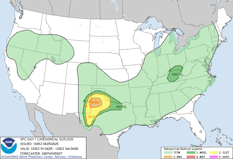
check out the latest maps from the SPC! We are literally as close as you can get to a moderate outlook without being moderate:
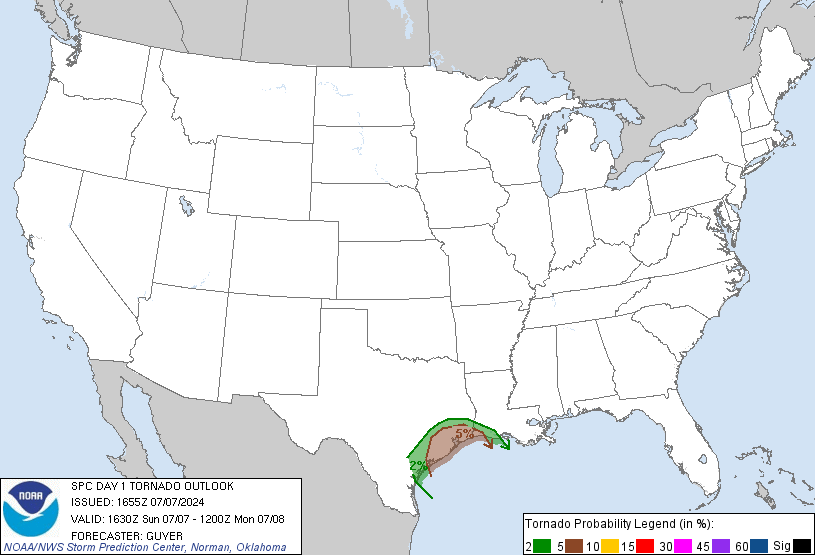
Tornado risk
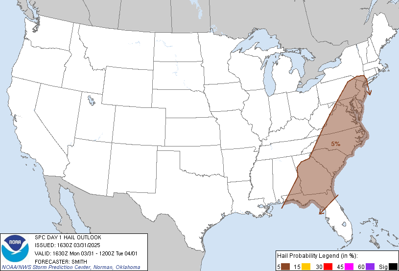
Hail risk
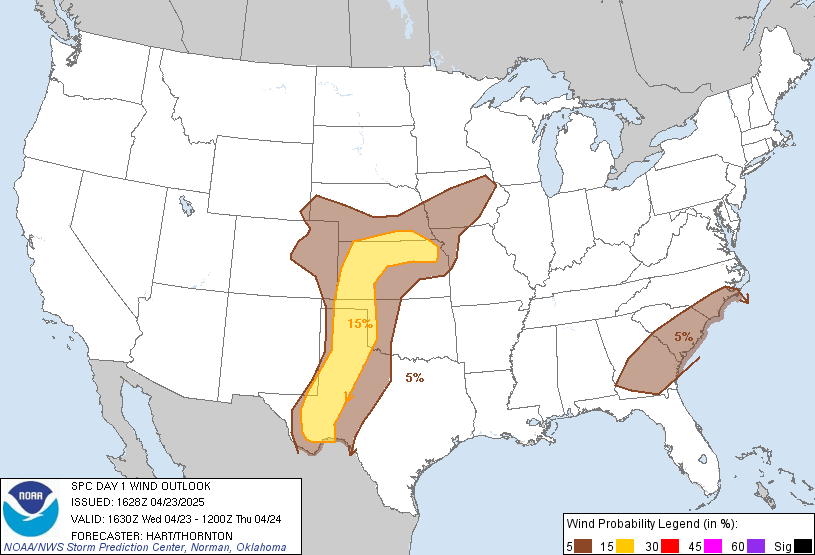
Damaging wind risk
...TX TO LOWER MS VALLEY...
A MUCH MORE UNSTABLE AIR MASS IS IN PLACE ACROSS CENTRAL/SRN TX TO S
OF FRONTAL ZONE. ONGOING STRONG/SEVERE THUNDERSTORMS EXPECTED WITH
AFTERNOON HEATING TO INCREASE IN NUMBER AND INTENSITY AS THE STORMS
CONTINUE DEVELOPING S/SEWD THRU MUCH OF TX BY LATER TONIGHT.
GIVEN MLCAPES RISING TO ABOVE 3000 J/KG AND 40-45 KT OF DEEP LAYER
SHEAR...VERY LARGE HAIL WILL BE THE DOMINANT THREAT. THERMODYNAMIC
PARAMETERS GIVEN THE DEEP LAYER SHEAR ALSO SUPPORT SUPERCELL
POTENTIAL. LARGEST HAIL ALONG WITH ISOLATED TORNADOES WOULD BE
ASSOCIATED WITH ANY SUPERCELL THAT DEVELOPS.
SEVERE STORMS WILL PROPAGATE INTO THE VERY UNSTABLE AIR MASS ACROSS
S TX AND LIKELY CONTINUE AFTER DARK.
FURTHER E ALONG GULF COAST...WHILE LAPSE RATES FAVOR A FEW SEVERE
STORMS...INSTABILITY AND SHEAR WILL BE A LITTLE LESS THAN THE
AFOREMENTION AREAS. SEVERE POTENTIAL THUS WOULD BE MORE WIDELY
SCATTERED WITH LARGE HAIL THE DOMINANT THREAT.


Tornado risk

Hail risk

Damaging wind risk
...TX TO LOWER MS VALLEY...
A MUCH MORE UNSTABLE AIR MASS IS IN PLACE ACROSS CENTRAL/SRN TX TO S
OF FRONTAL ZONE. ONGOING STRONG/SEVERE THUNDERSTORMS EXPECTED WITH
AFTERNOON HEATING TO INCREASE IN NUMBER AND INTENSITY AS THE STORMS
CONTINUE DEVELOPING S/SEWD THRU MUCH OF TX BY LATER TONIGHT.
GIVEN MLCAPES RISING TO ABOVE 3000 J/KG AND 40-45 KT OF DEEP LAYER
SHEAR...VERY LARGE HAIL WILL BE THE DOMINANT THREAT. THERMODYNAMIC
PARAMETERS GIVEN THE DEEP LAYER SHEAR ALSO SUPPORT SUPERCELL
POTENTIAL. LARGEST HAIL ALONG WITH ISOLATED TORNADOES WOULD BE
ASSOCIATED WITH ANY SUPERCELL THAT DEVELOPS.
SEVERE STORMS WILL PROPAGATE INTO THE VERY UNSTABLE AIR MASS ACROSS
S TX AND LIKELY CONTINUE AFTER DARK.
FURTHER E ALONG GULF COAST...WHILE LAPSE RATES FAVOR A FEW SEVERE
STORMS...INSTABILITY AND SHEAR WILL BE A LITTLE LESS THAN THE
AFOREMENTION AREAS. SEVERE POTENTIAL THUS WOULD BE MORE WIDELY
SCATTERED WITH LARGE HAIL THE DOMINANT THREAT.
0 likes
- Extremeweatherguy
- Category 5

- Posts: 11095
- Joined: Mon Oct 10, 2005 8:13 pm
- Location: Florida
- Extremeweatherguy
- Category 5

- Posts: 11095
- Joined: Mon Oct 10, 2005 8:13 pm
- Location: Florida
- Extremeweatherguy
- Category 5

- Posts: 11095
- Joined: Mon Oct 10, 2005 8:13 pm
- Location: Florida
- Portastorm
- Storm2k Moderator

- Posts: 9955
- Age: 63
- Joined: Fri Jul 11, 2003 9:16 am
- Location: Round Rock, TX
- Contact:
Extremeweatherguy wrote:Looking at how impressive the storms to the NW are...I am very surprised that they have let all the warnings expire. Hopefully they will issue new ones soon, because there is no way that they are not severe.
Nothing here yet but plenty of thunder. Very heavy rains to our north and northwest. I hear that parts of I-35 were covered with water between Temple and Waco earlier. Hope those Mothers Day travelers take care!
0 likes
Serious thunder and it's getting darker here. I was at http://rainbowweather.com/vweather/litng2000.html earlier and it looks like a line is coming right at our house :O
At that site, there's a yellow box around some of the storms but the site legend doesn't explain...
We've got watches up here. Warnings to our NW and E, looks like y'all in Houston are in for a noisey afternoon/evening....
At that site, there's a yellow box around some of the storms but the site legend doesn't explain...
We've got watches up here. Warnings to our NW and E, looks like y'all in Houston are in for a noisey afternoon/evening....
0 likes
Very wicked skies in League City. The sky has a red and green tint to it.
0 likes
The following post is NOT an official forecast and should not be used as such. It is just the opinion of the poster and may or may not be backed by sound meteorological data. It is NOT endorsed by any professional institution including storm2k.org For Official Information please refer to the NHC and NWS products.
- Portastorm
- Storm2k Moderator

- Posts: 9955
- Age: 63
- Joined: Fri Jul 11, 2003 9:16 am
- Location: Round Rock, TX
- Contact:
Shoshana wrote:Serious thunder and it's getting darker here. I was at http://rainbowweather.com/vweather/litng2000.html earlier and it looks like a line is coming right at our house :O
At that site, there's a yellow box around some of the storms but the site legend doesn't explain...
We've got watches up here. Warnings to our NW and E, looks like y'all in Houston are in for a noisey afternoon/evening....
Shoshana, you're in the NE part of Travis County, right? If I remember correctly you're about 10 miles east of me or thereabouts. I'm near Parmer/Mopac in north Austin.
Gusty winds here now, some thunder ... but nothing substantial yet although that AUS radar is lighting up like a Christmas tree!
0 likes
Portastorm wrote:Shoshana wrote:Serious thunder and it's getting darker here. I was at http://rainbowweather.com/vweather/litng2000.html earlier and it looks like a line is coming right at our house :O
At that site, there's a yellow box around some of the storms but the site legend doesn't explain...
We've got watches up here. Warnings to our NW and E, looks like y'all in Houston are in for a noisey afternoon/evening....
Shoshana, you're in the NE part of Travis County, right? If I remember correctly you're about 10 miles east of me or thereabouts. I'm near Parmer/Mopac in north Austin.
Gusty winds here now, some thunder ... but nothing substantial yet although that AUS radar is lighting up like a Christmas tree!
Yup - NE Travis Co, about 5-6 miles away from you - near Parmer and Dessau.
Thank goodness for surge protectors and UPSs!
0 likes
- Extremeweatherguy
- Category 5

- Posts: 11095
- Joined: Mon Oct 10, 2005 8:13 pm
- Location: Florida
We are getting pounded with some serious rain right now in central Montgomery County. No hail but it is the hardest rain I have seen all year by far. I was in my garden out back picking beans watching the clouds and taking pictures of them till the rain and lightning ran me back to the house. I was completely soaked by the time I got to the house but I was able to get dinner just in time!! 
It looks like alot more rain behind this too!
It looks like alot more rain behind this too!
0 likes
Return to “USA & Caribbean Weather”
Who is online
Users browsing this forum: Brent and 45 guests


