Watching the BOC
Moderator: S2k Moderators
Forum rules

The posts in this forum are NOT official forecasts and should not be used as such. They are just the opinion of the poster and may or may not be backed by sound meteorological data. They are NOT endorsed by any professional institution or STORM2K. For official information, please refer to products from the National Hurricane Center and National Weather Service.
-
The Hurricaner

- Tropical Depression

- Posts: 92
- Joined: Tue Jun 13, 2006 3:59 pm
- Location: Miami, FL


-
HouTXmetro

- Category 5

- Posts: 3949
- Joined: Sun Jun 13, 2004 6:00 pm
- Location: District of Columbia, USA
The Hurricaner wrote:Where would this thing go if it developed? It looks like its just gonna go on land very soon and not turn into anything.
Energy from the Wav should be pulled into the BOC/GOMEX
0 likes
[Disclaimer: My Amateur Opinion, please defer to your local authorities or the NHC for Guidance.]
-
Dean4Storms
- S2K Supporter

- Posts: 6358
- Age: 62
- Joined: Sun Aug 31, 2003 1:01 pm
- Location: Miramar Bch. FL
Not a whole lot of moisture out there to work with. I don't see anything becoming of any of the waves for now.
0 likes
My opinion and statements DO NOT represent the opinion of the EMA, NHC, NWS, or any other professional agency, organization, or group. For official information, please refer to the NHC and NWS products.
-
beachbum_al

- Category 5
- Posts: 2163
- Age: 55
- Joined: Thu Jul 14, 2005 9:23 pm
- Location: South Alabama Coast
- Contact:
-
Extremeweatherguy

- Category 5
- Posts: 11095
- Joined: Mon Oct 10, 2005 8:13 pm
- Location: Florida
Chief Met Frank B. (Chan. 2 Houston) just said that the upper level low currently over Brownsville could move into the Gulf tomorrow and become a TD and head toward TX. This is the first time I have heard of a scenario like this, anyone else have any thoughts? I guess all it would really need to do for this to happen is:
-work down to the surface
-be over water
Looks like the moisture and low shear are already in place.
I guess we will have to watch closely tomorrow, and I actually hope he is right. A nice TD or weak storm could greatly help out with the drought.
EDIT: I just checked the reporting stations near Brownsville and many have seen sustained winds over 20mph and gusts up to near 30mph this afternoon. I wonder if this is a sign of this thing trying to work down to the surface?
0 likes
-
Audrey2Katrina

- Category 5
- Posts: 4252
- Age: 76
- Joined: Fri Dec 23, 2005 10:39 pm
- Location: Metaire, La.
Don't know about it becoming a TD, but perhaps a short lived one... I did notice that convection in the SW GOM and around that area, but figured it'd just get dragged along and not amount to much. I nice little TD that would hopefully move from there to OVER HERE, would be welcome, I think we all could use the rain, and certainly cooler temps.
A2K
A2K
0 likes
Flossy 56 Audrey 57 Hilda 64* Betsy 65* Camille 69* Edith 71 Carmen 74 Bob 79 Danny 85 Elena 85 Juan 85 Florence 88 Andrew 92*, Opal 95, Danny 97, Georges 98*, Isidore 02, Lili 02, Ivan 04, Cindy 05*, Dennis 05, Katrina 05*, Gustav 08*, Isaac 12*, Nate 17, Barry 19, Cristobal 20, Marco, 20, Sally, 20, Zeta 20*, Claudette 21 IDA* 21 Francine *24
-
gatorcane

- S2K Supporter
- Posts: 23703
- Age: 47
- Joined: Sun Mar 13, 2005 3:54 pm
- Location: Boca Raton, FL
Extremeweatherguy wrote:Chief Met Frank B. (Chan. 2 Houston) just said that the upper level low currently over Brownsville could move into the Gulf tomorrow and become a TD and head toward TX. This is the first time I have heard of a scenario like this, anyone else have any thoughts? I guess all it would really need to do for this to happen is:
-work down to the surface
-be over water
Looks like the moisture and low shear are already in place.
I guess we will have to watch closely tomorrow, and I actually hope he is right. A nice TD or weak storm could greatly help out with the drought.
EDIT: I just checked the reporting stations near Brownsville and many have seen sustained winds over 20mph and gusts up to near 30mph this afternoon. I wonder if this is a sign of this thing trying to work down to the surface?
Honestly looking out there now I highly doubt it - Alberto was supposed to be a BOC storm too but ended up a Florida storm. I was questioning why many were calling the BOC when absolutely nothing was in the BOC at the time - same this time.
0 likes
-
Extremeweatherguy
- Category 5
- Posts: 11095
- Joined: Mon Oct 10, 2005 8:13 pm
- Location: Florida
Here is the latest water vapor:
http://www.ssd.noaa.gov/goes/east/gmex/loop-wv.html
Looking at this, I do not know if the MLL/ULL will be able to get east and have enough time to develop. The BOC/western Gulf may have to wait a little longer for an organized system, but either way...heavy rains look likely.
http://www.ssd.noaa.gov/goes/east/gmex/loop-wv.html
Looking at this, I do not know if the MLL/ULL will be able to get east and have enough time to develop. The BOC/western Gulf may have to wait a little longer for an organized system, but either way...heavy rains look likely.
0 likes
-
HurricaneHunter914
- Category 5
- Posts: 4439
- Age: 32
- Joined: Fri Mar 10, 2006 7:36 pm
- Location: College Station, TX
bay of campeche right now looks favorable development, lets see how this thing turns out after a while.
0 likes
Personal Forecast Disclaimer:
The posts in this forum are NOT official forecast and should not be used as such. They are just the opinion of the poster and may or may not be backed by sound meteorological data. They are NOT endorsed by any professional institution or storm2k.org. For official information, please refer to the NHC and NWS products.
The posts in this forum are NOT official forecast and should not be used as such. They are just the opinion of the poster and may or may not be backed by sound meteorological data. They are NOT endorsed by any professional institution or storm2k.org. For official information, please refer to the NHC and NWS products.
-
Audrey2Katrina
- Category 5
- Posts: 4252
- Age: 76
- Joined: Fri Dec 23, 2005 10:39 pm
- Location: Metaire, La.
heavy rains look likely.
Right now, I can deal with that!
A2K
0 likes
Flossy 56 Audrey 57 Hilda 64* Betsy 65* Camille 69* Edith 71 Carmen 74 Bob 79 Danny 85 Elena 85 Juan 85 Florence 88 Andrew 92*, Opal 95, Danny 97, Georges 98*, Isidore 02, Lili 02, Ivan 04, Cindy 05*, Dennis 05, Katrina 05*, Gustav 08*, Isaac 12*, Nate 17, Barry 19, Cristobal 20, Marco, 20, Sally, 20, Zeta 20*, Claudette 21 IDA* 21 Francine *24
-
HurricaneHunter914
- Category 5
- Posts: 4439
- Age: 32
- Joined: Fri Mar 10, 2006 7:36 pm
- Location: College Station, TX
Looks like the Gulf Coast States are going to get some very needed rain pretty soon.
0 likes
Personal Forecast Disclaimer:
The posts in this forum are NOT official forecast and should not be used as such. They are just the opinion of the poster and may or may not be backed by sound meteorological data. They are NOT endorsed by any professional institution or storm2k.org. For official information, please refer to the NHC and NWS products.
The posts in this forum are NOT official forecast and should not be used as such. They are just the opinion of the poster and may or may not be backed by sound meteorological data. They are NOT endorsed by any professional institution or storm2k.org. For official information, please refer to the NHC and NWS products.

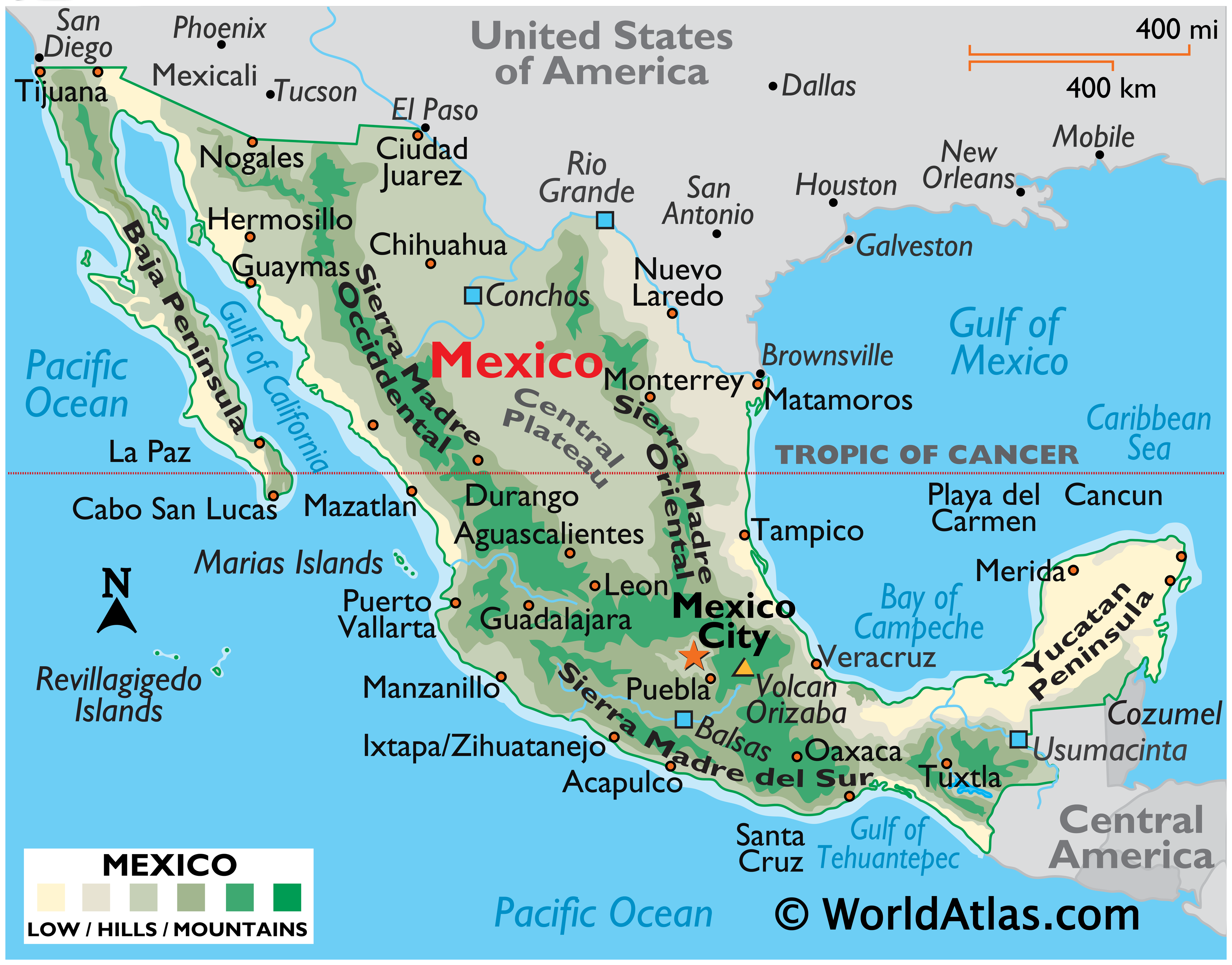
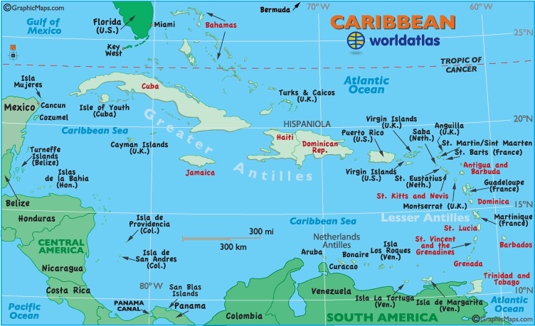
Noah wrote:Can someone post a map that shows BOC and the lesser antillies..spellingSo i know where they are and can sticky it to my pc.. thanks
Here's a decent pair of maps that have everything clearly labeled:
http://www.worldatlas.com/webimage/coun ... xcolor.gif
http://www.worldatlas.com/webimage/coun ... ribnew.gif
0 likes
-
JamesFromMaine2

- Category 4

- Posts: 989
- Joined: Tue Jul 19, 2005 1:38 am
- Location: Portland Maine USA
- Contact:
-
Audrey2Katrina
- Category 5
- Posts: 4252
- Age: 76
- Joined: Fri Dec 23, 2005 10:39 pm
- Location: Metaire, La.
If you're referring to the circled "BOC"... as well as the "Lesser Antilles" that's pretty much it... The Greater Antilles are the BIG Islands like Puerto Rico, Hispaniola, Jamaica, and Cuba... while the arc of smaller ones are the "Lesser".
Sure do hope that convection off the coast of SW Louisiana heads up this way and cools/wets us up a bit.
A2K
Sure do hope that convection off the coast of SW Louisiana heads up this way and cools/wets us up a bit.
A2K
0 likes
Flossy 56 Audrey 57 Hilda 64* Betsy 65* Camille 69* Edith 71 Carmen 74 Bob 79 Danny 85 Elena 85 Juan 85 Florence 88 Andrew 92*, Opal 95, Danny 97, Georges 98*, Isidore 02, Lili 02, Ivan 04, Cindy 05*, Dennis 05, Katrina 05*, Gustav 08*, Isaac 12*, Nate 17, Barry 19, Cristobal 20, Marco, 20, Sally, 20, Zeta 20*, Claudette 21 IDA* 21 Francine *24
-
HouTXmetro
- Category 5
- Posts: 3949
- Joined: Sun Jun 13, 2004 6:00 pm
- Location: District of Columbia, USA
clfenwi wrote:Noah wrote:Can someone post a map that shows BOC and the lesser antillies..spelling
Here's a decent pair of maps that have everything clearly labeled:
http://www.worldatlas.com/webimage/coun ... xcolor.gif
http://www.worldatlas.com/webimage/coun ... ribnew.gif
Thank you very much!
0 likes
-
beachbum_al
- Category 5
- Posts: 2163
- Age: 55
- Joined: Thu Jul 14, 2005 9:23 pm
- Location: South Alabama Coast
- Contact:
-
JonathanBelles
- Professional-Met

- Posts: 11430
- Age: 35
- Joined: Sat Dec 24, 2005 9:00 pm
- Location: School: Florida State University (Tallahassee, FL) Home: St. Petersburg, Florida
- Contact:
Who is online
Users browsing this forum: Bing [Bot] and 71 guests