Worst thunderstorm you have ever been in.
Moderator: S2k Moderators
Forum rules

The posts in this forum are NOT official forecast and should not be used as such. They are just the opinion of the poster and may or may not be backed by sound meteorological data. They are NOT endorsed by any professional institution or STORM2K.
-
Tstormwatcher

- S2K Supporter

- Posts: 3086
- Joined: Thu Oct 20, 2005 7:31 pm
- Location: New Bern, NC
Worst thunderstorm you have ever been in.
For me, we were camping in the Shenendoah mountains. We had our tents set up and were eating in a 3 sided lean-to when a severe storm moved in. It started pouring for 5 minutes and then stopped and then the hail came. Dime sized completely covered the ground and then more heavy rain. When it ended, an erie fog eveloped the area. Luckily the hail didn't pierce any of the tents. Round 2 came right after we went to bed. An electrical storm came in with very strong winds. The top of the tent kept hitting me in the head as I held on for dear life. We were camping on a ridge top. This went on for about 30 minutes. The wierd thing was the next day after we got back on the road, the first town we came too had hundreds of big trees down and some building damage. the news said that they had 100mph winds go through. Figured we had at least 50 mph winds back in camp.
0 likes
-
Scorpion
-
JenBayles

- Category 5

- Posts: 3461
- Age: 63
- Joined: Tue Aug 26, 2003 3:27 pm
- Location: Houston, TX
- Contact:
November 1992. Just moved in our house in late September and nearly lost the roof when a twister zipped through the street behind us. It was an outbreak typical of severe Houston weather: instead of one big tornado like we had in Kansas, you get a gazillion little ones. Dumbazz me - I did the deer in the headlights routine at the back picture window while the tornado did its thing....

0 likes
-
george_r_1961

- S2K Supporter
- Posts: 3171
- Age: 64
- Joined: Sat Oct 12, 2002 9:14 pm
- Location: Carbondale, Pennsylvania
-
Extremeweatherguy

- Category 5
- Posts: 11095
- Joined: Mon Oct 10, 2005 8:13 pm
- Location: Florida
A few (but not all) specific storm stories I have:
Hurricane Charley = This is by far the worst event I have ever experienced. It only lasted for an hour, but it was an hour of hell. In my area sustained winds reached 75-85mph and gusts hit 100mph+. Debris were flying everywhere, trees were bending and snapping like twigs; it was scary. After the storm I was without power for 8 days and without water for 5. The Orlando airport received heavy damages as well. Gusts to 105mph+ snapped most pine trees in that area and destroyed hangers and planes. It was amazing. I can still remember having to drive over an hour to find gas the next day through downed oaks, smashed billboards, and snapped power poles. Not a fun experience.
Hurricane Frances = Frances was a never ending wind storm for my area. It went on for well over 24 hours with 40-55mph winds and gusts to 75mph.
Hurricane Jeanne = Jeanne, like Frances, lasted for a long time. It was 18 hours of rain and wind with top gusts near 80mph. I lost power for about 2 days after the storm passed.
Missouri Supercell = it hit in the middle of the night with 70mph gusts, nickle sized hail, excessive lightning, and a tornado a mile down the road. It was one of the worst storms I can remember.
Florida Supercell = During a May day in Oviedo, FL a supercell developed and passed right over my area. I received gusts to 50-60mph, 15 minutes of pea to dime sized hail, and excessive lightning.
Houston Supercall = This one was a recent event (May 4th, 2006). The storm came from nowhere and dumped an hour of hail on the area. The hail reached the size of baseballs during the heart of the storm and caused widespread damage. Many cars were banged up, and most area homes are still getting new roofs put on.
Hurricane Rita = 3-6 hours of gusts to 55-65mph. Widespread minor damages in Houston.
Hurricane Erin = This happened overnight and I can't remember much as I slept through most of it. There were, however, gusts to 60-70mph in my area at the time and downed branches were a common sight the day after.
Raleigh, NC Tornado = A weak tornado narrowly missed my area, but we still had 45-60mph wind gusts capable of downing a small tree in my backyard.
Hurricane Floyd = 60mph wind gusts in Raleigh, NC knocked down a large oak in my backyard onto a fence. Otherwise, most of the area damage was minor.
Last edited by Extremeweatherguy on Fri Jul 21, 2006 3:11 pm, edited 3 times in total.
0 likes
-
Aslkahuna

- Professional-Met

- Posts: 4549
- Joined: Thu Feb 06, 2003 5:00 pm
- Location: Tucson, AZ
- Contact:
The Phoenix storm was on August 14,1996. I chased a different storm in that same complex into Tucson where it produced a tornado that I saw and reported to NWS. But I have so many intense storms to choose from that it's hard to make a choice-do I pick the one in Dugway with winds over 100 mph, the one in MO that sent a nighttime tornado a block away, or the one here in 1992 that sent a meso over the house with strong winds that shredded my nectarine tree? There are others as well.
Steve
Steve
0 likes
-
Tstormwatcher
- S2K Supporter
- Posts: 3086
- Joined: Thu Oct 20, 2005 7:31 pm
- Location: New Bern, NC
george_r_1961 wrote:June 6 1977 here. Had gusts to 98 mph at the Norfolk Airport and a tour boat..the Dixie Lee..overturned in the harbor. All were lost.
I remember that storm, I lived in Virginia beach at the time and was in the 7th grade. I remember watching our trees bend over but luckily they didn't fall, just lost a bunch of branches
0 likes
-
vbhoutex

- Storm2k Executive

- Posts: 29149
- Age: 74
- Joined: Wed Oct 09, 2002 11:31 pm
- Location: Cypress, TX
- Contact:
I don't remember the month or the year-had to be like November and probably 1991(yes Jen I do remember the 1992 outbreak here too). I was heading to work in NW Houston and as I approached the newly built Beltway I saw a wall cloud to the West of it. I turned North on the BW and headed up to 290 and West on it to Jones road. As I was travelling I was watching the wall cloud/possible tornado(in Houston it is often difficult to tell because there aren't a lot of open spaces anymore)and it kept getting closer to me and the weather to say the least was deteriorating. I had to pull off the road at 290 and Jones because the car was being bucked around so bad and I couldn't see through the rain anyway. I was in a big Chevy Impala and that vehicle was rocking and rolling to the point I wasn't about to get out of it and try and take shelter in the building I was parked next to(I thought the car was going to be pushed into it!). At the time my guess on the winds was in the 70 mph range. I found out later that day that indeed there was a tornado that had passed right behind me, within a quarter of a mile, and hit a subdivision there.
0 likes
-
Jim Cantore
Hurricane cell: Isabel 2003, we didn't get much rain but that night one band of cells, ridiculous rain, the hardest I've ever seen, constant 55mph winds and rain that sounded like rocks hitting the roof, crazy night.
Thunderstorm: tie, one in 1998 gave me about 50-60mph winds and lightning. July 27th 2005, 100 degrees was the high, then I got nailed with a wind gust of 56mph and lightning along with heavy rain.
if I had to pick one though.....
July 1st 2005, no wind, just alot of rain and lightning but it tried to form a tornado. it turned day into night at 5:45pm. the air was dead still, the thunder was quiet. the most erry 15 minutes of my life.
and dont tell me it wasnt tornadic, that sucker was rotating.
P.S my resize tool aint working, so mods if you want to re-size it go right ahead.
P.S again: Never mind I got it.
0 likes
-
bvigal

- S2K Supporter
- Posts: 2276
- Joined: Sun Jul 24, 2005 8:49 am
- Location: British Virgin Islands
- Contact:
Wow, hard to choose on this one. The one where I was probably in the most actual danger: One night I was out spotting, assigned by EOC to a rather remote rural area, as severe weather approached (tornado watch, tstorm warning). The only time I could see the sky was in the lightning flashes, which is always a bit unnerving. Suddenly we got a gust front, maybe 70-80mph. I'm sure if I'd been broadside to those winds, instead of nose into them, my SUV would have tipped over. The winds, later determined by NWS inspector as straightline, no tornado, estimated up to 100mph, blew out store windows, uprooted trees, and did other damage, but no injuries.
When I lived at 6200ft next to some 13000ft mountains, we had a thunderstorm one night which was louder than any I ever heard in the midwest. 2"-3" hail was blowing so hard into the windows, I was just sure they were going to break any minute. The thunder was deafening, rattling everything in the house, and one picture fell off the wall. I actually grabbed the dog and huddled in the hallway, as far away from those windows as possible. My ears were ringing for a while afterward. Almost all vehicles left outside had hail damage.
This one isn't severe, but illustrates the "deer in the headlight" reaction. I'd just flown in to MO to visit my folks, came out of the guest bedroom to look out the balcony sliding doors of 3rd floor, south-facing apartment, and there was a white tornado, from out of rather innocuous-looking cloud. No wind, sun shining, this pretty little white thing way up in the sky, all the way to the ground, just moving east nice as you please, wobble, wiggle. Not like any tornado I've ever seen. I couldn't help just standing there and staring at it!
Of course the worst I've actually experienced (though from a very safe location) was the afternoon/night I was being "introduced" to EOC dispatch. (trial by fire!) 3 tornados (only 1 fatality), flash flooding (2 fatalities). After dropping the tornados, a severe thunderstorm (a red blob on radar) over 30miles in diameter, sat over our county and regenerated itself for nearly 6 hours. I was in EOC for 18hrs, because there were no roads to get home. All contained bridges over creeks that were under water for several hours.
0 likes

I've been in a couple bad storms just in the last few years. March 31st 2005, and April 6th 2005. I recorded 21 inches of total rain in my backyard after these heavy rain events occurred. You guys wanna talk about training thunderstorms check out the loops on the pages I post, I lived just south of Pensacola. There was some unbelievable flooding in this area, and it almost never floods in this area. The water on April 6th/7th was 3 ft deep on my street and up to my steps. And believe me, the ground is sand there so it takes alot to flood. Alright enough rambling, look at these loops folks... http://www.spc.noaa.gov/exper/archive/e ... index.html
http://www.spc.noaa.gov/exper/archive/e ... index.html
http://www.spc.noaa.gov/exper/archive/e ... index.html
0 likes
-
Ivanhater

- Storm2k Moderator

- Posts: 11221
- Age: 39
- Joined: Fri Jul 01, 2005 8:25 am
- Location: Pensacola
Droop12 wrote:I've been in a couple bad storms just in the last few years. March 31st 2005, and April 6th 2005. I recorded 21 inches of total rain in my backyard after these heavy rain events occurred. You guys wanna talk about training thunderstorms check out the loops on the pages I post, I lived just south of Pensacola. There was some unbelievable flooding in this area, and it almost never floods in this area. The water on April 6th/7th was 3 ft deep on my street and up to my steps. And believe me, the ground is sand there so it takes alot to flood. Alright enough rambling, look at these loops folks... http://www.spc.noaa.gov/exper/archive/e ... index.html
http://www.spc.noaa.gov/exper/archive/e ... index.html
Boy do I remember those floods last year...just would not stop!!
0 likes
Michael

-
Hurricaneman

- Category 5
- Posts: 7404
- Age: 45
- Joined: Tue Aug 31, 2004 3:24 pm
- Location: central florida
Scorpion wrote:Phoenix AZ 1996. Very violent storm... 115 mph gusts and several roofs were ripped off. Powerlines down everywhere.
I remember that, I was visiting my aunt and uncle, we went back to the hotel after dinner, I went to the swimming pool at the hotel when the dark clouds, I got out of the pool and noticed what was a dust cloud and since the stairs were outside, I felt at about one floor from our room the wind became violent and dust hit me in the face like bullets, when I got back to our room, the power lines went down, and I saw several peoples swimsuits in trees across the street, including my parents swim suits and one of our towels
0 likes
-
Zackiedawg
- Tropical Depression

- Posts: 87
- Joined: Tue Nov 08, 2005 10:46 am
- Location: Boca Raton, Florida
Being in Florida, I can't really come up with dates of the worst storms. On any given summer day, we can get 45MPH-60MPH gusts, nickel-sized hail, rampant lightning, small tornadoes or microburst winds, and several inches of rain per hour. Sometimes daily for many weeks in a row (for example, the past 2 weeks, which have had nearly non-stop late afternoon boomers, and a few nighttimers too).
However, I can single out a few notable memories:
In 1985, the coconut palm in my backyard was struck by lightning during a bad storm, and the top 50 feet or so of the tree was blown clean off and into my pool...the remaining stump burned until the fire department came and put it out. That same lightning strike also blew up 4 lightbulbs in the house - not blown...but blown UP - glass shot across the room...and we lost one Sony Trinitron television.
In 1990, I graduated from Tulane University in New Orleans, and graduation day was greeted with huge storms that sat on New Orleans all day. By 4pm, when graduation ended, it had dropped over 17 inches of rain on the city, and streets were underwater. I drove from the campus about 8 miles in a 1987 Hyundai on the streetcar tracks with water lapping over the grill onto the hood up the center of St. Charles Avenue, then down the central median of Poydras, to get to the hotel to drop off my parents. We had to drive through axle deep water through the Central Business District to get to the French Quarter, where we spent two days waiting for the water to recede.
In 1993, I was driving back from Las Cruces, New Mexico to Los Angeles...and started the grade up towards Flagstaff on the 40 heading westbound...I had just come from the Meteor Crater. The sky was mostly black with a strange greenish haze, and looked nasty. As I neared Flagstaff in the higher elevations, the rain opened up, lightning started getting severe enough that I was seeing it strike trees beside the road, and then hail began to fall. First it was pea-and-dime, but it started getting heavier and bigger, enough that it was coating the road and making the way quite slippery. I pulled way off the road and tried to wedge my car under the protection of the big pines and alpine trees, while the hail increased to baseball size. By the time it was over, I had a dozen scratches on my Montero SUV from fallen branches as the tree shredded above me, and two sizeable fist-shaped dents...one just above the windshield on the roof, and one at the left side of the hood, from where two of the baseballs made it through. As I reentered the highway, I passed dozens of cars with windows busted out and huge dents in the bodywork.
In 1996, I was on my way to my former college roommate's wedding in Fort Worth, TX to be best man. Driving over from Florida, I made it just past Beaumont in one leg - 17 or so hours, and stopped for the night. The next morning I headed towards Dallas/Fort Worth and ran head-on into one of the meanest and heaviest hailstorms and thunderstorms I'd seen. I managed to reach a highway underpass before the hail really started getting big and heavy...and watched it completely tear up the landscape, cars, roofs, signs, and everything else. When I finally made Dallas, the Trinity was flowing over some bridges, reports of a schoolbus full of children lost in a creek nearby, hundreds of cars were stranded...the hail had been strong enough to actually punch through the sheetmetal and disable engines. Many areas had no power. My friend's house had tiles broken off the roof from the hail, and his wife-to-be's Taurus looked like someone had taken a ball-peen sledgehammer to the entire car - a total loss. I pulled into town with a headlight-high waterline around my truck and a cracked windshield.
I think that last one won the award for me!
0 likes
-
arizonasooner
That 1996 Phoenix storm is a popular one. It actually hit the north Valley the hardest and that's where the 115 mph winds were recorded. We went out to go get one of those large doghouses in our pickup truck and drove right into the middle of the storm. We had to point the truck into the wind to avoid being rolled over. Trees were knocked over in the road right in front of us...
We never got that doghouse, and when we made it home, just about every house in north Glendale where we lived had some form of damage... The truck we were driving had shingles in the bed from the area we had driven through. Crazy stuff, as power was out at our house for 54 hours. Not good when it's 108F outside, as it was the next couple of days.
We never got that doghouse, and when we made it home, just about every house in north Glendale where we lived had some form of damage... The truck we were driving had shingles in the bed from the area we had driven through. Crazy stuff, as power was out at our house for 54 hours. Not good when it's 108F outside, as it was the next couple of days.
0 likes
-
Extremeweatherguy
- Category 5
- Posts: 11095
- Joined: Mon Oct 10, 2005 8:13 pm
- Location: Florida
Here is a damage survey conducted for that event:arizonasooner wrote:That 1996 Phoenix storm is a popular one. It actually hit the north Valley the hardest and that's where the 115 mph winds were recorded. We went out to go get one of those large doghouses in our pickup truck and drove right into the middle of the storm. We had to point the truck into the wind to avoid being rolled over. Trees were knocked over in the road right in front of us...
We never got that doghouse, and when we made it home, just about every house in north Glendale where we lived had some form of damage... The truck we were driving had shingles in the bed from the area we had driven through. Crazy stuff, as power was out at our house for 54 hours. Not good when it's 108F outside, as it was the next couple of days.
Damage Survey Overview
A damage survey was conducted by four NWSFO Phoenix staff members on 15 August 1996. The survey consisted of a visual inspection of the area, along with eyewitness interviews. The damage area was quite extensive, with more than 180 mi2 (465 km2) of the northwest Phoenix metropolitan area receiving significant damage. Analysis of damage vectors revealed a broad, divergent pattern, and was consistent with macroburst/imbedded microburst damage (Bunting and Smith 1993). Based on observed damage, maximum macroburst wind gusts were 60 to 85 kts (70 to 100 mph), with peak microburst wind gusts between 85 and 100 knots (100 to 120 mph).
Typical damage observed in the area included: numerous uprooted mature trees; extensive damage to roofs and shingles, including clay tiles which are more resistant to wind damage than asphalt shingles; block walls and fences blown down; several hundred downed power poles and lines; damage to cacti and other native plants; damage to trailers that were not tied down; damage or destruction of air conditioning and/or evaporative cooling units located on rooftops; and damage to boats on lakes. Two railroad cars were flipped, and two 720-ton pillars erected to support a highway overpass/bridge were blown over.
Some witnesses believed a tornado was responsible for the damage, even though few residents observed anything resembling a tornado. While it is likely that several gustnadoes were generated along the leading edge of the macrobursts or microbursts, no evidence of tornadic damage could be found during the damage survey.
A follow-up aerial survey, conducted in a helicopter provided by the Salt River Project, was conducted by an NWS/NSSL team on 16 August 1996. This survey, which took 1.5 hours to complete, confirmed the findings of the ground survey.
0 likes
-
Aslkahuna
- Professional-Met
- Posts: 4549
- Joined: Thu Feb 06, 2003 5:00 pm
- Location: Tucson, AZ
- Contact:
The only confirmed tornado that I know of that occurred on August 14, 1996 was on the west side of Tucson and was observed by an off duty NWS Employee and myself among others. It was a short lived F0 storm. The Tucson area also had damage (as well as a dust storm) though the strongest winds I measured were 58 mph just north of the San Xavier Mission which was south of the main blast from the storm. I was chasing that day in the Tucson area because I recognized the pattern as being a dangerous one. In fact, on my video about 40 minutes before the storm moved into Tucson as I was taping the beginning of the intersection of two lines, I can be heard commenting that the situation was one that could produce tornadoes (it was a similar pattern that on July 28,1994 that produced a F2 in Tucson and a smaller one east of SV). The activity didn't end with Tucson and Phoenix as the complex that developed slammed Casa Grande, ripped through the Tohono O'Odham Nation, hit Gila Bend hard and brought wind damage to Yuma around midnight after travelling across most of Arizona. The Imperial Valley and CA desert locations also had strong storms. The storms were still active as they moved towards San Diego where they ingestied cool stable air and died out as they moved offshore the next morning. The mid August period of 1996 was a very interesting period as we did several chases on storms in Santa Cruz and Cochise Counties and while we didn't spot any more tornadoes, we did see a couple of funnels and some well defined wall clouds and inflow structure including at least one rotating wall cloud.
Steve
Steve
0 likes
-
conestogo_flood
- Category 5
- Posts: 1268
- Joined: Wed Sep 28, 2005 5:49 pm
I've been in quite a few, I usually talk about different storms during these questions...
The last one I was in was one of the worst storms I have ever experienced.
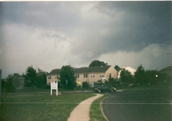
May 31, 2006, there was a severe thunderstorm watch for here, I was alone with my best friend. I can't really think of the time, but a storm was rolling in around 3pm. The sky was black in the west, with a wall of lightning. The power went out just before it hit, and just before the tornado warning was issued so we had no warning.
When it rolled it, it turned to night outside, and the rain just started pouring. Lightning ever second, the thunder was so loud we had to plug our ears. The winds started to pick up, gusts at least 50-60 mph outside. Then the hail started, dime to nickel size falling very fast, and covering the ground like snow.
The lightning continued, and one bolt hit a pole about 50 feet from my house, everything shook and we decided to move to the basement just to be safe. The storm in all lasted about 30 minutes, maybe more. The power was out all across Waterloo, almost 90,000 people in the dark. There was some tree and window damaging in a few areas.
Also, a funnel cloud came down 200 feet off the ground over west Waterloo and hung for about 5 minutes.
TORNADO WARNING
ISSUED BY ENVIRONMENT CANADA
AT 3:09 PM EDT WEDNESDAY 31 MAY 2006.
---------------------------------------------------------------------
TORNADO WARNING FOR:
=NEW= KITCHENER - CAMBRIDGE - REGION OF WATERLOO
=NEW= GUELPH - ERIN - SOUTHERN WELLINGTON COUNTY.
---------------------------------------------------------------------
==DISCUSSION==
RADAR AND SEVERE WEATHER WATCHER REPORTED A SEVERE THUNDER STORM
ABOUT 20 KILOMETRES WEST OF KITCHENER. THIS THUNDERSTORM IS MOVING
EASTWARD ABOUT 20 KM/H AND IS CAPABLE OF PRODUCING TORNADOES.
Kitchener is a city directly below Waterloo. The Twin Cities, Kitchener-Waterloo.
The last one I was in was one of the worst storms I have ever experienced.
May 31, 2006, there was a severe thunderstorm watch for here, I was alone with my best friend. I can't really think of the time, but a storm was rolling in around 3pm. The sky was black in the west, with a wall of lightning. The power went out just before it hit, and just before the tornado warning was issued so we had no warning.
When it rolled it, it turned to night outside, and the rain just started pouring. Lightning ever second, the thunder was so loud we had to plug our ears. The winds started to pick up, gusts at least 50-60 mph outside. Then the hail started, dime to nickel size falling very fast, and covering the ground like snow.
The lightning continued, and one bolt hit a pole about 50 feet from my house, everything shook and we decided to move to the basement just to be safe. The storm in all lasted about 30 minutes, maybe more. The power was out all across Waterloo, almost 90,000 people in the dark. There was some tree and window damaging in a few areas.
Also, a funnel cloud came down 200 feet off the ground over west Waterloo and hung for about 5 minutes.
TORNADO WARNING
ISSUED BY ENVIRONMENT CANADA
AT 3:09 PM EDT WEDNESDAY 31 MAY 2006.
---------------------------------------------------------------------
TORNADO WARNING FOR:
=NEW= KITCHENER - CAMBRIDGE - REGION OF WATERLOO
=NEW= GUELPH - ERIN - SOUTHERN WELLINGTON COUNTY.
---------------------------------------------------------------------
==DISCUSSION==
RADAR AND SEVERE WEATHER WATCHER REPORTED A SEVERE THUNDER STORM
ABOUT 20 KILOMETRES WEST OF KITCHENER. THIS THUNDERSTORM IS MOVING
EASTWARD ABOUT 20 KM/H AND IS CAPABLE OF PRODUCING TORNADOES.
Kitchener is a city directly below Waterloo. The Twin Cities, Kitchener-Waterloo.
0 likes
Return to “USA & Caribbean Weather”
Who is online
Users browsing this forum: No registered users and 129 guests