From the NHC on August 29, 2005
AT 10 AM CDT...1500Z...THE CENTER OF HURRICANE KATRINA WAS LOCATED
NEAR LATITUDE 30.2 NORTH... LONGITUDE 89.6 WEST. THIS POSITION IS
NEAR THE MOUTH OF THE PEARL RIVER...ABOUT 35 MILES EAST-NORTHEAST
OF NEW ORLEANS LOUISIANA AND ABOUT 45 MILES WEST-SOUTHWEST OF
BILOXI MISSISSIPPI.
KATRINA IS MOVING TOWARD THE NORTH NEAR 16 MPH...AND THIS GENERAL
MOTION IS EXPECTED TO CONTINUE TODAY AND TONIGHT. ON THIS TRACK
THE CENTER WILL MOVE OVER SOUTHERN MISSISSIPPI TODAY AND INTO
CENTRAL MISSISSIPPI THIS EVENING.
MAXIMUM SUSTAINED WINDS ARE NEAR 125 MPH...WITH HIGHER GUSTS.
KATRINA IS NOW A CATEGORY THREE HURRICANE ON THE SAFFIR-SIMPSON
SCALE.
AT NOON CDT...1700Z...THE CENTER OF HURRICANE KATRINA WAS LOCATED
NEAR LATITUDE 30.8 NORTH... LONGITUDE 89.6 WEST OR ABOUT 40 MILES
SOUTH-SOUTHWEST OF HATTIESBURG MISSISSIPPI.
KATRINA IS MOVING TOWARD THE NORTH NEAR 17 MPH...AND THIS GENERAL
MOTION IS EXPECTED TO CONTINUE TODAY AND TONIGHT. ON THIS TRACK
THE CENTER WILL CONTINUE MOVING OVER SOUTHERN MISSISSIPPI TODAY AND
INTO CENTRAL MISSISSIPPI THIS EVENING AND TONIGHT.
MAXIMUM SUSTAINED WINDS HAVE DECREASED TO NEAR 105 MPH...WITH HIGHER
GUSTS. KATRINA IS NOW A CATEGORY TWO HURRICANE ON THE
SAFFIR-SIMPSON SCALE.
AT 2 PM CDT...1900Z...THE CENTER OF HURRICANE KATRINA WAS LOCATED
NEAR LATITUDE 31.4 NORTH... LONGITUDE 89.6 WEST OR ABOUT 20 MILES
WEST-SOUTHWEST OF HATTIESBURG MISSISSIPPI.
KATRINA IS MOVING TOWARD THE NORTH NEAR 18 MPH...AND THIS GENERAL
MOTION IS EXPECTED TO CONTINUE TODAY AND TONIGHT. ON THIS TRACK
THE CENTER WILL CONTINUE MOVING OVER SOUTHERN MISSISSIPPI TODAY AND
INTO CENTRAL MISSISSIPPI THIS EVENING AND TONIGHT.
MAXIMUM SUSTAINED WINDS HAVE DECREASED TO NEAR 95 MPH...WITH HIGHER
GUSTS. KATRINA IS NOW A CATEGORY ONE HURRICANE ON THE
SAFFIR-SIMPSON SCALE.
AT 4 PM CDT...2100Z...THE CENTER OF HURRICANE KATRINA WAS LOCATED
NEAR LATITUDE 31.9 NORTH... LONGITUDE 89.6 WEST OR ABOUT 30 MILES
NORTHWEST OF LAUREL MISSISSIPPI.
KATRINA IS MOVING TOWARD THE NORTH NEAR 18 MPH...AND A GRADUAL TURN
TO THE NORTH-NORTHEAST WITH AN ADDITIONAL INCREASE IN FORWARD SPEED
IS EXPECTED DURING THE NEXT 24 HOURS. ON THIS TRACK THE CENTER
WILL BE MOVING OVER CENTRAL AND NORTHERN MISSISSIPPI TONIGHT AND
INTO WESTERN TENNESSEE ON TUESDAY.
MAXIMUM SUSTAINED WINDS ARE NEAR 75 MPH...WITH HIGHER GUSTS.
KATRINA IS A CATEGORY ONE HURRICANE ON THE SAFFIR-SIMPSON SCALE.
Between 2pm and 4pm all hell broke lose at my house. Being in the eyewall was an experience I don't want to have again. That's when one heard trees snapping and crashing to the ground, the constant roar of the winds, debris flying everywhere, and my house popping, groaning, creaking, and vibrating so bad that I thought it was going to come off of it's foundation. That's also the time at which my bed became a waterbed

I looked at the map you guys were discussing (
http://myweb.cableone.net/nolasue/KatrinaWinds2.gif ) If I am reading the map correctly, I find it hard to believe that cat 3 winds would stop on the shorelines south of the Buras area and not continue across, then pick back up just offshore to the north and east of the land mass.
Also, according to the map, cat 3 winds stop just before moving inland on the Mississippi coast. According to the NHC advisories, Katrina was a 125 mph cat 3 at the mouth of the Pearl River. (For those unfamiliar with the area, the Pearl River is the border between LA and MS through Washington Parish, LA/Pearl River Co. MS and St. Tammany Parish LA/Hancock Co., MS.) According to the map being discussed, we're supposed to believe that she switched her winds off just before moving ashore? I find that to be quite questionable, especially considering that the NHC says she was at least 125 mph at MS landfall and even cat 2 40 miles south of Hattiesburg. ( here's a map of MS
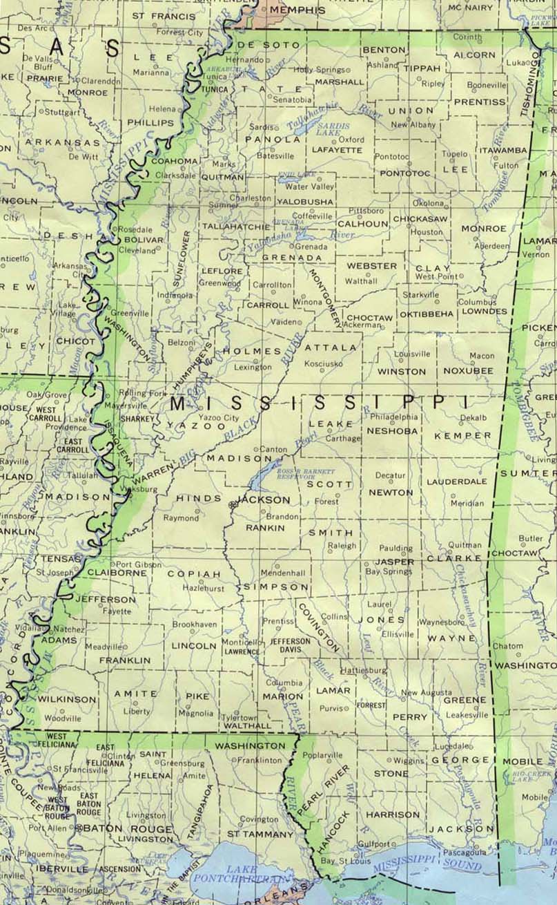
http://www.lib.utexas.edu/maps/united_s ... ppi_90.jpg I'm in Covington Co. and I can assure you, it was quite windy here)
To touch on the saffir simpson scale for a moment,
http://www.nhc.noaa.gov/aboutsshs.shtml I found it interesting to read that not until cat 3 did the scale mention trees being stripped of foilage. Well, folks, you should have seen the trees here...errrr the ones left standing. They were bare of foilage. Does that mean I think Katrina was still a 3 in my area? Nah, but she sure packed a whollop. I can't recall seeing that many trees down and the ones left standing bare. It looked like the middle of winter with the bare trees. Weird thing was, the evergreens were even bare. There were also numerous trees stripped of their bark!
While it's easy to argue and say she was this or she was that, the bottom line is that she was nothing short of the worst natural disaster this area has ever seen...be it that she was a 5 or a tropical depression. It will take YEARS for the area along the coast and WELL inland to fully recover from the destruction. Arguing at what cat she came in will do nothing to help those who lost everything. And like someone else mentioned. unless you've been through it yourself, lived it daily, you have no clue what it's like.


