Tropical Depression Bud (03E) in EPAC
Moderator: S2k Moderators
Forum rules

The posts in this forum are NOT official forecasts and should not be used as such. They are just the opinion of the poster and may or may not be backed by sound meteorological data. They are NOT endorsed by any professional institution or STORM2K. For official information, please refer to products from the National Hurricane Center and National Weather Service.
-
Jim Cantore
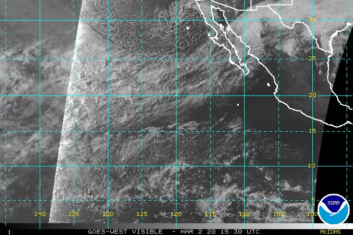
Nice healthy young storm too
already got a well defined eye
http://www.ssd.noaa.gov/goes/west/epac/vis-l.jpg
already got a well defined eye
http://www.ssd.noaa.gov/goes/west/epac/vis-l.jpg
0 likes
-
fasterdisaster
- Category 5

- Posts: 1868
- Joined: Mon Sep 19, 2005 4:41 pm
- Location: Miami, Florida
-
Matt-hurricanewatcher
-
Epsilon_Fan

- Category 1

- Posts: 353
- Joined: Fri Jan 13, 2006 1:03 pm
- Location: Charleston, SC
-
SouthFloridawx

- S2K Supporter

- Posts: 8346
- Age: 47
- Joined: Tue Jul 26, 2005 1:16 am
- Location: Sarasota, FL
- Contact:
-
Matt-hurricanewatcher
-
Jim Cantore
Matt-hurricanewatcher wrote:Wait 6 more hours...I expect the eye to clear with a soild ring of convection around it...It could even more some darker colars=higher clouds. I'm forecasting 12 hours from now this will be a major now.
I agree, this is intensifying at a good rate and continues in my mind to look healthier by the hour.
0 likes

fasterdisaster wrote:This thing looking ugly in the convection department.
You aren't going to get very deep convection to persist all the time. The warming cloud tops are only indicate that the rapid intensification cycle is coming to an end. The overal structure of the hurricane continues to slowly improve.
0 likes
-
Air Force Met
- Military Met

- Posts: 4372
- Age: 56
- Joined: Tue Jul 08, 2003 9:30 am
- Location: Roan Mountain, TN
Matt-hurricanewatcher wrote:Not really...The eye wall is 90 percent closed with moderate convection. I expect it to close off, and the eye to clear out over the next 12 hours.
100 knots with in 12 hours...
I think what they meant is that the tops are not that cold. IR temps earlier this afternoon were running around -80C...now they are in the -50C range.
One reason is the heat content in that area is not that high.
Organization looks good...but the convection itself is pretty weak...-50C over the tropics means tops are only 35-40,000 feet. That ain't so special.
0 likes
-
Jim Cantore
Air Force Met wrote:Matt-hurricanewatcher wrote:Not really...The eye wall is 90 percent closed with moderate convection. I expect it to close off, and the eye to clear out over the next 12 hours.
100 knots with in 12 hours...
I think what they meant is that the tops are not that cold. IR temps earlier this afternoon were running around -80C...now they are in the -50C range.
One reason is the heat content in that area is not that high.
Organization looks good...but the convection itself is pretty weak...-50C over the tropics means tops are only 35-40,000 feet. That ain't so special.
It aint no Wilma
0 likes

Thunder44 wrote:fasterdisaster wrote:This thing looking ugly in the convection department.
You aren't going to get very deep convection to persist all the time. The warming cloud tops are only indicate that the rapid intensification cycle is coming to an end. The overall structure of the hurricane continues to slowly improve.
Did you know that the cloud tops warmed before Bud started rapidly intensifying? That's means you can't be right.
0 likes
-
cycloneye

- Admin

- Posts: 148746
- Age: 69
- Joined: Thu Oct 10, 2002 10:54 am
- Location: San Juan, Puerto Rico
0 likes
Visit the Caribbean-Central America Weather Thread where you can find at first post web cams,radars
and observations from Caribbean basin members Click Here
and observations from Caribbean basin members Click Here

-
AnnularCane

- S2K Supporter
- Posts: 2949
- Joined: Thu Jun 08, 2006 9:18 am
- Location: Wytheville, VA
-
HurricaneHunter914
- Category 5
- Posts: 4439
- Age: 32
- Joined: Fri Mar 10, 2006 7:36 pm
- Location: College Station, TX
Now expected to become a 115 mph MAJOR HURRICANE! 
0 likes
Personal Forecast Disclaimer:
The posts in this forum are NOT official forecast and should not be used as such. They are just the opinion of the poster and may or may not be backed by sound meteorological data. They are NOT endorsed by any professional institution or storm2k.org. For official information, please refer to the NHC and NWS products.
The posts in this forum are NOT official forecast and should not be used as such. They are just the opinion of the poster and may or may not be backed by sound meteorological data. They are NOT endorsed by any professional institution or storm2k.org. For official information, please refer to the NHC and NWS products.
WTPZ23 KNHC 120217
TCMEP3
HURRICANE BUD FORECAST/ADVISORY NUMBER 6
NWS TPC/NATIONAL HURRICANE CENTER MIAMI FL EP032006
0300 UTC WED JUL 12 2006
HURRICANE CENTER LOCATED NEAR 14.6N 114.1W AT 12/0300Z
POSITION ACCURATE WITHIN 20 NM
PRESENT MOVEMENT TOWARD THE WEST-NORTHWEST OR 290 DEGREES AT 10 KT
ESTIMATED MINIMUM CENTRAL PRESSURE 975 MB
MAX SUSTAINED WINDS 80 KT WITH GUSTS TO 100 KT.
64 KT....... 15NE 15SE 15SW 15NW.
50 KT....... 40NE 40SE 40SW 40NW.
34 KT....... 80NE 80SE 80SW 80NW.
12 FT SEAS..180NE 180SE 90SW 90NW.
WINDS AND SEAS VARY GREATLY IN EACH QUADRANT. RADII IN NAUTICAL
MILES ARE THE LARGEST RADII EXPECTED ANYWHERE IN THAT QUADRANT.
REPEAT...CENTER LOCATED NEAR 14.6N 114.1W AT 12/0300Z
AT 12/0000Z CENTER WAS LOCATED NEAR 14.4N 113.6W
FORECAST VALID 12/1200Z 15.2N 115.6W
MAX WIND 90 KT...GUSTS 110 KT.
64 KT... 20NE 20SE 20SW 20NW.
50 KT... 40NE 40SE 40SW 40NW.
34 KT... 90NE 90SE 90SW 90NW.
FORECAST VALID 13/0000Z 16.0N 117.7W
MAX WIND 100 KT...GUSTS 120 KT.
64 KT... 25NE 25SE 25SW 25NW.
50 KT... 50NE 50SE 50SW 50NW.
34 KT...100NE 100SE 100SW 100NW.
FORECAST VALID 13/1200Z 16.8N 120.0W
MAX WIND 100 KT...GUSTS 120 KT.
64 KT... 25NE 25SE 25SW 25NW.
50 KT... 50NE 50SE 50SW 50NW.
34 KT...100NE 100SE 100SW 100NW.
FORECAST VALID 14/0000Z 17.3N 122.3W
MAX WIND 95 KT...GUSTS 115 KT.
50 KT... 45NE 40SE 40SW 45NW.
34 KT... 90NE 80SE 80SW 90NW.
FORECAST VALID 15/0000Z 17.5N 126.0W
MAX WIND 80 KT...GUSTS 100 KT.
50 KT... 40NE 30SE 30SW 40NW.
34 KT... 75NE 60SE 60SW 75NW.
EXTENDED OUTLOOK. NOTE...ERRORS FOR TRACK HAVE AVERAGED NEAR 200 NM
ON DAY 4 AND 225 NM ON DAY 5...AND FOR INTENSITY NEAR 20 KT EACH DAY
OUTLOOK VALID 16/0000Z 17.5N 130.0W
MAX WIND 65 KT...GUSTS 80 KT.
OUTLOOK VALID 17/0000Z 17.5N 134.0W
MAX WIND 50 KT...GUSTS 60 KT.
REQUEST FOR 3 HOURLY SHIP REPORTS WITHIN 300 MILES OF 14.6N 114.1W
NEXT ADVISORY AT 12/0900Z
$$
FORECASTER RHOME/STEWART
-----------------------------------------------------------------------------------------------
WTPZ43 KNHC 120217
TCDEP3
HURRICANE BUD DISCUSSION NUMBER 6
NWS TPC/NATIONAL HURRICANE CENTER MIAMI FL EP032006
800 PM PDT TUE JUL 11 2006
SATELLITE IMAGERY FROM THIS EVENING INDICATES THAT BUD HAS BEEN
UNDERGOING RAPID INTENSIFICATION WITH AN EYE FEATURE FIRST PEAKING
THROUGH THE CIRRUS CANOPY AROUND 2030 UTC AND THEN BECOMING CLEARLY
DEFINED BY 2230 UTC. LATEST DVORAK CLASSIFICATIONS ARE AN
IMPRESSIVE T4.5...77 KT...FROM SAB AND AFWA...AND T5.0...90 KT...
FROM TAFB. THE CURRENT INTENSITY OF 80 KT IS A COMPROMISE OF THESE
ESTIMATES BUT CLOSER TO THE LOWER END OF THE SPECTRUM UNDER THE
ASSUMPTION THAT THE WINDS ARE LAGGING THE SATELLITE SIGNATURE.
WITH THE VERTICAL SHEAR EXPECTED TO BE LOW AND THE SST SUFFICIENTLY
HIGH...THE OFFICIAL FORECAST CALLS FOR INTENSIFICATION TO CONTINUE
THROUGH 24-36 HOURS. THEREAFTER...BUD IS FORECAST TO MOVE INTO
COOLER WATERS RESULTING IN GRADUAL WEAKENING. THE OFFICIAL
INTENSITY FORECAST IS IN GOOD AGREEMENT WITH THE SHIPS MODEL
THROUGH 48 HOURS BUT CALLS FOR SLOWER WEAKENING THEREAFTER.
THE INITIAL MOTION ESTIMATE IS 290/10...ESSENTIALLY RIGHT ON THE
PREVIOUS FORECAST TRACK. GLOBAL MODELS OFFER SOME INTERESTING
SOLUTIONS RANGING FROM THE GFS WHICH SHOWS BUD MOVING
WEST-SOUTHWESTWARD AND INTERACTING WITH AN ITCZ DISTURBANCE TO ITS
WEST...TO THE NOGAPS AND CANADIAN MODELS WHICH PLOW BUD RIGHT INTO
THE MID-LEVEL SUBTROPICAL RIDGE EXTENDING EAST/WEST ACROSS THE
PACIFIC. THE OFFICIAL FORECAST ASSUMES THAT THE SUBTROPICAL RIDGE
WILL REMAIN IN PLACE AND SUFFICIENTLY STRONG TO PRODUCE A GENERAL
WEST-NORTHWEST MOTION THROUGH 36 HOURS. THEREAFTER...WEAKENING IS
EXPECTED WITH A TURN TOWARDS THE WEST BEGINNING BY 48 HOURS. THE
OFFICIAL FORECAST REPRESENTS ONLY A SLIGHT NORTHWARD ADJUSTMENT
FROM THE PREVIOUS FORECAST TRACK.
FORECAST POSITIONS AND MAX WINDS
INITIAL 12/0300Z 14.6N 114.1W 80 KT
12HR VT 12/1200Z 15.2N 115.6W 90 KT
24HR VT 13/0000Z 16.0N 117.7W 100 KT
36HR VT 13/1200Z 16.8N 120.0W 100 KT
48HR VT 14/0000Z 17.3N 122.3W 95 KT
72HR VT 15/0000Z 17.5N 126.0W 80 KT
96HR VT 16/0000Z 17.5N 130.0W 65 KT
120HR VT 17/0000Z 17.5N 134.0W 50 KT
$$
FORECASTER RHOME/STEWART
0 likes

Who is online
Users browsing this forum: Hurricanehink and 56 guests