937
WTPA41 PHFO 260232
TCDCP1
TROPICAL DEPRESSION DANIEL DISCUSSION NUMBER 37
NWS CENTRAL PACIFIC HURRICANE CENTER HONOLULU HI EP052006
500 PM HST TUE JUL 25 2006
DANIEL HAS CHANGED LITTLE IN APPEARANCE ON VISIBLE SATELLITE IMAGERY
OVER THE PAST 6 HOURS. THE LOW LEVEL CIRCULATION CENTER REMAINS
EXPOSED AND WELL DEFINED. THE 0000 UTC FIXES FROM ALL AGENCIES WERE
ALL VERY CLOSE. DANIEL HAS MOVED WEST AT ABOUT 3 KT OVER THE PAST 6
HOURS.
DANIEL REMAINS RATHER WEAK. INFRARED IMAGERY SHOWS NO ACTIVE
CONVECTION NEAR THE CENTER MAKING IT IMPOSSIBLE TO DETERMINE A DATA
T-NUMBER USING THE DVORAK TECHNIQUE. FIXES AT 0000 UTC RANGED FROM
2.0 TO 3.0. WITH NO DEEP CONVECTION AND RELATIVELY DRY AIR
SURROUNDING THE STORM...DANIEL SHOULD CONTINUE TO WEAKEN.
SINCE DANIEL WILL BE A SHALLOW SYSTEM FROM NOW ON...IT WILL BE
INCREASINGLY STEERED BY THE LOWER LEVEL FLOW. AN UNUSUALLY STRONG
1032 MB HIGH CENTERED NEAR 40N 148W IS FORECAST TO MOVE WEST AND
STRENGTHEN A BIT MORE. DANIEL SHOULD GET PICKED UP BY THE LOW LEVEL
EAST SOUTHEAST FLOW AND GRADUALLY ACCELERATE TOWARDS THE WEST
NORTHWEST. THE MODELS ALL SHOW DANIEL FOLLOWING A WEST NORTHWEST
TRACK. FOR OUR FORECAST TRACK WE HAVE COMPROMISED BETWEEN THE
GFS...WHICH HAS BEEN PERFORMING WELL OVER THE PAST 24 HOURS...AND
CONSENSUS...WITH NO CHANGE FROM OUR PREVIOUS TRACK.
DANIEL IS CURRENTLY OVER 25 DEGREE CELSIUS SEA SURFACE
TEMPERATURES...AND IS FORECAST TO MOVE OVER 26 DEGREE CELSIUS SEA
SURFACE TEMPERATURES NEAR THE HAWAIIAN ISLANDS. THE SHIPS MODEL
SHOWS DANIEL RE-INTENSIFYING OVER THE WARMER WATER AT DAYS 4 AND
5...BUT WITH NO DEEP CONVECTION REMAINING...RE-INTENSIFICATION IS
NOT LIKELY. DANIEL IS LIKELY TO CONTINUE WEAKENING OVER THE NEXT 5
DAYS. ALTHOUGH THE CIRCULATION WILL BE WEAK...THE PRESSURE GRADIENT
BETWEEN DANIEL AND THE STRONG HIGH TO THE NORTH WILL KEEP THE WINDS
ON THE NORTH SIDE OF THE SYSTEM A BIT STRONGER THAN WOULD OTHERWISE
BE EXPECTED.
THERE WILL STILL BE A SHALLOW AREA OF VERY MOIST AIR ASSOCIATED WITH
DANIEL FOR THE NEXT FEW DAYS BUT THE MODELS SHOW NO STRONG DYNAMICS
TO LIFT THE MOISTURE. THAT WILL LIMIT THE THREAT OF EXCESSIVE
RAINFALL ALONG DANIEL/S TRACK.
FORECAST POSITIONS AND MAX WINDS
INITIAL 26/0300Z 16.2N 143.1W 30 KT
12HR VT 26/1200Z 16.3N 143.8W 30 KT
24HR VT 27/0000Z 16.7N 145.3W 25 KT
36HR VT 27/1200Z 17.1N 147.6W 25 KT
48HR VT 28/0000Z 17.7N 150.5W 25 KT...DISSIPATING
72HR VT 29/0000Z 19.1N 156.4W 25 KT...DISSIPATING
96HR VT 30/0000Z 20.8N 162.6W 25 KT...REMNANT LOW
120HR VT 31/0000Z 22.0N 169.0W 25 KT...REMNANT LOW
$$
FORECASTER KODAMA/DONALDSON
Tropical Depression Daniel (05E) in CPAC
Moderator: S2k Moderators
Forum rules

The posts in this forum are NOT official forecasts and should not be used as such. They are just the opinion of the poster and may or may not be backed by sound meteorological data. They are NOT endorsed by any professional institution or STORM2K. For official information, please refer to products from the National Hurricane Center and National Weather Service.
-
cycloneye

- Admin

- Posts: 148746
- Age: 69
- Joined: Thu Oct 10, 2002 10:54 am
- Location: San Juan, Puerto Rico
0 likes
Visit the Caribbean-Central America Weather Thread where you can find at first post web cams,radars
and observations from Caribbean basin members Click Here
and observations from Caribbean basin members Click Here
-
Mike Doran
Kevin (can I call you by your first name),
It is true that I have been called Methane Mike. It certainly is a good joke. But methane hydrates, the cause of interest for me and cause of my nickname, I suspect, are going to be no laughing matter to Californians, or to Floridians or those who were hammered by Katrina and Rita, as the profound conductivity meaning of this ice is appreciated. Out here in California, we are having trouble getting our air conditioners to be all powered. My swimming pool is 88 degF. Think about that for a second.
But getting back to my point. The science I am discussing here is not worthy of publication. It is high school level. So I will slow it down for you. Slow it way down, mathwise, anyway.
http://hyperphysics.phy-astr.gsu.edu/hb ... ac.html#c1
Take a look at this page where it is talking about the voltage of a capaciter. V=Q/C--it is a simple equation. C=>capacitance.
Check out this link where capacitance is further defined:
http://en.wikipedia.org/wiki/Capacitance
What I am saying is that as 'C' goes to zero than the voltage goes to infinity. That provides the potential difference for lightning near the disorganizing storm and boy did we have lightning.
There were all the things I have described and a sort of recharging, too, and then there are 'twin' storms in the GOM and GOC right now as I write.
You know, nothing I have written about just the electrics inside hurricanes is particularly novel or profound. Consistent with this, Burke et al. [1992] has reported the detection of keV electrons and large electric field transients above a hurricane. These various observations all suggest that what is occurring at great depths in the ocean may couple to the ionosphere. The coupling mechanisms was said by them not to be well understood, but it seems probable that "capacitive coupling" through the displacement current may drive conduction currents within the ionosphere [Hale and Baginski, 1987]. What is novel or profound is to talk about decarbonation as having a CONDUCTIVITY meaning (which it does) and is shown easily by small scale experiment you can perform with a beer and a voltmeter, and that decarbonation has been shown to go along with tropical storms by Bates et al Nature [1999] respecting a study of Hurricane Felix. I am also pointing out that the electrics have profound cloud microphysics meaning.
So anyway, all I am doing here is verifying something. A storm becomes disorganized and there are a lot of strikes. That is the essence of science. You can call it whatever you want, but as Joe Bastardi recently said to Mike Watkins, "arm yourself with knowledge . . ."
0 likes
-
Derek Ortt
-
Mike Doran


Derek Ortt wrote:yes, at home I still use dial-up
but when there is something important, I go into the office and just run GARP for any loops
How can you use the Internet with Dial-up when you know how much faster your "home" work would be instead of going to the office every time you do very heavy Internet use? I would switch right away even though it costs more.
0 likes
-
Mike Doran
-
cycloneye
- Admin
- Posts: 148746
- Age: 69
- Joined: Thu Oct 10, 2002 10:54 am
- Location: San Juan, Puerto Rico
183
WTPA31 PHFO 262046
TCPCP1
BULLETIN
TROPICAL DEPRESSION DANIEL ADVISORY NUMBER 40
NWS CENTRAL PACIFIC HURRICANE CENTER HONOLULU HI EP052006
1100 AM HST WED JUL 26 2006
TROPICAL DEPRESSION DANIEL IS DISSIPATING INTO A REMNANT LOW FAR
EAST SOUTHEAST OF THE ISLANDS.
FOR STORM INFORMATION SPECIFIC TO YOUR AREA...INCLUDING POSSIBLE
INLAND WATCHES AND WARNINGS...PLEASE MONITOR PRODUCTS ISSUED BY
YOUR LOCAL WEATHER OFFICE.
AT 1100 AM HST...2100Z...THE CENTER OF TROPICAL DEPRESSION DANIEL
WAS LOCATED NEAR LATITUDE 16.1 NORTH...LONGITUDE 144.1 WEST OR
ABOUT 765 MILES...EAST-SOUTHEAST OF HILO...HAWAII AND ABOUT 970
MILES...EAST-SOUTHEAST OF HONOLULU...OAHU.
THE DEPRESSION IS MOVING TOWARD THE WEST NEAR 12 MPH
MAXIMUM SUSTAINED WINDS ARE NEAR 35 MPH...WITH HIGHER GUSTS.
LITTLE CHANGE IN STRENGTH IS FORECAST DURING THE NEXT 24 HOURS.
ESTIMATED MINIMUM CENTRAL PRESSURE IS 1009 MB...29.80 INCHES.
REPEATING THE 1100 AM HST POSITION...16.1 N...144.1 W. MOVEMENT
TOWARD...WEST NEAR 12 MPH. MAXIMUM SUSTAINED WINDS...35 MPH.
MINIMUM CENTRAL PRESSURE...1009 MB.
THIS THE FINAL PUBLIC ADVISORY ON DANIEL BY THE CENTRAL PACIFIC
HURRICANE CENTER.
$$
FORECASTER MATSUDA
Almost was a cat 5 as it got to 150 mph.Now until 2012.
0 likes
Visit the Caribbean-Central America Weather Thread where you can find at first post web cams,radars
and observations from Caribbean basin members Click Here
and observations from Caribbean basin members Click Here


 buh-bye, don't let the door hit ya on your way to 2012!

Danny is back....
Code: Select all
644
WHXX01 KMIA 271447
CHGE77

 DISCLAIMER...NUMERICAL MODELS ARE SUBJECT TO LARGE ERRORS.
 PLEASE REFER TO TPC/NHC OFFICIAL FORECASTS FOR TROPICAL CYCLONES.

  NATIONAL HURRICANE CENTER CENTRAL PACIFIC OBJECTIVE AIDS FOR

  DISTURBANCE     DANIEL (EP052006) ON 20060727  1200 UTC

          ...00 HRS...   ...12 HRS...   ...24 HRS...   ...36 HRS...
          060727  1200   060728  0000   060728  1200   060729  0000

           LAT    LON     LAT    LON     LAT    LON     LAT    LON
  BAMD    16.9N 146.6W   17.4N 148.4W   18.0N 150.6W   18.7N 153.0W
  BAMM    16.9N 146.6W   17.5N 148.5W   18.1N 150.9W   18.8N 153.4W
  LBAR    16.9N 146.6W   17.3N 148.4W   18.1N 150.7W   19.1N 153.4W
  SHIP        25KTS          23KTS          23KTS          26KTS
  DSHP        25KTS          23KTS          23KTS          26KTS

          ...48 HRS...   ...72 HRS...   ...96 HRS...   ..120 HRS...
          060729  1200   060730  1200   060731  1200   060801  1200

           LAT    LON     LAT    LON     LAT    LON     LAT    LON
  BAMD    19.0N 155.4W   18.2N 160.1W   16.2N 163.6W   15.8N 163.3W
  BAMM    19.2N 156.0W   18.7N 161.2W   17.4N 165.4W   16.8N 167.5W
  LBAR    20.0N 155.9W   20.1N 160.1W   18.3N 161.4W   22.3N 163.7W
  SHIP        29KTS          38KTS          43KTS          42KTS
  DSHP        29KTS          37KTS          43KTS          42KTS

               ...INITIAL CONDITIONS...
  LATCUR =  16.9N LONCUR = 146.6W DIRCUR = 285DEG SPDCUR =  10KT
  LATM12 =  16.2N LONM12 = 144.4W DIRM12 = 278DEG SPDM12 =   7KT
  LATM24 =  16.1N LONM24 = 143.1W
  WNDCUR =   25KT RMAXWD =   25NM WNDM12 =   30KT
  CENPRS = 1010MB OUTPRS = 1012MB OUTRAD =   90NM SDEPTH =   M
  RD34NE =    0NM RD34SE =    0NM RD34SW =    0NM RD34NW =   0NM

 $$
0 likes
-
Coredesat
-
JonathanBelles
- Professional-Met

- Posts: 11430
- Age: 35
- Joined: Sat Dec 24, 2005 9:00 pm
- Location: School: Florida State University (Tallahassee, FL) Home: St. Petersburg, Florida
- Contact:
-
NYCHurr06
-
Coredesat
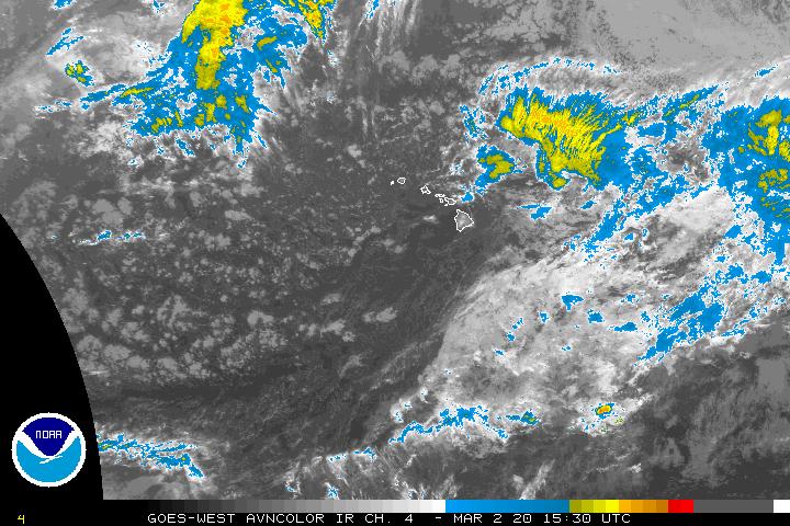
Now 30 kt according to NRL (it was previously 25 kt). Convection's trying to make a comeback:

http://www.ssd.noaa.gov/goes/west/cpac/avn.jpg
http://www.ssd.noaa.gov/goes/west/cpac/avn.jpg
0 likes
-
bombarderoazul
- Tropical Storm

- Posts: 186
- Joined: Tue Sep 20, 2005 4:12 pm
-
JonathanBelles
- Professional-Met
- Posts: 11430
- Age: 35
- Joined: Sat Dec 24, 2005 9:00 pm
- Location: School: Florida State University (Tallahassee, FL) Home: St. Petersburg, Florida
- Contact:
-
Coredesat

-
JonathanBelles
- Professional-Met
- Posts: 11430
- Age: 35
- Joined: Sat Dec 24, 2005 9:00 pm
- Location: School: Florida State University (Tallahassee, FL) Home: St. Petersburg, Florida
- Contact:
Who is online
Users browsing this forum: Hurricanehink and 107 guests