GOM System (Ex 95L)
Moderator: S2k Moderators
Forum rules

The posts in this forum are NOT official forecasts and should not be used as such. They are just the opinion of the poster and may or may not be backed by sound meteorological data. They are NOT endorsed by any professional institution or STORM2K. For official information, please refer to products from the National Hurricane Center and National Weather Service.


Pooficane
Earlier I said this thing may not be a blob; it's a deb, since it could develop into Debbicane Debby. Now it looks like a poof instead, because that's what it's going to go. Poof. So call this one Pooficane Poofy.
0 likes
-
Stormcenter
- S2K Supporter

- Posts: 6687
- Joined: Wed Sep 03, 2003 11:27 am
- Location: Houston, TX
Re: Pooficane
jimvb wrote:Earlier I said this thing may not be a blob; it's a deb, since it could develop into Debbicane Debby. Now it looks like a poof instead, because that's what it's going to go. Poof. So call this one Pooficane Poofy.
Don't put it in it's grave just yet. Let's see what happens later tonight and early tomorrow.
0 likes
-
Stormcenter
- S2K Supporter
- Posts: 6687
- Joined: Wed Sep 03, 2003 11:27 am
- Location: Houston, TX
It will be very interesting to see what happens when this hits the GOM later tomorrow morning. Does anyone remember Danny?
http://www.ssd.noaa.gov/goes/east/gmex/loop-avn.html
http://www.ssd.noaa.gov/goes/east/gmex/loop-avn.html
0 likes

-
Grease Monkey

- Category 2

- Posts: 727
- Joined: Fri Jun 09, 2006 9:25 pm
-
Stormcenter
- S2K Supporter
- Posts: 6687
- Joined: Wed Sep 03, 2003 11:27 am
- Location: Houston, TX
CronkPSU wrote:wow, that is incredible how it just disappears...good find stormcenter, really looked good there for a long time... but Derek nailed it again on this "system"
The NHC still seems to think the potential is still there but like the season so far I wouldn't bet on it. Though I would not be surprised to see a flare up again in the same general area.
0 likes
-
Yankeegirl

- Category 5

- Posts: 3417
- Age: 49
- Joined: Sun May 23, 2004 11:59 pm
- Location: Cy-Fair, Northwest Houston
- Contact:

-
rainstorm
Re: Pooficane
jimvb wrote:Earlier I said this thing may not be a blob; it's a deb, since it could develop into Debbicane Debby. Now it looks like a poof instead, because that's what it's going to go. Poof. So call this one Pooficane Poofy.
pooficane poofy? lol
0 likes

-
cycloneye

- Admin

- Posts: 148759
- Age: 69
- Joined: Thu Oct 10, 2002 10:54 am
- Location: San Juan, Puerto Rico
ABNT20 KNHC 160908
TWOAT
TROPICAL WEATHER OUTLOOK
NWS TPC/NATIONAL HURRICANE CENTER MIAMI FL
530 AM EDT WED AUG 16 2006
FOR THE NORTH ATLANTIC...CARIBBEAN SEA AND THE GULF OF MEXICO...
A WEAK AREA OF SURFACE LOW PRESSURE IS LOCATED A COUPLE OF HUNDRED
MILES SOUTHEAST OF THE NORTH CAROLINA COAST. SHOWER ACTIVITY
REMAINS MINIMAL WITH THIS SYSTEM...AND UPPER-LEVEL WINDS WILL
GRADUALLY BECOME LESS FAVORABLE FOR DEVELOPMENT OVER THE NEXT
COUPLE OF DAYS. HOWEVER...SOME POTENTIAL FOR DEVELOPMENT STILL
EXISTS TODAY AND AN AIR FORCE RESERVE RECONNAISSANCE AIRCRAFT WILL
BE AVAILABLE TO INVESTIGATE THE SYSTEM THIS AFTERNOON...IF
NECESSARY.
SHOWERS AND THUNDERSTORMS OVER THE NORTH-CENTRAL GULF OF MEXICO HAVE
DIMINISHED.
ELSEWHERE...TROPICAL STORM FORMATION IS NOT EXPECTED THROUGH
THURSDAY.
$$
FORECASTER FRANKLIN
5:30 TWO.Only a small sentence for 95L meaning=
0 likes
Visit the Caribbean-Central America Weather Thread where you can find at first post web cams,radars
and observations from Caribbean basin members Click Here
and observations from Caribbean basin members Click Here

There is still low surface pressure in the gulf it will be interesting to see what the afternoon heating brings.
http://www.ndbc.noaa.gov/station_page.php?station=42040
http://www.ndbc.noaa.gov/station_page.php?station=42040
0 likes
-
Stormavoider
- Category 2
- Posts: 671
- Joined: Sat Jul 01, 2006 4:37 pm
- Location: Spring Hill Fl.


-
ConvergenceZone
.gif)
- Category 5
- Posts: 5241
- Joined: Fri Jul 29, 2005 1:40 am
- Location: Northern California
kenl01 wrote:Looks like it's awfully quiet for mid August. We are rapidly heading for Aug.20th and we still don't have the 4th named storm nor the first hurricane yet. The 2006 season will be below average shortly, since at least 1 hurricane should have formed by now.
Yea, I'm telling ya, there's something abnormally quiet about this year. People bring up past year and late starts, but at least I remember a few of those years having far more convection....Other than the system off the Florida Coast, it looks absolutely DEAD out there, and we are going into the latter part of August. If the conditions look the same by September 1st, then forget it. Oh, we'll probably still get a storm or 2 in September, but nothing like were forecasting. Of course, that's a big IF, depending if any changes occur between now and September 1st
0 likes
ConvergenceZone wrote:kenl01 wrote:Looks like it's awfully quiet for mid August. We are rapidly heading for Aug.20th and we still don't have the 4th named storm nor the first hurricane yet. The 2006 season will be below average shortly, since at least 1 hurricane should have formed by now.
Yea, I'm telling ya, there's something abnormally quiet about this year. People bring up past year and late starts, but at least I remember a few of those years having far more convection....Other than the system off the Florida Coast, it looks absolutely DEAD out there, and we are going into the latter part of August. If the conditions look the same by September 1st, then forget it. Oh, we'll probably still get a storm or 2 in September, but nothing like were forecasting. Of course, that's a big IF, depending if any changes occur between now and September 1st
Agreed there !
0 likes

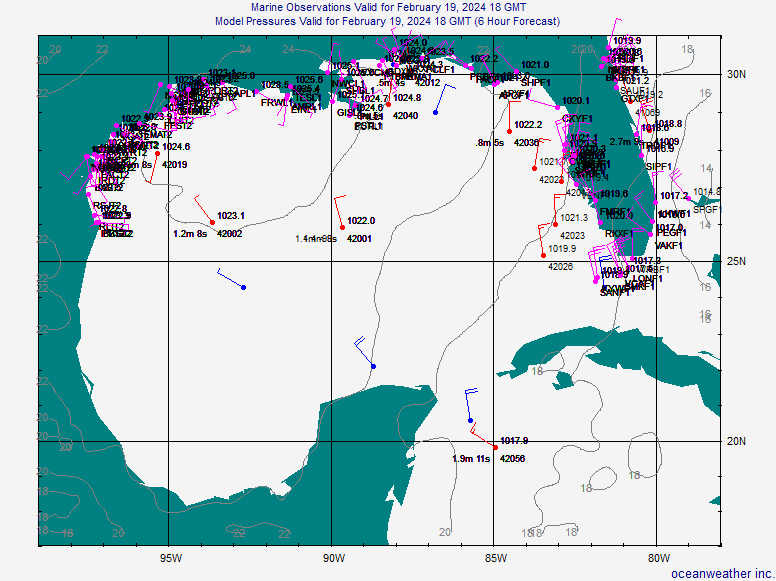
Take a look at this map
http://oceanweather.com/data/Gulf-of-Me ... ineM00.gif
Today the ULL and strong Northerly flow should keep anything from developing but if the broad low is still there tommorow it will have to be watched closely.
http://oceanweather.com/data/Gulf-of-Me ... ineM00.gif
Today the ULL and strong Northerly flow should keep anything from developing but if the broad low is still there tommorow it will have to be watched closely.
0 likes
Our dry Texas friends should like this AFD
AREA FORECAST DISCUSSION
NATIONAL WEATHER SERVICE NEW ORLEANS LA
404 AM CDT WED AUG 16 2006
.DISCUSSION...
ONLY COSMETIC CHANGES TO ONGOING PACKAGE THIS MORNING.
ANOTHER MCS COLD CORE FEATURE HAS MOVED OFFSHORE THIS MORNING. THE
FIRST OF THESE FROM YESTERDAY MORNING DEVELOPED AND FELL APART
OVER THE GULF DURING THE EVENING HOURS. THE PRE-EXISTING SFC CIRCULATION
CONTINUED TO MOVE SOUTHWARD AND AS MID AND HIGH LEVEL CLOUDINESS
CLEARED...VIOLA LOW LEVEL CLOUDS COULD THEN FORM CAUSING THE
SYSTEM TO EVOLVE INTO MORE OF A LOW LEVEL WARM CORE
SYSTEM...ALTHOUGH VERY SMALL. THIS WOULD BE THE FIRST OF TWO
CIRCULATIONS OVER THE GULF CENTERED AT ~25.2N 91.5W. IT IS ALSO
REACTING WITH SFC RIDGING OVER THE WESTERN GULF CAUSING PRESSURES
TO REAMIN QUITE HIGH.
THE SECOND IS MUCH LARGER AND BROADER AND IS A LITTLE HARDER TO
PICK OUT. IT IS ROUGHLY CENTERED SOMEWHERE AROUND 26.1N 85.9W
WHICH IS ALSO WHERE BUOY 42003 IS LOCATED OVER THE EAST CENTRAL
GULF. THIS BUOY HAS SHOWN A STEADY PRESSURE DROP FROM 0400Z TO
CURRENT TIME BUT IT HAS BEEN MODEST. THE BUOY IS SHOWING A
PRESSURE OF 1013.O MB AND DROPPED A MB OVER THE LAST 4 HRS.
USUALLY THE LARGER CIRCULATION WOULD DOMINATE AND BELIEVE IN THIS
CASE IT WILL SINCE THE FIRST IS MOVING INTO A REGION OF HIGH
PRESSURE AT THE SFC. NEVERTHELESS A LOT OF EYES WILL BE TRAINED ON
THE GULF FOR THE NEXT FEW DAYS.
A LARGE BLOCKING UPPER-MID LEVEL RIDGE CENTERED NEAR SHV TODAY AND
TOMORROW WILL CAUSE THE UPPER LOW OVER FLA TO TAKE A SLIGHT DETOUR
SOUTHWEST AS IT MOVES OVER THE GULF. THE SPACING BETWEEN THESE TWO
FEATURES WILL BECOME TIGHT ENOUGH TO INCREASE THE UPPER LEVEL
EASTERLY FLOW TO AROUND 35 KNOTS OVER THIS AREA. THIS TYPE OF
ENVIRONMENT IS NOT THE BEST FOR DEVELOPING TROPICAL SYSTEMS. BUT
THE WEST SIDE OF THE UPPER LOW IS SHOWING A MORE FAVORABLE
ENVIRONMENT FOR SOME DEVELOPMENT TODAY THROUGH TOMORROW. THE
SYNOPTIC MEAN FLOW OVER THE GULF SHOULD ALSO KEEP WHATEVER
DEVELOPS MOVING WESTWARD AND EVENTUALLY NW TOWARD THE CENTRAL OR UPPER
TX COAST. AS THE LOW OR OPEN WAVE?????? MOVES SLOWLY WEST IT WILL
BRING A NICE WALL OF DEEP TROPICAL MOISTURE THROUGH THE AREA EARLY
THURSDAY CAUSING TEMPS TO FALL BACK TO THE LOW TO MID 90S AND MORE
SH/TS TO BREAK OUT.
0 likes
I (we) were witness to a "poof" two weeks ago, when a strong tropical wave (behind what was left of Chris) approached South Florida. It caused very heavy rainfall (3 inches in 90 minutes) in this area, and, during that 90 minutes, it was easy to say we were encountering tropical storm conditions (including a total obscuration of the sky - not even one break), but, it just as quickly dissipated, and, two hours later, the sky at sunset was clear and calm, as if it had never happened...
Steve Lyons said it was due to very dry northeasterlies, which dissipated the wave, but, in my mind, it was not the normal, in a good sort of way, that's for sure...
Frank
Steve Lyons said it was due to very dry northeasterlies, which dissipated the wave, but, in my mind, it was not the normal, in a good sort of way, that's for sure...
Frank
0 likes
Who is online
Users browsing this forum: hurricanes1234 and 42 guests