gatorcane, I agree - look at these current temps in western Canada (in Celcius):
http://weatheroffice.ec.gc.ca/canada_e.html?Day=0
Models Showing a Deep system in Central Altantic!
Moderator: S2k Moderators
Forum rules

The posts in this forum are NOT official forecasts and should not be used as such. They are just the opinion of the poster and may or may not be backed by sound meteorological data. They are NOT endorsed by any professional institution or STORM2K. For official information, please refer to products from the National Hurricane Center and National Weather Service.
-
SouthFloridawx

- S2K Supporter

- Posts: 8346
- Age: 47
- Joined: Tue Jul 26, 2005 1:16 am
- Location: Sarasota, FL
- Contact:
CMC showing some possible potential down the road also.
http://moe.met.fsu.edu/cyclonephase/cmc ... 0/102.html
http://moe.met.fsu.edu/cyclonephase/cmc ... 0/102.html
0 likes
-
Hybridstorm_November2001

- S2K Supporter
- Posts: 2817
- Joined: Sat Aug 21, 2004 2:50 pm
- Location: SW New Brunswick, Canada
- Contact:
HURAKAN wrote:The way the season is going I won't be trusting much anything that says development, especially south of 10ºN.
We didn't even have our first hurricane form until September 1st in 2001, but we still ended the season with 15 named storms, 9 hurricanes & 4 major hurricanes:
http://weather.unisys.com/hurricane/atl ... index.html
0 likes
skysummit, my "had to be there" comment wasn't for you, or anyone who was affected by Katrina, or any of the other landfalls, but, was meant for those (like that JB person, who sits in the hollows of Pennsylvania, and, seems to always root for a hurricane - down here)...
I know you have suffered, and, for that my heart is heavy, since I know of my own suffering following Andrew...
Frank
I know you have suffered, and, for that my heart is heavy, since I know of my own suffering following Andrew...
Frank
0 likes
-
skysummit

- S2K Supporter
- Posts: 5305
- Age: 50
- Joined: Tue Aug 31, 2004 11:09 pm
- Location: Ponchatoula, LA
- Contact:
Frank2 wrote:skysummit, my "had to be there" comment wasn't for you, or anyone who was affected by Katrina, or any of the other landfalls, but, was meant for those (like that JB person, who sits in the hollows of Pennsylvania, and, seems to always root for a hurricane - down here)...
I know you have suffered, and, for that my heart is heavy, since I know of my own suffering following Andrew...
Frank
Ok...sorry for my rant Frank.
0 likes

-
Derek Ortt
-
HurricaneHunter914
- Category 5

- Posts: 4439
- Age: 32
- Joined: Fri Mar 10, 2006 7:36 pm
- Location: College Station, TX
0 likes
Personal Forecast Disclaimer:
The posts in this forum are NOT official forecast and should not be used as such. They are just the opinion of the poster and may or may not be backed by sound meteorological data. They are NOT endorsed by any professional institution or storm2k.org. For official information, please refer to the NHC and NWS products.
The posts in this forum are NOT official forecast and should not be used as such. They are just the opinion of the poster and may or may not be backed by sound meteorological data. They are NOT endorsed by any professional institution or storm2k.org. For official information, please refer to the NHC and NWS products.
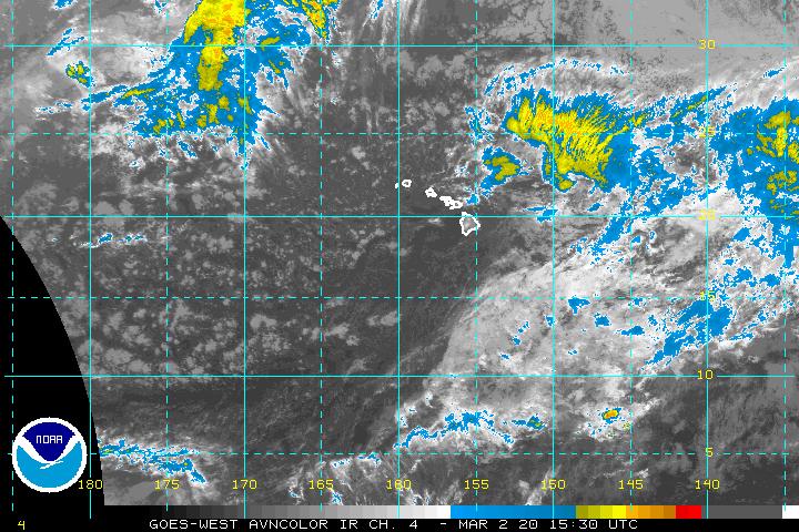
HurricaneHunter914 wrote:http://www.ssd.noaa.gov/goes/west/cpac/avn-l.jpg
DAMN! I think this is what you're talking about!
No, that's not what I'm talking about, the powerful East Pacific system I'm talking about is about to move off South America. It's not in the Central Pacific. The system your looking at now is Invest 91C. It just went up on the NRL.
0 likes
-
CrazyC83
- Professional-Met

- Posts: 34310
- Joined: Tue Mar 07, 2006 11:57 pm
- Location: Deep South, for the first time!
Re: 06Z Showing a Deep system in Central Altantic!
caneman wrote:http://moe.met.fsu.edu/cgi-bin/gfstc2.cgi?time=2006081606&field=850mb+Vorticity&hour=Animation
Final a model showing a Significant system.
Remnants of 94L?
0 likes
-
stormernie
You can see this new system that will exit Africa in about a day or so....
http://www.nrlmry.navy.mil/archdat/medi ... dust.x.jpg
http://www.nrlmry.navy.mil/archdat/medi ... dust.x.jpg
0 likes

-
Matt-hurricanewatcher
-
Dean4Storms
- S2K Supporter
- Posts: 6358
- Age: 62
- Joined: Sun Aug 31, 2003 1:01 pm
- Location: Miramar Bch. FL
Check out long range GFS forecast for Aug. 31
I know it is about as likely as a cat hugging a bird, but it is interesting......
http://www.nco.ncep.noaa.gov/pmb/nwprod ... _372.shtml
I know it is about as likely as a cat hugging a bird, but it is interesting......
http://www.nco.ncep.noaa.gov/pmb/nwprod ... _372.shtml
0 likes
-
'CaneFreak

- Category 5
- Posts: 1487
- Joined: Mon Jun 05, 2006 10:50 am
- Location: New Bern, NC
18Z GFS continues this trend towards tropical cyclogenesis in the eastern atlantic.....hopefully this trend will continue......
http://www.nco.ncep.noaa.gov/pmb/nwprod ... _180.shtml
http://www.nco.ncep.noaa.gov/pmb/nwprod ... _180.shtml
0 likes


'CaneFreak wrote:18Z GFS continues this trend towards tropical cyclogenesis in the eastern atlantic.....hopefully this trend will continue......
http://www.nco.ncep.noaa.gov/pmb/nwprod ... _180.shtml
we'll see what happens when the wave hits the coast.. too many times the gfs wants to produce a mega hurricane and it just goes poof.. but the time of year is just about right...
0 likes
Who is online
Users browsing this forum: hurricanes1234, Steve and 33 guests