australia climate note
Moderator: S2k Moderators
Forum rules
The posts in this forum are NOT official forecasts and should not be used as such. They are just the opinion of the poster and may or may not be backed by sound meteorological data. They are NOT endorsed by any professional institution or STORM2K. For official information, please refer to products from the National Hurricane Center and National Weather Service.
-
willjnewton
australia climate note
I got great news everyone the climate note out of australia Just came out on the 15th and it said that the eastern pacific is very stable and that means neutral conditions persists, thank the lord, that means that this 2006 storm season is going to be a monster am I correct???
0 likes
-
StormWarning1
- Category 1

- Posts: 254
- Joined: Sun Jul 10, 2005 9:29 pm
- Location: Nashville TN
- cycloneye
- Admin

- Posts: 148759
- Age: 69
- Joined: Thu Oct 10, 2002 10:54 am
- Location: San Juan, Puerto Rico
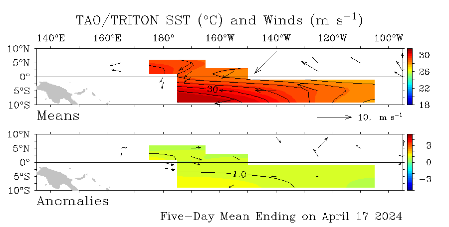
Wll this graphic shows that no el nino is in place now.Neutral conditions prevail as +0.5c at el nino 3-4 area is not sufficient to call it el nino.
Will the thread will remain open.We all love you.

Will the thread will remain open.We all love you.

Last edited by cycloneye on Wed Aug 16, 2006 7:51 pm, edited 1 time in total.
0 likes
Visit the Caribbean-Central America Weather Thread where you can find at first post web cams,radars
and observations from Caribbean basin members Click Here
and observations from Caribbean basin members Click Here
-
Matt-hurricanewatcher
-
Matt-hurricanewatcher
- wxmann_91
- Category 5

- Posts: 8013
- Age: 34
- Joined: Fri Jul 15, 2005 2:49 pm
- Location: Southern California
- Contact:
That's a question baffling scientists all around the world. Usually a low SOI means lower pressures around Tahiti and therefore a decrease of upwelling trade winds at the equator, thus the increase in SSTA's in the equatorial Pacific. The SOI has been in the negatives for 15 days and today was the first day of which it has emerged positive. Perhaps the next drop will induce an effect on SST's? Maybe there's a lag time?
BTW Matt, it's question, not quastion.
And Will, there are several things that make an Atlantic season active or quiet. ENSO is just one of them. So, it does not necessarily mean the season will be a "monster".
BTW Matt, it's question, not quastion.
And Will, there are several things that make an Atlantic season active or quiet. ENSO is just one of them. So, it does not necessarily mean the season will be a "monster".
0 likes
-
willjnewton
thats because the soI does not mean anything, may be there saying the trade winds our slightly stronger or average in the atlantic Matt, and that is usually NOT a indication of a el nino and plus the eastern pacific remains stable and that indicates neutral conditions, so there you have your question answerd
0 likes
- wxmann_91
- Category 5

- Posts: 8013
- Age: 34
- Joined: Fri Jul 15, 2005 2:49 pm
- Location: Southern California
- Contact:
thats because the soI does not mean anything, may be there saying the trade winds our slightly stronger or average in the atlantic Matt, and that is usually NOT a indication of a el nino and plus the eastern pacific remains stable and that indicates neutral conditions, so there you have your question answerd
Incorrect. The MEI is an index that determines how strong the ENSO phase is, and it's calculated from both the SOI and SSTA's in the equatorial Pacific. Trade winds induce upwelling in the area, and reduced trade winds reduces upwelling.
Thus El Nino-Southern Oscillation.
0 likes
-
willjnewton
-
StormsAhead
- Category 5

- Posts: 1447
- Joined: Thu Jul 14, 2005 6:38 pm
- Location: Cape Cod, Massachusetts
Matt-hurricanewatcher wrote:I got a quastion...How can the SOI be so low like there is a El nino but the Pacific waters do not show it?
Water temperature and SOI are two indicators used to identify an El Nino. They usually correlate very well in strong (positive or negative) ENSO events, and not so well during weak events. Also, the SOI tends to become negative before the water warms enough for an official El Nino, and it also tends to stay negative even after the warm water temperatures reverse.
0 likes
I'm giving a 90% chance (and have been since June) for an El Nino to be declared based on the trimonthly average of NINO region 3.4 SST anom. reaching +0.5 C or higher and remaining that way for several trimonthly periods. The first trimonthly period would be no later than Sep/Oct/Nov.
Also, strongly negative -SOI's themselves, like what we've had recently, have been associated with a negative impact on the hurricane season on average in the past. What typically tend to be most negatively affected are the major hurricanes that develop in the MDR (east of Lesser Antilles) due to increased shear on average in that area. That doesn't mean you can't sometimes still have a bad season, including in terms of landfalls. I'm talking averages here.
I first gave El Nino a 90% chance on 6/6/06 here at the following link and see no reason to back down:
http://www.storm2k.org/phpbb2/viewtopic ... c&start=20
0 likes
wxmann_91 wrote:True StormsAhead, but I find it hard to believe a record low (August standards) SOI would be followed by a drop in equatorial Pacific SSTA's, which is what has been experienced so far in August. Doesn't make much sense.
Interestingly, my studies have found that there often tends to be a counterintuitive concurrent DROP in NINO 3.4 SST anom.'s when the SOI falls sharply! I can't explain it. Actually, this just happenned last week when the 3.4 SST anom. fell from +0.4 C to +0.3 C just after the record breaking SOI plunge of 8/5-7. Regardless, the counterintuitive SST drop is typically followed a couple of weeks later by a stronger rise that more than makes up for that temporary fall.
0 likes
cycloneye wrote:Wll this graphic shows that no el nino is in place now.Neutral conditions prevail as +0.5c at el nino 3-4 area is not sufficient to call it el nino.
Will the thread will remain open.We all love you.
Actually Luis, +0.5 C is just warm enough for a weak El Nino according to the NOAA definition if it lasts long enough. However, officially, the 3.4 SST anom. has still not exceeded +0.4 C and was only +0.3 C last week per the following link:
http://www.cpc.ncep.noaa.gov/data/indices/wksst.for
One problem is that SST anomaly maps often disagree with each other or with actual numbers. Regardless, I am confident that 3.4 will OFFICIALLY reach the crucial +0.5 level very soon.
0 likes
Personal Forecast Disclaimer:
The posts in this forum are NOT official forecasts and should not be used as such. They are just the opinion of the poster and may or may not be backed by sound meteorological data. They are NOT endorsed by any professional institution or storm2k.org. For official information, please refer to the NHC and NWS products.
The posts in this forum are NOT official forecasts and should not be used as such. They are just the opinion of the poster and may or may not be backed by sound meteorological data. They are NOT endorsed by any professional institution or storm2k.org. For official information, please refer to the NHC and NWS products.
- AussieMark
- Category 5

- Posts: 5858
- Joined: Tue Sep 02, 2003 6:36 pm
- Location: near Sydney, Australia
for it to be an official El Nino the index has to be +0.5C for 3 consecutive months
Australian Enso Update
http://www.bom.gov.au/climate/enso/
Australian Enso Update
http://www.bom.gov.au/climate/enso/
Last edited by AussieMark on Wed Aug 16, 2006 10:10 pm, edited 1 time in total.
0 likes
Who is online
Users browsing this forum: hurricanes1234, Steve and 35 guests

