invest 92-c thread
Moderator: S2k Moderators
Forum rules

The posts in this forum are NOT official forecasts and should not be used as such. They are just the opinion of the poster and may or may not be backed by sound meteorological data. They are NOT endorsed by any professional institution or STORM2K. For official information, please refer to products from the National Hurricane Center and National Weather Service.
-
JonathanBelles
- Professional-Met

- Posts: 11430
- Age: 35
- Joined: Sat Dec 24, 2005 9:00 pm
- Location: School: Florida State University (Tallahassee, FL) Home: St. Petersburg, Florida
- Contact:

-
bombarderoazul
- Tropical Storm

- Posts: 186
- Joined: Tue Sep 20, 2005 4:12 pm


-
wxmann_91

- Category 5

- Posts: 8013
- Age: 34
- Joined: Fri Jul 15, 2005 2:49 pm
- Location: Southern California
- Contact:
It is weird. Maybe El Nino is already starting to effect the Pacific? Normally, El Nino doesn't really affect global weather patterns until two months after it appears, but maybe it's quicker for the Eastern Pacific, and then the effects start propogating around the world?
The next sign is to see a long-track STY develop in the eastern WPAC. Then we will know for sure that El Nino or El Nino-like conditions are brewing.
The next sign is to see a long-track STY develop in the eastern WPAC. Then we will know for sure that El Nino or El Nino-like conditions are brewing.
0 likes
-
Matt-hurricanewatcher
Look at the floater placed over Hector...You will see a well defined LLC at 142 west moving west-northwest...Which had deep convection over it...The shear coming off the back side of Hector is shearing the convectoin a little. We will see if it can develop its conveciton again. I think this should be a depression very soon if it reforms that convection.
http://www.cira.colostate.edu/ramm/rmsd ... PICAL.html
http://www.cira.colostate.edu/ramm/rmsd ... PICAL.html
0 likes
-
Matt-hurricanewatcher
Its at near 142-143 with the convection that has the LLC. A few other swirls in between the systems.
http://www.ssd.noaa.gov/goes/west/cpac/avn-l.jpg
http://www.ssd.noaa.gov/goes/west/cpac/avn-l.jpg
0 likes
-
WindRunner

- Category 5
- Posts: 5806
- Age: 35
- Joined: Fri Jul 29, 2005 8:07 pm
- Location: Warrenton, VA, but Albany, NY for school
- Contact:
First model runs:
DISCLAIMER...NUMERICAL MODELS ARE SUBJECT TO LARGE ERRORS.
PLEASE REFER TO TPC/NHC OFFICIAL FORECASTS FOR TROPICAL CYCLONES.
NATIONAL HURRICANE CENTER CENTRAL PACIFIC OBJECTIVE AIDS FOR
DISTURBANCE INVEST (CP922006) ON 20060821 0000 UTC
...00 HRS... ...12 HRS... ...24 HRS... ...36 HRS...
060821 0000 060821 1200 060822 0000 060822 1200
LAT LON LAT LON LAT LON LAT LON
BAMD 12.0N 141.9W 12.8N 143.7W 13.4N 145.4W 13.9N 146.9W
BAMM 12.0N 141.9W 13.1N 143.6W 14.0N 145.0W 14.4N 146.1W
LBAR 12.0N 141.9W 12.3N 143.5W 13.1N 145.4W 13.8N 147.2W
SHIP 15KTS 20KTS 25KTS 28KTS
DSHP 15KTS 20KTS 25KTS 28KTS
...48 HRS... ...72 HRS... ...96 HRS... ..120 HRS...
060823 0000 060824 0000 060825 0000 060826 0000
LAT LON LAT LON LAT LON LAT LON
BAMD 14.3N 148.3W 16.7N 150.3W 20.5N 150.2W 25.2N 150.8W
BAMM 14.8N 147.3W 16.4N 150.0W 18.5N 152.4W 21.1N 154.6W
LBAR 14.4N 149.0W 15.8N 151.5W 17.7N 153.3W 20.5N 154.8W
SHIP 32KTS 35KTS 33KTS 29KTS
DSHP 32KTS 35KTS 33KTS 29KTS
...INITIAL CONDITIONS...
LATCUR = 12.0N LONCUR = 141.9W DIRCUR = 260DEG SPDCUR = 9KT
LATM12 = 12.3N LONM12 = 139.9W DIRM12 = 263DEG SPDM12 = 8KT
LATM24 = 12.7N LONM24 = 137.2W
WNDCUR = 15KT RMAXWD = 0NM WNDM12 = 15KT
CENPRS = 1010MB OUTPRS = 1012MB OUTRAD = 150NM SDEPTH = S
RD34NE = 0NM RD34SE = 0NM RD34SW = 0NM RD34NW = 0NM
0 likes
-
WindRunner
- Category 5
- Posts: 5806
- Age: 35
- Joined: Fri Jul 29, 2005 8:07 pm
- Location: Warrenton, VA, but Albany, NY for school
- Contact:

-
WindRunner
- Category 5
- Posts: 5806
- Age: 35
- Joined: Fri Jul 29, 2005 8:07 pm
- Location: Warrenton, VA, but Albany, NY for school
- Contact:
-
WindRunner
- Category 5
- Posts: 5806
- Age: 35
- Joined: Fri Jul 29, 2005 8:07 pm
- Location: Warrenton, VA, but Albany, NY for school
- Contact:
DISCLAIMER...NUMERICAL MODELS ARE SUBJECT TO LARGE ERRORS.
PLEASE REFER TO TPC/NHC OFFICIAL FORECASTS FOR TROPICAL CYCLONES.
NATIONAL HURRICANE CENTER CENTRAL PACIFIC OBJECTIVE AIDS FOR
DISTURBANCE INVEST (CP922006) ON 20060823 0000 UTC
...00 HRS... ...12 HRS... ...24 HRS... ...36 HRS...
060823 0000 060823 1200 060824 0000 060824 1200
LAT LON LAT LON LAT LON LAT LON
BAMD 15.0N 145.9W 15.0N 147.2W 15.3N 148.7W 16.2N 149.6W
BAMM 15.0N 145.9W 15.1N 147.3W 15.5N 148.9W 16.2N 150.2W
LBAR 15.0N 145.9W 14.8N 147.0W 15.0N 148.5W 15.2N 150.2W
SHIP 20KTS 22KTS 24KTS 28KTS
DSHP 20KTS 22KTS 24KTS 28KTS
...48 HRS... ...72 HRS... ...96 HRS... ..120 HRS...
060825 0000 060826 0000 060827 0000 060828 0000
LAT LON LAT LON LAT LON LAT LON
BAMD 17.6N 149.7W 19.7N 148.0W 20.5N 147.4W 21.4N 148.4W
BAMM 17.4N 150.7W 19.3N 150.2W 21.0N 149.4W 22.3N 149.5W
LBAR 15.5N 151.8W 15.8N 154.2W 15.6N 155.9W 16.1N 156.3W
SHIP 31KTS 31KTS 31KTS 22KTS
DSHP 31KTS 31KTS 31KTS 22KTS
...INITIAL CONDITIONS...
LATCUR = 15.0N LONCUR = 145.9W DIRCUR = 270DEG SPDCUR = 5KT
LATM12 = 14.9N LONM12 = 145.0W DIRM12 = 270DEG SPDM12 = 6KT
LATM24 = 15.0N LONM24 = 143.5W
WNDCUR = 20KT RMAXWD = 45NM WNDM12 = 20KT
CENPRS = 1010MB OUTPRS = 1012MB OUTRAD = 90NM SDEPTH = S
RD34NE = 0NM RD34SE = 0NM RD34SW = 0NM RD34NW = 0NM
And neither do the models . . . not sure why the SSD did that, though. I guess it was an error . . . and this would have been the most pathetic looking TD ever . . .
0 likes
-
WindRunner
- Category 5
- Posts: 5806
- Age: 35
- Joined: Fri Jul 29, 2005 8:07 pm
- Location: Warrenton, VA, but Albany, NY for school
- Contact:
Sorry if anyone gets annoyed by my bringing this back up, but this thing is still alive and kicking. Models are looking the best yet, with a peak at 30kts in 48hrs. Vis is actually somewhat impressive, and convection finally might be gaining some persistence.

EDIT: This was also mentioned in the 10AM HST TWO:
EDIT: This was also mentioned in the 10AM HST TWO:
...
A weak disturbance is located near 15.7N 148.3W, or about 510 miles southeast of Hilo and was moving toward the west northwest around 12 mph. Although convection has recently flared just north of the center, a recent quickscat pass does not show a closed circulation but rather a sharp elongated trough extending from the area of convection southwest to near 10N 153W. If the convection persists through the day, there is a chance a tropical depression may form, however the enviornment is not all that favorable. Ssts are marginal and the disturbance is moving toward an area of much stronger westerly shear.
...
0 likes
-
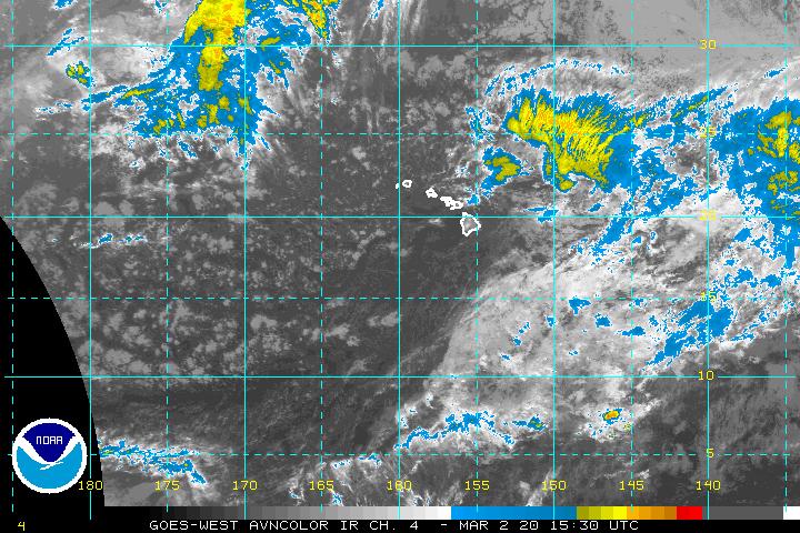
Matt-hurricanewatcher
Looks like a tropical depression to me nice LLC with convection forming over it.
http://www.ssd.noaa.gov/goes/west/cpac/avn-l.jpg
http://www.ssd.noaa.gov/goes/west/cpac/avn-l.jpg
0 likes
-
WindRunner
- Category 5
- Posts: 5806
- Age: 35
- Joined: Fri Jul 29, 2005 8:07 pm
- Location: Warrenton, VA, but Albany, NY for school
- Contact:
Who is online
Users browsing this forum: cycloneye and 43 guests