Hurricane Ioke thread
Moderator: S2k Moderators
Forum rules

The posts in this forum are NOT official forecasts and should not be used as such. They are just the opinion of the poster and may or may not be backed by sound meteorological data. They are NOT endorsed by any professional institution or STORM2K. For official information, please refer to products from the National Hurricane Center and National Weather Service.
-
JonathanBelles
- Professional-Met

- Posts: 11430
- Age: 35
- Joined: Sat Dec 24, 2005 9:00 pm
- Location: School: Florida State University (Tallahassee, FL) Home: St. Petersburg, Florida
- Contact:
-
WindRunner

- Category 5

- Posts: 5806
- Age: 35
- Joined: Fri Jul 29, 2005 8:07 pm
- Location: Warrenton, VA, but Albany, NY for school
- Contact:
WTPA42 PHFO 240256
TCDCP2
HURRICANE IOKE DISCUSSION NUMBER 17
NWS CENTRAL PACIFIC HURRICANE CENTER HONOLULU HI CP012006
500 PM HST WED AUG 23 2006
CURRENT INTENSITIES FROM CPHC..AFWA AND JTWC WERE ALL 5.0 ON THE 130 PM HST FIXES. VISIBLE IMAGERY SHOWED A RAGGED...CLOUD-FILLED EYE. WE HAVE KEPT THE INITIAL INTENSITY AT 90 KT. FINAL T-NUMBERS ON TWO OF THE FIXES HAD DROPPED TO 4.5 BUT IMAGERY RIGHT AFTER FIX TIME SHOWED THE T-NUMBER BACK UP TO 5.0 AS THE EYE BECAME BETTER DEFINED.
IOKE CONTINUES TO MOVE TOWARD THE NORTHWEST...TOWARDS 305 DEGREES AT 7 KT...TO THE SOUTH OF A WEAK SUBTROPICAL RIDGE AND TOWARD A LOW PRESSURE SYSTEM WEST OF THE DATELINE. THE DYNAMIC MODELS REMAIN IN EXCELLENT AGREEMENT. THE MODELS SHOW THE TRACK CONTINUING TOWARDS THE NORTHWEST FOR THE NEXT 24 HOURS...THEN GRADUALLY TURNING TO THE WEST... THEN TOWARDS THE WEST SOUTHWEST. THIS TRACK SEEMS REASONABLE BASED ON THE UPPER AIR FORECASTS. A LOW ALOFT NEAR 33N 171E WILL MOVE SOUTHWEST FOR THE NEXT 12 HOURS...THEN NORTHWEST. AN ANTICYCLONE WILL BUILD NEAR 25N 175W AND PUSH IOKE WEST...THEN WEST SOUTHWEST. THE FORECAST TRACK CLOSELY FOLLOWS THE PREVIOUS TRACK WITH A SLIGHT INCREASE IN FORWARD MOTION TO BETTER MATCH THE MODEL CONSENSUS.
THE FORECAST INTENSITIES ARE LITTLE-CHANGED FROM THE PREVIOUS FORECAST. WITH SEA SURFACE TEMPERATURES UNCHANGED AND LITTLE SHEAR...INTENSITY IS FORECAST TO REMAIN UNCHANGED THROUGH 48 HOURS. AFTER 48 HOURS...SHEAR WILL INCREASE AND IOKE WILL START WEAKENING...WITH SLOW WEAKENING CONTINUING THROUGH DAY 5.
FORECAST POSITIONS AND MAX WINDS
INITIAL 24/0300Z 18.3N 171.7W 90 KT
12HR VT 24/1200Z 18.8N 172.5W 90 KT
24HR VT 25/0000Z 19.4N 173.6W 90 KT
36HR VT 25/1200Z 19.9N 174.9W 90 KT
48HR VT 26/0000Z 20.0N 176.3W 90 KT
72HR VT 27/0000Z 19.6N 179.1W 85 KT
96HR VT 28/0000Z 18.2N 177.7E 75 KT
120HR VT 29/0000Z 17.5N 174.5E 65 KT
$$
FORECASTER DONALDSON
And fact, what do you mean?
0 likes
-
JonathanBelles
- Professional-Met
- Posts: 11430
- Age: 35
- Joined: Sat Dec 24, 2005 9:00 pm
- Location: School: Florida State University (Tallahassee, FL) Home: St. Petersburg, Florida
- Contact:
-
WindRunner
- Category 5
- Posts: 5806
- Age: 35
- Joined: Fri Jul 29, 2005 8:07 pm
- Location: Warrenton, VA, but Albany, NY for school
- Contact:
-
JonathanBelles
- Professional-Met
- Posts: 11430
- Age: 35
- Joined: Sat Dec 24, 2005 9:00 pm
- Location: School: Florida State University (Tallahassee, FL) Home: St. Petersburg, Florida
- Contact:
http://www.wunderground.com/tropical/tr ... _5day.html
it does not make it there, or bearly at most.
it does not make it there, or bearly at most.
0 likes
-
WindRunner
- Category 5
- Posts: 5806
- Age: 35
- Joined: Fri Jul 29, 2005 8:07 pm
- Location: Warrenton, VA, but Albany, NY for school
- Contact:
fact789 wrote:http://www.wunderground.com/tropical/tracking/cp200602_5day.html
it does not make it there, or bearly at most.
Wunderground has a bug in their software that doesn't account for passing across the date line . . . try this map, the official one:
http://www.prh.noaa.gov/cphc/tc_graphic ... rTrack.gif
0 likes
-
JonathanBelles
- Professional-Met
- Posts: 11430
- Age: 35
- Joined: Sat Dec 24, 2005 9:00 pm
- Location: School: Florida State University (Tallahassee, FL) Home: St. Petersburg, Florida
- Contact:
-
WindRunner
- Category 5
- Posts: 5806
- Age: 35
- Joined: Fri Jul 29, 2005 8:07 pm
- Location: Warrenton, VA, but Albany, NY for school
- Contact:
fact789 wrote:why is there such a difference?
Instead of plotting the points as 178E and 176E (or whatever the official forecast says), Wunderground automatically assumes that the numbers are degrees W, thus never allowing the possibility of plotting a point in the eastern hemisphere - the other side of the dateline.
0 likes
-
senorpepr

- Military Met/Moderator

- Posts: 12542
- Age: 43
- Joined: Fri Aug 22, 2003 9:22 pm
- Location: Mackenbach, Germany
- Contact:
WindRunner wrote:fact789 wrote:http://www.wunderground.com/tropical/tracking/cp200602_5day.html
it does not make it there, or bearly at most.
No, it actually makes it there by a lot.
Wunderground has a bug in their software that doesn't account for passing across the date line . . . try this map, the official one:
http://www.prh.noaa.gov/cphc/tc_graphic ... rTrack.gif
OH NO!!! NOT AN OFFICIAL MAP!!!
0 likes

WindRunner wrote:fact789 wrote:why is there such a difference?
Instead of plotting the points as 178E and 176E (or whatever the official forecast says), Wunderground automatically assumes that the numbers are degrees W, thus never allowing the possibility of plotting a point in the eastern hemisphere - the other side of the dateline.
LOL, the forecast track literally "bounces" off the dateline. It's almost as if there's a boundary condition problem in a model...
0 likes

-
Matt-hurricanewatcher
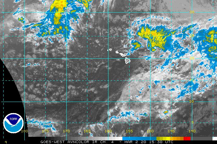
Looks like its bombing again. Full red Cdo around a small pin hole eye. Would not be suprized if it was a cat4 again.
http://www.ssd.noaa.gov/goes/west/cpac/avn-l.jpg
http://www.ssd.noaa.gov/goes/west/cpac/avn-l.jpg
0 likes
-
Matt-hurricanewatcher
Ok after a closer look at the eye...I would say 105 knots....But when that eye clears 115 knots again.
http://www.ssd.noaa.gov/goes/flt/t7/avn-l.jpg
http://www.ssd.noaa.gov/goes/flt/t7/avn-l.jpg
0 likes

Matt-hurricanewatcher wrote:Looks like its bombing again. Full red Cdo around a small pin hole eye. Would not be suprized if it was a cat4 again.
http://www.ssd.noaa.gov/goes/west/cpac/avn-l.jpg
That's exactly right. I came to post that but you already did. Need that eye to clear out.
0 likes
http://the.honoluluadvertiser.com/artic ... br49p.html
Follow-up to the story I posted earlier... the people who took refuge on Johnston Island are fine and their ship weathered the storm.
Follow-up to the story I posted earlier... the people who took refuge on Johnston Island are fine and their ship weathered the storm.
0 likes
-
Matt-hurricanewatcher
-
wxmann_91

- Category 5
- Posts: 8013
- Age: 34
- Joined: Fri Jul 15, 2005 2:49 pm
- Location: Southern California
- Contact:
Matt-hurricanewatcher wrote:Looks like its bombing again. Full red Cdo around a small pin hole eye. Would not be suprized if it was a cat4 again.
http://www.ssd.noaa.gov/goes/west/cpac/avn-l.jpg
I completely agree Matt. I would say high end Cat 3 attm and if this trend continues Cat 4 by morning.
FWIW GFDL makes this a sub-930 cane, as high as the waters allow, with 950 mb winds at 144 kt, in 5 days.
0 likes
Who is online
Users browsing this forum: JoshwaDone and 72 guests