heading NE to center
702
SXXX50 KNHC 272139
AF302 0605A ERNESTO HDOB 43 KNHC
2129. 1652N 07545W 01523 0050 328 011 166 136 012 01606 0000000000
2130 1650N 07545W 01525 0050 340 008 170 134 009 01609 0000000000
2130. 1649N 07546W 01523 0051 356 007 176 126 008 01606 0000000000
2131 1647N 07546W 01523 0050 010 006 170 138 006 01606 0000000000
2131. 1645N 07546W 01526 0051 014 006 168 140 006 01609 0000000000
2132 1644N 07546W 01525 0051 017 006 172 136 006 01608 0000000000
2132. 1642N 07546W 01526 0056 021 005 176 142 005 01614 0000000000
2133 1642N 07544W 01523 0054 034 003 176 140 004 01610 0000000000
2133. 1643N 07543W 01523 0051 054 003 172 138 003 01606 0000000000
2134 1644N 07542W 01524 0051 023 002 172 136 003 01608 0000000000
2134. 1646N 07541W 01524 0050 002 003 168 138 004 01607 0000000000
2135 1647N 07540W 01524 0050 342 004 172 130 005 01607 0000000000
2135. 1648N 07539W 01524 0050 316 005 174 128 005 01607 0000000000
2136 1649N 07537W 01525 0049 302 005 172 128 006 01607 0000000000
2136. 1650N 07536W 01524 0049 301 006 174 124 006 01606 0000000000
2137 1652N 07535W 01524 0049 309 006 176 122 006 01605 0000000000
2137. 1653N 07534W 01524 0049 319 009 170 128 009 01606 0000000000
2138 1654N 07533W 01524 0048 327 008 176 128 008 01605 0000000000
2138. 1655N 07531W 01523 0049 325 010 172 130 011 01605 0000000000
2139 1656N 07530W 01526 0048 310 011 162 134 011 01607 0000000000
;
Hurricane Ernesto - Cat. 1
Moderator: S2k Moderators
-
craptacular
- Category 2

- Posts: 581
- Joined: Wed Aug 02, 2006 9:17 pm
- Location: The Mad City, WI
Looks like Flora 1975 tangled with the Cuban "mountains" twice and then went on to regain CAT3 status (though she made no mainland landfall).
http://weather.unisys.com/hurricane/atl ... /track.gif
http://weather.unisys.com/hurricane/atl ... /track.dat
Greta 1956 had a brief encounter with some of the higher Cuban elevations as a Tropical Storm with nary a blip in storm intensity.
http://weather.unisys.com/hurricane/atl ... /track.gif
http://weather.unisys.com/hurricane/atl ... /track.dat
Gordon 1994 seemed largely unaffected when he crossed the east end of Cuba.
http://weather.unisys.com/hurricane/atl ... /track.gif
http://weather.unisys.com/hurricane/atl ... /track.dat
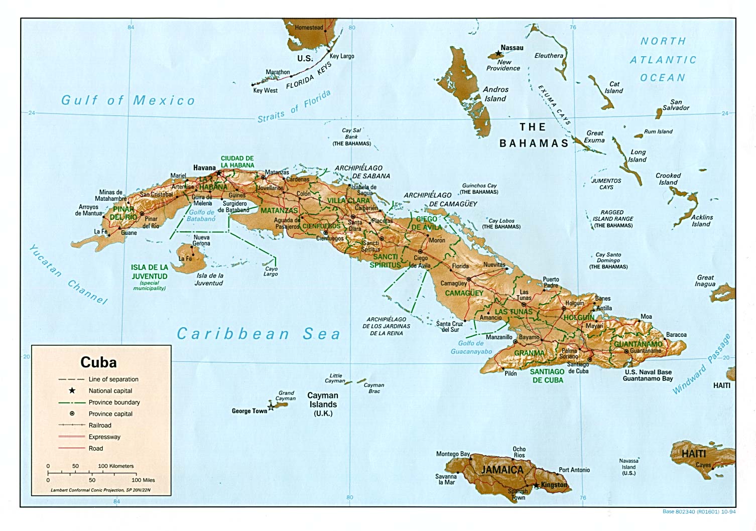
Cuba Relief Map
http://www.lib.utexas.edu/maps/americas/cuba_rel94.jpg
My cursory spin through the historical tracks suggests that though a few storms do get walloped by Cuba, the vast majority of storms seem to recover intensity to some extent after an enounter with Cuba.
http://weather.unisys.com/hurricane/atl ... /track.gif
http://weather.unisys.com/hurricane/atl ... /track.dat
Greta 1956 had a brief encounter with some of the higher Cuban elevations as a Tropical Storm with nary a blip in storm intensity.
http://weather.unisys.com/hurricane/atl ... /track.gif
http://weather.unisys.com/hurricane/atl ... /track.dat
Gordon 1994 seemed largely unaffected when he crossed the east end of Cuba.
http://weather.unisys.com/hurricane/atl ... /track.gif
http://weather.unisys.com/hurricane/atl ... /track.dat
Cuba Relief Map
http://www.lib.utexas.edu/maps/americas/cuba_rel94.jpg
My cursory spin through the historical tracks suggests that though a few storms do get walloped by Cuba, the vast majority of storms seem to recover intensity to some extent after an enounter with Cuba.
0 likes
-
storms in NC

- S2K Supporter

- Posts: 2338
- Joined: Thu Jul 28, 2005 2:58 pm
- Location: Wallace,NC 40 miles NE of Wilm
- Contact:


-
storms in NC
- S2K Supporter
- Posts: 2338
- Joined: Thu Jul 28, 2005 2:58 pm
- Location: Wallace,NC 40 miles NE of Wilm
- Contact:
-
saints63213

- Tropical Low

- Posts: 40
- Joined: Thu Aug 25, 2005 8:07 pm
-
Dean4Storms
- S2K Supporter
- Posts: 6358
- Age: 63
- Joined: Sun Aug 31, 2003 1:01 pm
- Location: Miramar Bch. FL
Opal storm wrote:It's probably the most unlikely scenerio right now since only one model really supports it."Ice" wrote:Oh Lord, I hope and pray that this is not the chosen one...CrazyC83 wrote:Scenario 1 - Worst-case scenario that one rogue model suggests. Pushes due west, brushing the southernmost lands of Cuba while mostly over water, allowing Ernesto to hold or strengthen. Then it moves into the open Gulf - likely as a Category 2 hurricane - and the Loop Current blows it up to a Category 4 or 5. Then it makes landfall in the Florida Panhandle most likely as Category 3.
But that one model has been the most consistant and is one of the best in forecasting tracks.
0 likes
-
Dean4Storms
- S2K Supporter
- Posts: 6358
- Age: 63
- Joined: Sun Aug 31, 2003 1:01 pm
- Location: Miramar Bch. FL
saints63213 wrote:I don't think the center is over land at all and it hasn't been over land. looks like its to the south west of the convection off Haiti.storms in NC wrote:It is Half way across Haiti now. We will know in a few hours. But to look now you can see it refireing back up
You are correct Saints. BTW, is that you in that pic? Wow!
0 likes
-
Aquawind

- Category 5

- Posts: 6714
- Age: 62
- Joined: Mon Jun 16, 2003 10:41 pm
- Location: Salisbury, NC
- Contact:
Cuba Surface obs..
http://weather.noaa.gov/weather/CU_cc.html
http://www.lib.utexas.edu/maps/americas/cuba_rel94.jpg
http://weather.noaa.gov/weather/CU_cc.html
http://www.lib.utexas.edu/maps/americas/cuba_rel94.jpg
0 likes


-
craptacular
- Category 2
- Posts: 581
- Joined: Wed Aug 02, 2006 9:17 pm
- Location: The Mad City, WI
226
SXXX50 KNHC 272149
AF302 0605A ERNESTO HDOB 44 KNHC
2139. 1657N 07529W 01524 0048 312 011 164 132 011 01605 0000000000
2140 1659N 07528W 01524 0048 306 011 162 134 011 01605 0000000000
2140. 1700N 07527W 01523 0047 308 011 160 138 011 01604 0000000000
2141 1701N 07525W 01524 0047 308 010 162 134 010 01604 0000000000
2141. 1702N 07524W 01524 0047 315 011 170 130 011 01604 0000000000
2142 1703N 07523W 01524 0047 310 011 172 130 011 01604 0000000000
2142. 1705N 07522W 01524 0046 295 010 160 134 011 01603 0000000000
2143 1706N 07521W 01524 0046 292 011 160 134 011 01603 0000000000
2143. 1707N 07519W 01524 0046 297 011 160 134 011 01602 0000000000
2144 1708N 07518W 01525 0045 295 011 162 134 011 01603 0000000000
2144. 1709N 07517W 01523 0045 294 012 166 134 012 01601 0000000000
2145 1711N 07516W 01525 0044 293 013 166 134 013 01602 0000000000
2145. 1712N 07514W 01524 0043 290 013 166 132 013 01600 0000000000
2146 1713N 07513W 01524 0043 292 014 168 130 014 01600 0000000000
2146. 1714N 07512W 01524 0042 290 014 168 132 014 01600 0000000000
2147 1715N 07511W 01524 0042 293 014 170 130 015 01598 0000000000
2147. 1717N 07509W 01524 0043 295 015 168 132 015 01600 0000000000
2148 1718N 07508W 01524 0043 299 016 170 132 017 01599 0000000000
2148. 1719N 07507W 01524 0042 299 017 170 132 017 01599 0000000000
2149 1720N 07506W 01524 0042 300 017 166 132 018 01599 0000000000
;
0 likes

-
TheShrimper
- Category 2
- Posts: 516
- Joined: Sun Aug 01, 2004 5:05 pm
If there any extensions to the watch area it will be up the Fl. east coast to Deerfield Beach. This is because of the prximity to the storm. Later if the path remains as projected, the watches will go up on the west coast north to Everglades City and then to Bonita Beach. That will be later than the east coast advisories are posted.
0 likes
-
TheShrimper
- Category 2
- Posts: 516
- Joined: Sun Aug 01, 2004 5:05 pm
-
HurricaneHunter914
- Category 5
- Posts: 4439
- Age: 32
- Joined: Fri Mar 10, 2006 7:36 pm
- Location: College Station, TX
The meteoroligist TV said that Ernesto is taking in big gulps of dry air and will likely stay a TS for the next several days. I just looked at the water vapor and there is barely any dry air for it to take in. Not only that, it appears that Ernesto is organizing and moving away from Haiti. Looks like I was wrong about Ernesto dieing.
0 likes
Personal Forecast Disclaimer:
The posts in this forum are NOT official forecast and should not be used as such. They are just the opinion of the poster and may or may not be backed by sound meteorological data. They are NOT endorsed by any professional institution or storm2k.org. For official information, please refer to the NHC and NWS products.
The posts in this forum are NOT official forecast and should not be used as such. They are just the opinion of the poster and may or may not be backed by sound meteorological data. They are NOT endorsed by any professional institution or storm2k.org. For official information, please refer to the NHC and NWS products.

-
Stratusxpeye

- Category 2
- Posts: 686
- Joined: Tue Jun 07, 2005 10:40 am
- Location: Tampa, Florida
- Contact:
Dean4Storms wrote:Opal storm wrote:It's probably the most unlikely scenerio right now since only one model really supports it."Ice" wrote:Oh Lord, I hope and pray that this is not the chosen one...CrazyC83 wrote:Scenario 1 - Worst-case scenario that one rogue model suggests. Pushes due west, brushing the southernmost lands of Cuba while mostly over water, allowing Ernesto to hold or strengthen. Then it moves into the open Gulf - likely as a Category 2 hurricane - and the Loop Current blows it up to a Category 4 or 5. Then it makes landfall in the Florida Panhandle most likely as Category 3.
But that one model has been the most consistant and is one of the best in forecasting tracks.
I could almost bet on that track not verifying as the trend even further east is continuing in some of the models and by the past few hours motion of this storm it's verifying itself. my bet is on southeast or extreme southwest florida.
0 likes
-
Scorpion
HurricaneHunter914 wrote:The meteoroligist TV said that Ernesto is taking in big gulps of dry air and will likely stay a TS for the next several days. I just looked at the water vapor and there is barely any dry air for it to take in. Not only that, it appears that Ernesto is organizing and moving away from Haiti. Looks like I was wrong about Ernesto dieing.
Don't ever listen to the TV mets.
0 likes
-
craptacular
- Category 2
- Posts: 581
- Joined: Wed Aug 02, 2006 9:17 pm
- Location: The Mad City, WI
dropsonde #6 from AF309
448
UZNT13 KNHC 272158
XXAA 77223 99209 70799 08009 99010 30056 07006 00093 29256 07006
92785 24243 07020 85521 19046 07524 70165 10662 07013 50588 04773
08515 40760 14385 09018 30971 30962 08001 88999 77999
31313 09608 82131
61616 AF309 0705A ERNESTO OB 06
62626 SPL 2091N07992W 2142 MBL WND 07009 AEV 20604 DLM WND 07515
010307 WL150 07006 075 =
XXBB 77228 99209 70799 08009 00010 30056 11850 19046 22836 18033
33801 16658 44768 13834 55711 10857 66695 10263 77633 04857 88619
03863 99601 02060 11588 01066 22583 00461 33567 00764 44562 00961
55557 00970 66547 01575 77527 02967 88519 03376 99493 05774 11477
06564 22470 07337 33462 08522 44457 08557 55451 08373 66396 14983
77300 31162
21212 00010 07006 11987 06506 22974 07511 33938 07020 44850 07524
55757 06516 66671 07507 77515 07014 88499 08515 99462 06523 11448
07017 22423 05014 33413 08014 44366 11515 55330 06510 66300 06501
31313 09608 82131
61616 AF309 0705A ERNESTO OB 06
62626 SPL 2091N07992W 2142 MBL WND 07009 AEV 20604 DLM WND 07515
010307 WL150 07006 075 =
;
0 likes
Who is online
Users browsing this forum: No registered users and 17 guests