Ernesto Satellite,Analysis and Models Thread 4
Moderator: S2k Moderators
Forum rules

The posts in this forum are NOT official forecasts and should not be used as such. They are just the opinion of the poster and may or may not be backed by sound meteorological data. They are NOT endorsed by any professional institution or STORM2K. For official information, please refer to products from the National Hurricane Center and National Weather Service.

-
brunota2003

- S2K Supporter

- Posts: 9476
- Age: 35
- Joined: Sat Jul 30, 2005 9:56 pm
- Location: Stanton, KY...formerly Havelock, NC
- Contact:

EmeraldCoast1 wrote:My new motto with hurricanes: NEVER SAY NEVER.
Actually, for those of us in the islands (that I know at least, and that includes boat liveaboards and land living sorts on quite a few islands in the Caribbean) that has always been our motto.
That is why it is constantly stressed here and elsewhere...be prepared for the worst, hope for the best and carry on with life with one eye glued to the weather during this season.
I personally see no reason to give any pro a hard time as to the forecasting of this storm, or any other. Weather science is a man-made thing, based on the best knowledge available at the present time...and does the best it can. It will never (yeah, I'm comfortable here saying never) be an exact science.
True knowledge of weather, in my opinion, is - use the tools at hand (a heck of a lot more than people had not so many years in the past!), and just BE PREPARED! Sometimes that helps, sometimes it doesn't. Many here lose days of work time getting ready for storms that *don't happen* - it's just a fact of life, no harm no foul. But it might be life saving.
Just don't blame the weather folk...it's NOT their fault
0 likes
-
KFDM Meteorologist

- Professional-Met

- Posts: 1314
- Joined: Tue May 16, 2006 9:52 pm
- Location: Upper Texas Coast/Orange County
-
Thatsmrhurricane
- Tropical Storm

- Posts: 182
- Joined: Fri Jun 09, 2006 5:30 pm
- Location: CBNC
-
storms in NC

- S2K Supporter
- Posts: 2338
- Joined: Thu Jul 28, 2005 2:58 pm
- Location: Wallace,NC 40 miles NE of Wilm
- Contact:
SCMedic wrote:http://tinyurl.com/nxlyu
GFDL has it coming ashore in McClellanville, SC area with 100kt winds..
<a href="http://imageshack.us"><img src="http://img64.imageshack.us/img64/227/203553wsmjm8.gif" border="0" alt="Image Hosted by ImageShack.us" /></a>
And then at 5pm...The plot thickens for Charleston....
I can just about bet it will be going into the Cape Fear River. When it calls for SC seem to go to the River Who Knows
0 likes
-
HurricaneHunter914
- Category 5

- Posts: 4439
- Age: 32
- Joined: Fri Mar 10, 2006 7:36 pm
- Location: College Station, TX
The track is now to the east of Sanford, so my house might be spared, but things can change quickly.
0 likes
Personal Forecast Disclaimer:
The posts in this forum are NOT official forecast and should not be used as such. They are just the opinion of the poster and may or may not be backed by sound meteorological data. They are NOT endorsed by any professional institution or storm2k.org. For official information, please refer to the NHC and NWS products.
The posts in this forum are NOT official forecast and should not be used as such. They are just the opinion of the poster and may or may not be backed by sound meteorological data. They are NOT endorsed by any professional institution or storm2k.org. For official information, please refer to the NHC and NWS products.
-
deltadog03

- Professional-Met
- Posts: 3580
- Joined: Tue Jul 05, 2005 6:16 pm
- Location: Macon, GA
Depends on the strength. A TS, even a strong one, won't have a major enough impact on Miami to cancel that game. That's Monday night....ABC.....big $$$. I know this is only vaguely weather-related, but the money dictates that the game gets played unless conditions make it impossible to do so.
0 likes
-
MiamiensisWx
BlowMeAway wrote:Based on the NHC track, it looks like Miami barely gets smacked.... They get off again with a pretty wimpy storm. And it looks like Charleston gets hit pretty hard with anything from Cat-2 up to another Hugo-level storm depending on how much it can get its act together over the water.
I would NOT call a 70MPH tropical storm with potential for flooding and extensive wind damage "wimpy". Tell that to people in Miami who went through a "wimpy" Category One Katrina or who got "only" Category One winds in Wilma. With the uncertainties in track, the last thing we need is complacency on intensity or anything for that matter. Besides, making statements like "Miami barely gets smacked" only serves to let the guards of others down. Of course this 99.9 percent won't be a major hurricane, but all storms can be and are destructive, and making blanket statements like that don't really aid in hurricane and tropical storm/depression preparedness, nor does hype.
Last edited by MiamiensisWx on Mon Aug 28, 2006 3:51 pm, edited 1 time in total.
0 likes
-
CocoCreek
- Tropical Depression

- Posts: 52
- Joined: Wed Aug 24, 2005 12:26 pm
- Location: Coconut Creek, FL
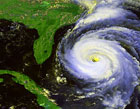
It definitely seems like IR is starting to light up somewhat near the center and in other areas of the overall circulation after a bit of a lull throughout the day...probably being enhanced a bit by the ULL moving to the West.
Last edited by CocoCreek on Mon Aug 28, 2006 3:51 pm, edited 1 time in total.
0 likes
-
HurricaneJim

- Tropical Storm
- Posts: 136
- Joined: Thu Aug 26, 2004 9:26 pm
- Location: Rucksack, somewhere
- Contact:
Well, this "amatuer" earns his living covering these storms. And year after year I have seen it again and again...if heavy duty steering doesn't interfere, they stick to warm water like glue.
I never say never either, but they keep doing the same thing.
I've been saying for a couple of days that it's gonna run up the Gulf Stream and it's looking like that's what it wants to do. The US Navy agrees...best model I use.
Jim
http://www.myspace.com/hurricanejim
http://www.myspace.com/stormchasetroopers

NAVY WAM LINK
https://www.fnmoc.navy.mil/PUBLIC/WAM/all_natl.html
I never say never either, but they keep doing the same thing.
I've been saying for a couple of days that it's gonna run up the Gulf Stream and it's looking like that's what it wants to do. The US Navy agrees...best model I use.
Jim
http://www.myspace.com/hurricanejim
http://www.myspace.com/stormchasetroopers
NAVY WAM LINK
https://www.fnmoc.navy.mil/PUBLIC/WAM/all_natl.html
0 likes


Okay, what gives? Derek had it going to NC WAY off Charleston shores. I was feeling safe. Then I click on the NHC forcast and that lovely H is staring me right in the eye.
Holy Cow! I think I'm going with Derek's prediction.
Holy Cow!
Last edited by krisj on Mon Aug 28, 2006 3:56 pm, edited 1 time in total.
0 likes
-
HurricaneHunter914
- Category 5
- Posts: 4439
- Age: 32
- Joined: Fri Mar 10, 2006 7:36 pm
- Location: College Station, TX
Rapid Intesification is also a possibility once it gets over the Gulf Stream so alot of strengthening could happen.
0 likes
Personal Forecast Disclaimer:
The posts in this forum are NOT official forecast and should not be used as such. They are just the opinion of the poster and may or may not be backed by sound meteorological data. They are NOT endorsed by any professional institution or storm2k.org. For official information, please refer to the NHC and NWS products.
The posts in this forum are NOT official forecast and should not be used as such. They are just the opinion of the poster and may or may not be backed by sound meteorological data. They are NOT endorsed by any professional institution or storm2k.org. For official information, please refer to the NHC and NWS products.
-
Evil Jeremy

- S2K Supporter
- Posts: 5463
- Age: 32
- Joined: Mon Apr 10, 2006 2:10 pm
- Location: Los Angeles, CA
Who is online
Users browsing this forum: Hurricanehink and 67 guests