Area in S. FL/Bahamas
Moderator: S2k Moderators
Forum rules

The posts in this forum are NOT official forecasts and should not be used as such. They are just the opinion of the poster and may or may not be backed by sound meteorological data. They are NOT endorsed by any professional institution or STORM2K. For official information, please refer to products from the National Hurricane Center and National Weather Service.


-
Eyewall


-
Brent
- S2K Supporter

- Posts: 38757
- Age: 37
- Joined: Sun May 16, 2004 10:30 pm
- Location: Tulsa Oklahoma
- Contact:
5:30pm TWO:
A BROAD TROUGH OF LOW PRESSURE NEAR FLORIDA IS PRODUCING A
LARGE AREA OF SHOWERS AND THUNDERSTORMS OVER THE NORTHWESTERN
BAHAMAS...FLORIDA AND THE ADJACENT WATERS. THUNDERSTORM ACTIVITY
REMAINS DISORGANIZED AND DEVELOPMENT...IF ANY...IS EXPECTED TO BE
SLOW TO OCCUR AS THE SYSTEM MOVES SLOWLY NORTH-NORTHEASTWARD.
0 likes
#neversummer
-
jusforsean

- Category 1

- Posts: 395
- Joined: Wed Nov 09, 2005 8:22 am
- Location: South Florida
Brent wrote:5:30pm TWO:
A BROAD TROUGH OF LOW PRESSURE NEAR FLORIDA IS PRODUCING A
LARGE AREA OF SHOWERS AND THUNDERSTORMS OVER THE NORTHWESTERN
BAHAMAS...FLORIDA AND THE ADJACENT WATERS. THUNDERSTORM ACTIVITY
REMAINS DISORGANIZED AND DEVELOPMENT...IF ANY...IS EXPECTED TO BE
SLOW TO OCCUR AS THE SYSTEM MOVES SLOWLY NORTH-NORTHEASTWARD.
Uh, Hello I thought this was nothing????? whats the deal?
0 likes


Yup...thank goodness I didn't look at the vapor and see all that swirl....yup...sure am glad didn't look at it...yessir
http://www.ssd.noaa.gov/goes/east/watl/loop-wv.html

http://www.ssd.noaa.gov/goes/east/watl/loop-wv.html
0 likes

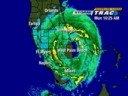
It sure appears to have either low or mid level turning off the Palm Beach coast of FL. to me. Check out the water vapor, and the visible with a 15 loop animation.
http://weather.msfc.nasa.gov/GOES/goeseasthurr.html
Click on medium size, 15 image and on visible block the last 2 frames.
Is it just me??
http://weather.msfc.nasa.gov/GOES/goeseasthurr.html
Click on medium size, 15 image and on visible block the last 2 frames.
Is it just me??
0 likes
-
cycloneye

- Admin

- Posts: 149520
- Age: 69
- Joined: Thu Oct 10, 2002 10:54 am
- Location: San Juan, Puerto Rico
ABNT20 KNHC 061529
TWOAT
TROPICAL WEATHER OUTLOOK
NWS TPC/NATIONAL HURRICANE CENTER MIAMI FL
1130 AM EDT WED SEP 6 2006
FOR THE NORTH ATLANTIC...CARIBBEAN SEA AND THE GULF OF MEXICO...
THE NATIONAL HURRICANE CENTER IS ISSUING ADVISORIES ON TROPICAL
STORM FLORENCE...LOCATED ABOUT 800 MILES EAST OF THE NORTHERN
LEEWARD ISLANDS.
THUNDERSTORM ACTIVITY HAS INCREASED THIS MORNING A COUPLE OF HUNDRED
MILES EAST OF JACKSONVILLE FLORIDA. THIS ACTIVITY COULD GET A
LITTLE BETTER ORGANIZED AS IT MOVES NORTHEASTWARD LATER TODAY...BUT
UPPER-LEVEL WINDS DO NOT FAVOR SIGNIFICANT DEVELOPMENT AS A
TROPICAL WEATHER SYSTEM. THIS ACTIVITY IS EXPECTED TO MERGE WITH A
FRONTAL ZONE OVER THE NEXT DAY OR SO...WHEN SOME NON-TROPICAL
DEVELOPMENT COULD OCCUR.
ELSEWHERE...TROPICAL STORM FORMATION IS NOT EXPECTED THROUGH
THURSDAY.
$$
FORECASTER FRANKLIN
0 likes
Visit the Caribbean-Central America Weather Thread where you can find at first post web cams,radars
and observations from Caribbean basin members Click Here
and observations from Caribbean basin members Click Here


92L Invest is up! There's no sat pic. But look at Scatt. I believe it's for this system.
http://www.nrlmry.navy.mil/tc_pages/tc_home.html
http://www.nrlmry.navy.mil/tc_pages/tc_home.html
0 likes
Who is online
Users browsing this forum: Ulf and 81 guests