Is the Gap Closing For Gordon to Escape?
Moderator: S2k Moderators
Forum rules
The posts in this forum are NOT official forecasts and should not be used as such. They are just the opinion of the poster and may or may not be backed by sound meteorological data. They are NOT endorsed by any professional institution or STORM2K. For official information, please refer to products from the National Hurricane Center and National Weather Service.
- gatorcane
- S2K Supporter

- Posts: 23703
- Age: 47
- Joined: Sun Mar 13, 2005 3:54 pm
- Location: Boca Raton, FL
Is the Gap Closing For Gordon to Escape?
Looks to be that the big subtropical ridge that is currently NE of TD7 is actually starting to build back westward now that Florence is clearing 35N. Also there is a decent ridge near Florida that looks to be building quickly east. These observations are based on Water Vapor analysis over the last 6 hours.
Thoughts on these new developments?
http://www.ssd.noaa.gov/goes/east/nwatl/loop-wv.html
Thoughts on these new developments?
http://www.ssd.noaa.gov/goes/east/nwatl/loop-wv.html
Last edited by gatorcane on Tue Sep 12, 2006 12:08 am, edited 3 times in total.
0 likes
Maybe if TD7 was located down in the Caribbean... Models indicate continues northwesterly upper-level flow off the southeastern US coast through the next 72 hours. Storm-relative shear would be high for a path into the SE US, though there'd be no reason for it to head WNW or NW anyway.
The next decent upper-level trough is progged to come off the east coast this weekend. That should be enough to sweep Gordon back out to sea. HERE is the GFS 300mb forecast for Saturday evening.
The next decent upper-level trough is progged to come off the east coast this weekend. That should be enough to sweep Gordon back out to sea. HERE is the GFS 300mb forecast for Saturday evening.
Last edited by WxGuy1 on Mon Sep 11, 2006 1:13 pm, edited 1 time in total.
0 likes
Hey, WxGuy1:
Interesting that you use the term "storm realtive shear". It's obviously a metric used in meso forecasting an awful lot, but I had never heard it in a tropical context until now, and always thought it would more accurately depict the shear a storm is "seeing" as it takes the storm's own motion into account. So I had been wondering...
Is there a storm-relative shear product for the tropics anywhere--is this variable actually calculated and analyzed?
Thanks!
0 likes
- GeneratorPower
- S2K Supporter

- Posts: 1648
- Age: 46
- Joined: Sun Dec 18, 2005 11:48 pm
- Location: Huntsville, AL
- gatorcane
- S2K Supporter

- Posts: 23703
- Age: 47
- Joined: Sun Mar 13, 2005 3:54 pm
- Location: Boca Raton, FL
GeneratorPower wrote:gatorcane, I see in the WV imagery where the highs are pinching in closer together. Good observation.
I'm very surprised that there is not anymore debate than I am seeing on this. The ridges are clearly closing in on Florence's wake quite quickly today.
I still don't think this recurve track is very certain just yet.
0 likes
gatorcane wrote:GeneratorPower wrote:gatorcane, I see in the WV imagery where the highs are pinching in closer together. Good observation.
I'm very surprised that there is not anymore debate than I am seeing on this. The ridges are clearly closing in on Florence's wake quite quickly today.
I still don't think this recurve track is very certain just yet.
Yes, and you can see the upper-level trough over the northern and central plains poised to amplify with time as it sweeps eastward. This should provide enough southwesterly flow downstream of the trough axis to recurve Gordon out to sea. The dry air you sea to the west is associated with >30kt 300mb flow, which turns northerly by tomorrow to Gordon's west. I can't imagine shear will be too favorable for much intensification before he gets booted. The ECMWF doesn't seem as strong with the next upper-level trough forecast to move off the east coast, but there still seems to be some decent westerly mid- and upper-level flow north of Cuba (perhaps occassional northerly flow). Again, I think Gordon would have a much greater risk to the US if he was located several hundred miles southwest.
0 likes
- GeneratorPower
- S2K Supporter

- Posts: 1648
- Age: 46
- Joined: Sun Dec 18, 2005 11:48 pm
- Location: Huntsville, AL
Well, and that is precisely what the NHC forecasters said last night. They said "highly uncertain" forecast track. That means highly uncertain!
One of the things that's nice about seeing your own WV loop is that you can spot trends and changes before they are published in the NHC updates.
There are two possibilities as to why there hasn't been more fuss over this. One, the pro-mets are seeing something in the overall pattern that still favors a northward motion, so therefore there is no need to change the thinking.
Two, they still haven't learned the Ernesto lesson.
0 likes
-
Stratosphere747
- Category 5

- Posts: 3772
- Joined: Thu Sep 11, 2003 8:34 pm
- Location: Surfside Beach/Freeport Tx
- Contact:
-
donsutherland1
- S2K Analyst

- Posts: 2718
- Joined: Mon Sep 15, 2003 8:49 pm
- Location: New York
Re: Is the Gap Closing For Gordon to Escape?
Gatorcane,
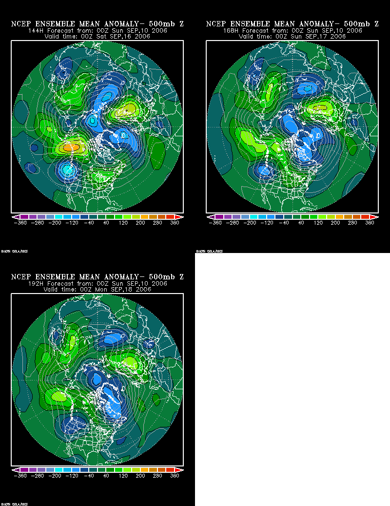
The most recent GFS ensembles are reasonably similar to the animation I posted last night.

This animation, if it is correct, would strongly argue for recurvature.
The most recent GFS ensembles are reasonably similar to the animation I posted last night.

This animation, if it is correct, would strongly argue for recurvature.
0 likes
- gatorcane
- S2K Supporter

- Posts: 23703
- Age: 47
- Joined: Sun Mar 13, 2005 3:54 pm
- Location: Boca Raton, FL
WxGuy1 wrote:gatorcane wrote:GeneratorPower wrote:gatorcane, I see in the WV imagery where the highs are pinching in closer together. Good observation.
I'm very surprised that there is not anymore debate than I am seeing on this. The ridges are clearly closing in on Florence's wake quite quickly today.
I still don't think this recurve track is very certain just yet.
Yes, and you can see the upper-level trough over the northern and central plains poised to amplify with time as it sweeps eastward. This should provide enough southwesterly flow downstream of the trough axis to recurve Gordon out to sea. The dry air you sea to the west is associated with >30kt 300mb flow, which turns northerly by tomorrow to Gordon's west. I can't imagine shear will be too favorable for much intensification before he gets booted. The ECMWF doesn't seem as strong with the next upper-level trough forecast to move off the east coast, but there still seems to be some decent westerly mid- and upper-level flow north of Cuba (perhaps occassional northerly flow). Again, I think Gordon would have a much greater risk to the US if he was located several hundred miles southwest.
so if that trough in the plains doesn't come to fruition then would the chances of recurvature be less?
0 likes
- gatorcane
- S2K Supporter

- Posts: 23703
- Age: 47
- Joined: Sun Mar 13, 2005 3:54 pm
- Location: Boca Raton, FL
Some more support for the gap closing....
BensonTCwatcher wrote:Here is one for fun. THIS is not a forecast, and it is not official, for pete's sake.
I have not spent too much time on this system, but the current setup, although generally looks like it will end up recurving as forecast, has few bugs in it to me.
1. The ridge is building back to the NW of Gordie here quicker than the globals have it forecast. This would cause the system to track to the NW for say 12 hours ( maybe less) and then pick up a significant westward ( perhaps SW a jog or 2) motion for up at least 48 to 72 hours.
http://www.atmos.washington.edu/~ovens/loops/wxloop.cgi?wv_east_enhanced+12
0 likes
- BensonTCwatcher
- Category 5

- Posts: 1050
- Joined: Sat Aug 28, 2004 10:11 pm
- Location: Southport NC
gatorcane wrote:Some more support for the gap closing....BensonTCwatcher wrote:Here is one for fun. THIS is not a forecast, and it is not official, for pete's sake.
I have not spent too much time on this system, but the current setup, although generally looks like it will end up recurving as forecast, has few bugs in it to me.
1. The ridge is building back to the NW of Gordie here quicker than the globals have it forecast. This would cause the system to track to the NW for say 12 hours ( maybe less) and then pick up a significant westward ( perhaps SW a jog or 2) motion for up at least 48 to 72 hours.
http://www.atmos.washington.edu/~ovens/loops/wxloop.cgi?wv_east_enhanced+12
Yes, it looks that way to me short term, long term this gets caught by the front off the EC. The models also disagree with me
0 likes
Who is online
Users browsing this forum: Category5Kaiju, Google [Bot], NotSparta, Ulf and 40 guests


