Moisture from Lane and possible TX Flood Event
Moderator: S2k Moderators
Forum rules
The posts in this forum are NOT official forecast and should not be used as such. They are just the opinion of the poster and may or may not be backed by sound meteorological data. They are NOT endorsed by any professional institution or STORM2K.
- jasons2k
- Storm2k Executive

- Posts: 8290
- Age: 52
- Joined: Wed Jul 06, 2005 12:32 pm
- Location: The Woodlands, TX
FWIW the 40% they had for today had nothing to do with fears of this busting, it's all about timing.
Also, the 90% for tonight is also due to increased confidence with the timing. A few days ago the window was Sun-Tue, so they "shotgunned" a lot of 40-50% pops for CYA purposes....now it's pretty clear the mother load of moisture is coming tonight (as opposed to Monday night) so it's up to 90%.
I don't think there's been any doubt this was going to nail us - at some point.
0 likes
- southerngale
- Retired Staff

- Posts: 27418
- Joined: Thu Oct 10, 2002 1:27 am
- Location: Southeast Texas (Beaumont area)
I'm in Brownwood now and there's a 90% chance for today! They desperately need rain here, so if we don't get the flooding that is possible, this could be great for here. I haven't been here in several years and it's not the pretty green I'm used to....everything is brown.
I'm in Brown County, ironically enough.
FLOOD WATCH
NATIONAL WEATHER SERVICE SAN ANGELO TX
832 AM CDT SUN SEP 17 2006
...HEAVY RAINFALL FOR PORTIONS OF WEST CENTRAL TEXAS THROUGH THIS EVENING...
.A STRONG COLD FRONT WILL INTERACT WITH ABUNDANT TROPICAL MOISTURE
TO PRODUCE HEAVY RAINFALL ACROSS PORTIONS OF WEST CENTRAL TEXAS
TODAY AND INTO THIS EVENING. AS THE COLD FRONT PUSHES THROUGH THE
AREA LATE THIS AFTERNOON AND THIS EVENING...THE THREAT OF HEAVY
RAIN WILL DECREASE FROM NORTHWEST TO SOUTHEAST.
RUNNELS-TOM GREEN-CONCHO-CROCKETT-SCHLEICHER-SUTTON-SHACKELFORD-
TAYLOR-CALLAHAN-COLEMAN-BROWN-MCCULLOCH-SAN SABA-MENARD-KIMBLE-
MASON-
INCLUDING THE CITIES OF...BALLINGER...WINTERS...SAN ANGELO...
EDEN...OZONA...ELDORADO...SONORA...ALBANY...ABILENE...CLYDE...
BAIRD...CROSS PLAINS...COLEMAN...BROWNWOOD...BRADY...SAN SABA...
MENARD...JUNCTION...MASON
832 AM CDT SUN SEP 17 2006
...FLASH FLOOD WATCH IN EFFECT THROUGH THIS EVENING...
THE NATIONAL WEATHER SERVICE IN SAN ANGELO HAS ISSUED A
* FLASH FLOOD WATCH FOR A PORTION OF WEST CENTRAL TEXAS...
INCLUDING THE FOLLOWING AREAS...IN WEST CENTRAL TEXAS...
BROWN...CALLAHAN...COLEMAN...CONCHO...CROCKETT...KIMBLE...
MASON...MCCULLOCH...MENARD...RUNNELS...SAN SABA...SCHLEICHER...
SHACKELFORD...SUTTON...TAYLOR AND TOM GREEN.
* THROUGH THIS EVENING
* ABUNDANT MOISTURE FROM BOTH THE GULF OF MEXICO AND TROPICAL
STORM LANE ACROSS WESTERN MEXICO WILL COMBINE WITH A STRONG COLD
FRONT TO PRODUCE HEAVY RAINFALL ACROSS WEST CENTRAL TEXAS INTO
THIS EVENING.
* RAINFALL TOTALS OF 1 TO 2 INCHES...AND WITH MORE ISOLATED TOTALS
TO 4 INCHES WILL BE POSSIBLE ACROSS WEST CENTRAL TEXAS.
A FLASH FLOOD WATCH MEANS THAT CONDITIONS MAY DEVELOP THAT LEAD
TO FLASH FLOODING. FLASH FLOODING IS A VERY DANGEROUS SITUATION.
F YOU ARE IN THE WATCH AREA...PLAN NOW FOR WHAT YOU WILL DO IF
FLASH FLOODING DEVELOPS. STAY INFORMED AND BE READY TO ACT IF YOU
SEE FLOODING OR IF A FLASH FLOOD WARNING IS ISSUED
0 likes
- Extremeweatherguy
- Category 5

- Posts: 11095
- Joined: Mon Oct 10, 2005 8:13 pm
- Location: Florida
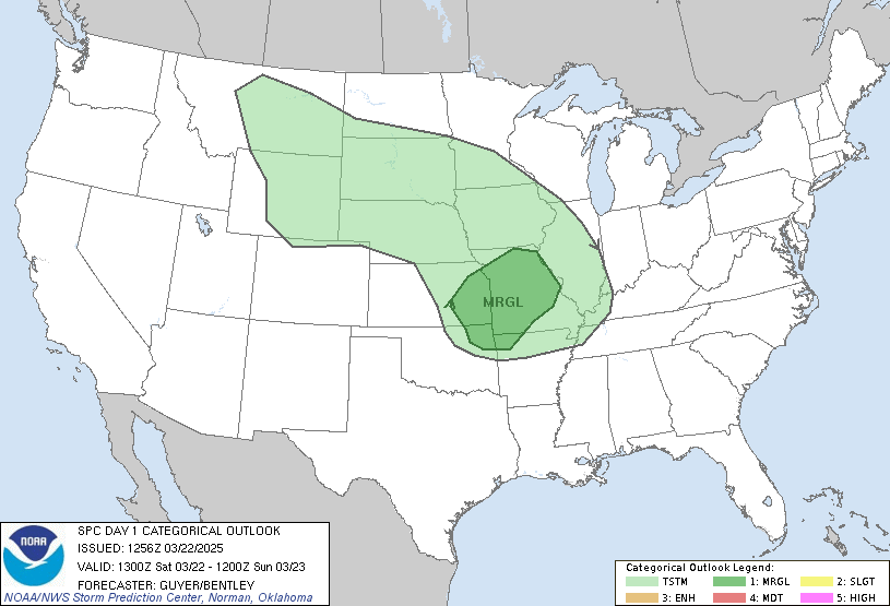
The SPC shows a slight risk of svr. weather just to the north of most of Houston metro:

It will be interesting to see if this gets adjusted southward today toward our area. Even if not, we are still under the "5%" risk area for winds and hail, so there is (at the very least) a minor severe risk.

It will be interesting to see if this gets adjusted southward today toward our area. Even if not, we are still under the "5%" risk area for winds and hail, so there is (at the very least) a minor severe risk.
0 likes
- TexasStooge
- Category 5

- Posts: 38127
- Joined: Tue Mar 25, 2003 1:22 pm
- Location: Irving (Dallas County), TX
- Contact:
- Extremeweatherguy
- Category 5

- Posts: 11095
- Joined: Mon Oct 10, 2005 8:13 pm
- Location: Florida
- Extremeweatherguy
- Category 5

- Posts: 11095
- Joined: Mon Oct 10, 2005 8:13 pm
- Location: Florida
Hazardous Weather Outlook
HAZARDOUS WEATHER OUTLOOK...CORRECTED
NATIONAL WEATHER SERVICE HOUSTON/GALVESTON TX
721 AM CDT SUN SEP 17 2006
TXZ163-164-176>179-195>200-210>214-226-227-235>238-181230-
AUSTIN-BRAZORIA-BRAZOS-BURLESON-CHAMBERS-COLORADO-FORT BEND-
GALVESTON-GRIMES-HARRIS-HOUSTON-JACKSON-LIBERTY-MADISON-MATAGORDA-
MONTGOMERY-POLK-SAN JACINTO-TRINITY-WALKER-WALLER-WASHINGTON-
WHARTON-
721 AM CDT SUN SEP 17 2006
THIS HAZARDOUS WEATHER OUTLOOK IS FOR PORTIONS OF SOUTHEAST TEXAS.
.DAY ONE AND TWO...TODAY THROUGH MONDAY.
A COMBINATION OF PACIFIC MOISTURE FROM THE REMAINS OF TROPICAL
DEPRESSION LANE IN THE PACIFIC AND GULF MOISTURE STREAMING INTO
THE REGION WILL HELP TO FUEL SCATTERED TO NUMEROUS SHOWERS AND
THUNDERSTORMS THIS AFTERNOON THROUGH MONDAY MORNING. AN UPPER
LEVEL STORM SYSTEM OVER THE PLAINS WILL SHIFT EAST AND LIFT THIS
MOISTURE NORTHWARDS WHILE DRIVING A COLD FRONT SOUTH INTO
SOUTHEAST TEXAS LATE TONIGHT INTO MONDAY MORNING. THIS FRONT SHOULD
PROVIDE ADDITIONAL LIFT TO CAUSE A LARGE SWATH OF SHOWERS AND
THUNDERSTORMS TO DEVELOP TO THE WEST OF THE REGION AND SLOWLY
TRAVERSE THE AREA. THESE STORMS WILL BE CAPABLE OF SUSTAINED HEAVY
DOWNPOURS...BRINGING RAINFALL ACCUMULATIONS OF AROUND 1 INCH WITH
SCATTERED AMOUNTS OF 3 TO 5 INCHES. A FLOOD WATCH MAY BE NEEDED
LATE TODAY OR TONIGHT.
IN ADDITION A MARGINAL THREAT OF SEVERE WEATHER WILL EXIST TONIGHT
AND MONDAY AHEAD OF THE FRONT. STRONG WINDS IN THE LOWER PORTIONS OF
THE ATMOSPHERE THAT VEER FROM SOUTH TO WEST WITH HEIGHT MAY LEAD TO
A THREAT OF SHORT LIVED TORNADOES OR POSSIBLY MICROBURSTS.
THE RAIN SHOULD END BY MONDAY AFTERNOON AS THE FRONT PUSHES OUT INTO
THE GULF OF MEXICO.
0 likes
The current setup does not match those of OCT 1994 and really OCt 1998. Both of those system, while they did have a tropical connection were multiday events with stalling frontal systems.
This is a progressive system with really a 24-36 hour time frame of excessive rainfall...somewhta similar to Oct 2002 and Hurr. Kenna.
With PWS as high as forecast 2.4-2.6 in rainfall rates of 3-4 inches per hour will be common and somebody will probably see 4-8 inches before it is all done. Main question is where?? Current feeling is the area along and E of I-35 is favored for cell training where totals may really add up fast.
0 likes
- Yankeegirl
- Category 5

- Posts: 3417
- Age: 50
- Joined: Sun May 23, 2004 11:59 pm
- Location: Cy-Fair, Northwest Houston
- Contact:
- Yankeegirl
- Category 5

- Posts: 3417
- Age: 50
- Joined: Sun May 23, 2004 11:59 pm
- Location: Cy-Fair, Northwest Houston
- Contact:
- PTrackerLA
- Category 5

- Posts: 5281
- Age: 42
- Joined: Thu Oct 10, 2002 8:40 pm
- Location: Lafayette, LA
- Yankeegirl
- Category 5

- Posts: 3417
- Age: 50
- Joined: Sun May 23, 2004 11:59 pm
- Location: Cy-Fair, Northwest Houston
- Contact:
- Yankeegirl
- Category 5

- Posts: 3417
- Age: 50
- Joined: Sun May 23, 2004 11:59 pm
- Location: Cy-Fair, Northwest Houston
- Contact:
Scattered thunderstorms are starting to push in from the west. They look pretty healthy.
http://www.khou.com/images/weather/dop320_a.gif
http://www.khou.com/images/weather/dop320_a.gif
0 likes
- Extremeweatherguy
- Category 5

- Posts: 11095
- Joined: Mon Oct 10, 2005 8:13 pm
- Location: Florida
yeah, they seem to be intensifying too.Johnny wrote:Scattered thunderstorms are starting to push in from the west. They look pretty healthy.
http://www.khou.com/images/weather/dop320_a.gif
0 likes
- Yankeegirl
- Category 5

- Posts: 3417
- Age: 50
- Joined: Sun May 23, 2004 11:59 pm
- Location: Cy-Fair, Northwest Houston
- Contact:
i have been watching those storms too and i took a nap and they are still in the same area they were when i started my nap... Everything just seems like its not moving too much... I guess once the front gets closer, that will change... also not sure if things are going to get too busy here, everything seems to still be to the north of us... I dunno... 

0 likes
- Extremeweatherguy
- Category 5

- Posts: 11095
- Joined: Mon Oct 10, 2005 8:13 pm
- Location: Florida

MESOSCALE DISCUSSION 1984
NWS STORM PREDICTION CENTER NORMAN OK
0602 PM CDT SUN SEP 17 2006
AREAS AFFECTED...SRN TX
CONCERNING...SEVERE POTENTIAL...WATCH UNLIKELY
VALID 172302Z - 180130Z
STORMS WILL INCREASE IN COVERAGE ACROSS SOUTH TX THROUGH THE EVENING
HOURS...WITH ISOLATED DAMAGING WET MICROBURSTS ALONG WITH VERY HEAVY
RAIN.
A VERY MOIST AND UNSTABLE AIR MASS CURRENTLY IN PLACE WITH GPS WATER
VAPOR SENSORS INDICATING PRECIPITABLE WATER VALUES IN EXCESS OF 2.25
INCHES. TEMPERATURES ARE RELATIVELY WARM ALOFT...WITH POOR LAPSE
RATES. HOWEVER...MID/UPPER VORTICITY MAXIMUM WILL CONTINUE EWD OUT
OF NRN MEXICO...AND WITH INCREASING LOW LEVEL CONVERGENCE...THIS
WILL FAVOR THE DEVELOPMENT OF NUMEROUS THUNDERSTORMS. ALTHOUGH A
SLIGHT INCREASE IN WIND PROFILES IS POSSIBLE WITH UPPER
FEATURE...THEY WILL LIKELY BE ONLY MARGINALLY FAVORABLE FOR
SUPERCELLS. SOME LOW LEVEL VEERING WITH HEIGHT/WARM ADVECTION WILL
FAVOR REDEVELOPMENT ON S/SW FLANKS...WITH POSSIBLE TRAINING ECHOES.
AT THIS TIME...IT APPEARS LOW LEVEL SHEAR WILL NOT BE STRONG ENOUGH
FOR A TORNADO THREAT. HOWEVER...VWP/PROFILER DATA WILL BE WATCHED
CLOSELY FOR A POSSIBLE STRONGER THAN FORECAST INCREASE IN LOW LEVEL
JETLET WHICH MAY ENHANCE THIS THREAT.
..JEWELL.. 09/17/2006
ATTN...WFO...HGX...CRP...EWX...BRO...
All this activity will then head NE toward us!
0 likes
- Yankeegirl
- Category 5

- Posts: 3417
- Age: 50
- Joined: Sun May 23, 2004 11:59 pm
- Location: Cy-Fair, Northwest Houston
- Contact:
Return to “USA & Caribbean Weather”
Who is online
Users browsing this forum: Edwards Limestone, txtwister78 and 67 guests


