Ok, I've created 2 Hurricanes. How did I do?
Moderator: S2k Moderators
Forum rules

The posts in this forum are NOT official forecasts and should not be used as such. They are just the opinion of the poster and may or may not be backed by sound meteorological data. They are NOT endorsed by any professional institution or STORM2K. For official information, please refer to products from the National Hurricane Center and National Weather Service.
-
SouthFloridawx

- S2K Supporter

- Posts: 8346
- Age: 47
- Joined: Tue Jul 26, 2005 1:16 am
- Location: Sarasota, FL
- Contact:
-
Jim Cantore
-
SouthFloridawx
- S2K Supporter
- Posts: 8346
- Age: 47
- Joined: Tue Jul 26, 2005 1:16 am
- Location: Sarasota, FL
- Contact:


-
Jim Cantore
I've seen SLOSH runs for a storm like this (cat 3 and 4) nothing short of disturbing.
And around here, I'm sure alot of people think we aren't at risk from Hurricanes, they're sadly and gravely mistaken.
Cape May county alone would take at least 36 hours to evacuate.
And around here, I'm sure alot of people think we aren't at risk from Hurricanes, they're sadly and gravely mistaken.
Cape May county alone would take at least 36 hours to evacuate.
Last edited by Jim Cantore on Wed Sep 27, 2006 6:26 am, edited 1 time in total.
0 likes
-
Jim Cantore
-
ObsessedMiami

- Category 1

- Posts: 432
- Joined: Tue Aug 31, 2004 8:08 pm
- Location: West Kendall, Fl
-
terstorm1012

- S2K Supporter
- Posts: 1314
- Age: 44
- Joined: Fri Sep 10, 2004 5:36 pm
- Location: Millersburg, PA
In your advisory:
Philadelphia is only 80 miles from AC...I think they'd receive far more substantial hurricane force winds at Gaby's landfall.
it'd be a nigthmare with all those condos and the Comcast Tower going up. Construction cranes airborne everywhere.
good report though, looking forward to the rest of your prognostication.
1000 dead is plausible. in a scenario in the Philadelphia Area Weather book, they guessed about that if Eduoard (1996) had made a strike on New Jersey as some models had predicted. Not to mention the vast amount of tree damage and trees falling on houses (i imagine people actually would take this one seriously and would at least stay home in the big cities, hopefully the shore points would evacuate in time)
my reasoning for why i think they'd take it seriously is you and I both live in the area (well I'm a lot more west but grew up in the area) and know just how shrill and hype the media, especially NBC 10 out of Philly, can get about the weather. If they report it the way they report snowstorms people will run like mad for the stores and hunker down at home.
Last edited by terstorm1012 on Wed Sep 27, 2006 2:02 pm, edited 2 times in total.
0 likes
-
terstorm1012
- S2K Supporter
- Posts: 1314
- Age: 44
- Joined: Fri Sep 10, 2004 5:36 pm
- Location: Millersburg, PA
'Category 5 wrote:This was the last Hurricane to hit New Jersey
The last time the state saw a notible storm surge was 21 years ago today, Hurricane Gloria flooded Cape May, and that was a weaker Hurricane then this, also the strongest part of it was offshore.
not necessarily true. the noreasters in the winter of 1997 wrecked Sea Isle City with their storm surges.
0 likes
-
Jim Cantore
terstorm1012 wrote:'Category 5 wrote:This was the last Hurricane to hit New Jersey
The last time the state saw a notible storm surge was 21 years ago today, Hurricane Gloria flooded Cape May, and that was a weaker Hurricane then this, also the strongest part of it was offshore.
not necessarily true. the noreasters in the winter of 1997 wrecked Sea Isle City with their storm surges.
I meant Hurricane related. Believe me, I know what these noreasters do.
0 likes
-
angelwing

- S2K Supporter
- Posts: 4462
- Age: 64
- Joined: Tue Jan 18, 2005 3:06 pm
- Location: Kulpsville, PA
terstorm1012 wrote:In your advisory:
my reasoning for why i think they'd take it seriously is you and I both live in the area (well I'm a lot more west but grew up in the area) and know just how shrill and hype the media, especially NBC 10 out of Philly, can get about the weather. If they report it the way they report snowstorms people will run like mad for the stores and hunker down at home.
I can see it now, all the french toast shopping, as soon as NBC10 says something the acme is packed in 5 minutes and out of the french toast items in an hour or less, sigh. Of course the beer distributor next door is packed too
0 likes
-
Jim Cantore
Ok, heres Gabrielles life story, I've made a disclaimer to fit it
The following is NOT a real storm and we hope it never will be. This isn't even a forecast. This is just a simulation to speak.
On August 30th, TD 7 formed to the southeast of the Cape Verde Islands. It nearly became quite short lived as its forward speed nearly sheered it apart. It managed to hold it’s own before becoming Tropical Storm Gabrielle late on August 31st. Through September 1st, Gabrielle went though a steady strengthening trend, nearly reaching Hurricane strength that night. Gabrielle became a Category 1 Hurricane on September 2nd, and through the day strengthened to a category 3 Hurricane. Gabrielle continued to strengthen into the 3rd, becoming a strong category 4 by the end of the day. Gabrielle strengthened further and became a category 5 on September 4th. Gabrielle reached her peak intensity of 165mph and 917mb on the afternoon of September 4th. Early on the 5th, Gabrielle underwent an eyewall replacement cycle. She weakened briefly to a category 4 before briefly regaining category 5 strength that afternoon.
During the afternoon of September 5th began stage one of a catastrophic series of events. A strong ridge had kept Gabrielle moving westward. However during the 5th, Gabrielle found a slightly weaker spot. Gabrielle, who was a large and obviously powerful Hurricane would punch through this weak spot, in response she turned toward the west-northwest just past longitude 65 west. Gabrielle was projected to turn out to sea, possibly striking Bermuda.
The last player in this setup, the Bermuda high, was located between Newfoundland and the Azores. At this point it had no effect.
Gabrielle weakened to a category 4 Hurricane on September 6th, and remained that way throughout the day. Gabrielle also began a turn toward the northwest. By days end she still packed winds at 145mph and had begun moving toward the North-northwest. On September 7th it appeared that Gabrielle, now packing winds at 135mph, was going to past west of Bermuda then head toward Nova Scotia or Newfoundland. However, there was one thing that wasn’t in the forecast about to unfold.
Late on September 7th, the Bermuda High began an unforecasted slide toward the west, by early on September 8th, it had set up shop just south of Nova Scotia.
On September 8th, Gabrielle, now a strong category 3 Hurricane, in response to the Bermuda high’s sudden detour. Shifted track and was moving just west of Northwest. She was now making a beeline for the Mid Atlantic coast. Hurricane watches went up from Cape Hatteras North Carolina to Nantucket Massachusetts.
During the afternoon of September 8th, it appeared that Gabrielle would make an extremely rare landfall in ether Delaware or New Jersey. Hurricane Warnings were issued from Chincoteague Virginia to Montauk New York. Tropical Storm Warnings were issued from Chincoteague, south to Cape Hatteras, and from Montauk north to the Massachusetts/New Hampshire boarder.
By now, Evacuations were underway from Virginia to New York, and scattered in low lying and surge prone areas from North Carolina to Cape Cod. This became the largest peacetime evacuation in U.S history, breaking the record held by Hurricane Floyd.
By the morning of September 9th, Gabrielle was set to make landfall in the Delaware Bay area as a category 3 Hurricane. Gabrielle had become an extremely large Hurricane, with Hurricane force winds extending out 135 miles from the center on ether side, and Tropical storm force winds extending out 400 miles to ether side.
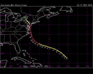
At 2pm EDT on September 9th, Gabrielle came ashore in Cape May New Jersey as a category 3 Hurricane with winds at 120mph. It was the first full fledged Hurricane to make landfall in New Jersey in 104 years, and the first Major Hurricane to hit the state in 186 years.
Gabrielle moved inland. Late on September 9th, she got caught in between the East Coast Trough and the Bermuda High. In response, she turned toward the North and eventually the north-northeast and accelerated. The pressure gradient created by the interaction with the misplaced Bermuda high allowed high winds to spread well inland. Gabrielle became extratropical on September 11th as she moved passed the Saint Lawrence in Quebec.
The Jersey coast experienced a storm surge as high as 22 feet. Long Beach Island, which was split in half for a time during Hurricane Gloria, was split in half again. This time permanently. The Barrier islands along the Jersey shore were wiped clean.
In all Gabrielle caused $90 Billion in damage, making it the costliest natural disaster in U.S history.
Gabrielle Killed 1,102 people
Fatalities by state
New Jersey: 750
New York: 250
Delaware: 75
Pennsylvania: 10
Virginia: 7
Maryland: 5
North Carolina: 3
Connecticut: 2
I've also adjusted the wind gusts slightly
Atlantic City NJ: 131mph
Ocean City NJ: 127mph
Wildwood NJ: 122mph
Cape May NJ: 119mph
Somers Point NJ: 114mph
Long Beach Island NJ: 111mph
Sea Isle City NJ: 109mph
Lewes DE: 104mph
Wilmington DE: 93mph
Asbury Park NJ: 91mph
Philadelphia PA: 90mph
New York City: 88mph
Sandy Hook NJ: 87mph
Fort Dix NJ: 86mph
Montauk NY: 82mph
Camden NJ: 81mph
Fenwick Island DE: 79mph
Trenton NJ: 78mph
Ocean City MD: 76mph
Newark NJ: 75mph
Chincoteague VA: 74mph
Baltimore MD: 72mph
Bridgeport CT: 71mph
Virginia Beach VA: 70mph
Newport RI: 69mph
Nags Head NC: 66mph
Providence RI: 64mph
Marthas Vineyard MA: 58mph
Cape Hatteras NC: 56mph
Boston MA: 46mph
Washington DC: 43mph
The following is NOT a real storm and we hope it never will be. This isn't even a forecast. This is just a simulation to speak.
On August 30th, TD 7 formed to the southeast of the Cape Verde Islands. It nearly became quite short lived as its forward speed nearly sheered it apart. It managed to hold it’s own before becoming Tropical Storm Gabrielle late on August 31st. Through September 1st, Gabrielle went though a steady strengthening trend, nearly reaching Hurricane strength that night. Gabrielle became a Category 1 Hurricane on September 2nd, and through the day strengthened to a category 3 Hurricane. Gabrielle continued to strengthen into the 3rd, becoming a strong category 4 by the end of the day. Gabrielle strengthened further and became a category 5 on September 4th. Gabrielle reached her peak intensity of 165mph and 917mb on the afternoon of September 4th. Early on the 5th, Gabrielle underwent an eyewall replacement cycle. She weakened briefly to a category 4 before briefly regaining category 5 strength that afternoon.
During the afternoon of September 5th began stage one of a catastrophic series of events. A strong ridge had kept Gabrielle moving westward. However during the 5th, Gabrielle found a slightly weaker spot. Gabrielle, who was a large and obviously powerful Hurricane would punch through this weak spot, in response she turned toward the west-northwest just past longitude 65 west. Gabrielle was projected to turn out to sea, possibly striking Bermuda.
The last player in this setup, the Bermuda high, was located between Newfoundland and the Azores. At this point it had no effect.
Gabrielle weakened to a category 4 Hurricane on September 6th, and remained that way throughout the day. Gabrielle also began a turn toward the northwest. By days end she still packed winds at 145mph and had begun moving toward the North-northwest. On September 7th it appeared that Gabrielle, now packing winds at 135mph, was going to past west of Bermuda then head toward Nova Scotia or Newfoundland. However, there was one thing that wasn’t in the forecast about to unfold.
Late on September 7th, the Bermuda High began an unforecasted slide toward the west, by early on September 8th, it had set up shop just south of Nova Scotia.
On September 8th, Gabrielle, now a strong category 3 Hurricane, in response to the Bermuda high’s sudden detour. Shifted track and was moving just west of Northwest. She was now making a beeline for the Mid Atlantic coast. Hurricane watches went up from Cape Hatteras North Carolina to Nantucket Massachusetts.
During the afternoon of September 8th, it appeared that Gabrielle would make an extremely rare landfall in ether Delaware or New Jersey. Hurricane Warnings were issued from Chincoteague Virginia to Montauk New York. Tropical Storm Warnings were issued from Chincoteague, south to Cape Hatteras, and from Montauk north to the Massachusetts/New Hampshire boarder.
By now, Evacuations were underway from Virginia to New York, and scattered in low lying and surge prone areas from North Carolina to Cape Cod. This became the largest peacetime evacuation in U.S history, breaking the record held by Hurricane Floyd.
By the morning of September 9th, Gabrielle was set to make landfall in the Delaware Bay area as a category 3 Hurricane. Gabrielle had become an extremely large Hurricane, with Hurricane force winds extending out 135 miles from the center on ether side, and Tropical storm force winds extending out 400 miles to ether side.
At 2pm EDT on September 9th, Gabrielle came ashore in Cape May New Jersey as a category 3 Hurricane with winds at 120mph. It was the first full fledged Hurricane to make landfall in New Jersey in 104 years, and the first Major Hurricane to hit the state in 186 years.
Gabrielle moved inland. Late on September 9th, she got caught in between the East Coast Trough and the Bermuda High. In response, she turned toward the North and eventually the north-northeast and accelerated. The pressure gradient created by the interaction with the misplaced Bermuda high allowed high winds to spread well inland. Gabrielle became extratropical on September 11th as she moved passed the Saint Lawrence in Quebec.
The Jersey coast experienced a storm surge as high as 22 feet. Long Beach Island, which was split in half for a time during Hurricane Gloria, was split in half again. This time permanently. The Barrier islands along the Jersey shore were wiped clean.
In all Gabrielle caused $90 Billion in damage, making it the costliest natural disaster in U.S history.
Gabrielle Killed 1,102 people
Fatalities by state
New Jersey: 750
New York: 250
Delaware: 75
Pennsylvania: 10
Virginia: 7
Maryland: 5
North Carolina: 3
Connecticut: 2
I've also adjusted the wind gusts slightly
Atlantic City NJ: 131mph
Ocean City NJ: 127mph
Wildwood NJ: 122mph
Cape May NJ: 119mph
Somers Point NJ: 114mph
Long Beach Island NJ: 111mph
Sea Isle City NJ: 109mph
Lewes DE: 104mph
Wilmington DE: 93mph
Asbury Park NJ: 91mph
Philadelphia PA: 90mph
New York City: 88mph
Sandy Hook NJ: 87mph
Fort Dix NJ: 86mph
Montauk NY: 82mph
Camden NJ: 81mph
Fenwick Island DE: 79mph
Trenton NJ: 78mph
Ocean City MD: 76mph
Newark NJ: 75mph
Chincoteague VA: 74mph
Baltimore MD: 72mph
Bridgeport CT: 71mph
Virginia Beach VA: 70mph
Newport RI: 69mph
Nags Head NC: 66mph
Providence RI: 64mph
Marthas Vineyard MA: 58mph
Cape Hatteras NC: 56mph
Boston MA: 46mph
Washington DC: 43mph
Last edited by Jim Cantore on Wed Sep 27, 2006 8:21 pm, edited 3 times in total.
0 likes
-
terstorm1012
- S2K Supporter
- Posts: 1314
- Age: 44
- Joined: Fri Sep 10, 2004 5:36 pm
- Location: Millersburg, PA
-
Jim Cantore
-
Jim Cantore
-
terstorm1012
- S2K Supporter
- Posts: 1314
- Age: 44
- Joined: Fri Sep 10, 2004 5:36 pm
- Location: Millersburg, PA
-
Jim Cantore