SE Texas weather thread #2 - Flood watch issued!
Moderator: S2k Moderators
Forum rules

The posts in this forum are NOT official forecast and should not be used as such. They are just the opinion of the poster and may or may not be backed by sound meteorological data. They are NOT endorsed by any professional institution or STORM2K.
-
HouTXmetro

- Category 5

- Posts: 3949
- Joined: Sun Jun 13, 2004 6:00 pm
- Location: District of Columbia, USA
vbhoutex wrote:Tomorrow KD. I think get the same emails he does. Possible 2"+ again in some areas depending on how things set up.


Well the e-mail did say "Moisture will return today and tonight". I assumed that moisture meant rain. That's how I interpreted that. Could be wrong.
And the e-mail was from Jeff.
0 likes
[Disclaimer: My Amateur Opinion, please defer to your local authorities or the NHC for Guidance.]

Thanks VB and HouTXMetro. We definitley do not need more rainfall especially anything over 2".
Just curious but did Jeff mention another big rain event for the late weekend into next week. This mornings Hou-Gal AFD mentioned the possibilty.
Just curious but did Jeff mention another big rain event for the late weekend into next week. This mornings Hou-Gal AFD mentioned the possibilty.
0 likes
The following post is NOT an official forecast and should not be used as such. It is just the opinion of the poster and may or may not be backed by sound meteorological data. It is NOT endorsed by any professional institution including storm2k.org For Official Information please refer to the NHC and NWS products.
-
JonathanBelles
- Professional-Met

- Posts: 11430
- Age: 35
- Joined: Sat Dec 24, 2005 9:00 pm
- Location: School: Florida State University (Tallahassee, FL) Home: St. Petersburg, Florida
- Contact:
-
Yankeegirl

- Category 5
- Posts: 3417
- Age: 50
- Joined: Sun May 23, 2004 11:59 pm
- Location: Cy-Fair, Northwest Houston
- Contact:
-
jasons2k

- Storm2k Executive

- Posts: 8290
- Age: 52
- Joined: Wed Jul 06, 2005 12:32 pm
- Location: The Woodlands, TX
HouTXmetro wrote:vbhoutex wrote:Tomorrow KD. I think get the same emails he does. Possible 2"+ again in some areas depending on how things set up.
Well the e-mail did say "Moisture will return today and tonight". I assumed that moisture meant rain. That's how I interpreted that. Could be wrong.
And the e-mail was from Jeff.
hey HouTex, I get them too and no moisture doesn't mean rain. He meant moisture return (higher dewpoints and precipitable water) which will provide the fuel for additional rain.
------------
for the others...he didn't mention next weekend. Here is what he sent:
"Cold front will move across the area Wednesday night with additional heavy rains possible. Models have come into better agreement with good moisture return today and tonight with PWS back over 2.0 inches by early Wednesday. High moisture levels once again coupled with good dynamics will produce widespread showers and thunderstorms. Rainfall amounts will average 1-2 inches with isolated amounts of 3-4 inches possible. This will aggravate ongoing flooding problems along area rivers."
0 likes
-
vbhoutex

- Storm2k Executive
- Posts: 29149
- Age: 74
- Joined: Wed Oct 09, 2002 11:31 pm
- Location: Cypress, TX
- Contact:
jschlitz wrote:HouTXmetro wrote:vbhoutex wrote:Tomorrow KD. I think get the same emails he does. Possible 2"+ again in some areas depending on how things set up.
Well the e-mail did say "Moisture will return today and tonight". I assumed that moisture meant rain. That's how I interpreted that. Could be wrong.
And the e-mail was from Jeff.
hey HouTex, I get them too and no moisture doesn't mean rain. He meant moisture return (higher dewpoints and precipitable water) which will provide the fuel for additional rain.
------------
for the others...he didn't mention next weekend. Here is what he sent:
"Cold front will move across the area Wednesday night with additional heavy rains possible. Models have come into better agreement with good moisture return today and tonight with PWS back over 2.0 inches by early Wednesday. High moisture levels once again coupled with good dynamics will produce widespread showers and thunderstorms. Rainfall amounts will average 1-2 inches with isolated amounts of 3-4 inches possible. This will aggravate ongoing flooding problems along area rivers."
I think Jeff has mentioned in past emails this possibility about the weekend, but it wasn't mentioned in the latest and I think I have deleted the others already.
0 likes
-
Yankeegirl
- Category 5
- Posts: 3417
- Age: 50
- Joined: Sun May 23, 2004 11:59 pm
- Location: Cy-Fair, Northwest Houston
- Contact:
I still have them, you want me to look? looking back, the most he talks about is this wednesday and thursday... here is a clip from it...
"Break appears brief as SW US trough reloads with another storm system that cuts across TX Wednesday and Thursday. In fact the models remain very unsettled especially the GFS through the end of the month in a very wet “El Nino” like pattern."
this is from Jeffs e mail sent out on Friday 10/13...
"Break appears brief as SW US trough reloads with another storm system that cuts across TX Wednesday and Thursday. In fact the models remain very unsettled especially the GFS through the end of the month in a very wet “El Nino” like pattern."
this is from Jeffs e mail sent out on Friday 10/13...
0 likes
-
Extremeweatherguy

- Category 5
- Posts: 11095
- Joined: Mon Oct 10, 2005 8:13 pm
- Location: Florida
Temps will probably get even colder than forecast behind these two fronts. Accuweather and the models are showing 40s for Friday morning and then again for the first few mornings following the weekend front. Might be time to pull out the blankets and long sleeves! 
BTW: Accuweather is also showing a stretch of 2-3 days with highs in the 60s behind the weekend front.
BTW: Accuweather is also showing a stretch of 2-3 days with highs in the 60s behind the weekend front.
0 likes
-
Yankeegirl
- Category 5
- Posts: 3417
- Age: 50
- Joined: Sun May 23, 2004 11:59 pm
- Location: Cy-Fair, Northwest Houston
- Contact:
-
gboudx

- S2K Supporter

- Posts: 4090
- Joined: Thu Sep 04, 2003 1:39 pm
- Location: Rockwall, Tx but from Harvey, La
Yankeegirl wrote:I still have them, you want me to look? looking back, the most he talks about is this wednesday and thursday... here is a clip from it...
"Break appears brief as SW US trough reloads with another storm system that cuts across TX Wednesday and Thursday. In fact the models remain very unsettled especially the GFS through the end of the month in a very wet “El Nino” like pattern."
this is from Jeffs e mail sent out on Friday 10/13...
Is this a privileged email list, or open to the public?
0 likes
-
Extremeweatherguy
- Category 5
- Posts: 11095
- Joined: Mon Oct 10, 2005 8:13 pm
- Location: Florida
Saturday will probably be the warmest of the days beyond Thursday...but even so, "warm" will probably mean around 80F for a high and lows near 55-60F. Saturday night should feature a chance of storms with another cold front.Yankeegirl wrote:your not going to hear me complain... how is saturday looking... i am going to take the kids to the air show that day over at ellington field... i swear it always rains when the thunderbirds are going to be there!!!!
Last edited by Extremeweatherguy on Tue Oct 17, 2006 4:01 pm, edited 1 time in total.
0 likes
-
Extremeweatherguy
- Category 5
- Posts: 11095
- Joined: Mon Oct 10, 2005 8:13 pm
- Location: Florida
check out the latest NWS forecast for NW Houston from Thursday onward:
This forecast looks AMAZING!
Thursday: Showers and thunderstorms likely, mainly before 1pm. Mostly cloudy, with a high near 67. North wind between 10 and 15 mph. Chance of precipitation is 60%.
Thursday Night: Partly cloudy, with a low around 52.
Friday: Mostly sunny, with a high near 75.
Friday Night: Mostly clear, with a low around 56.
Saturday: A 30 percent chance of showers and thunderstorms. Partly cloudy, with a high near 80.
Saturday Night: A 30 percent chance of showers and thunderstorms. Partly cloudy, with a low around 64.
Sunday: Partly cloudy, with a high near 70.
Sunday Night: Mostly clear, with a low around 54.
Monday: Mostly sunny, with a high near 76.
This forecast looks AMAZING!
0 likes
-
vbhoutex
- Storm2k Executive
- Posts: 29149
- Age: 74
- Joined: Wed Oct 09, 2002 11:31 pm
- Location: Cypress, TX
- Contact:
gboudx wrote:Yankeegirl wrote:I still have them, you want me to look? looking back, the most he talks about is this wednesday and thursday... here is a clip from it...
"Break appears brief as SW US trough reloads with another storm system that cuts across TX Wednesday and Thursday. In fact the models remain very unsettled especially the GFS through the end of the month in a very wet “El Nino” like pattern."
this is from Jeffs e mail sent out on Friday 10/13...
Is this a privileged email list, or open to the public?
His emails noirmally cover only the SE TX/Houston metro area normally, so my presumption would be that they may not be of much use/interest to someone outside of this area.
He does weigh in on the tropics however, when there is a system in the GOM.
I'm not sure if he is taking anymore to his email list as he does have to limit his time for it somewhat/balance it with his job here in Houston. If he see's this I will let him answer. If he doesn't answer in a few days one of us that is on the list can ask if he is taking more.
0 likes
-
Extremeweatherguy
- Category 5
- Posts: 11095
- Joined: Mon Oct 10, 2005 8:13 pm
- Location: Florida
AREA FORECAST DISCUSSION
NATIONAL WEATHER SERVICE HOUSTON/GALVESTON TX
336 PM CDT TUE OCT 17 2006
.DISCUSSION...
IT HAS WARMED UP RAPIDLY EARLY THIS AFTERNOON ACROSS INLAND AREAS
WITH READINGS NEAR 90 (SO FAR). WE HAVE MORE CLOUD COVER THAN EXPECTED
THOUGH AND THIS IS SOMEWHAT HOLDING THE TEMPERATURES FROM GOING UP
FASTER. IT WILL REMAIN QUITE MOIST NEAR THE SURFACE TONIGHT AND
LOW LEVEL MOISTURE ADVECTION WILL EVEN ENHANCE THIS BY EARLY TOMORROW
MORNING. LIGHT WINDS AND RELATIVELY LIGHT CLOUD COVER SHOULD RESULT
IN PATCHES OF FOG (DENSE IN SOME AREAS) LATER TONIGHT. INCREASING
MOISTURE LEVELS EXPECTED TOMORROW. PWATS APPROACHING 2.2 TO 2.4
INCHES AHEAD OF A COLD FRONT THAT WILL MAKE ITS WAY ACROSS CWFA LATE
WEDNESDAY NIGHT AND INTO EARLY THURSDAY MORNING. THE FRONT IS
INDICATED TO MOVE QUITE RAPIDLY ACROSS REGION. THE VERY HIGH
MOISTURE LEVELS AND RR QUAD OF APPROACHING UPPER JET CORE (ALONG
WITH DIFFLUENT FLOW) SHOULD PROVIDE LOCALLY HEAVY RAINFALL DESPITE
FAST MOVEMENT OF BOUNDARY (THIS WILL BE LOOKED INTO MORE DETAIL BY
TONIGHTS SHIFT ONCE THE 00Z MODEL RUN COMES IN). WE SHALL HOLD
OFF FOR NOW WITH THE MENTION OF LOCALLY HEAVY RAINFALL FOR
TOMORROW NIGHT. COOLER AND DRIER AIR FILTERING ACROSS CWFA BEHIND
FRONT ON THURSDAY. FRIDAY LOOKS LIKE A GOOD DAY FOR OUTDOOR ACTIVITY.
THE NEXT FRONT IS INDICATED TO MOVE OUR REGION SATURDAY NIGHT.
MOISTURE LEVELS WILL AGAIN INCREASE AHEAD OF THIS FRONT BUT
INDICATIONS ARE IT WILL NOT BE AS HIGH LIKE TOMORROW NIGHT. DRYING
AND COOLING INDICATED ON SUNDAY WITH THE HIGH PRESSURE PUSHING
STRAIGHT THROUGH TEXAS AND THEN SETTLING OVER REGION ON MONDAY. 37
0 likes
-
gboudx
- S2K Supporter
- Posts: 4090
- Joined: Thu Sep 04, 2003 1:39 pm
- Location: Rockwall, Tx but from Harvey, La
vbhoutex wrote:gboudx wrote:Yankeegirl wrote:I still have them, you want me to look? looking back, the most he talks about is this wednesday and thursday... here is a clip from it...
"Break appears brief as SW US trough reloads with another storm system that cuts across TX Wednesday and Thursday. In fact the models remain very unsettled especially the GFS through the end of the month in a very wet “El Nino” like pattern."
this is from Jeffs e mail sent out on Friday 10/13...
Is this a privileged email list, or open to the public?
His emails noirmally cover only the SE TX/Houston metro area normally, so my presumption would be that they may not be of much use/interest to someone outside of this area.
He does weigh in on the tropics however, when there is a system in the GOM.
I'm not sure if he is taking anymore to his email list as he does have to limit his time for it somewhat/balance it with his job here in Houston. If he see's this I will let him answer. If he doesn't answer in a few days one of us that is on the list can ask if he is taking more.
I assumed as much on the coverage. However, that wouldn't preclude me from being interested in receiving his emails. I was receiving emails from a guy in New Orleans for a while before he took a new job and had to stop. My interest is in learning more about weather, and the chance possibility of decifering clues as to the weather further north. I certainly wouldn't bother him with questions like, "what about NTX?"
If he isn't taking more addresses, then that's fine. Just thought I'd ask. Thanks for the reply.
0 likes

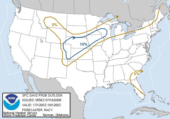
Extremeweatherguy wrote:Looks like the SPC thinks we will be having bad luck with our weather again tomorrow too...
Day 2 outlook:
...SERN TX/LOWER MS VALLEY NEWD INTO THE WRN PORTIONS OF THE TN
VALLEY...
RICH BOUNDARY LAYER MOISTURE FROM SRN TX NEWD ALONG GULF COASTAL
STATES SHOULD ADVECTED NEWD AHEAD OF EWD MOVING COLD FRONT DURING
THE DAY ON WEDNESDAY. ALTHOUGH DEWPOINTS AT 70F OR HIGHER ARE
EXPECTED AS FAR NORTHEAST AS ERN AR...TEMPERATURES ALOFT WILL REMAIN
RELATIVELY WARM AND RESULT IN MODEST INSTABILITY AT BEST... WITH
MLCAPES LIKELY RANGING FROM AROUND 500 MB ACROSS THE NRN PORTION OF
THE SLIGHT RISK AREA TO AS HIGH AS 2000 J/KG ACROSS ERN TX.
CONVECTION MAY RESULT FROM TWO DIFFERENT LIFTING SOURCES. THE LOW
LATITUDE SHORTWAVE TROUGH SHOULD AID IN CONVECTION INITIATION IN SRN
TX EARLY IN THE PERIOD...WITH THIS CONVECTION SPREADING NEWD ACROSS
THE LOWER MID VALLEY DURING THE DAY AND INTO THE WRN TN VALLEY
OVERNIGHT. OTHER THUNDERSTORMS ARE ALSO EXPECTED TO DEVELOP DURING
THE MID/LATE AFTERNOON HOURS ALONG THE COLD FRONT...FROM IL INTO TX.
THE STRENGTH OF THE SHEAR AND INSTABILITY...ESPECIALLY FROM CENTRAL
AR SWWD INTO ERN TX WOULD FAVOR SEVERE STORMS... INCLUDING A FEW
SUPERCELLS. ALTHOUGH THE LOW LEVEL SHEAR MAY SUPPORT A TORNADO OR
TWO...THE RELATIVELY WARM TEMPERATURES ALOFT ...500 MB TEMPERATURES
FROM -6C TO-8C...AND WEAK LAPSE RATES INDICATE WIND DAMAGE AND
MARGINALLY SEVERE HAIL WOULD BE THE MAIN THREATS.
AAARRRRGGGHHH!!!!! Not more rain again. Many bayous are flooded. More rain, more flooding. Looks like it will be a nighttime problem, which means being awaken by thunder while asleep.
0 likes

Tomorrow will bring more very heavy rain no doubt. The turn around from the drier and clear skies has come to an abrupt end this evening. I thought there was smoke from a fire a few minutes ago and verified its low and very fast moving scud clouds......very tropical feel. The high PWATs are here again. The dewpoint is 77F. This is just amazing.
0 likes
The following post is NOT an official forecast and should not be used as such. It is just the opinion of the poster and may or may not be backed by sound meteorological data. It is NOT endorsed by any professional institution including storm2k.org For Official Information please refer to the NHC and NWS products.
Return to “USA & Caribbean Weather”
Who is online
Users browsing this forum: AnnularCane and 62 guests