MESOSCALE DISCUSSION 2201
NWS STORM PREDICTION CENTER NORMAN OK
0915 PM CST TUE NOV 14 2006
AREAS AFFECTED...ERN AR ACROSS PARTS OF WRN TN AND NRN MS
CONCERNING...SEVERE POTENTIAL...WATCH POSSIBLE
VALID 150315Z - 150515Z
DEEP CONVECTION SHOULD GRADUALLY INTENSIFY THROUGH TONIGHT ACROSS
THE LOWER MS VALLEY FROM ERN AR TO WRN TN AND NRN MS AS A POWERFUL
STORM SYSTEM EVOLVES OVER THE SRN PLAINS. IN ADDITION TO IMMINENT
TORNADO WATCH ISSUANCE ACROSS PARTS OF SRN AR...ANOTHER WATCH MAY BE
NEEDED FOR AREAS OF ERN AR...AS WELL AS NRN MS AND WRN TN...LATER
TONIGHT OR EARLY WEDNESDAY.
RECENT TSTM DEVELOPMENT HAS OCCURRED ALONG/NORTH OF SURFACE WARM
FRONT EAST OF LITTLE ROCK. BASED ON LITTLE ROCK EVENING SOUNDING AND
LATEST OBJECTIVE DATA...THIS ACTIVITY IS OCCURRING IN A MARGINALLY
UNSTABLE THERMODYNAMIC ENVIRONMENT WHERE EFFECTIVE SHEAR APPEARS
SUPPORTIVE OF UPDRAFT ROTATION AND PERHAPS SOME HAIL. THERMODYNAMIC
AND KINEMATIC REGIME IS....HOWEVER...EXPECTED TO UNDERGO POTENTIALLY
RAPID CHANGE OVER THE NEXT FEW HOURS AS SIGNIFICANT SHORT WAVE
ENERGY MOVES EAST ACROSS OK AND DEEP-LAYER CYCLOGENESIS OCCURS
ACROSS THE RED RIVER/TXK AREAS. WHILE ONGOING AND IMMEDIATE FUTURE
ACTIVITY SHOULD REMAIN ELEVATED AND POSE PRIMARILY A HAIL
THREAT...DYNAMIC BOUNDARY LAYER MODIFICATION APPEARS POSSIBLE ACROSS
PARTS OF THE LOWER MS RIVER VALLEY AFTER MIDNIGHT. THUS...A SEVERE
WATCH MAY BE NEEDED FOR HAIL POTENTIAL FROM INCREASING ELEVATED
SUPERCELL STORMS...WITH SOME CHANCE FOR A TORNADO WATCH BY EARLY
WEDNESDAY.
..CARBIN.. 11/15/2006
ATTN...WFO...MEG...JAN...LZK...
34189119 34469175 34769229 35149242 36029205 36139080
36008972 35238854 34738821 33768837 32948873 32748967
32939069
November 15: Tornado Outbreak - Southeast US - 9 killed
Moderator: S2k Moderators
Forum rules

The posts in this forum are NOT official forecast and should not be used as such. They are just the opinion of the poster and may or may not be backed by sound meteorological data. They are NOT endorsed by any professional institution or STORM2K.
-
MississippiHurricane

- ChatStaff

- Posts: 648
- Age: 41
- Joined: Sat Jul 16, 2005 12:20 am
- Location: Hanover, Maryland
- Contact:
-
rsdoug1981
- Tropical Storm

- Posts: 184
- Joined: Tue Aug 31, 2004 4:22 pm
- Location: Canton, MS
Misshurricane wrote:I HOPE no hail here........just spent $180 for a new windshield today.
Eeek? No garage? The mesoscale discussion that CrazyC83 just posted also gives me a little hope regarding the tornado threat. The prime area of instability looks to shift north of you and me. Again, I'm not letting my guard down, but I'll take a squall line any day of the week over supercells.
0 likes
-
CrazyC83
- Professional-Met

- Posts: 34315
- Joined: Tue Mar 07, 2006 11:57 pm
- Location: Deep South, for the first time!
rsdoug1981 wrote:Misshurricane wrote:I HOPE no hail here........just spent $180 for a new windshield today.
Eeek? No garage? The mesoscale discussion that CrazyC83 just posted also gives me a little hope regarding the tornado threat. The prime area of instability looks to shift north of you and me. Again, I'm not letting my guard down, but I'll take a squall line any day of the week over supercells.
Good for you for not letting the guard down.
I personally think the I-20 corridor is the focal point, stretching north somewhat.
0 likes
-
senorpepr

- Military Met/Moderator

- Posts: 12542
- Age: 43
- Joined: Fri Aug 22, 2003 9:22 pm
- Location: Mackenbach, Germany
- Contact:
CrazyC83 wrote:As for the FEMA trailers, remember Evansville? While the chances are low, that is a long way from zero.
Yes... but that doesn't account for the rest of the mobile home parks that were left untouched. You're still speaking of one small area (at most a few hundred acres of land) in a VERY large area (several hundreds of square miles). The chances are much closer to zero than you think.
Matter of fact... let's look at it this way:
The statistical chances of a single tornado hitting a 200 acre mobile home park in the area the size of Watch 850 (41,020 mi^2): 0.00076%
0 likes

CrazyC83 wrote:rsdoug1981 wrote:Misshurricane wrote:I HOPE no hail here........just spent $180 for a new windshield today.
Eeek? No garage? The mesoscale discussion that CrazyC83 just posted also gives me a little hope regarding the tornado threat. The prime area of instability looks to shift north of you and me. Again, I'm not letting my guard down, but I'll take a squall line any day of the week over supercells.
Good for you for not letting the guard down.
I personally think the I-20 corridor is the focal point, stretching north somewhat.
ok, what makes you think there will be tornadoes with the parameters currently in place? i'm trying to figure out if i'm missing something here, because i really dont see it happening. i realize the MD said the storm will deepen over the area and therefore will cause better shear and more instability late tonight, but with the current parameters, it isnt looking very good.
0 likes
-
senorpepr
- Military Met/Moderator
- Posts: 12542
- Age: 43
- Joined: Fri Aug 22, 2003 9:22 pm
- Location: Mackenbach, Germany
- Contact:
dean wrote:i dont see why they are thinking tornado, especially PDS. EVERYTHING IN ARKANSAS IS LINEAR! not only that, but like i said before, dp's only from 55-64 throughout the entire watch. only reason i can see a tornado happening is that LCL's are really low, so it wont take a whole lot of moisture to form a tornado, but first you need SHEAR to form supercells to produce tornadoes, and that isn't there.
Actually, there is sufficient shear. It's not directional, but rather speed shear. But still... all the ingredients aren't together. You're not going to get an outbreak without instability and moisture... just like you're not going to start a car without gas and an ignition
0 likes
-
CrazyC83
- Professional-Met
- Posts: 34315
- Joined: Tue Mar 07, 2006 11:57 pm
- Location: Deep South, for the first time!
dean wrote:CrazyC83 wrote:rsdoug1981 wrote:Misshurricane wrote:I HOPE no hail here........just spent $180 for a new windshield today.
Eeek? No garage? The mesoscale discussion that CrazyC83 just posted also gives me a little hope regarding the tornado threat. The prime area of instability looks to shift north of you and me. Again, I'm not letting my guard down, but I'll take a squall line any day of the week over supercells.
Good for you for not letting the guard down.
I personally think the I-20 corridor is the focal point, stretching north somewhat.
ok, what makes you think there will be tornadoes with the parameters currently in place? i'm trying to figure out if i'm missing something here, because i really dont see it happening. i realize the MD said the storm will deepen over the area and therefore will cause better shear and more instability late tonight, but with the current parameters, it isnt looking very good.
The jet stream provides enhanced upper-level shear. The surface parameters are the only thing preventing a major outbreak now. That explains the lack of activity now. However, residents should be very prepared - if it changes, it will be in their sleep.
Better safe than sorry, especially overnight.
There is still a question mark in the title, as it is not 100% certain, but I think it is 60-70% certain at this point. (There were three question marks previously until today)
0 likes
-
senorpepr
- Military Met/Moderator
- Posts: 12542
- Age: 43
- Joined: Fri Aug 22, 2003 9:22 pm
- Location: Mackenbach, Germany
- Contact:
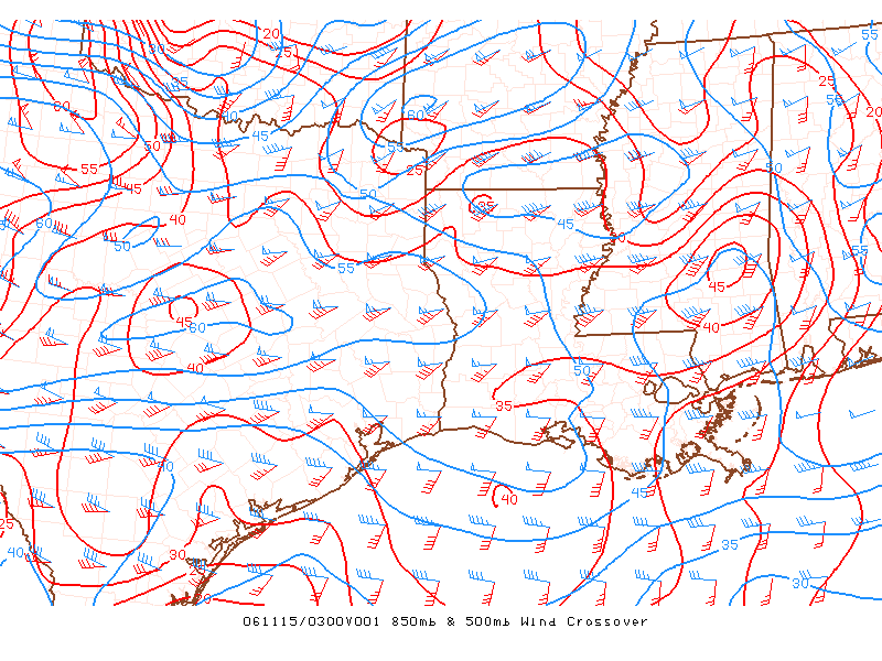
Another issue is a cap, as mentioned by SPC. If you look throughout West Texas through Mississippi, there is some sort of an inversion between 850mb and the surface. Unless there is significant warm air advection during the thermal minimum... it's going to be difficult to bust through this cap to any widespread level.
0 likes


senor.. officials in Mississippi are not taking the chance that it may or may not threaten a mobile home park. What they are concerned about is the people in FEMA trailers. They are small and a gust of wind in a thunderstorm is dangerous. They will be opening up shelters for those in FEMA trailers. IMO, that is an excellent call. After Katrina, no one takes chances anymore.
There is ALOT of craziness that comes out of the gulf this time of year. When those two meet it usually spells waterspouts that move onshore. I know this can happen. Watched one jump my house and hit my neighbors house.
There is ALOT of craziness that comes out of the gulf this time of year. When those two meet it usually spells waterspouts that move onshore. I know this can happen. Watched one jump my house and hit my neighbors house.
0 likes
-
the_winds_that_sheared_me
- Tropical Storm
- Posts: 132
- Joined: Sun Aug 06, 2006 5:15 pm
- Location: Orange Park, Fla
senorpepr wrote:CrazyC83 wrote:As for the FEMA trailers, remember Evansville? While the chances are low, that is a long way from zero.
Yes... but that doesn't account for the rest of the mobile home parks that were left untouched. You're still speaking of one small area (at most a few hundred acres of land) in a VERY large area (several hundreds of square miles). The chances are much closer to zero than you think.
Matter of fact... let's look at it this way:
The statistical chances of a single tornado hitting a 200 acre mobile home park in the area the size of Watch 850 (41,020 mi^2): 0.00076%
I agree with the statistics Senorpepr but I have noticed in the news pictures that tornadoes seem to "seek out" mobile home areas and even the NWS agrees with this with this paragraph in the last tornado episode to hit Orlando, Fla last week:
IF IN MOBILE HOMES OR VEHICLES...EVACUATE THEM AND GET INSIDE A
SUBSTANTIAL SHELTER. IF NO SHELTER IS AVAILABLE...LIE FLAT IN THE
NEAREST DITCH OR OTHER LOW SPOT AND COVER YOUR HEAD WITH YOUR HANDS.
I'd say 7 times outta 10 when you hear of damage/deaths from a tornado , its because one hit a mobile home park. I dunno almost seems like the flatness and lack of trees in a mobile home park help develop tornadoes perhaps due to the lack of anything to block the airflow.
If I were in a mobile home in the PDS Tornado watch area, I would not go to sleep without making sure my noaa radio was in alert mode.
0 likes
-
senorpepr
- Military Met/Moderator
- Posts: 12542
- Age: 43
- Joined: Fri Aug 22, 2003 9:22 pm
- Location: Mackenbach, Germany
- Contact:
Yes, but this really isn't worthy of being called a "worse-case" scenario... especially when much of the FEMA parks aren't even in the significant danger area.Lindaloo wrote:senor.. officials in Mississippi are not taking the chance that it may or may not threaten a mobile home park. What they are concerned about is the people in FEMA trailers. They are small and a gust of wind in a thunderstorm is dangerous. They will be opening up shelters for those in FEMA trailers. IMO, that is an excellent call. After Katrina, no one takes chances anymore.
There is ALOT of craziness that comes out of the gulf this time of year. When those two meet it usually spells waterspouts that move onshore. I know this can happen. Watched one jump my house and hit my neighbors house.
0 likes
-
senorpepr
- Military Met/Moderator
- Posts: 12542
- Age: 43
- Joined: Fri Aug 22, 2003 9:22 pm
- Location: Mackenbach, Germany
- Contact:
the_winds_that_sheared_me wrote:I agree with the statistics Senorpepr but I have noticed in the news pictures that tornadoes seem to "seek out" mobile home areas and even the NWS agrees with this with this paragraph in the last tornado episode to hit Orlando, Fla last week:IF IN MOBILE HOMES OR VEHICLES...EVACUATE THEM AND GET INSIDE A
SUBSTANTIAL SHELTER. IF NO SHELTER IS AVAILABLE...LIE FLAT IN THE
NEAREST DITCH OR OTHER LOW SPOT AND COVER YOUR HEAD WITH YOUR HANDS.
I'd say 7 times outta 10 when you hear of damage/deaths from a tornado , its because one hit a mobile home park. I dunno almost seems like the flatness and lack of trees in a mobile home park help develop tornadoes perhaps due to the lack of anything to block the airflow.
If I were in a mobile home in the PDS Tornado watch area, I would not go to sleep without making sure my noaa radio was in alert mode.
Yes, but how many times does a tornado touchdown and it hits nobody? Much more often than not. Tornadoes don't seek out mobile home parks. The airflow near one doesn't affect the development of tornadoes. It's just that they take damage easier. Nonetheless... the chances are still extremely low.
0 likes
-
CrazyC83
- Professional-Met
- Posts: 34315
- Joined: Tue Mar 07, 2006 11:57 pm
- Location: Deep South, for the first time!
Lindaloo wrote:I do not buy that worse case scenario either. But you will agree that it is better to be safe than sorry, especially down here.
This is really a combination of factors that I agree with your theory. The fact that this is an overnight outbreak (if it happens) means that becomes especially true. Unlike hurricanes, you can't go to bed and expect to wake up not having been passed by the tornado events if they hit you.
0 likes
Absolutely. Alot of deaths occurr when severe weather happens during the night. I learned a hard lesson and that is, take weather more seriously. You never know what can happen. Weather is not an exact science because Mother Nature has been known to fool even the top meteorologists as we found out in 2005.
0 likes
Return to “USA & Caribbean Weather”
Who is online
Users browsing this forum: wxman22 and 149 guests