Here is a current Winter Weather Advisory for Home (Philadelphia, PA) until 6:00am,
Mon Jan 22 2007, from your local National Weather Service office.
MERCER-GLOUCESTER-CAMDEN-NORTHWESTERN BURLINGTON-OCEAN-ATLANTIC-
COASTAL ATLANTIC-COASTAL OCEAN-SOUTHEASTERN BURLINGTON-BERKS-
CHESTER-MONTGOMERY-BUCKS-DELAWARE-PHILADELPHIA-
INCLUDING THE CITIES OF...TRENTON...GLASSBORO...CAMDEN...
CHERRY HILL...MOORESTOWN...MOUNT HOLLY...JACKSON...HAMMONTON...
ATLANTIC CITY...LONG BEACH ISLAND...WHARTON STATE FOREST...
READING...WEST CHESTER...NORRISTOWN...DOYLESTOWN...MEDIA
1137 AM EST SUN JAN 21 2007
...WINTER WEATHER ADVISORY IN EFFECT FROM 6 PM THIS EVENING TO
6 AM EST MONDAY...
LOW PRESSURE HEADED ACROSS THE MID MISSISSIPPI VALLEY THIS AFTERNOON
WILL MOVE NORTHEASTWARD AND BRING AN AREA OF MOISTURE INTO OUR
REGION TOWARD EVENING AND CONTINUE FOR AWHILE TONIGHT. AS THIS MAIN
STORM MOVES TOWARD WESTERN PENNSYLVANIA LATE TONIGHT AND WEAKENS,
ANOTHER STORM MAY FORM OFF THE NORTH CAROLINA COAST AND THEN MOVE
OUT TO SEA.
SNOW IS EXPECTED TO DEVELOP LATER THIS AFTERNOON AND EARLY THIS
EVENING FROM WEST TO EAST. AS THE INTENSITY OF THE PRECIPITATION
BECOMES LIGHTER AND STARTS TO END, SOME FREEZING DRIZZLE IS
EXPECTED TONIGHT. TOTAL SNOW ACCUMULATIONS OF A COATING TO AN
INCH ARE ANTICIPATED, TOPPED BY A THIN COATING OF ICE LATE TONIGHT
AND EARLY MONDAY MORNING.
WHILE UNTREATED ROADWAYS WILL BECOME SLIPPERY, ANY FREEZING DRIZZLE
WILL MAKE DRIVING MORE DIFFICULT TONIGHT AND FOR THE MONDAY MORNING
COMMUTE. BE ESPECIALLY CAREFUL WHILE DRIVING ON BRIDGES, OVERPASSES
AND ANY OTHER ELEVATED ROADWAYS.
STAY TUNED TO NOAA WEATHER RADIO ALL HAZARDS OR YOUR LOCAL MEDIA
OUTLET FOR FURTHER UPDATES.
Here we go again, PA/NJ...Possible Snow & MORE ARTIC air
Moderator: S2k Moderators
Forum rules
 The posts in this forum are NOT official forecast and should not be used as such. They are just the opinion of the poster and may or may not be backed by sound meteorological data. They are NOT endorsed by any professional institution or STORM2K.

The posts in this forum are NOT official forecast and should not be used as such. They are just the opinion of the poster and may or may not be backed by sound meteorological data. They are NOT endorsed by any professional institution or STORM2K.
-
angelwing

- S2K Supporter

- Posts: 4462
- Age: 64
- Joined: Tue Jan 18, 2005 3:06 pm
- Location: Kulpsville, PA
Here we go again, PA/NJ...Possible Snow & MORE ARTIC air
Last edited by angelwing on Sun Jan 28, 2007 2:49 pm, edited 2 times in total.
0 likes


-
Jim Cantore
-
Jim Cantore
-
angelwing
- S2K Supporter
- Posts: 4462
- Age: 64
- Joined: Tue Jan 18, 2005 3:06 pm
- Location: Kulpsville, PA
Special Weather Statement
(Expires: Wednesday January 24 5:00PM EST)
special weather statement
national weather service mount holly nj
413 am est wed jan 24 2007
new castle-kent de-inland sussex-delaware beaches-cecil-kent md-
queen anne's-talbot-caroline-sussex-warren-morris-hunterdon-
somerset-middlesex-western monmouth-eastern monmouth-mercer-salem-
gloucester-camden-northwestern burlington-ocean-cumberland-
atlantic-cape may-atlantic coastal cape may-coastal atlantic-
coastal ocean-southeastern burlington-carbon-monroe-berks-lehigh-
northampton-chester-montgomery-bucks-delaware-philadelphia-
including the cities of...wilmington...dover...georgetown...
rehoboth beach...elkton...chestertown...centreville...easton...
denton...newton...washington...morristown...flemington...
somerville...new brunswick...freehold...sandy hook...trenton...
pennsville...glassboro...camden...cherry hill...moorestown...
mount holly...jackson...millville...hammonton...
cape may court house...ocean city...atlantic city...
long beach island...wharton state forest...jim thorpe...
stroudsburg...reading...allentown...bethlehem...west chester...
norristown...doylestown...media
413 am est wed jan 24 2007
...snow showers and possibly snow squalls on thursday followed by
the coldest air mass of the season thursday night into friday
night...
an unseasonably cold and unstable arctic air mass is forecast to
move through the region during thursday and thursday evening. as it
crosses the area it will trigger scattered snow showers and possibly
even a few snow squalls. it would not be shocking if thunder
accompanied the strongest squalls. the snow showers by themselves
could produce accumulations up to an inch. but if squalls were to
occur, a localized and quick one or two inches of snow could
accumulate. this in turn would cause hazardous driving conditions.
persons traveling on thursday are advised to be prepared for
rapidly changing and variable weather and road conditions. please
factor in extra time to reach your destination and leave plenty
of distance between yourself and the vehicles around you.
arctic air will be streaming into the region on thursday and this
process will intensify as winds increase thursday night. low
temperatures by friday morning will be in the single digits and
teens nearly everywhere. factoring in the wind chill will produce
readings below zero across northern parts of pennsylvania and new
jersey and around zero elsewhere. municipalities which have a high
number of homeless population are advised to start making the
necessary preparations to help these individuals. anyone that has to
work or spend time outdoors thursday night or friday should find
their warmest outfits, since this may very well match or exceed the
coldest day of last winter. where multiple layers and do not forget
the hat, scarves and gloves. winds on friday are expected to gust as
strongly as 40 to 45 mph.
winds are expected to diminish friday night, although temperatures
might be slightly colder. a moderating trend is expected for the
weekend, but the overall cold weather pattern is not leaving us
anytime soon.
0 likes
-
angelwing
- S2K Supporter
- Posts: 4462
- Age: 64
- Joined: Tue Jan 18, 2005 3:06 pm
- Location: Kulpsville, PA
Here is a current Special Weather Statement for Home (Philadelphia, PA) until 6:00am, Thu Jan 25 2007, from your local National Weather Service office.
---------------------------------------------------------------------
SPECIAL WEATHER STATEMENT
NATIONAL WEATHER SERVICE MOUNT HOLLY NJ
323 PM EST WED JAN 24 2007
NEW CASTLE-KENT DE-INLAND SUSSEX-DELAWARE BEACHES-CECIL-KENT MD-
QUEEN ANNE'S-TALBOT-CAROLINE-SUSSEX-WARREN-MORRIS-HUNTERDON-
SOMERSET-MIDDLESEX-WESTERN MONMOUTH-EASTERN MONMOUTH-MERCER-SALEM-
GLOUCESTER-CAMDEN-NORTHWESTERN BURLINGTON-OCEAN-CUMBERLAND-
ATLANTIC-CAPE MAY-ATLANTIC COASTAL CAPE MAY-COASTAL ATLANTIC-
COASTAL OCEAN-SOUTHEASTERN BURLINGTON-CARBON-MONROE-BERKS-LEHIGH-
NORTHAMPTON-CHESTER-MONTGOMERY-BUCKS-DELAWARE-PHILADELPHIA-
INCLUDING THE CITIES OF...WILMINGTON...DOVER...GEORGETOWN...
REHOBOTH BEACH...ELKTON...CHESTERTOWN...CENTREVILLE...EASTON...
DENTON...NEWTON...WASHINGTON...MORRISTOWN...FLEMINGTON...
SOMERVILLE...NEW BRUNSWICK...FREEHOLD...SANDY HOOK...TRENTON...
PENNSVILLE...GLASSBORO...CAMDEN...CHERRY HILL...MOORESTOWN...
MOUNT HOLLY...JACKSON...MILLVILLE...HAMMONTON...
CAPE MAY COURT HOUSE...OCEAN CITY...ATLANTIC CITY...
LONG BEACH ISLAND...WHARTON STATE FOREST...JIM THORPE...
STROUDSBURG...READING...ALLENTOWN...BETHLEHEM...WEST CHESTER...
NORRISTOWN...DOYLESTOWN...MEDIA
323 PM EST WED JAN 24 2007
...SNOW SHOWERS AND POSSIBLY SNOW SQUALLS ON THURSDAY FOLLOWED BY
THE COLDEST AIR MASS OF THE SEASON THURSDAY NIGHT INTO FRIDAY
NIGHT...
AN UNSEASONABLY COLD AND UNSTABLE ARCTIC AIR MASS IS FORECAST TO
MOVE INTO THE REGION THURSDAY AND THURSDAY EVENING. AS IT DOES SO IT
WILL TRIGGER SCATTERED SNOW SHOWERS, POSSIBLY A FEW SNOW SQUALLS,
AND PERHAPS EVEN SOME THUNDER. THE SNOW SHOWERS BY THEMSELVES COULD
PRODUCE ACCUMULATIONS OF UP TO AN INCH. IF LOCALIZED SNOW SQUALLS
WERE TO OCCUR, WINDS WOULD INCREASE AND VISIBILITIES WOULD BE
REDUCED TO A QUARTER MILE OR LESS IN SNOW AND BLOWING SNOW, A QUICK
ONE OR TWO INCHES OF SNOW WOULD ACCUMULATE, AND DRIVING CONDITIONS
WOULD BECOME LOCALLY DANGEROUS.
PERSONS TRAVELING ON THURSDAY ARE ADVISED TO BE PREPARED FOR
RAPIDLY CHANGING AND VARIABLE WEATHER AND ROAD CONDITIONS. PLEASE
FACTOR IN EXTRA TIME TO REACH YOUR DESTINATION AND LEAVE PLENTY OF
DISTANCE BETWEEN YOURSELF AND THE VEHICLES AROUND YOU IN THE EVENT
YOU DRIVE INTO FALLING AND/OR BLOWING SNOW.
ARCTIC AIR WILL BE STREAMING INTO THE REGION ON THURSDAY, AND THIS
PROCESS WILL INTENSIFY AS WINDS INCREASE THURSDAY NIGHT. LOW
TEMPERATURES BY FRIDAY MORNING WILL BE IN THE SINGLE DIGITS AND
TEENS NEARLY EVERYWHERE. WIND CHILL VALUES WILL DROP TO BELOW ZERO
ACROSS NORTHERN PARTS OF PENNSYLVANIA AND NEW JERSEY AND TO AROUND
ZERO ELSEWHERE.
MUNICIPALITIES WHICH HAVE A HIGH NUMBER OF HOMELESS PEOPLE ARE
ADVISED TO MAKE THE NECESSARY PREPARATIONS TO HELP THESE
INDIVIDUALS. ANYONE THAT HAS TO WORK OR SPEND TIME OUTDOORS THURSDAY
NIGHT OR FRIDAY SHOULD FIND THEIR WARMEST OUTFITS, SINCE THIS MAY
VERY WELL MATCH THE COLDEST DAY OF LAST WINTER. WEAR MULTIPLE LAYERS
OF CLOTHING AND DO NOT FORGET HATS, SCARVES AND GLOVES. WINDS ON
FRIDAY ARE EXPECTED TO GUST AS STRONG AS 35 TO 40 MPH.
FINALLY, PEOPLE WITH OUTDOOR PETS SHOULD SEE TO IT THAT THEY HAVE,
AT A MINIMUM, A STURDY AND WELL-INSULATED SHELTER FROM THE WIND AND
COLD AND ACCESS TO UNFROZEN WATER. THE MOST HUMANE THING TO DO IS TO
BRING THEM INDOORS.
WINDS ARE EXPECTED TO DIMINISH FRIDAY NIGHT, ALTHOUGH TEMPERATURES
MIGHT BE SLIGHTLY COLDER. A MODERATING TREND IS EXPECTED FOR THE
WEEKEND, BUT THE OVERALL COLD WEATHER PATTERN IS NOT LEAVING US
ANYTIME SOON.
0 likes
-
Stephanie

- S2K Supporter
- Posts: 23843
- Age: 63
- Joined: Thu Feb 06, 2003 9:53 am
- Location: Glassboro, NJ
I read this earlier and I love how they even mention that the municipalities that have a high number of homeless should try and make the necessary preparations. That and also the animals. It's a nice public service announcement.
I'm just glad that the "deep freeze" won't last more than a day. I'm not looking forward to Friday's weather!
I'm just glad that the "deep freeze" won't last more than a day. I'm not looking forward to Friday's weather!
0 likes
-
arizonasooner
-
arizonasooner
-
Stephanie
- S2K Supporter
- Posts: 23843
- Age: 63
- Joined: Thu Feb 06, 2003 9:53 am
- Location: Glassboro, NJ
Sounds like you have a problem with your employer, arizona.
We normally have about 20 inches of snow each year - we've had a trace so far. An inch of snow in a squall can still cause accidents. I know you guys have seen alot of snow already, perhaps it's our turn.
I could use a few days off myself. With my new job, I can't start taking days off (or get paid for holidays) until the middle of February. I am accumulating time though.
0 likes
-
angelwing
- S2K Supporter
- Posts: 4462
- Age: 64
- Joined: Tue Jan 18, 2005 3:06 pm
- Location: Kulpsville, PA
Since I live 45 miles from the base, the Staff Sargeant & The Captain don't like me to drive if it's snowing because of the distance and because of the bridges I have to take (no matter which way, even the PA/NJ turnpike is off the ground at the border)they would rather me stay home. A new contracting company took over in October and they didn't honor my time from the prior contracting company, but I did get a $6 raise and the base already told me for the weather I should be paid as it's not my fault that I can't get in, they would rather I be safe, so I can deal with that.
The night job is a different story but they're only 8 miles away so that's not a big deal it's a lot closer in case anything happens.
The night job is a different story but they're only 8 miles away so that's not a big deal it's a lot closer in case anything happens.
0 likes
-
arizonasooner
Sounds like you have a problem with your employer, arizona
Ahh, the crux of the problem...
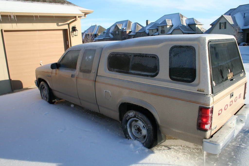
Yeah, back in December, the weather deteriorated to a full fledged blizzard before management said "go home if you feel it is unsafe to stay..." Then the next day, with ALL roads snowpacked and hazardous, those who chose to stay home were either docked a day's pay or forced to take a day of vacation.
Similar occurrence with the recent ice storm. Only they said we could leave at noon on Friday - everything was already iced up. The smart ones chose not to come in Friday, so they were only docked a half day's pay.
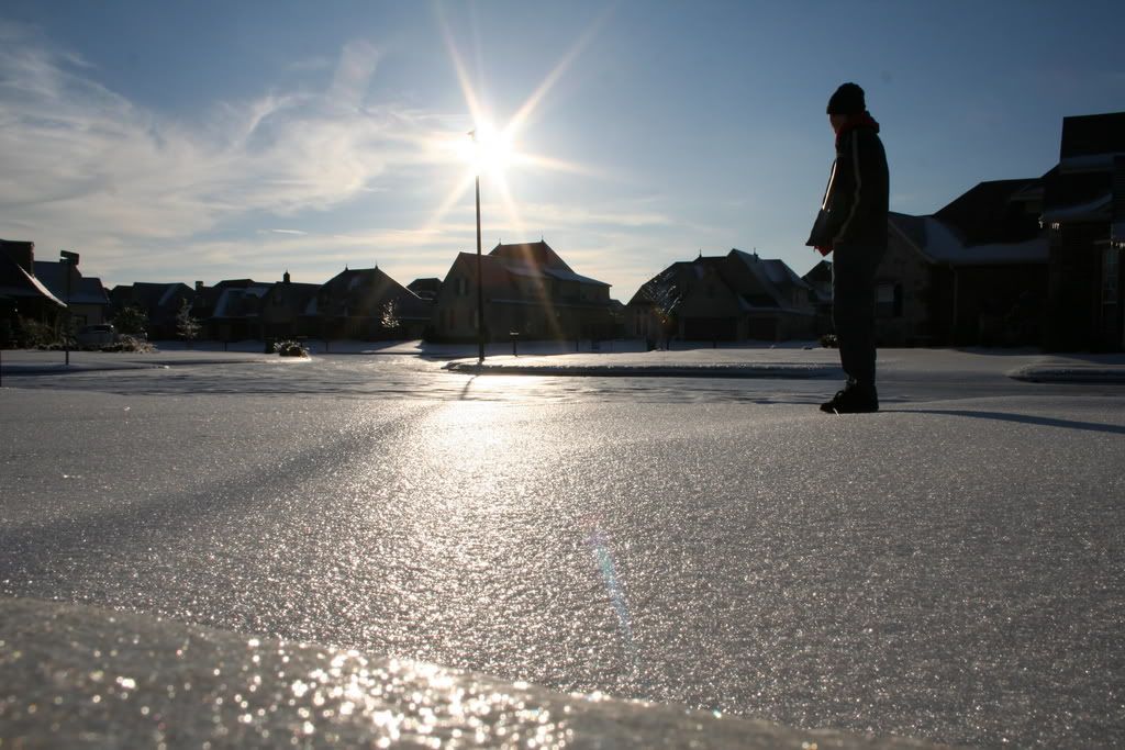
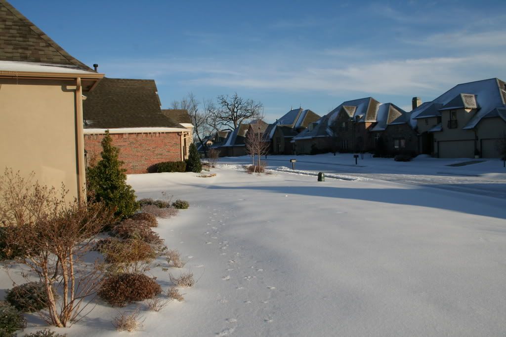
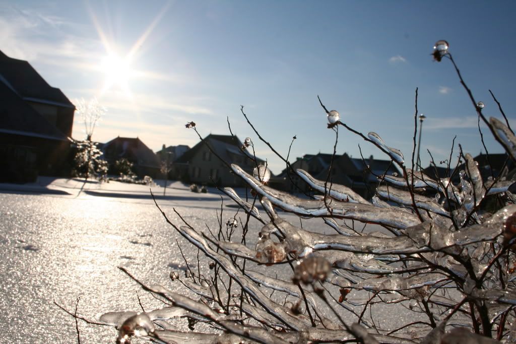
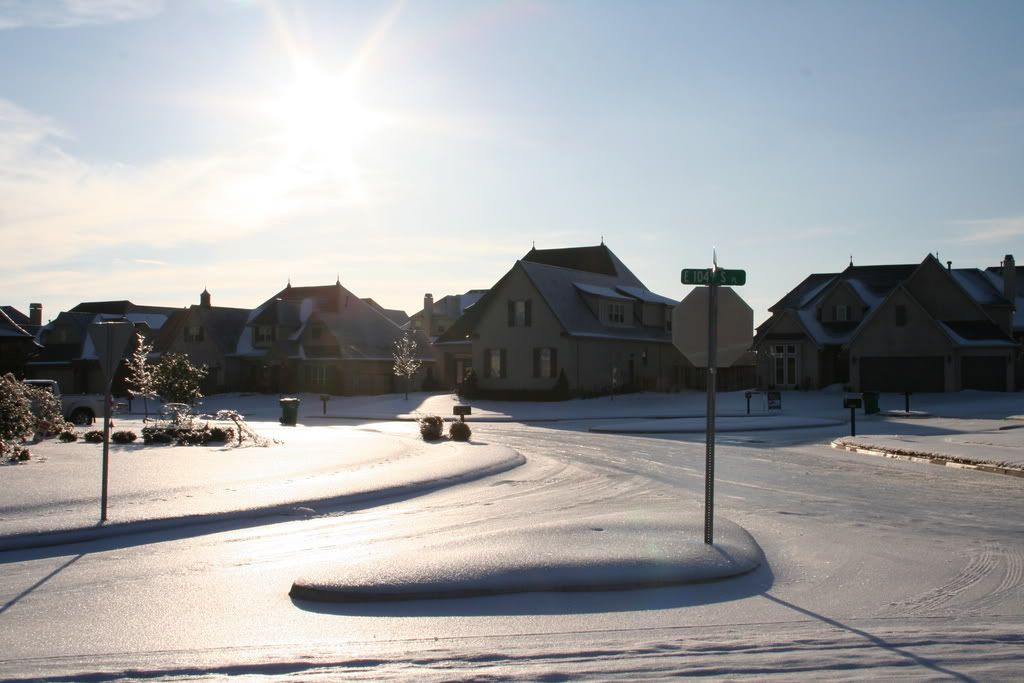
The entire following week was dodgy. Schools were closed for five days. But work went on - if you were brave enough to get out on the roads, which were not snowpacked, but instead were glazed with 3" plus of solid ICE.
Why did I leave Phoenix????
Oh, here's some pics of the ice...
0 likes
-
Stephanie
- S2K Supporter
- Posts: 23843
- Age: 63
- Joined: Thu Feb 06, 2003 9:53 am
- Location: Glassboro, NJ
WOW!! I can imagine myself falling on that ice just looking at it!
Everytime I've had to stay home due to a storm I've had to use personal time/vacation time as well. I work for the casinos which are open 24/7/365. They have put up the staff if they are stuck there while at work.
I think that angel's situation at the base is the exception and not the norm. I'm glad that they take care of you angel!
0 likes
-
angelwing
- S2K Supporter
- Posts: 4462
- Age: 64
- Joined: Tue Jan 18, 2005 3:06 pm
- Location: Kulpsville, PA
I'm happy too! Probaly one of the few quirks for going to NJ
But I do know about getting docked for not going to work, my old job out of 100 people, only 10 (including me)came to work the day after Floyd. We got sent home after about 4 hours because the computers were down. the rest of the employees got docked the day, which I thought was highly unfair
(BTW, call me Mary, when I signed up Miss Mary beat me to it, so had to think of something )
)
But I do know about getting docked for not going to work, my old job out of 100 people, only 10 (including me)came to work the day after Floyd. We got sent home after about 4 hours because the computers were down. the rest of the employees got docked the day, which I thought was highly unfair
(BTW, call me Mary, when I signed up Miss Mary beat me to it, so had to think of something
0 likes
Who is online
Users browsing this forum: No registered users and 88 guests