The posts in this forum are NOT official forecast and should not be used as such. They are just the opinion of the poster and may or may not be backed by sound meteorological data. They are NOT endorsed by any professional institution or


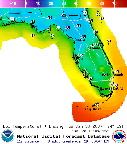
1) Low stratocumulous clouds are starting to edge closer to the East Coast of Florida indicating the mid-level (and perhaps low-level) wind flow is showing signs of coming in more from the NE -- this would mean a warmer night than expected for the East and Southeast coasts of Florida. These signs could be ephemeral, however, so we will have to monitor this situation...
2) A deck of cirrus clouds from the Western GOM is racing ENE towards South Florida -- that could also hold up temps if this cloudcover remains in tact and is over Florida during the late night hours....
Any thoughts?
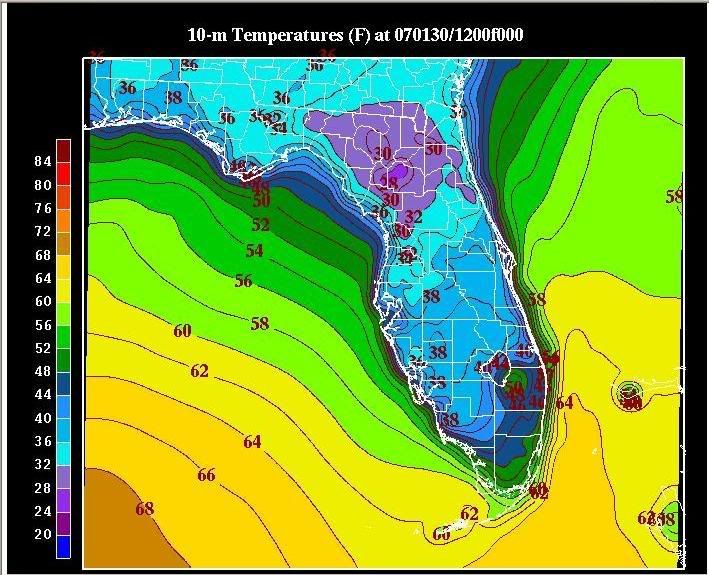
Latest vis: